Latest mountain bike news

A mountain biker navigates through a rocky, wooded trail covered in fallen leaves, wearing an orange helmet and a black shirt with a logo. The cyclist is focused, leaning forward on their orange bike, with motion blur suggesting speed. Trees and stones can be seen in the background, showcasing a natural outdoor environment.
  5
A scenic view of a forest with tall trees displaying vibrant yellow foliage under a bright sky, featuring the text "Chequamegon-Nicolet National Forest" along with the establishment year "EST. 1933."
  4
Alt tag: Close-up of a PrestaCycle Torqrachet tool, showing a red handle with a torque measurement scale from 2 to 10 Nm, alongside several interchangeable bits, positioned on a textured surface with a blurred natural background.
10 Best Kids Mountain Bikes
  4
A group of mountain bikers navigating a dirt track during a cycling event titled "Hump or Jump." The riders, wearing colorful helmets and jerseys, are seen executing jumps on the course with spectators observing in the background. A banner overhead promotes a water solutions company. Trees and a street are visible in the surroundings.
<!-- wp:image {"id":241595,"align":"none"} -->
<figure class="wp-block-image alignnone"><a href="https://images.singletracks.com/blog/wp-content/uploads/2018/06/coldwater_mountain-20.jpg"><img src="https://images.singletracks.com/blog/wp-content/uploads/2018/06/coldwater_mountain-20-1170x783.jpg" alt="" class="wp-image-241595"/></a><figcaption class="wp-element-caption">Coldwater Mountain in Alabama. photo: Aaron Chamberlain</figcaption></figure>
<!-- /wp:image -->

<!-- wp:paragraph -->
<p>Every mountain biker loves the thrill of a long descent. Picking up speed, hitting a bump that lifts the bike off the ground, and feeling the effortless pull of gravity down the trail is second to none.</p>
<!-- /wp:paragraph -->

<!-- wp:paragraph -->
<p>When thinking about the best descents, most mountain bikers can list off a number of must-rides in the western USA. But what about the east coast? It turns out the eastern USA offers plenty of equally rewarding descents. The unique terrain here means descents tend to be shorter, and more interrupted by roots, rocks, and often wet ground, which adds to the challenge and excitement. Here are 10 of the best MTB descents in the eastern USA.</p>
<!-- /wp:paragraph -->

<!-- wp:heading {"level":3} -->
<h3 class="wp-block-heading" id="h-bear-creek-georgia">Bear Creek, Georgia</h3>
<!-- /wp:heading -->

<!-- wp:paragraph -->
<p>With its beautiful scenery, a mix of singletrack and doubletrack, creek crossings, whoop-te-doos, and switchbacks, the <a href="https://www.singletracks.com/bike-trails/bear-creek-ellijay.html">Bear Creek trail</a> is an ideal north Georgia mountain biking experience. Located in the Chattahoochee National Forest, riders will find several trailheads and approaches to ride Bear Creek. The classic up and back, though only 10 miles total, will feel like a complete day of riding.</p>
<!-- /wp:paragraph -->

<!-- wp:image {"id":240941,"align":"none","className":"size-full wp-image-240941"} -->
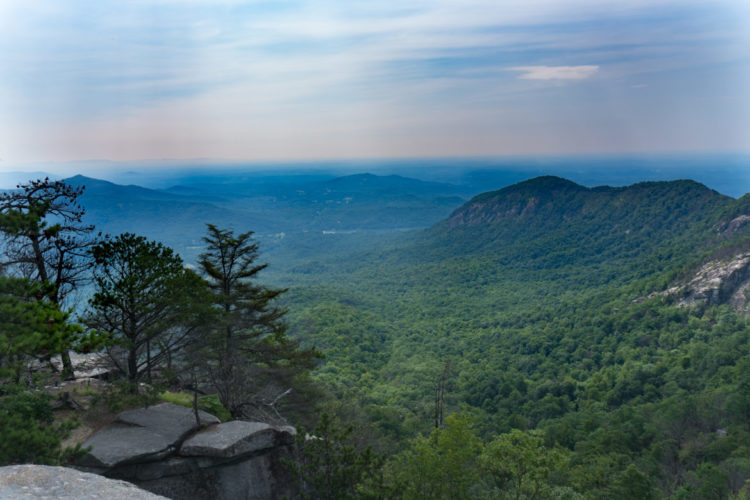
<figure class="wp-block-image alignnone size-full wp-image-240941"><img src="https://images.singletracks.com/blog/wp-content/uploads/2018/06/557-1179150698-orig.jpg" alt="" class="wp-image-240941"/><figcaption class="wp-element-caption">View from the top of the Bear Creek trail. Photo by Rebus</figcaption></figure>
<!-- /wp:image -->

<!-- wp:paragraph -->
<p>From the Bear Creek trailhead outside Ellijay, riders will begin climbing right away. The first mile is steep, and most riders will find themselves taking breaks. After the first mile, the climb becomes much more manageable. While climbing, keep an eye out for the massive Gennett Poplar tree, one of the largest trees in Georgia.</p>
<!-- /wp:paragraph -->

<!-- wp:image {"id":241579,"align":"none"} -->
<figure class="wp-block-image alignnone"><a href="https://images.singletracks.com/blog/wp-content/uploads/2018/06/jim_bear_creek-0.jpg"><img src="https://images.singletracks.com/blog/wp-content/uploads/2018/06/jim_bear_creek-0.jpg" alt="" class="wp-image-241579"/></a><figcaption class="wp-element-caption">photo: Jeff Barber</figcaption></figure>
<!-- /wp:image -->

<!-- wp:paragraph -->
<p>Before heading down, stop to take in the view. You earned it! Upper Bear Creek begins with a few tight and tricky switchbacks, quickly becomes smooth and fast, and finally transitions to more technical toward the bottom. Along the way, riders&nbsp;will encounter plenty of opportunities to get some air and the wide trails encourage fast speeds. Remember to keep an eye out for riders slowly making their way uphill.</p>
<!-- /wp:paragraph -->

<!-- wp:image {"id":241578,"align":"none"} -->
<figure class="wp-block-image alignnone"><a href="https://images.singletracks.com/blog/wp-content/uploads/2018/06/bear_creek1-0.jpg"><img src="https://images.singletracks.com/blog/wp-content/uploads/2018/06/bear_creek1-0-1170x779.jpg" alt="" class="wp-image-241578"/></a><figcaption class="wp-element-caption">The climb up Bear Creek actually isn't too bad, which is rare for an East Coast descent. photo: Jeff Barber</figcaption></figure>
<!-- /wp:image -->

<!-- wp:paragraph -->
<p>Many riders combine the Bear Creek descent with the Pinhoti Trail, sections 1 and 2. To do this loop, park at Mulberry Gap and head up Old CCC Camp road to the top of Bear Creek. Descend the Bear Creek Trail, then hang a right on Pinhoti 1 near the bottom of the Bear Creek trail. Then take Pinhoti 2 back to Mulberry Gap.</p>
<!-- /wp:paragraph -->

<!-- wp:paragraph -->
<p>Other notable descents in the area include <a href="https://www.singletracks.com/bike-trails/pinhoti-p3.html">Pinhoti 3</a>, <a href="https://www.singletracks.com/bike-trails/stanley-gap.html">Stanley Gap</a>, and <a href="https://www.singletracks.com/bike-trails/mountaintown-creek-trail.html">Mountaintown Creek</a>.</p>
<!-- /wp:paragraph -->

<!-- wp:heading {"level":3} -->
<h3 class="wp-block-heading" id="h-bomb-dog-trail-alabama">Bomb Dog Trail, Alabama</h3>
<!-- /wp:heading -->

<!-- wp:paragraph -->
<p>Named for Floyd, a local bomb sniffing dog, <a href="https://www.singletracks.com/bike-trails/bomb-dog.html">Bomb Dog</a> is a rocky, 10-mile loop on <a href="https://www.singletracks.com/bike-trails/coldwater-mt.html">Coldwater Mountain</a> with loads of jumps and bermed turns. The three mile descent includes black diamond options and plenty of chances to catch some air. Loose rock is perhaps the only thing that will keep riders from reaching high speed.&nbsp;The 1,200 feet of climbing to the top of Bomb Dog is fairly gradual, and is broken up between the beginning and end of the loop.</p>
<!-- /wp:paragraph -->

<!-- wp:image {"id":240958,"align":"none","className":"size-medium wp-image-240958"} -->
<figure class="wp-block-image alignnone size-medium wp-image-240958"><img src="https://images.singletracks.com/blog/wp-content/uploads/2018/06/IMG_0305-orig-750x563.jpg" alt="" class="wp-image-240958"/><figcaption class="wp-element-caption">Bomb Dog. photo: Dave Holmes.</figcaption></figure>
<!-- /wp:image -->

<!-- wp:paragraph -->
<p>The well-marked loop is ridden clockwise and starts at the Coldwater trailhead. The ride starts with the Mama and Papa Bear trails before hitting the Bomb Dog trail itself. On the descent, riders will enjoy a good deal of fast, flowing trail over clay soil, with rocky sections mixed in. Advanced, creative riders can find many unique lines through trail features along the way.</p>
<!-- /wp:paragraph -->

<!-- wp:image {"id":240959,"align":"none","className":"size-medium wp-image-240959"} -->
<figure class="wp-block-image alignnone size-medium wp-image-240959"><img src="https://images.singletracks.com/blog/wp-content/uploads/2018/06/P1010420-orig-563x750.jpg" alt="" class="wp-image-240959"/><figcaption class="wp-element-caption">Rocks and more rocks on Bomb Dog. Photo by Kuato.</figcaption></figure>
<!-- /wp:image -->

<!-- wp:paragraph -->
<p>The trails at Coldwater tend to stay dry in this system with few wet spots. The Coldwater trail system is growing, and includes trails rated from beginner to advanced. For a truly black-diamond descent, take Gazza which roughly parallels Bomb Dog before joining the trail down below. For a truly sustained, flowy, and fast descent, take the Talledega, Trillium, and Hare trails down to the Anniston trailhead for a total of 3 miles fast, swoopy of descending.</p>

<!-- /wp:paragraph -->

<!-- wp:heading {"level":3} -->
<h3 class="wp-block-heading" id="h-bull-mountain-georgia">Bull Mountain, Georgia</h3>
<!-- /wp:heading -->

<!-- wp:paragraph -->
<p>For a big ride with some long descents, the <a href="https://www.singletracks.com/bike-trails/bull-mountain.html">Bull and Jake Mountain</a> area in north Georgia is a great choice. This IMBA Epic loop offers beautiful mountain views and a true backwoods feeling. The Jake Mountain side of the loop includes fast, flowing trails, while the Bull Mountain side is steeper and more technical. Be sure to bring a map to avoid taking a wrong turn, and keep an eye out for horses on the trails.</p>
<!-- /wp:paragraph -->

<!-- wp:image {"id":241581,"align":"none"} -->
<figure class="wp-block-image alignnone"><a href="https://images.singletracks.com/blog/wp-content/uploads/2018/06/DSC_2328.jpg"><img src="https://images.singletracks.com/blog/wp-content/uploads/2018/06/DSC_2328-1170x783.jpg" alt="" class="wp-image-241581"/></a><figcaption class="wp-element-caption">photo: Aaron Chamberlain</figcaption></figure>
<!-- /wp:image -->

<!-- wp:paragraph -->
<p>The 30-mile "Dirty Thirty" loop starts at the Bull Mountain trailhead. Riding counter clockwise is recommended to enjoy the biggest descent at the end of the ride. Start at the Bull Mountain connector and ride toward the Jake Mountain trail. Jake Mountain trail continues for 5 miles and involves crossing Jones Creek. Continue on to the Black Branch trail. Parts of this 3-mile trail are rocky. Next, climb 2 miles on No Tell, followed by a descent down Nimblewill Branch.</p>
<!-- /wp:paragraph -->

<!-- wp:image {"id":241580,"align":"none"} -->
<figure class="wp-block-image alignnone"><a href="https://images.singletracks.com/blog/wp-content/uploads/2018/06/DSC_2497.jpg"><img src="https://images.singletracks.com/blog/wp-content/uploads/2018/06/DSC_2497-1170x783.jpg" alt="" class="wp-image-241580"/></a><figcaption class="wp-element-caption">photo: Aaron Chamberlain</figcaption></figure>
<!-- /wp:image -->

<!-- wp:paragraph -->
<p>At the bottom of Nimblewill, turn right on the road and climb gradually. Keep a lookout for Bare Hare trail, where the climb continues. (Some may need to push here.) Finally, start cruising down off the top of Bull Mountain. Relax and enjoy finishing the ride with nearly 5 miles of descending. Most of the trail is open and fast, with a few twisty, technical sections and some small creek crossings.</p>
<!-- /wp:paragraph -->

<!-- wp:heading {"level":3} -->
<h3 class="wp-block-heading" id="h-farlow-gap-daniel-ridge-north-carolina">Farlow Gap/Daniel Ridge, North Carolina</h3>
<!-- /wp:heading -->

<!-- wp:image {"id":241584,"align":"none"} -->
<figure class="wp-block-image alignnone"><a href="https://images.singletracks.com/blog/wp-content/uploads/2018/06/S3W7860.jpg"><img src="https://images.singletracks.com/blog/wp-content/uploads/2018/06/S3W7860-1170x780.jpg" alt="" class="wp-image-241584"/></a><figcaption class="wp-element-caption">photo: kamoteus</figcaption></figure>
<!-- /wp:image -->

<!-- wp:paragraph -->
<p><a href="https://www.singletracks.com/bike-trails/farlow-gap.html">Farlow Gap</a> offers a very technical 3-mile descent in Pisgah National Forest. The decent continues down <a href="https://www.singletracks.com/bike-trails/daniel-ridge.html">Daniel Ridge</a> with even more rocks and roots, showcasing plenty of what Pisgah has to offer mountain bikers.</p>
<!-- /wp:paragraph -->

<!-- wp:image {"id":241582,"align":"none"} -->
<figure class="wp-block-image alignnone"><a href="https://images.singletracks.com/blog/wp-content/uploads/2018/06/S3W8034.jpg"><img src="https://images.singletracks.com/blog/wp-content/uploads/2018/06/S3W8034-780x1170.jpg" alt="" class="wp-image-241582"/></a><figcaption class="wp-element-caption">photo: kamoteus</figcaption></figure>
<!-- /wp:image -->

<!-- wp:paragraph -->
<p>From the top of the Farlow Gap trailhead, riders will immediately begin descending this strenuous trail. Known as one of the toughest trails in Pisgah, Farlow Gap has abundant roots, rocks, and switchbacks. Many riders choose to hike-a-bike some of the rock gardens.</p>
<!-- /wp:paragraph -->

<!-- wp:paragraph -->
<p>After descending 2,000 feet, the <a href="https://www.singletracks.com/bike-trails/daniel-ridge.html">Daniel Ridge trail</a> begins. Make sure your brakes are working well! You can go either right or left on Daniel Ridge. To maximize the downhill, stay right and enjoy two more miles of descending over rocks and roots and a stream below.</p>
<!-- /wp:paragraph -->

<!-- wp:image {"id":241585,"align":"none"} -->
<figure class="wp-block-image alignnone"><a href="https://images.singletracks.com/blog/wp-content/uploads/2018/06/daniel_ridge-1.jpg"><img src="https://images.singletracks.com/blog/wp-content/uploads/2018/06/daniel_ridge-1-1170x780.jpg" alt="" class="wp-image-241585"/></a><figcaption class="wp-element-caption">Leah take a switchback on Daniel RIdge. photo: Jeff Barber</figcaption></figure>
<!-- /wp:image -->

<!-- wp:paragraph -->
<p>At the end of Daniel Ridge, there are opportunities to view waterfalls. Note that riding up Farlow Gap is extremely difficult and not recommended, so most mountain bikers ride up Pilot Mountain road from the Davidson River trailhead .</p>
<!-- /wp:paragraph -->

<!-- wp:image {"id":240947,"align":"none","className":"size-medium wp-image-240947"} -->
<figure class="wp-block-image alignnone size-medium wp-image-240947"><img src="https://images.singletracks.com/blog/wp-content/uploads/2018/06/IMG_20140523_164708-orig-563x750.jpg" alt="" class="wp-image-240947"/><figcaption class="wp-element-caption">Waterfall off of Daniel Ridge trail. Photo by jn35646</figcaption></figure>
<!-- /wp:image -->

<!-- wp:heading {"level":3} -->
<h3 class="wp-block-heading" id="h-greens-lick-ingles-field-gap-north-carolina">Greens' Lick/Ingles Field Gap, North Carolina</h3>
<!-- /wp:heading -->

<!-- wp:paragraph -->
<p>Clearly Pisgah National Forest is home to some of the best descents in the east. To experience the less technical side of what Pisgah has to offer, try this 13-mile loop that in <a href="https://www.singletracks.com/bike-trails/bent-creek.html">Bent Creek</a> that includes <a href="https://www.singletracks.com/mtb-trails/one-of-ashevilles-most-famous-trails-has-been-re-built-from-top-to-bottom/">Green's Lick trail</a> and Ingles Gap trail. Riders will get a workout on the 6-mile climb, and will be rewarded with a total of saven miles of descending. The trails are not overly technical, allowing riders to descend quickly. Keep in mind, these trails are bidirectional and multi-use.</p>
<!-- /wp:paragraph -->

<!-- wp:image {"id":241586,"align":"none"} -->
<figure class="wp-block-image alignnone"><a href="https://images.singletracks.com/blog/wp-content/uploads/2018/06/S3W2050.jpg"><img src="https://images.singletracks.com/blog/wp-content/uploads/2018/06/S3W2050-1170x780.jpg" alt="" class="wp-image-241586"/></a><figcaption class="wp-element-caption">photo: kamoteus</figcaption></figure>
<!-- /wp:image -->

<!-- wp:paragraph -->
<p><span style="color: #444444; font-style: normal; font-weight: 300;">The loop starts at the Wesley Branch trailhead parking lot. Begin the loop on Deer Lake Lodge trail, and continue to Wolf Branch. Wolf Branch is where the climbing begins. Next comes Ingles Field Gap, which climbs steeply over moderately technical terrain. Next is the rocky Northern Boundary trail, which leads to the highest elevation point of the ride.</span></p>
<!-- /wp:paragraph -->

<!-- wp:image {"id":240961,"align":"none","className":"size-medium wp-image-240961"} -->
<figure class="wp-block-image alignnone size-medium wp-image-240961"><img src="https://images.singletracks.com/blog/wp-content/uploads/2018/06/IMG_1863-0-orig-563x750.jpg" alt="" class="wp-image-240961"/><figcaption class="wp-element-caption">Green's Lick. Photo by harmonf.</figcaption></figure>
<!-- /wp:image -->

<!-- wp:paragraph -->
<p>Finally, begin the descent on Green's Lick. On this 2-mile trail, riders will encounter jump after jump, and a few rocks as well to really get the adrenaline pumping. When Green's Lick ends, take Sidehill, followed by Little Hickory Top, both of which have a little climbing. Next is the descent on Ingles Field Gap, which is the most technical trail on the ride, and is peppered with rocks and roots. From here take Wolf Branch, which has a mix of short climbs and smooth, fast descents. Finish the loop on the Hard Times Connector. Enjoy the fast, smooth downhill back to the parking area.</p>
<!-- /wp:paragraph -->

<!-- wp:image {"id":240962,"align":"none","className":"size-medium wp-image-240962"} -->
<figure class="wp-block-image alignnone size-medium wp-image-240962"><img src="https://images.singletracks.com/blog/wp-content/uploads/2018/06/615-1173488465-orig-563x750.jpg" alt="" class="wp-image-240962"/><figcaption class="wp-element-caption">The beauty of riding Pisgah in foliage season. Photo by ositoking.</figcaption></figure>
<!-- /wp:image -->

<!-- wp:heading {"level":3} -->
<h3 class="wp-block-heading" id="h-live-wire-1-amp-2-tennessee">Live Wire 1 &amp; 2, Tennessee</h3>
<!-- /wp:heading -->

<!-- wp:paragraph -->
<p>Live Wire 1 &amp; 2 are part of the <a href="https://www.singletracks.com/bike-trails/raccoon-mountain-trail-network.html">Raccoon Mountain trail system</a>. Together these trails total 4.7 miles and boast over 800 feet of descending. The Live Wires are fast and flowing with occasional rock gardens to keep riders on their toes. While the trails are bidirectional, it is recommended to ride counterclockwise to optimize the downhill. Bringing a map is also recommended.</p>
<!-- /wp:paragraph -->

<!-- wp:image {"id":241588,"align":"none"} -->
<figure class="wp-block-image alignnone"><a href="https://images.singletracks.com/blog/wp-content/uploads/2018/06/Clip2-165-0.jpg"><img src="https://images.singletracks.com/blog/wp-content/uploads/2018/06/Clip2-165-0-1170x658.jpg" alt="" class="wp-image-241588"/></a><figcaption class="wp-element-caption">Lower Chunky trail at Raccoon Mountain. photo: jbond352</figcaption></figure>
<!-- /wp:image -->

<!-- wp:paragraph -->
<p>There is parking located in a number of places, including where Live Wire 1 &amp; 2 intersect.&nbsp; This is the recommended starting point. Begin counterclockwise down the length of Live Wire 2. This trail is rated as an advanced trail due to all the rocks and roots. However, these will not slow down the descent for the most part.</p>
<!-- /wp:paragraph -->

<!-- wp:paragraph -->
<p>At the bottom of the 750-foot descent, make a loop with High Voltage, Split Rock, Laurel Point, Electric Ave, and East rim to the top of Live Wire 1. This trail&nbsp;is rated as intermediate. The ride finishes with a fun descent featuring switchbacks and bridges. The descent is fast and steep in places, allowing for a blistering pace.</p>
<!-- /wp:paragraph -->

<!-- wp:heading {"level":3} -->
<h3 class="wp-block-heading" id="h-moose-alley-burke-vermont">Moose Alley, Burke, Vermont</h3>
<!-- /wp:heading -->

<!-- wp:paragraph -->
<p>The 110 miles of <a href="https://www.singletracks.com/bike-trails/kingdom-trails.html">Kingdom Trails</a> are a paradise for any mountain biker. For those who enjoy long descents, <a href="https://www.singletracks.com/bike-trails/moose-alley-14256.html">Moose Alley</a> should be on your route when exploring Kingdom Trails. Moose Alley is the shortest trail on our list at only 1.8 miles, but it can be combined with nearby trails that offer some fun downhills.</p>
<!-- /wp:paragraph -->

<!-- wp:paragraph -->
<p>Parking at Moose Alley is not available, but there are numerous routes to take to include this trail. While purchasing a pass at the Welcome Center, be sure to pick up a free trail map. Start out on White School, off of East Darling Hill Road. This 3.1 mile singletrack is a gradual climb with beautiful scenery along the Passumpsic River. White School Trail ends on White School road. Turn right, and cross Route 114 to the start of Moose Alley.</p>
<!-- /wp:paragraph -->

<!-- wp:image {"id":240936,"align":"none","className":"size-full wp-image-240936"} -->
<figure class="wp-block-image alignnone size-full wp-image-240936"><img src="https://images.singletracks.com/blog/wp-content/uploads/2018/06/image1-9.jpeg" alt="" class="wp-image-240936"/><figcaption class="wp-element-caption">View from While School</figcaption></figure>
<!-- /wp:image -->

<!-- wp:paragraph -->
<p>The climb up Moose Alley is a workout, but very rideable, with plenty of short breaks in the climbing. After reaching the top, enjoy the view of the surrounding mountains from Magill fields. On the descent, enjoy fun features including drops, some bermed turns, and lots of roots. This rugged and remote trail has a true New England feel.</p>
<!-- /wp:paragraph -->

<!-- wp:paragraph -->
<p>If you're up for more descending, on your way back pass by White School trailhead, and continue to Good 'n You on the left. Ride this loop counter clockwise for the best descending. From here enjoy a quick descent down Farm Junk with tight turns, rocks, and roots. Farm Junk returns to White School. Relax and take in the scenery on the easy ride back to town.</p>
<!-- /wp:paragraph -->

<!-- wp:heading {"level":3} -->
<h3 class="wp-block-heading" id="h-oak-knoll-carrabassett-valley-maine">Oak Knoll, Carrabassett Valley, Maine</h3>
<!-- /wp:heading -->

<!-- wp:paragraph -->
<p>In recent years, <a href="https://www.singletracks.com/bike-trails/jabba-the-hut.html">the trail system in Carrabassett Valley</a> has grown to nearly 100 miles of trails for mountain bikers to enjoy. There are a number of descents worth checking out, which include everything from fast and flowing with bermed switchbacks to technical, black-diamond descents. The 2.8 mile <a href="https://www.singletracks.com/bike-trails/oak-knoll.html">Oak Knoll trail</a>, with a 700-foot elevation change, tops the list.</p>
<!-- /wp:paragraph -->

<!-- wp:image {"id":240950,"align":"none","className":"size-full wp-image-240950"} -->
<figure class="wp-block-image alignnone size-full wp-image-240950"><img src="https://images.singletracks.com/blog/wp-content/uploads/2018/06/image1-11.jpeg" alt="" class="wp-image-240950"/><figcaption class="wp-element-caption">Descending Oak Knoll</figcaption></figure>
<!-- /wp:image -->

<!-- wp:paragraph -->
<p>Trails maps are available at the Sugarloaf Outdoor Center in Carrabassett Valley. To access Oak Knoll, park at Campbell Field Parking area, across the road from the Outdoor Center. Ride across the bridge to the Narrow Gauge trail, and immediately turn left onto Mile's Mile. This trail along the Carrabassett River serves as a pleasant warm up. At the end, turn left on Narrow Gauge again. A short distance ahead there is a doubletrack to the left with signage for Maine Huts and Trails. Turn here.</p>
<!-- /wp:paragraph -->

<!-- wp:paragraph -->
<p>Keep a lookout for the entrance to Oak Knoll on the left. For those who prefer to make a loop rather than up and down Oak Knoll, continue straight past the start of Oak Knoll. This route goes up the smooth, bermed switchbacks of Newtons Revenge, and leads directly to Oak Knoll.</p>
<!-- /wp:paragraph -->

<!-- wp:image {"id":240951,"align":"none","className":"size-medium wp-image-240951"} -->
<figure class="wp-block-image alignnone size-medium wp-image-240951"><img src="https://images.singletracks.com/blog/wp-content/uploads/2018/06/mobile-1470958701-orig-563x750.jpg" alt="" class="wp-image-240951"/><figcaption class="wp-element-caption">Views of Sugarloaf Mountain. Photo by planemusic.</figcaption></figure>
<!-- /wp:image -->

<!-- wp:paragraph -->
<p>Descending Oak Knoll, riders will pick on speed on the smooth switchbacks with stunning views of Sugarloaf Mountain, the Bigelows, and other surrounding peaks. Sections of stony trail and small drops will keep riders on their toes. Be sure to watch for uphill riders and hikers. The descent crosses a gravel service road twice, and during the fall foliage season, the scenery from the trail is breathtaking.</p>
<!-- /wp:paragraph -->

<!-- wp:heading {"level":3} -->
<h3 class="wp-block-heading" id="h-ridgeline-north-carolina">Ridgeline, North Carolina</h3>
<!-- /wp:heading -->

<!-- wp:image {"id":241590,"align":"none"} -->
<figure class="wp-block-image alignnone"><a href="https://images.singletracks.com/blog/wp-content/uploads/2018/06/S3W3467.jpg"><img src="https://images.singletracks.com/blog/wp-content/uploads/2018/06/S3W3467-1170x780.jpg" alt="" class="wp-image-241590"/></a><figcaption class="wp-element-caption">photo: kamoteus</figcaption></figure>
<!-- /wp:image -->

<!-- wp:paragraph -->
<p>For a 6-mile loop with super fast, smooth flowy descents, check out <a href="https://www.singletracks.com/bike-trails/ridgeline-trail-65.html">Ridgeline</a> in <a href="https://www.singletracks.com/bike-trails/dupont-state-forest.html">Dupont State Forest</a>. Perfect for all levels of riders, this well-maintained trail with high berms allows riders to reach higher speeds than most trails in the east. Be aware, however, that this loop is bidirectional and multi-use. Horses are very common in this area, even on the Ridgeline descent. Keep a long enough line of sight to allow time to move over.</p>
<!-- /wp:paragraph -->

<!-- wp:image {"id":240953,"align":"none","className":"size-medium wp-image-240953"} -->
<figure class="wp-block-image alignnone size-medium wp-image-240953"><img src="https://images.singletracks.com/blog/wp-content/uploads/2018/06/mobile-1451828145-orig-563x750.jpg" alt="" class="wp-image-240953"/><figcaption class="wp-element-caption">photo: will-hegedus</figcaption></figure>
<!-- /wp:image -->

<!-- wp:paragraph -->
<p>Park at the Lake Imaging parking area and start the rocky ascent on the Jim Branch trail. Then it's on to the Isaac Heath trail for a break from the climbing with a short, flowy descent. From here take Buck Forest Road to Thomas Cemetery road, both of which are a gradual climb. Thomas Cemetery Road turns into White Pine trail, which leads to Hooker Creek trail. Hooker Creek starts with a fast descent, before a short climb to Ridgeline.</p>
<!-- /wp:paragraph -->

<!-- wp:image {"id":241591,"align":"none"} -->
<figure class="wp-block-image alignnone"><a href="https://images.singletracks.com/blog/wp-content/uploads/2018/06/2016-05-07112528-1.jpg"><img src="https://images.singletracks.com/blog/wp-content/uploads/2018/06/2016-05-07112528-1-1170x878.jpg" alt="" class="wp-image-241591"/></a><figcaption class="wp-element-caption">photo: Greg Heil</figcaption></figure>
<!-- /wp:image -->

<!-- wp:paragraph -->
<p>The 1.5 mile descent down Ridgeline is one of the smoothest and fastest trails in the east. Enjoy the bermed corners, occasional jumps, and uninterrupted downhill. Let it rip, and remember why you are hooked on mountain biking. Since this loop is only 6 miles long, many riders will want to complete it at least twice!</p>
<!-- /wp:paragraph -->

<!-- wp:heading {"level":3} -->
<h3 class="wp-block-heading" id="h-timber-ridge-virginia">Timber Ridge, Virginia</h3>
<!-- /wp:heading -->

<!-- wp:paragraph -->
<p>At eight miles in length, the <a href="https://www.singletracks.com/bike-trails/timber-ridge.html">Timber Ridge trail</a> boasts nearly 3,000 feet of descending. The trail can be technical and very steep in places. Timber Ridge starts at <a href="https://www.singletracks.com/bike-trails/reddish-knob.html">Reddish Knob</a>, a well-known peak near the Virginia/West Virginia state line. Since Reddish Knob can be accessed by car, it is possible to shuttle this ride. Otherwise, bike the long, steep climb on the paved road to Reddish Knob. The road is very narrow, so use caution. Enjoy the scenery before starting the descent.</p>
<!-- /wp:paragraph -->

<!-- wp:image {"id":240956,"align":"none","className":"size-medium wp-image-240956"} -->
<figure class="wp-block-image alignnone size-medium wp-image-240956"><img src="https://images.singletracks.com/blog/wp-content/uploads/2018/06/20150815_111230-orig-750x422.jpg" alt="" class="wp-image-240956"/><figcaption class="wp-element-caption">The view from Reddish Knob. Photo by Alex NIN.</figcaption></figure>
<!-- /wp:image -->

<!-- wp:paragraph -->
<p>For riders who are not shuttling, park at the end of Timber Ridge trail on Tillman road. Choose to ride Timber Ridge up, or climb the adjacent Wolf Ridge trail. Both are very steep and sometimes technical. Unfortunately, there is no easy way up. Just remember, the views and the long descent will make the climb worthwhile.</p>
<!-- /wp:paragraph -->

<!-- wp:image {"id":241592,"align":"none"} -->
<figure class="wp-block-image alignnone"><a href="https://images.singletracks.com/blog/wp-content/uploads/2018/06/3-7.jpg"><img src="https://images.singletracks.com/blog/wp-content/uploads/2018/06/3-7.jpg" alt="" class="wp-image-241592"/></a><figcaption class="wp-element-caption">photo: jtorlando25</figcaption></figure>
<!-- /wp:image -->

<!-- wp:paragraph -->
<p>From the Reddish Knob parking area, the Timber Ridge trail starts with a steep, rocky descent. Less experienced mountain bikers may not be comfortable riding very early portions of this trail. Don't be discouraged if you need to hike-a-bike. Until the last two miles, the trail is narrow and rocky, but very rideable after the initial rock gardens. The final two miles of singletrack are fun and flowy, and include some jumps. This ride, while very rewarding, is not appropriate for novice riders. Be prepared with necessary supplies for this challenging descent.</p>
<!-- /wp:paragraph -->

<!-- wp:paragraph -->
<p><em>Your turn: <a href="https://www.singletracks.com/blog/forums/topic/best-eastern-usa-mtb-descents/">What is your favorite East Coast mountain bike descent</a>?</em></p>
<!-- /wp:paragraph -->
  4
A group of people gathered around a large bonfire at night, with flames and sparks illuminating the scene. Some individuals are actively adding branches to the fire, while others are seen in motion, creating a lively atmosphere. The dark surroundings contrast with the bright firelight, enhancing the warmth and energy of the gathering.
  1
A mountain biker riding along a winding dirt path through a lush green landscape, with stunning mountain ranges and a blue sky in the background.
  2
A hand holding a multi-tool with an orange center section and various screwdriver tips, placed next to a bicycle's handlebar. The background features a textured rock surface and a bicycle tire, indicating an outdoor setting.
  2
Four hardtail mountain bikes displayed in a grid layout, featuring two black bikes, one red bike, and one silver bike. The text "10 MORE HARDCORE HARDTAILS" is prominently displayed below the images, highlighting a selection of rugged off-road bicycles.
  10
A scenic mountain landscape featuring a dirt path winding through a field of wildflowers, surrounded by lush green hills and towering trees under a partly cloudy sky.
A person in a blue shirt is pointing towards a scenic mountain view while standing next to another person in a ranger uniform and a hat. They are surrounded by a grassy field and tall trees under a clear blue sky.
  1
A black electric mountain bike parked on a dirt pathway surrounded by tall green grass and wildflowers. The bike features wide tires, a visible battery, and a sleek design, suitable for off-road biking.
  7
A mountain biker navigating a winding dirt trail surrounded by sparse vegetation, captured in black and white. The biker is wearing a helmet and cycling gear, leaning into the turn as they ride through the scenic landscape.
Two young cyclists race on a dirt track surrounded by lush green forest. One rider, wearing a white helmet and a black jacket with orange accents, is positioned slightly ahead and focuses intently on the trail. The other rider sports a green helmet and red and black racing gear, both preparing to navigate the challenging course. Their bikes have colorful wheels, and they are mid-action, showcasing their competitive spirit.
Two cyclists riding on a rocky terrain with a backdrop of snow-capped mountains. The image features text highlighting a challenging journey: "Over 17,000 Feet, Across 330 Kilometers, All in 4 Days." The overall tone conveys a sense of adventure and exploration.
<!-- wp:image {"id":241595,"align":"none"} -->
<figure class="wp-block-image alignnone"><a href="https://images.singletracks.com/blog/wp-content/uploads/2018/06/coldwater_mountain-20.jpg"><img src="https://images.singletracks.com/blog/wp-content/uploads/2018/06/coldwater_mountain-20-1170x783.jpg" alt="" class="wp-image-241595"/></a><figcaption class="wp-element-caption">Coldwater Mountain in Alabama. photo: Aaron Chamberlain</figcaption></figure>
<!-- /wp:image -->

<!-- wp:paragraph -->
<p>Every mountain biker loves the thrill of a long descent. Picking up speed, hitting a bump that lifts the bike off the ground, and feeling the effortless pull of gravity down the trail is second to none.</p>
<!-- /wp:paragraph -->

<!-- wp:paragraph -->
<p>When thinking about the best descents, most mountain bikers can list off a number of must-rides in the western USA. But what about the east coast? It turns out the eastern USA offers plenty of equally rewarding descents. The unique terrain here means descents tend to be shorter, and more interrupted by roots, rocks, and often wet ground, which adds to the challenge and excitement. Here are 10 of the best MTB descents in the eastern USA.</p>
<!-- /wp:paragraph -->

<!-- wp:heading {"level":3} -->
<h3 class="wp-block-heading" id="h-bear-creek-georgia">Bear Creek, Georgia</h3>
<!-- /wp:heading -->

<!-- wp:paragraph -->
<p>With its beautiful scenery, a mix of singletrack and doubletrack, creek crossings, whoop-te-doos, and switchbacks, the <a href="https://www.singletracks.com/bike-trails/bear-creek-ellijay.html">Bear Creek trail</a> is an ideal north Georgia mountain biking experience. Located in the Chattahoochee National Forest, riders will find several trailheads and approaches to ride Bear Creek. The classic up and back, though only 10 miles total, will feel like a complete day of riding.</p>
<!-- /wp:paragraph -->

<!-- wp:image {"id":240941,"align":"none","className":"size-full wp-image-240941"} -->
<figure class="wp-block-image alignnone size-full wp-image-240941"><img src="https://images.singletracks.com/blog/wp-content/uploads/2018/06/557-1179150698-orig.jpg" alt="" class="wp-image-240941"/><figcaption class="wp-element-caption">View from the top of the Bear Creek trail. Photo by Rebus</figcaption></figure>
<!-- /wp:image -->

<!-- wp:paragraph -->
<p>From the Bear Creek trailhead outside Ellijay, riders will begin climbing right away. The first mile is steep, and most riders will find themselves taking breaks. After the first mile, the climb becomes much more manageable. While climbing, keep an eye out for the massive Gennett Poplar tree, one of the largest trees in Georgia.</p>
<!-- /wp:paragraph -->

<!-- wp:image {"id":241579,"align":"none"} -->
<figure class="wp-block-image alignnone"><a href="https://images.singletracks.com/blog/wp-content/uploads/2018/06/jim_bear_creek-0.jpg"><img src="https://images.singletracks.com/blog/wp-content/uploads/2018/06/jim_bear_creek-0.jpg" alt="" class="wp-image-241579"/></a><figcaption class="wp-element-caption">photo: Jeff Barber</figcaption></figure>
<!-- /wp:image -->

<!-- wp:paragraph -->
<p>Before heading down, stop to take in the view. You earned it! Upper Bear Creek begins with a few tight and tricky switchbacks, quickly becomes smooth and fast, and finally transitions to more technical toward the bottom. Along the way, riders&nbsp;will encounter plenty of opportunities to get some air and the wide trails encourage fast speeds. Remember to keep an eye out for riders slowly making their way uphill.</p>
<!-- /wp:paragraph -->

<!-- wp:image {"id":241578,"align":"none"} -->
<figure class="wp-block-image alignnone"><a href="https://images.singletracks.com/blog/wp-content/uploads/2018/06/bear_creek1-0.jpg"><img src="https://images.singletracks.com/blog/wp-content/uploads/2018/06/bear_creek1-0-1170x779.jpg" alt="" class="wp-image-241578"/></a><figcaption class="wp-element-caption">The climb up Bear Creek actually isn't too bad, which is rare for an East Coast descent. photo: Jeff Barber</figcaption></figure>
<!-- /wp:image -->

<!-- wp:paragraph -->
<p>Many riders combine the Bear Creek descent with the Pinhoti Trail, sections 1 and 2. To do this loop, park at Mulberry Gap and head up Old CCC Camp road to the top of Bear Creek. Descend the Bear Creek Trail, then hang a right on Pinhoti 1 near the bottom of the Bear Creek trail. Then take Pinhoti 2 back to Mulberry Gap.</p>
<!-- /wp:paragraph -->

<!-- wp:paragraph -->
<p>Other notable descents in the area include <a href="https://www.singletracks.com/bike-trails/pinhoti-p3.html">Pinhoti 3</a>, <a href="https://www.singletracks.com/bike-trails/stanley-gap.html">Stanley Gap</a>, and <a href="https://www.singletracks.com/bike-trails/mountaintown-creek-trail.html">Mountaintown Creek</a>.</p>
<!-- /wp:paragraph -->

<!-- wp:heading {"level":3} -->
<h3 class="wp-block-heading" id="h-bomb-dog-trail-alabama">Bomb Dog Trail, Alabama</h3>
<!-- /wp:heading -->

<!-- wp:paragraph -->
<p>Named for Floyd, a local bomb sniffing dog, <a href="https://www.singletracks.com/bike-trails/bomb-dog.html">Bomb Dog</a> is a rocky, 10-mile loop on <a href="https://www.singletracks.com/bike-trails/coldwater-mt.html">Coldwater Mountain</a> with loads of jumps and bermed turns. The three mile descent includes black diamond options and plenty of chances to catch some air. Loose rock is perhaps the only thing that will keep riders from reaching high speed.&nbsp;The 1,200 feet of climbing to the top of Bomb Dog is fairly gradual, and is broken up between the beginning and end of the loop.</p>
<!-- /wp:paragraph -->

<!-- wp:image {"id":240958,"align":"none","className":"size-medium wp-image-240958"} -->
<figure class="wp-block-image alignnone size-medium wp-image-240958"><img src="https://images.singletracks.com/blog/wp-content/uploads/2018/06/IMG_0305-orig-750x563.jpg" alt="" class="wp-image-240958"/><figcaption class="wp-element-caption">Bomb Dog. photo: Dave Holmes.</figcaption></figure>
<!-- /wp:image -->

<!-- wp:paragraph -->
<p>The well-marked loop is ridden clockwise and starts at the Coldwater trailhead. The ride starts with the Mama and Papa Bear trails before hitting the Bomb Dog trail itself. On the descent, riders will enjoy a good deal of fast, flowing trail over clay soil, with rocky sections mixed in. Advanced, creative riders can find many unique lines through trail features along the way.</p>
<!-- /wp:paragraph -->

<!-- wp:image {"id":240959,"align":"none","className":"size-medium wp-image-240959"} -->
<figure class="wp-block-image alignnone size-medium wp-image-240959"><img src="https://images.singletracks.com/blog/wp-content/uploads/2018/06/P1010420-orig-563x750.jpg" alt="" class="wp-image-240959"/><figcaption class="wp-element-caption">Rocks and more rocks on Bomb Dog. Photo by Kuato.</figcaption></figure>
<!-- /wp:image -->

<!-- wp:paragraph -->
<p>The trails at Coldwater tend to stay dry in this system with few wet spots. The Coldwater trail system is growing, and includes trails rated from beginner to advanced. For a truly black-diamond descent, take Gazza which roughly parallels Bomb Dog before joining the trail down below. For a truly sustained, flowy, and fast descent, take the Talledega, Trillium, and Hare trails down to the Anniston trailhead for a total of 3 miles fast, swoopy of descending.</p>
<!-- /wp:paragraph -->

<!-- wp:heading {"level":3} -->
<h3 class="wp-block-heading" id="h-bull-mountain-georgia">Bull Mountain, Georgia</h3>
<!-- /wp:heading -->

<!-- wp:paragraph -->
<p>For a big ride with some long descents, the <a href="https://www.singletracks.com/bike-trails/bull-mountain.html">Bull and Jake Mountain</a> area in north Georgia is a great choice. This IMBA Epic loop offers beautiful mountain views and a true backwoods feeling. The Jake Mountain side of the loop includes fast, flowing trails, while the Bull Mountain side is steeper and more technical. Be sure to bring a map to avoid taking a wrong turn, and keep an eye out for horses on the trails.</p>
<!-- /wp:paragraph -->

<!-- wp:image {"id":241581,"align":"none"} -->
<figure class="wp-block-image alignnone"><a href="https://images.singletracks.com/blog/wp-content/uploads/2018/06/DSC_2328.jpg"><img src="https://images.singletracks.com/blog/wp-content/uploads/2018/06/DSC_2328-1170x783.jpg" alt="" class="wp-image-241581"/></a><figcaption class="wp-element-caption">photo: Aaron Chamberlain</figcaption></figure>
<!-- /wp:image -->

<!-- wp:paragraph -->
<p>The 30-mile "Dirty Thirty" loop starts at the Bull Mountain trailhead. Riding counter clockwise is recommended to enjoy the biggest descent at the end of the ride. Start at the Bull Mountain connector and ride toward the Jake Mountain trail. Jake Mountain trail continues for 5 miles and involves crossing Jones Creek. Continue on to the Black Branch trail. Parts of this 3-mile trail are rocky. Next, climb 2 miles on No Tell, followed by a descent down Nimblewill Branch.</p>
<!-- /wp:paragraph -->

<!-- wp:image {"id":241580,"align":"none"} -->
<figure class="wp-block-image alignnone"><a href="https://images.singletracks.com/blog/wp-content/uploads/2018/06/DSC_2497.jpg"><img src="https://images.singletracks.com/blog/wp-content/uploads/2018/06/DSC_2497-1170x783.jpg" alt="" class="wp-image-241580"/></a><figcaption class="wp-element-caption">photo: Aaron Chamberlain</figcaption></figure>
<!-- /wp:image -->

<!-- wp:paragraph -->
<p>At the bottom of Nimblewill, turn right on the road and climb gradually. Keep a lookout for Bare Hare trail, where the climb continues. (Some may need to push here.) Finally, start cruising down off the top of Bull Mountain. Relax and enjoy finishing the ride with nearly 5 miles of descending. Most of the trail is open and fast, with a few twisty, technical sections and some small creek crossings.</p>
<!-- /wp:paragraph -->

<!-- wp:heading {"level":3} -->
<h3 class="wp-block-heading" id="h-farlow-gap-daniel-ridge-north-carolina">Farlow Gap/Daniel Ridge, North Carolina</h3>
<!-- /wp:heading -->

<!-- wp:image {"id":241584,"align":"none"} -->
<figure class="wp-block-image alignnone"><a href="https://images.singletracks.com/blog/wp-content/uploads/2018/06/S3W7860.jpg"><img src="https://images.singletracks.com/blog/wp-content/uploads/2018/06/S3W7860-1170x780.jpg" alt="" class="wp-image-241584"/></a><figcaption class="wp-element-caption">photo: kamoteus</figcaption></figure>
<!-- /wp:image -->

<!-- wp:paragraph -->
<p><a href="https://www.singletracks.com/bike-trails/farlow-gap.html">Farlow Gap</a> offers a very technical 3-mile descent in Pisgah National Forest. The decent continues down <a href="https://www.singletracks.com/bike-trails/daniel-ridge.html">Daniel Ridge</a> with even more rocks and roots, showcasing plenty of what Pisgah has to offer mountain bikers.</p>
<!-- /wp:paragraph -->

<!-- wp:image {"id":241582,"align":"none"} -->
<figure class="wp-block-image alignnone"><a href="https://images.singletracks.com/blog/wp-content/uploads/2018/06/S3W8034.jpg"><img src="https://images.singletracks.com/blog/wp-content/uploads/2018/06/S3W8034-780x1170.jpg" alt="" class="wp-image-241582"/></a><figcaption class="wp-element-caption">photo: kamoteus</figcaption></figure>
<!-- /wp:image -->

<!-- wp:paragraph -->
<p>From the top of the Farlow Gap trailhead, riders will immediately begin descending this strenuous trail. Known as one of the toughest trails in Pisgah, Farlow Gap has abundant roots, rocks, and switchbacks. Many riders choose to hike-a-bike some of the rock gardens.</p>
<!-- /wp:paragraph -->

<!-- wp:paragraph -->
<p>After descending 2,000 feet, the <a href="https://www.singletracks.com/bike-trails/daniel-ridge.html">Daniel Ridge trail</a> begins. Make sure your brakes are working well! You can go either right or left on Daniel Ridge. To maximize the downhill, stay right and enjoy two more miles of descending over rocks and roots and a stream below.</p>
<!-- /wp:paragraph -->

<!-- wp:image {"id":241585,"align":"none"} -->
<figure class="wp-block-image alignnone"><a href="https://images.singletracks.com/blog/wp-content/uploads/2018/06/daniel_ridge-1.jpg"><img src="https://images.singletracks.com/blog/wp-content/uploads/2018/06/daniel_ridge-1-1170x780.jpg" alt="" class="wp-image-241585"/></a><figcaption class="wp-element-caption">Leah take a switchback on Daniel RIdge. photo: Jeff Barber</figcaption></figure>
<!-- /wp:image -->

<!-- wp:paragraph -->
<p>At the end of Daniel Ridge, there are opportunities to view waterfalls. Note that riding up Farlow Gap is extremely difficult and not recommended, so most mountain bikers ride up Pilot Mountain road from the Davidson River trailhead .</p>
<!-- /wp:paragraph -->

<!-- wp:image {"id":240947,"align":"none","className":"size-medium wp-image-240947"} -->
<figure class="wp-block-image alignnone size-medium wp-image-240947"><img src="https://images.singletracks.com/blog/wp-content/uploads/2018/06/IMG_20140523_164708-orig-563x750.jpg" alt="" class="wp-image-240947"/><figcaption class="wp-element-caption">Waterfall off of Daniel Ridge trail. Photo by jn35646</figcaption></figure>
<!-- /wp:image -->

<!-- wp:heading {"level":3} -->
<h3 class="wp-block-heading" id="h-greens-lick-ingles-field-gap-north-carolina">Greens' Lick/Ingles Field Gap, North Carolina</h3>
<!-- /wp:heading -->

<!-- wp:paragraph -->
<p>Clearly Pisgah National Forest is home to some of the best descents in the east. To experience the less technical side of what Pisgah has to offer, try this 13-mile loop that in <a href="https://www.singletracks.com/bike-trails/bent-creek.html">Bent Creek</a> that includes <a href="https://www.singletracks.com/mtb-trails/one-of-ashevilles-most-famous-trails-has-been-re-built-from-top-to-bottom/">Green's Lick trail</a> and Ingles Gap trail. Riders will get a workout on the 6-mile climb, and will be rewarded with a total of saven miles of descending. The trails are not overly technical, allowing riders to descend quickly. Keep in mind, these trails are bidirectional and multi-use.</p>
<!-- /wp:paragraph -->

<!-- wp:image {"id":241586,"align":"none"} -->
<figure class="wp-block-image alignnone"><a href="https://images.singletracks.com/blog/wp-content/uploads/2018/06/S3W2050.jpg"><img src="https://images.singletracks.com/blog/wp-content/uploads/2018/06/S3W2050-1170x780.jpg" alt="" class="wp-image-241586"/></a><figcaption class="wp-element-caption">photo: kamoteus</figcaption></figure>
<!-- /wp:image -->

<!-- wp:paragraph -->
<p><span style="color: #444444; font-style: normal; font-weight: 300;">The loop starts at the Wesley Branch trailhead parking lot. Begin the loop on Deer Lake Lodge trail, and continue to Wolf Branch. Wolf Branch is where the climbing begins. Next comes Ingles Field Gap, which climbs steeply over moderately technical terrain. Next is the rocky Northern Boundary trail, which leads to the highest elevation point of the ride.</span></p>
<!-- /wp:paragraph -->

<!-- wp:image {"id":240961,"align":"none","className":"size-medium wp-image-240961"} -->
<figure class="wp-block-image alignnone size-medium wp-image-240961"><img src="https://images.singletracks.com/blog/wp-content/uploads/2018/06/IMG_1863-0-orig-563x750.jpg" alt="" class="wp-image-240961"/><figcaption class="wp-element-caption">Green's Lick. Photo by harmonf.</figcaption></figure>
<!-- /wp:image -->

<!-- wp:paragraph -->
<p>Finally, begin the descent on Green's Lick. On this 2-mile trail, riders will encounter jump after jump, and a few rocks as well to really get the adrenaline pumping. When Green's Lick ends, take Sidehill, followed by Little Hickory Top, both of which have a little climbing. Next is the descent on Ingles Field Gap, which is the most technical trail on the ride, and is peppered with rocks and roots. From here take Wolf Branch, which has a mix of short climbs and smooth, fast descents. Finish the loop on the Hard Times Connector. Enjoy the fast, smooth downhill back to the parking area.</p>
<!-- /wp:paragraph -->

<!-- wp:image {"id":240962,"align":"none","className":"size-medium wp-image-240962"} -->
<figure class="wp-block-image alignnone size-medium wp-image-240962"><img src="https://images.singletracks.com/blog/wp-content/uploads/2018/06/615-1173488465-orig-563x750.jpg" alt="" class="wp-image-240962"/><figcaption class="wp-element-caption">The beauty of riding Pisgah in foliage season. Photo by ositoking.</figcaption></figure>
<!-- /wp:image -->

<!-- wp:heading {"level":3} -->
<h3 class="wp-block-heading" id="h-live-wire-1-amp-2-tennessee">Live Wire 1 &amp; 2, Tennessee</h3>
<!-- /wp:heading -->

<!-- wp:paragraph -->
<p>Live Wire 1 &amp; 2 are part of the <a href="https://www.singletracks.com/bike-trails/raccoon-mountain-trail-network.html">Raccoon Mountain trail system</a>. Together these trails total 4.7 miles and boast over 800 feet of descending. The Live Wires are fast and flowing with occasional rock gardens to keep riders on their toes. While the trails are bidirectional, it is recommended to ride counterclockwise to optimize the downhill. Bringing a map is also recommended.</p>
<!-- /wp:paragraph -->

<!-- wp:image {"id":241588,"align":"none"} -->
<figure class="wp-block-image alignnone"><a href="https://images.singletracks.com/blog/wp-content/uploads/2018/06/Clip2-165-0.jpg"><img src="https://images.singletracks.com/blog/wp-content/uploads/2018/06/Clip2-165-0-1170x658.jpg" alt="" class="wp-image-241588"/></a><figcaption class="wp-element-caption">Lower Chunky trail at Raccoon Mountain. photo: jbond352</figcaption></figure>
<!-- /wp:image -->

<!-- wp:paragraph -->
<p>There is parking located in a number of places, including where Live Wire 1 &amp; 2 intersect.&nbsp; This is the recommended starting point. Begin counterclockwise down the length of Live Wire 2. This trail is rated as an advanced trail due to all the rocks and roots. However, these will not slow down the descent for the most part.</p>
<!-- /wp:paragraph -->

<!-- wp:paragraph -->
<p>At the bottom of the 750-foot descent, make a loop with High Voltage, Split Rock, Laurel Point, Electric Ave, and East rim to the top of Live Wire 1. This trail&nbsp;is rated as intermediate. The ride finishes with a fun descent featuring switchbacks and bridges. The descent is fast and steep in places, allowing for a blistering pace.</p>
<!-- /wp:paragraph -->

<!-- wp:heading {"level":3} -->
<h3 class="wp-block-heading" id="h-moose-alley-burke-vermont">Moose Alley, Burke, Vermont</h3>
<!-- /wp:heading -->

<!-- wp:paragraph -->
<p>The 110 miles of <a href="https://www.singletracks.com/bike-trails/kingdom-trails.html">Kingdom Trails</a> are a paradise for any mountain biker. For those who enjoy long descents, <a href="https://www.singletracks.com/bike-trails/moose-alley-14256.html">Moose Alley</a> should be on your route when exploring Kingdom Trails. Moose Alley is the shortest trail on our list at only 1.8 miles, but it can be combined with nearby trails that offer some fun downhills.</p>
<!-- /wp:paragraph -->

<!-- wp:paragraph -->
<p>Parking at Moose Alley is not available, but there are numerous routes to take to include this trail. While purchasing a pass at the Welcome Center, be sure to pick up a free trail map. Start out on White School, off of East Darling Hill Road. This 3.1 mile singletrack is a gradual climb with beautiful scenery along the Passumpsic River. White School Trail ends on White School road. Turn right, and cross Route 114 to the start of Moose Alley.</p>
<!-- /wp:paragraph -->

<!-- wp:image {"id":240936,"align":"none","className":"size-full wp-image-240936"} -->
<figure class="wp-block-image alignnone size-full wp-image-240936"><img src="https://images.singletracks.com/blog/wp-content/uploads/2018/06/image1-9.jpeg" alt="" class="wp-image-240936"/><figcaption class="wp-element-caption">View from While School</figcaption></figure>
<!-- /wp:image -->

<!-- wp:paragraph -->
<p>The climb up Moose Alley is a workout, but very rideable, with plenty of short breaks in the climbing. After reaching the top, enjoy the view of the surrounding mountains from Magill fields. On the descent, enjoy fun features including drops, some bermed turns, and lots of roots. This rugged and remote trail has a true New England feel.</p>
<!-- /wp:paragraph -->

<!-- wp:paragraph -->
<p>If you're up for more descending, on your way back pass by White School trailhead, and continue to Good 'n You on the left. Ride this loop counter clockwise for the best descending. From here enjoy a quick descent down Farm Junk with tight turns, rocks, and roots. Farm Junk returns to White School. Relax and take in the scenery on the easy ride back to town.</p>
<!-- /wp:paragraph -->

<!-- wp:heading {"level":3} -->
<h3 class="wp-block-heading" id="h-oak-knoll-carrabassett-valley-maine">Oak Knoll, Carrabassett Valley, Maine</h3>
<!-- /wp:heading -->

<!-- wp:paragraph -->
<p>In recent years, <a href="https://www.singletracks.com/bike-trails/jabba-the-hut.html">the trail system in Carrabassett Valley</a> has grown to nearly 100 miles of trails for mountain bikers to enjoy. There are a number of descents worth checking out, which include everything from fast and flowing with bermed switchbacks to technical, black-diamond descents. The 2.8 mile <a href="https://www.singletracks.com/bike-trails/oak-knoll.html">Oak Knoll trail</a>, with a 700-foot elevation change, tops the list.</p>
<!-- /wp:paragraph -->

<!-- wp:image {"id":240950,"align":"none","className":"size-full wp-image-240950"} -->
<figure class="wp-block-image alignnone size-full wp-image-240950"><img src="https://images.singletracks.com/blog/wp-content/uploads/2018/06/image1-11.jpeg" alt="" class="wp-image-240950"/><figcaption class="wp-element-caption">Descending Oak Knoll</figcaption></figure>
<!-- /wp:image -->

<!-- wp:paragraph -->
<p>Trails maps are available at the Sugarloaf Outdoor Center in Carrabassett Valley. To access Oak Knoll, park at Campbell Field Parking area, across the road from the Outdoor Center. Ride across the bridge to the Narrow Gauge trail, and immediately turn left onto Mile's Mile. This trail along the Carrabassett River serves as a pleasant warm up. At the end, turn left on Narrow Gauge again. A short distance ahead there is a doubletrack to the left with signage for Maine Huts and Trails. Turn here.</p>
<!-- /wp:paragraph -->

<!-- wp:paragraph -->
<p>Keep a lookout for the entrance to Oak Knoll on the left. For those who prefer to make a loop rather than up and down Oak Knoll, continue straight past the start of Oak Knoll. This route goes up the smooth, bermed switchbacks of Newtons Revenge, and leads directly to Oak Knoll.</p>
<!-- /wp:paragraph -->

<!-- wp:image {"id":240951,"align":"none","className":"size-medium wp-image-240951"} -->
<figure class="wp-block-image alignnone size-medium wp-image-240951"><img src="https://images.singletracks.com/blog/wp-content/uploads/2018/06/mobile-1470958701-orig-563x750.jpg" alt="" class="wp-image-240951"/><figcaption class="wp-element-caption">Views of Sugarloaf Mountain. Photo by planemusic.</figcaption></figure>
<!-- /wp:image -->

<!-- wp:paragraph -->
<p>Descending Oak Knoll, riders will pick on speed on the smooth switchbacks with stunning views of Sugarloaf Mountain, the Bigelows, and other surrounding peaks. Sections of stony trail and small drops will keep riders on their toes. Be sure to watch for uphill riders and hikers. The descent crosses a gravel service road twice, and during the fall foliage season, the scenery from the trail is breathtaking.</p>
<!-- /wp:paragraph -->

<!-- wp:heading {"level":3} -->
<h3 class="wp-block-heading" id="h-ridgeline-north-carolina">Ridgeline, North Carolina</h3>
<!-- /wp:heading -->

<!-- wp:image {"id":241590,"align":"none"} -->
<figure class="wp-block-image alignnone"><a href="https://images.singletracks.com/blog/wp-content/uploads/2018/06/S3W3467.jpg"><img src="https://images.singletracks.com/blog/wp-content/uploads/2018/06/S3W3467-1170x780.jpg" alt="" class="wp-image-241590"/></a><figcaption class="wp-element-caption">photo: kamoteus</figcaption></figure>
<!-- /wp:image -->

<!-- wp:paragraph -->
<p>For a 6-mile loop with super fast, smooth flowy descents, check out <a href="https://www.singletracks.com/bike-trails/ridgeline-trail-65.html">Ridgeline</a> in <a href="https://www.singletracks.com/bike-trails/dupont-state-forest.html">Dupont State Forest</a>. Perfect for all levels of riders, this well-maintained trail with high berms allows riders to reach higher speeds than most trails in the east. Be aware, however, that this loop is bidirectional and multi-use. Horses are very common in this area, even on the Ridgeline descent. Keep a long enough line of sight to allow time to move over.</p>
<!-- /wp:paragraph -->

<!-- wp:image {"id":240953,"align":"none","className":"size-medium wp-image-240953"} -->
<figure class="wp-block-image alignnone size-medium wp-image-240953"><img src="https://images.singletracks.com/blog/wp-content/uploads/2018/06/mobile-1451828145-orig-563x750.jpg" alt="" class="wp-image-240953"/><figcaption class="wp-element-caption">photo: will-hegedus</figcaption></figure>
<!-- /wp:image -->

<!-- wp:paragraph -->
<p>Park at the Lake Imaging parking area and start the rocky ascent on the Jim Branch trail. Then it's on to the Isaac Heath trail for a break from the climbing with a short, flowy descent. From here take Buck Forest Road to Thomas Cemetery road, both of which are a gradual climb. Thomas Cemetery Road turns into White Pine trail, which leads to Hooker Creek trail. Hooker Creek starts with a fast descent, before a short climb to Ridgeline.</p>
<!-- /wp:paragraph -->

<!-- wp:image {"id":241591,"align":"none"} -->
<figure class="wp-block-image alignnone"><a href="https://images.singletracks.com/blog/wp-content/uploads/2018/06/2016-05-07112528-1.jpg"><img src="https://images.singletracks.com/blog/wp-content/uploads/2018/06/2016-05-07112528-1-1170x878.jpg" alt="" class="wp-image-241591"/></a><figcaption class="wp-element-caption">photo: Greg Heil</figcaption></figure>
<!-- /wp:image -->

<!-- wp:paragraph -->
<p>The 1.5 mile descent down Ridgeline is one of the smoothest and fastest trails in the east. Enjoy the bermed corners, occasional jumps, and uninterrupted downhill. Let it rip, and remember why you are hooked on mountain biking. Since this loop is only 6 miles long, many riders will want to complete it at least twice!</p>
<!-- /wp:paragraph -->

<!-- wp:heading {"level":3} -->
<h3 class="wp-block-heading" id="h-timber-ridge-virginia">Timber Ridge, Virginia</h3>
<!-- /wp:heading -->

<!-- wp:paragraph -->
<p>At eight miles in length, the <a href="https://www.singletracks.com/bike-trails/timber-ridge.html">Timber Ridge trail</a> boasts nearly 3,000 feet of descending. The trail can be technical and very steep in places. Timber Ridge starts at <a href="https://www.singletracks.com/bike-trails/reddish-knob.html">Reddish Knob</a>, a well-known peak near the Virginia/West Virginia state line. Since Reddish Knob can be accessed by car, it is possible to shuttle this ride. Otherwise, bike the long, steep climb on the paved road to Reddish Knob. The road is very narrow, so use caution. Enjoy the scenery before starting the descent.</p>
<!-- /wp:paragraph -->

<!-- wp:image {"id":240956,"align":"none","className":"size-medium wp-image-240956"} -->
<figure class="wp-block-image alignnone size-medium wp-image-240956"><img src="https://images.singletracks.com/blog/wp-content/uploads/2018/06/20150815_111230-orig-750x422.jpg" alt="" class="wp-image-240956"/><figcaption class="wp-element-caption">The view from Reddish Knob. Photo by Alex NIN.</figcaption></figure>
<!-- /wp:image -->

<!-- wp:paragraph -->
<p>For riders who are not shuttling, park at the end of Timber Ridge trail on Tillman road. Choose to ride Timber Ridge up, or climb the adjacent Wolf Ridge trail. Both are very steep and sometimes technical. Unfortunately, there is no easy way up. Just remember, the views and the long descent will make the climb worthwhile.</p>
<!-- /wp:paragraph -->

<!-- wp:image {"id":241592,"align":"none"} -->
<figure class="wp-block-image alignnone"><a href="https://images.singletracks.com/blog/wp-content/uploads/2018/06/3-7.jpg"><img src="https://images.singletracks.com/blog/wp-content/uploads/2018/06/3-7.jpg" alt="" class="wp-image-241592"/></a><figcaption class="wp-element-caption">photo: jtorlando25</figcaption></figure>
<!-- /wp:image -->

<!-- wp:paragraph -->
<p>From the Reddish Knob parking area, the Timber Ridge trail starts with a steep, rocky descent. Less experienced mountain bikers may not be comfortable riding very early portions of this trail. Don't be discouraged if you need to hike-a-bike. Until the last two miles, the trail is narrow and rocky, but very rideable after the initial rock gardens. The final two miles of singletrack are fun and flowy, and include some jumps. This ride, while very rewarding, is not appropriate for novice riders. Be prepared with necessary supplies for this challenging descent.</p>
<!-- /wp:paragraph -->

<!-- wp:paragraph -->
<p><em>Your turn: <a href="https://www.singletracks.com/blog/forums/topic/best-eastern-usa-mtb-descents/">What is your favorite East Coast mountain bike descent</a>?</em></p>
<!-- /wp:paragraph -->
  2
Close-up view of a bicycle handlebar featuring a textured black grip and a blue hydraulic brake lever. The handlebar also shows additional components, including a gear shifter with a marked scale. The background is softly blurred, highlighting the details of the bike's controls.
  4
A person in a black helmet and athletic clothing is bending down next to a mountain bike on a dirt path surrounded by tall grass, with a body of water visible in the background. The scene suggests an outdoor cycling activity.
Various bicycle components arranged artistically, including a chain, cassette, crankset, disc brake rotors, derailleur, and hubs, all set against a dark background. The parts display sleek designs and are representative of high-performance cycling gear.
  5
A close-up of a brown and white sign indicating that bicycles are not allowed on the path. The sign features a bicycle icon crossed out with a red line. In the background, a wooded area with fallen leaves can be seen, along with another sign on a post further down the trail.
  3
A close-up view of a black mechanical component with a central lever and colored plastic elements (yellow and blue) visible inside. The component is mounted on a flat, light-colored surface, likely a workbench.
  8
Two hikers standing on a rocky outcrop surrounded by trees. One hiker is wearing an orange jacket and shorts, while the other is dressed in a dark shirt and shorts. The scene captures a mountainous landscape on a sunny day with scattered clouds.
  3
A close-up image of a black bicycle frame bag, labeled "Rock Bar," securely attached to the front fork of a mountain bike. The bag is designed to hold items like snacks or tools and features adjustable straps for a snug fit. The background includes visible bike components, such as the disc brake and tire.
  3
A close-up of a person wearing green biking gloves gripping the handlebar of a mountain bike, with a blurred background showing another cyclist. The scene is set in a natural outdoor landscape, highlighting the excitement of mountain biking.
  5
A close-up of a mountain lion resting among branches, partially covered in snow, with a tag on its ear. The animal's face is partially obscured by twigs and lichen, showcasing its keen eyes and distinctive features.
  7
A mountain biker in a black jacket and bright green shorts rides swiftly along a narrow wooden bridge on a forest trail. The background features tall trees, creating a natural, rugged environment. The motion blur emphasizes the speed and excitement of the ride.
A mountain biker falls to the ground, creating a cloud of dust, while navigating a steep dirt slope. The bike is partially upside down, and the rider is in a crouched position, wearing a blue helmet and white riding gear. The surrounding terrain is rocky and dusty, characteristic of a mountain biking trail.
A metal mold with a cylindrical black core positioned on a wooden workbench. It features side handles for lifting and several mounting holes along its surface. In the background, a red machine and a blue cloth are visible. The floor has a textured finish.
Scenic view of a calm lake surrounded by green and autumn-colored hills under a pastel pink and blue sky, reflecting in the water. A partially visible tree branch with leaves frames the top of the image.
Close-up image of a foot pump designed for bicycles, with a foot resting on the pump. The background features part of a bicycle tire. The image includes a brand logo and the tagline "Footpump - Compact and Efficient."
A sleek black mountain bike with a lightweight frame, featuring thick tires designed for off-road terrain. The bike is positioned at an angle against a neutral gray background, showcasing its modern design, handlebar, gears, and detailed tire tread.
  2
A red mountain bike positioned on a rocky surface, showcasing its sleek frame and components against a backdrop of natural scenery with trees and a soft-focus landscape.
  1
A portable electronic device on a stone surface, accompanied by two lithium rechargeable batteries and a remote control, with green grass and foliage in the background.
A mountain biker in an orange and black outfit aggressively corners on a dusty track, creating a plume of dust. The scene is set against a backdrop of mountains and a blue sky, with yellow tape marking the course.
A camouflage trail camera mounted on a tree trunk in a wooded area with fallen leaves and underbrush in the background.
  6
A group of mountain bikers on a dirt trail, with some participants sitting on rocks while others prepare to ride. One rider is in motion, descending a slope. The scene is set in a sunny outdoor environment with dry grass and sparse vegetation in the background.
  1
A scenic desert landscape at sunset, featuring a cholla cactus and other desert vegetation in the foreground, with a mountain bike leaning on the ground. The sky showcases vibrant hues of orange, pink, and purple as the sun sets behind distant mountains.
  4
A wooden bridge leading over a small creek, accompanied by two signs on a nearby tree. The top sign indicates "FLOW TRACK" with an arrow pointing right, while the bottom sign reads "GUESTS ONLY." The surrounding area features leaf-covered ground and lush foliage, suggesting a natural outdoor setting.
  5
A bright red mountain bike positioned on a dirt trail surrounded by lush green foliage, with sunlit trees in the background.
  1
A mountain biker jumps off a rocky ledge while descending a dirt track. In the background, a group of spectators sits atop a large rock, watching the action. The scene is set against a backdrop of rolling hills and a cloudy sky. Orange markers line the track, indicating the course.
  10
Signpost in a wooded area displaying various trail regulations, including prohibited activities for bicycles and ATVs, along with directional and difficulty information. Surrounding trees are bare, indicating a cooler season.
  29
A mountain biker navigating a rocky trail surrounded by lush greenery and mountains, with fog rolling through the landscape. The cyclist is wearing a helmet and gear, visible from behind as they ride along the rugged path.
  1
A variety of outdoor bags arranged on a rock, including a black waist pack, a camo-patterned bag, a blue Dakine bag, a black CamelBak bag, and a red Evoc hip pack. Each bag features different colors and styles, with water bottles visible in some. The background includes trees, suggesting an outdoor setting.
  3
Two cyclists ride on a dirt path through a scenic landscape featuring rolling hills and distant mountains. The sky is bright blue with fluffy white clouds scattered throughout. The cyclists are equipped with helmets and bags on their bikes, enjoying a sunny outdoor adventure.
  14
Two mountain bikers riding along a dirt path through a scenic landscape with mountains and a lake in the background under a partly cloudy sky.
A mountain biker rides along a dirt trail surrounded by lush greenery, with vibrant purple wildflowers in the foreground. In the distance, the skyline of a city is visible across the water, set against a hazy sky.