Latest mountain bike news

A scenic view of a mountainous landscape at sunrise, featuring rugged peaks illuminated by warm sunlight. In the foreground, a rustic wooden fence and scattered bushes blend with the natural surroundings, while a house is nestled among the trees in the distance. The scene captures the tranquility of nature, with a mix of rocky terrain and evergreen trees.
  4
A mountain biker rides along a narrow rock arch in a desert landscape, with cloudy skies overhead. The scene captures the thrill of outdoor adventure and the natural beauty of the terrain.
  6
A close-up image of a brightly colored, worn shoe resting on a large stone, surrounded by natural elements such as dried leaves and small plants. The shoe features a black toe with red accents and visible text printed on the side.
  2
Group of four outdoor enthusiasts posing together by a body of water. They are smiling and wearing casual attire, with logos visible on their shirts and hats. The background features a recreational area with boats and greenery under a clear blue sky.
  1
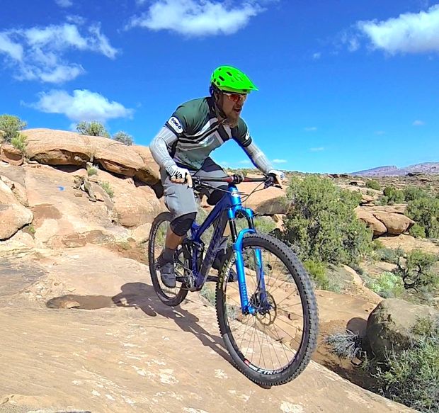
A mountain biker riding over rocky terrain on a sunny day with a clear blue sky. The cyclist is dressed in a black and pink jersey and gray shorts, focusing on navigating the challenging landscape.
  4
A group of mountain bikers in various colored outfits and helmets are lined up next to a starting banner on a dirt path. The setting appears to be a grassy area with hills in the background, under overcast skies. Some participants are holding umbrellas due to the weather, while others are on their bikes, preparing for the race.
  7
Alt text: A detailed view of a mountain bike featuring a black and green frame, showcasing the suspension system and handlebars. Images include close-ups of the shock absorber and fork with branding, highlighting the bike's advanced components.
  1
A mountain biker climbs a dirt trail on a hillside, surrounded by rocky terrain and sparse vegetation under a partly cloudy sky.
Four containers of Nikwax cleaning products are displayed on a red background. The products include TX.Direct Wash-In and TX.Direct Spray-On on the top, and Basewash and Tech Wash bottles on the bottom.
A scenic landscape view featuring rolling hills and a valley, with a winding river and patches of trees. In the distance, snow-capped mountains rise against a cloudy sky, illuminated by sunlight breaking through the clouds.
A black and yellow GT mountain bike frame is positioned on a workbench. The frame features a stylish design with prominent branding and is equipped with a shock absorber. A small piece of wood is supporting the frame, and the background shows a power outlet and a row of electrical sockets along the wall.
A blue fat bike with oversized tires is displayed against a textured white background. The bike features a sleek design, with a modern frame and disc brakes. Additionally, a graphic reading "Coming Soon" is positioned at the top left corner, adding a promotional element to the image.
A mountain biker performing a jump off a wooden ramp in a forested area, surrounded by trees and greenery. The rider is wearing a helmet and protective gear, showcasing an action shot that captures the thrill of the sport.
Two people riding mountain bikes along a dirt path in a desert landscape. The scene features sparse vegetation and a distant mountainous horizon under a cloudy sky.
  6
  2
A mountain bike with orange handlebars and two water bottles mounted on the frame is parked beside a trail sign featuring symbols for biking and hiking. In the background, a rocky mountain range and clear blue sky are visible. The scene is set in a natural outdoor environment with scattered shrubs.
  23
A mountain biker skillfully navigates a rocky trail on a bicycle, with a wooden bridge in the foreground. The landscape features rugged terrain and sparse vegetation, showcasing the challenging environment of the bike ride.
  6
Close-up of a man’s face with a focused expression, accompanied by the text "dirtTV" in the top left corner and the words "BEYOND THE BIKE 'NEEDLES'" prominently displayed. The background is dark, emphasizing the subject's features.
A black fat bike displayed in a shop, featuring oversized tires with white rims and a sleek frame design. Various bicycle accessories and other bikes are visible in the background, showcasing a vibrant retail environment.
  7
A person riding a mountain bike on a narrow dirt trail surrounded by tall grasses and rocky terrain, with hills in the background under a partially cloudy sky.
  2
A spacious bicycle shop featuring a variety of bicycles on display. The interior has high ceilings with bright overhead lights and large windows allowing natural light. Rows of bikes are arranged around the shop, with a counter where staff assist customers.
  9
Logo of "Bell Built" featuring a hexagonal design in red with the words "BELL BUILT" prominently displayed. The tagline "MAKING TRAILS" is included, accompanied by a gear symbol.
A cluttered bike shop filled with numerous bicycles, both on the floor and hanging from the ceiling. Various styles and colors of bikes are visible, including a bright yellow bike prominently displayed amongst many others. Price tags are attached to most bikes, and posters and signage decorate the walls of the shop. The overall atmosphere is busy and vibrant, highlighting a vast selection of bicycles.
  12
A person standing outdoors in a black t-shirt, speaking towards the camera with a scenic background featuring trees and mountains under a clear blue sky. A video player interface is visible at the bottom.
The townsite of Turret, Colorado is located just a few miles up in the Arkansas Hills from Salida. A gold mining town founded in 1897, Turret had a peak population of 400-600 people (depending on the source you consult), but the town collapsed around 1941, when the post office closed. (<a href="http://www.ghosttowns.com/states/co/turret.html">Source</a>) Now, essentially all of the land in Turret is private, and rustic homes are being built or renovated here, way off the grid. While solar panels are now joining old outhouses, many of the old buildings from the gold mining days are still easily visible from the public roads.

[caption id="attachment_43648" align="alignnone" width="620"]<a href="https://images.singletracks.com/blog/wp-content/uploads/2014/04/1455070_10152358017713447_3919587199652954176_n-e1398273073729.jpg"><img class="size-full wp-image-43648" alt="Looking down on the Turret townsite from above." src="https://images.singletracks.com/blog/wp-content/uploads/2014/04/1455070_10152358017713447_3919587199652954176_n-e1398273073729.jpg" width="620" height="465"></a> Looking down on the Turret townsite from above.[/caption]

The ride from Salida to Turret is a popular gravel grinder, with gorgeous views of the Collegiate Peaks across the valley, and the dry, rocky terrain on the Arkansas Hills side. From town, there's quite a bit of elevation gain up <a href="http://www.singletracks.com/bike-trails/cr-175.html">CR 175</a> to the left turn onto <a href="http://www.singletracks.com/bike-trails/fs-cr-185.html">CR 185</a>, which leads to <a href="http://www.singletracks.com/bike-trails/fs-184.html">FS 184</a> and the town of Turret. Having climbed that stretch of 175 numerous times, and since I was planning to tack on some additional exploring to my Turret ride, I drove up to the parking lot near &nbsp;the junction with 183, just shy of the left turn onto 185, to save some miles.

<a href="https://images.singletracks.com/blog/wp-content/uploads/2014/04/2014-04-17-16.07.39-1_620x465.jpg"><img class="alignnone size-full wp-image-43649" alt="2014-04-17 16.07.39-1_620x465" src="https://images.singletracks.com/blog/wp-content/uploads/2014/04/2014-04-17-16.07.39-1_620x465.jpg" width="620" height="465"></a>

When I lived in Georgia, I was no stranger to big gravel rides. We had miles upon miles of interconnected dirt roads in the nearby national forest, but really: the views have nothing, I repeat, nothing, on those in Colorado! Even if these happened to be the most boring of roads, the views would more than make up for the lack!

Still, these roads are anything&nbsp;<em>but</em> boring. While the section of road 185/184 over to Turret doesn't climb climb climb like 175/Ute Trail does, there are plenty of short, steep climbs and descents, making for a relatively rolling elevation profile, and a good workout!

And, there are plenty of cool things to look at along the way:

[caption id="attachment_43650" align="alignnone" width="620"]<a href="https://images.singletracks.com/blog/wp-content/uploads/2014/04/2014-04-17-16.12.13-1_620x465.jpg"><img class="size-full wp-image-43650" alt="Abandoned quarry, now filled in with water." src="https://images.singletracks.com/blog/wp-content/uploads/2014/04/2014-04-17-16.12.13-1_620x465.jpg" width="620" height="465"></a> Abandoned quarry, now filled in with water.[/caption]

<a href="https://images.singletracks.com/blog/wp-content/uploads/2014/04/2014-04-17-16.14.25-1_620x465.jpg"><img class="alignnone size-full wp-image-43651" alt="2014-04-17 16.14.25-1_620x465" src="https://images.singletracks.com/blog/wp-content/uploads/2014/04/2014-04-17-16.14.25-1_620x465.jpg" width="620" height="465"></a>

<a href="https://images.singletracks.com/blog/wp-content/uploads/2014/04/2014-04-17-16.14.32-1_620x465.jpg"><img class="alignnone size-full wp-image-43652" alt="2014-04-17 16.14.32-1_620x465" src="https://images.singletracks.com/blog/wp-content/uploads/2014/04/2014-04-17-16.14.32-1_620x465.jpg" width="620" height="465"></a>

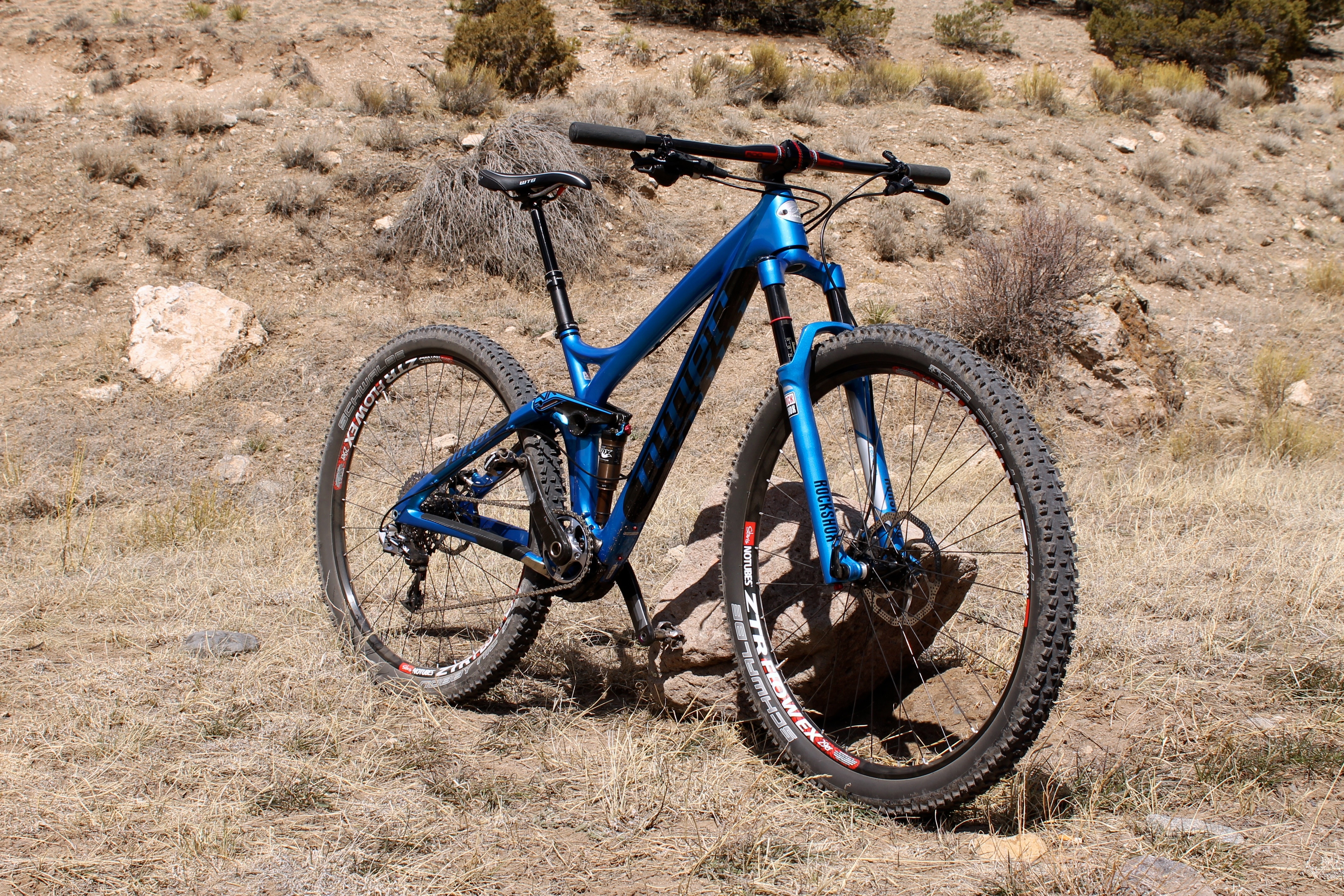
While I definitely didn't&nbsp;<em>need&nbsp;</em>as much suspension as the Niner RIP 9 RDO provides, since it weighs the same as my hardtail, I needed to log miles on it, and I never know what other sort of terrain I might encounter, this was the ideal steed for this ride.

<a href="https://images.singletracks.com/blog/wp-content/uploads/2014/04/2014-04-17-16.24.18-1_620x465.jpg"><img class="alignnone size-full wp-image-43653" alt="2014-04-17 16.24.18-1_620x465" src="https://images.singletracks.com/blog/wp-content/uploads/2014/04/2014-04-17-16.24.18-1_620x465.jpg" width="620" height="465"></a>

One of the sublime features of a this bike is that I can dial down the travel to "Trail" or "Climb" on the CTD shock and fork for efficiency on the gravel, but for the number of impromptu offroad excursions onto unmarked game trails I was able to open it all the way up for a full 125mm of travel for unexpected gnar.

Finally, I made it to my destination!

<a href="https://images.singletracks.com/blog/wp-content/uploads/2014/04/2014-04-17-16.30.14-1_620x465.jpg"><img class="alignnone size-full wp-image-43654" alt="2014-04-17 16.30.14-1_620x465" src="https://images.singletracks.com/blog/wp-content/uploads/2014/04/2014-04-17-16.30.14-1_620x465.jpg" width="620" height="465"></a>

<a href="https://images.singletracks.com/blog/wp-content/uploads/2014/04/2014-04-17-16.30.45-1_620x465.jpg"><img class="alignnone size-full wp-image-43655" alt="2014-04-17 16.30.45-1_620x465" src="https://images.singletracks.com/blog/wp-content/uploads/2014/04/2014-04-17-16.30.45-1_620x465.jpg" width="620" height="465"></a>

I took a left in town and dropped down the gulch for a little impromptu exploring, and the doubletrack road turned into a trail that, according to the forest service sign, is no longer open to motor vehicles (though it once was, and looks like it still receives jeep traffic). Based on the town signs, this doubletrack was called "Alpine Trail," but my map had this gulch labeled as <a href="http://www.singletracks.com/bike-trails/stafford-gulch.html">Stafford Gulch</a>.

<a href="https://images.singletracks.com/blog/wp-content/uploads/2014/04/2014-04-17-16.42.55-1_620x465.jpg"><img class="alignnone size-full wp-image-43656" alt="2014-04-17 16.42.55-1_620x465" src="https://images.singletracks.com/blog/wp-content/uploads/2014/04/2014-04-17-16.42.55-1_620x465.jpg" width="620" height="465"></a>

The doubletrack descended quickly down the gulch, which made me a bit nervous: what goes down must either come back up, or stay down and perish. Based on <a href="https://www.bluespruceventures.com/store/st/index.php?dispatch=products.view&amp;product_id=20">my trusty map</a>, it appeared those were the two choices: while it looked like the doubletrack&nbsp;<em>might</em> peeter out and dead end, it also looked like it could drop a couple of thousand vertical feet, all the way down to the Arkansas River. However, once there, there would be no bridge across the raging river (which had been rising day-by-day with snowmelt), and no other marked trails or roads along the banks on my side of the river.

[caption id="attachment_43657" align="alignnone" width="620"]<a href="https://images.singletracks.com/blog/wp-content/uploads/2014/04/2014-04-17-16.44.53-1_620x465.jpg"><img class="size-full wp-image-43657" alt="Stafford Gulch" src="https://images.singletracks.com/blog/wp-content/uploads/2014/04/2014-04-17-16.44.53-1_620x465.jpg" width="620" height="465"></a> Stafford Gulch[/caption]

So, after descending for a couple of miles, I made the tough decision to turn around and climb back up. I had no idea if the road would just end, or if it would indeed descend all the way to the river, but I knew one thing: I had already descended a long ways from Turret, and climbing all the way back up to 9,000 feet from the 7,500-foot elevation of the river (according to my map) didn't sound like a fun proposition.

<a href="https://images.singletracks.com/blog/wp-content/uploads/2014/04/2014-04-17-16.44.55-1_620x465.jpg"><img class="alignnone size-full wp-image-43658" alt="2014-04-17 16.44.55-1_620x465" src="https://images.singletracks.com/blog/wp-content/uploads/2014/04/2014-04-17-16.44.55-1_620x465.jpg" width="620" height="465"></a>

<a href="https://images.singletracks.com/blog/wp-content/uploads/2014/04/2014-04-17-16.57.13-1_620x465.jpg"><img class="alignnone size-full wp-image-43659" alt="2014-04-17 16.57.13-1_620x465" src="https://images.singletracks.com/blog/wp-content/uploads/2014/04/2014-04-17-16.57.13-1_620x465.jpg" width="620" height="465"></a>

I backtracked all the way up Stafford Gulch, back on roads 184/185, all the way back to my truck.

However, the spring weather was so gorgeous, I couldn't keep myself from a little more exploring in the hills!

<a href="https://images.singletracks.com/blog/wp-content/uploads/2014/04/2014-04-17-18.17.00_450x600.jpg"><img class="alignnone size-full wp-image-43661" alt="2014-04-17 18.17.00_450x600" src="https://images.singletracks.com/blog/wp-content/uploads/2014/04/2014-04-17-18.17.00_450x600.jpg" width="450" height="600"></a>

<a href="https://images.singletracks.com/blog/wp-content/uploads/2014/04/2014-04-17-18.17.04-1_450x600.jpg"><img class="alignnone size-full wp-image-43662" alt="2014-04-17 18.17.04-1_450x600" src="https://images.singletracks.com/blog/wp-content/uploads/2014/04/2014-04-17-18.17.04-1_450x600.jpg" width="450" height="600"></a>

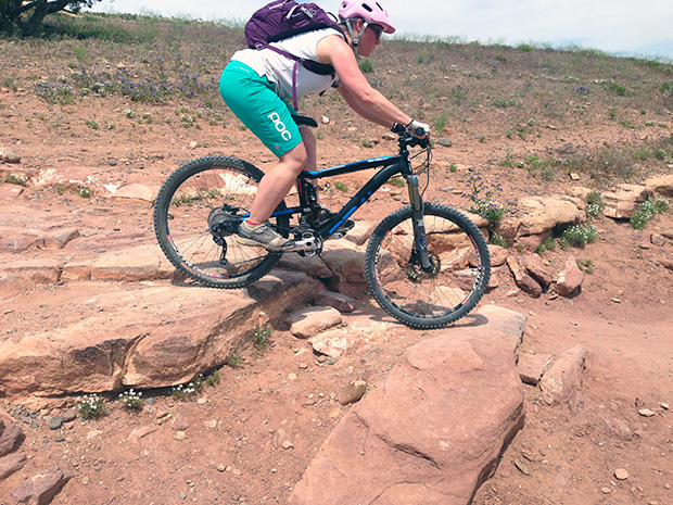
Remember the extra suspension that I wasn't using on the road? It definitely came in handy! As usual, the photo just doesn't do it justice, but I, quite literally, buzzed my butt on the rear tire while rolling this rock. This rock is about 8-10 feet tall:

<a href="https://images.singletracks.com/blog/wp-content/uploads/2014/04/2014-04-17-18.26.04_620x465.jpg"><img class="alignnone size-full wp-image-43660" alt="2014-04-17 18.26.04_620x465" src="https://images.singletracks.com/blog/wp-content/uploads/2014/04/2014-04-17-18.26.04_620x465.jpg" width="620" height="465"></a>

20 miles of riding on new-to-me terrain? Not bad for a Thursday evening!
A mountain biker navigating a rocky downhill trail, leaning forward with intensity as he expertly rides his blue bike through a rugged, natural landscape surrounded by trees and rocky terrain.
An artistic arrangement of Shimano XTR bike components, including a crankset, cassette, chain, and derailleur, set against a dark blue background. The text "SHIMANO XTR" and "ENGINEERED FOR THE WAY YOU RIDE" is prominently displayed.
  6
A fat tire bike parked on a snowy trail, with mountains and a cloudy sky in the background.
  7
A man wearing a black helmet, a dark plaid shirt, and black pants is standing next to a mountain bike. He is holding an orange object in one hand and has a relaxed expression while posing against a textured gray background.
A bright turquoise mountain bike with striking pink accents. The bike features a sturdy frame and is displayed on a stand against a green backdrop, indicating a bicycle event or exhibition.
  2
A cyclist navigating rocky terrain on a mountain bike, wearing a helmet and a red shirt, with trees in the background. The cyclist appears focused and is leaning forward, showcasing a dynamic riding posture.
  9
A high-performance mountain bike suspension fork with a black and silver design, featuring adjustable settings and a sturdy crown. The fork is shown from a frontal perspective, highlighting its sleek lines and branding.
  3
A sleek black fat bike positioned on snowy ground, showcasing its wide, knobby tires and sturdy frame. Pine trees in the background add a natural, wintry setting. The bike features a minimalist design with a small storage bag attached to the frame.
  4
A mountain biker performing a wheelie on a rocky trail, with a mountainous landscape in the background under a clear blue sky. The rider is wearing a helmet and protective gear, showcasing an adventurous moment in an outdoor setting.
  8
Close-up view of a mountain bike tire showcasing its textured tread pattern, designed for grip and traction on rough terrain. The background features blurred earthy tones, indicating an outdoor setting.
  2
A cyclist riding along a winding dirt trail on a rocky, arid landscape with sparse vegetation, surrounded by hills and distant mountains under a clear blue sky.
  4
Illustration of a cyclist riding a mountain bike over a winding path, set against a map outline of Georgia. The design includes the text "Georgia State Parks" and "Biker" at the bottom, with earthy colors reflecting outdoor adventure.
  5
A cyclist riding a mountain bike on a snowy trail in a mountainous landscape, with trees lining the path and clouds in the sky.
  2
Image of a black bicycle suspension fork with red accents. The fork features a sleek design and is branded with the RockShox logo. It is viewed from the front, showcasing its dual legs and mounting points at the bottom.
Outdoor recreation map for Sedona, Arizona, featuring topographic shaded relief and details on 14 popular mountain bike trails, including elevation profiles, trail mileages, and difficulty symbols. The map is waterproof and designed for outdoor use.
  2
A mountain biker navigating a dirt trail in a dense forest, surrounded by lush green foliage and trees. The biker is leaning into a turn, showcasing dynamic motion, while vibrant green plants are in the foreground.
A cyclist riding a mountain bike on a snow-covered trail surrounded by trees, with a cloudy sky overhead.
A person dressed in a bright green and black ski outfit, wearing a blue helmet, is standing on a snowy mountain slope. They are riding a snow bike, with snow-covered peaks and a clear blue sky in the background.
  2
A cyclist stands on a dirt path, gazing at a vibrant sunset over a green landscape dotted with yellow wildflowers. The sky is filled with soft, colorful clouds, and the cyclist is wearing a helmet and sport attire, with a mountain bike resting by their side.
  2
A black mountain bike leaned against a wooden railing overlooking a scenic view of a river and bare trees. The landscape features rolling hills in the background under a cloudy sky, with patches of grass and vegetation in the foreground.
  4
A narrow dirt trail winding through rocky terrain, flanked by large boulders and sparse vegetation. The path is surrounded by low trees and shrubs, creating a natural and rugged landscape. The scene captures the essence of outdoor exploration in a mountainous area.
  17
A female mountain biker navigating rocky terrain, wearing a helmet and cycling gear, as she skillfully rides her bike through a natural landscape. The background features scattered boulders and sparse vegetation.
  16