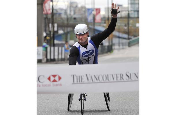
Wheelchair athlete Kelly Smith wins Vancouver Sun Run 10K just 17 months after fracturing his elbow in a gnarly Hawaii mountain bike crash.
From fastest speed runs to longest wheelies, mountain bikers continue pushing extreme limits with world records spanning jumps, races, and gravity-defying stunts.
This comprehensive article explains how to bleed bike disc brakes, replace worn pads, and inspect your hydraulic brakes for wear and damage.
Loeka's Harmony tech shorts offer women stylish plaid patterns, water-resistant fabric, and six pockets, while the matching Mint Chocolate Chip jersey provides feminine fit.
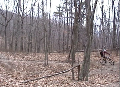
Spring's warming weather tempts mountain bikers onto wet trails, but riding muddy singletrack damages trails—opt for roads or better-drained alternatives instead.
Preparing for a 62-mile mountain bike race with a marathon-inspired training plan: substituting runs for rides and progressively longer weekend sessions.
Riders race 300 miles of unsupported singletrack from the Mexican border to Superior, Arizona, with real-time GPS tracking available online.
Cam Zink's long-awaited Sensus Grips feature a mushroom-inspired ridge pattern, super soft compound, USA manufacturing, and cost just $10.99 per pair.
Kona is crowdsourcing the name for their new long-travel all-mountain bike with Magic Link technology, offering a free bike as the grand prize.
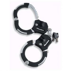
# A UK roofer recovers his stolen $2,900 mountain bike six years later after spotting someone riding it in front of his new house.
Mountain bikers can test ride the latest bikes and gear at the public Interbike Outdoor Demo East in Providence, Rhode Island this October.
# One-Sentence Excerpt Options:
Here are a few 24-word-or-less options in Singletracks style:
**Option 1 (19 words):**
New York rider builds his own mountain bike park with miles of trails, terrain parks, and an indoor winter track.
**Option 2 (24 words):**
When Paul Maggy couldn't find good trails near Plattsburgh, NY, he built the Adirondack Bike Ranch with terrain parks and an indoor track.
**Option 3 (18 words):**
The Adirondack Bike Ranch opens this month offering terrain parks, trail systems, and indoor riding for just $25 annually.
---
My recommendation is **Option 1** – it captures the DIY spirit, highlights the unique features (especially the indoor track), and maintains that enthusiastic, accessible tone Singletracks is known for.
Riders tear down steep staircases and through narrow alleyways during this insane 2005 Red Bull urban downhill race in Taxco, Mexico.
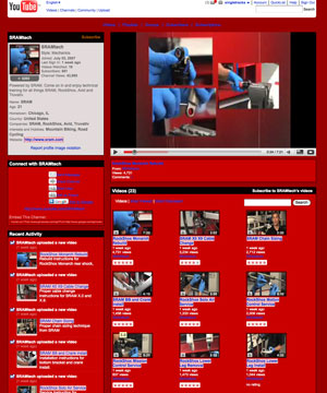
SRAM launched a YouTube channel featuring expert how-to videos for installing and servicing SRAM, RockShox, Avid, and Truvativ mountain bike components.
# Cannondale Moves Frame Manufacturing to Taiwan
Cannondale will shift all frame manufacturing from Pennsylvania to Taiwan by 2010, keeping only assembly, quality control, and customer support stateside.
Looking to shed weight from your mountain bike without spending a dime? Try these four simple tricks using basic tools and elbow grease.
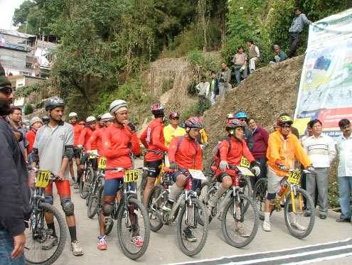
American wins two-week Himalayan mountain bike stage race but organizers cut prize money in half and failed to provide basic amenities.
Hayes Stroker Gram brakes shed 100 grams using titanium bolts and carbon levers, delivering excellent power and modulation for $273 each.
The Simple Strap is a lightweight, versatile $6.99 alternative to bulky seat bags that securely attaches tubes and tools to your seatpost.
Florida's Santos trail system faces an 80% funding cut that could eliminate its freeride park, prompting mountain bikers to rally support.
Gore's new $65 RideOn sealed cable system offers completely contamination-free shifting performance with smooth, crisp operation that's perfect for muddy conditions and demanding riders.
Three mountain bikers continue their epic journey from Fairbanks, Alaska to South America's tip, currently pushing through Peru after three years on the trail.
Mountain Bike Action magazine names Bend, Oregon the #1 mountain bike town, while Boulder, Colorado adds 4.6 miles of new singletrack.
The Titec Hellbent Nemesis Prolite saddle and Duke Prolite seatpost offer epic XC and all-mountain riders improved comfort, reduced weight, and sleek style.
Sugoi's Greta MTB shorts feature carbonized bamboo fabric, UV protection, and a removable mesh liner with women's-specific padding for all-day comfort.
Forbes lists the best US bike trails, but includes paved paths and dirt roads—prompting a discussion of truly epic mountain bike routes.
Trek's Waterloo plant implemented alternating work weeks for 300 employees in February, suggesting softening bike demand could mean better deals for consumers.
The Opus Maadh Limited features stunning custom graphics, 150mm VPP suspension, and weighs just 27 pounds in this versatile trail bike build.
The Sugoi Crossroads Henley blends casual style with high-tech bamboo fabric, offering lightweight breathability perfect for spring rides and early morning trail sessions.
Pro mountain biker Sam Brown, featured in New World Disorder 3 for riding the iconic "Deconstructed Wheel," dies in Spokane jail after drug arrest.
# Suggested Excerpt
Raccoon Mountain's Small Intestines trail features unique "toilet bowl" sections where the trail loops quickly back on itself, showcasing creative modern trailbuilding techniques.
**Word count: 24 words**
This excerpt captures the main subject (Raccoon Mountain trail feature), uses descriptive language typical of Singletracks, and highlights the innovative trail design aspect that makes the article noteworthy.
Klunkerz is the definitive visual history of mountain biking's origins on Mount Tam, featuring rare footage and interviews with pioneering legends like Gary Fisher.
Ellsworth offers $700 off new USA-made frames through March 31 when you trade in your old functional frame, which they'll donate to underprivileged kids.
While the northern hemisphere kicks off mountain biking season, epic stage races like the Absa Cape Epic are wrapping up down south.
Mountain bike prices may stabilize or drop up to 5% as metal supplies increase, fuel costs decline, and economic slowdown reduces demand.
The Intense Micro Knobby tires excel on pavement with 7,500 tiny knobs providing rail-like cornering, but quickly clog with mud on trails.
Customize your mountain bike tires for specific trail conditions by cutting tread patterns, just like pro racer Eric Carter does with his tires.
Learn how to properly inspect, adjust, and service mechanical disc brakes on your mountain bike with this comprehensive step-by-step maintenance guide.
A Jimi Wallet saves a rider from serious injury at Porcupine Rim, while Tasmanian police investigate a dangerous trail booby trap.
World Cup champion Marla Streb offers all-inclusive Costa Rica mountain bike skills camps featuring riding, zip-lining, surfing, yoga, and jungle adventures.
The Black Sheep ZAMer is a prototype mountain bike with giant 36-inch diameter wheels.
Iron Horse reportedly exits the mountain bike business due to mismanagement and greed, according to a former employee's forum post.
This week's MTB news includes leaked SRAM XX component photos, Leadman dirty century training tips, and surprising arguments favoring mountain bike trail access.
Skip the winter wait and head to the British Virgin Islands for a beginner-friendly MTB skills clinic and race series starting now.
# One-sentence excerpt (24 words or less):
Arkansas mountain biker Joe Auck, who lost his hand as a teenager, modifies his bike with distributive braking and creative shifting to ride with his kids.
The "dirty century" — 100 miles of off-road mountain biking — is rapidly becoming the ultimate endurance challenge for adventurous riders everywhere.
Hayes Stroker Ace brakes deliver impressive modulation and eye-popping stopping power with their four-piston calipers, perfect for aggressive all-mountain and downhill riding.
Legendary Bootleg Canyon Trail Master Brent Thomson passes away from complications following quadruple bypass surgery; memorial ride planned for St. Patrick's Day weekend.

 6
6