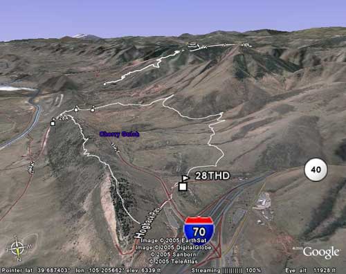
Google Maps adds terrain view with topography and park boundaries, making it a much better tool for mountain bikers to scout trails and elevation.
From GPS units and Fox suspension to Santa Cruz full-suspension rigs, Singletracks members aren't shy about dreaming big this holiday season.
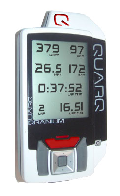
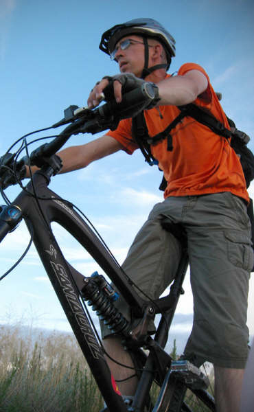
Quarq announces a new GPS for cycling.
Joel "Bombardier" joins Singletracks as Senior Bike Editor, bringing forum expertise to blog posts, gear moderation, and upcoming how-to content.
My Garmin Edge 305 mysteriously died mid-ride, but a simple software update from Garmin's website brought it back to life and fixed ongoing freezing issues.
Garmin's highly anticipated Edge 605 and 705 GPS units have been delayed until Q1 2008, disappointing mountain bikers hoping for a Christmas delivery.
The Christini AWD mountain bike features a switchable all-wheel drive system that promises improved traction for climbing, cornering, and descending on technical terrain.
Mac users can now download singletracks GPS data and load routes onto their Garmin Edge 205 or 305 using the free Training Center software.
Download GPS trail data from Singletracks.com and load it onto your Garmin Edge in just a few clicks using the free Training Center software.
Allen Sports' new $349 Navigator system pairs a GPS pod with your cellphone, but lacks functionality and requires cell coverage—unlike standalone units.
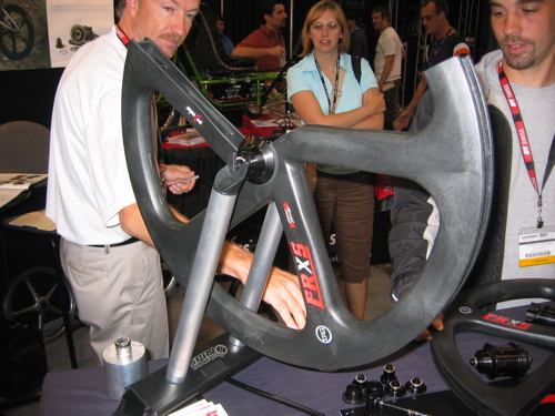
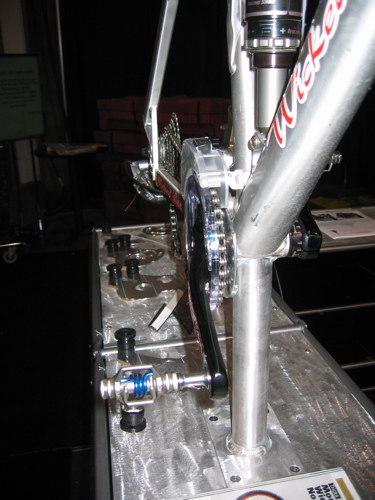
Tag Wheels' new composite wheel system is virtually indestructible and perfect for downhill riders, though the durability comes at a cost: $949 and 3700 grams.
Here's a one-sentence excerpt in Singletracks style:
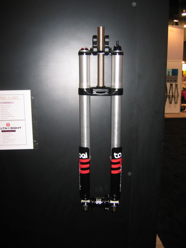
We scoped out the gnarliest suspension tech on the show floor, from Fusion's beefy 8-inch Delta Eight to Marzocchi's massive Triple 8.
The Magura Wotan is a work of art that deserves more attention than it got at Interbike next to the Fox booth.
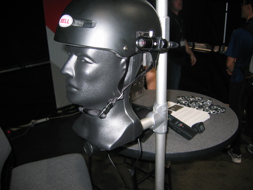
The V.I.O. POV.1 is a pro-sumer helmet cam system with versatile mounting, 4+ hour battery life, and television-beating quality for around $800.
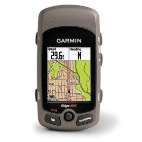
The Garmin Edge 705 uses ANT wireless technology to share GPS tracks between riders and sync with sensors, though its $650 price tag is steep.
The GoPro Helmet Hero captures TV-quality video for under $170 with waterproof housing, simple controls, and versatile mounting options for bikes and helmets.
The Sip Stream system combines the convenience of a hydration pack with traditional water bottles, mounting a drinking tube directly to your bike frame.
Tire Balls uses inflatable spheres instead of tubes or tubeless setups to keep your tires inflated, offering redundancy but adding significant weight.
The Wicked Racin Dualrailleur prevents chain drops while maintaining a double chainring setup, unlike traditional derailleur guides that limit riders to single rings.
Carver Bikes is adding 650B wheels to their titanium lineup, a mid-sized option that splits the difference between 29ers and traditional 26-inch wheels.
**Frustrated with Garmin Training Center's clunky data exports, we built a free web tool to split and convert your Edge GPS files.**
Singletracks now accepts user-submitted mountain bike gear reviews for all products, from sunglasses to bottom brackets, with member points awarded for contributions.
When a fellow rider calls you "old school" on the trail, it might be time for a mountain bike makeover—or embrace the retro style.
This wooden bike prototype boasts impressive stiffness and lightweight design, but would need serious modifications to handle the punishment of real mountain biking.
# My Garmin Edge 305 completely locked up mid-ride, freezing the map and ignoring all button inputs before finally shutting down and losing data.
MapSend Topo 3D delivers incredibly detailed maps to your GPS, but clunky data transfers and rectangular region selection leave room for improvement.
Netherlands-based Specialbike hunts down, refurbishes, and customizes vintage rides for up to $2000, proving classic bikes may be worth keeping in your garage.
Garmin's Motionbased online service promises advanced GPS data analysis, but system errors and questionable value make the free Training Center software a better choice.
# Mountain bikers are ditching lycra for baggy shorts, but some riders are still making the transition from 1990s spandex fashion.
The Magellan eXplorist 400 offers excellent value with expandable memory and long battery life, though its bulky size makes it an ostrich egg on your handlebars.
An Irish engineer invented a sideways bicycle with improved turning radius, but only 6 out of 10 people can actually ride it.
Learn essential tips for collecting accurate GPS trail data, from optimizing track point settings to avoiding signal gaps on wooded singletrack.
We visited North Carolina's first Trek concept store in Raleigh and left disappointed by the bland merchandising, poor branding, and uninspired layout.
A bar-end mounted rearview mirror for mountain biking promises to help you spot trailing mountain lions, but will likely get destroyed on tight singletrack.
The Magellan eXplorist 200 lacks computer connectivity and elevation tracking, making it a poor choice for mountain bikers despite its user-friendly interface.
TopoFusion offers mountain bikers powerful GPS trail mapping with topo maps, aerial photos, and innovative features like difficulty ratings—all for just $40.
Mac GPS Pro offers powerful GPS data editing tools for Mac users, but lacks built-in maps making it better suited for advanced riders than casual users.
Google Earth offers free 3D trail visualization and flythrough features for mountain bikers using GPS data or downloadable trail maps.
Gently used Garmin Edge 205 GPS for sale on eBay, includes free one-year Singletracks membership and possible t-shirt for winning bidder.
Is the Garmin Edge 305 any good for mountain biking? We put it to the test.
High school students in Carbondale learn to hand-build bike frames from master builder Koichi Yamaguchi, who crafted frames for Lance Armstrong.
The Garmin Forerunner 201 works better for running than mountain biking due to a weak antenna and bulky wrist design, though distance tracking impresses.
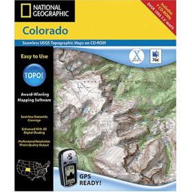
National Geographic TOPO! crashes frequently, requires multiple CDs, can't import GPX files, and costs $100 per state—skip it and choose better alternatives.
Mountain bikers spend more time online than watching races or reading magazines, making web advertising a smarter investment than sponsoring pro riders.
The R-one 4x4 is a four-wheeled mountain bike that's opening downhill riding to wheelchair users and able-bodied riders alike.
Shimano's new "Coasting" automatic shifting technology targets casual cruiser bikes, not mountain bikes, offering a potential gateway for future off-road riders.
DeLorme's Topo USA 6.0 offers vector-based maps, clickable trails, and nationwide coverage on one DVD, making it the best GPS mapping software for mountain bikers.
The Stair Cycle lets riders "pedal" by stepping up and down, creating a stand-up riding experience that could revolutionize mountain biking comfort and handling.


 3
3