
A little known feature of Google Earth is the ability to use custom map overalays. Several people have found ways to use topographic maps as Google Earth overlays and the Google Earth Blog has a good post with links to the more popular solutions.
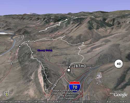
Google Earth is great for viewing mountain bike trail map data collected using your GPS but it will take a little work to get your data in the right format. Fortunately you can use free services like GPSVisualizer to convert your data to the proper format (did I mention Google Earth is also free?).
Once your trail data is in Google Earth, you can do cool stuff like view your track in 3D and even do a “flythrough” of the track you mapped. If you have a singletracks trail or full access membership you can download any and view any of our trail maps in Google Earth and other popular GPS mapping programs.
Even if you don’t have a GPS you can still use Google Earth and if you haven’t tried it yet, it’s a blast. Check out some of the free Google Earth bike trails we’ve posted on singletracks. Enjoy!


1 Comments
Jun 29, 2009