
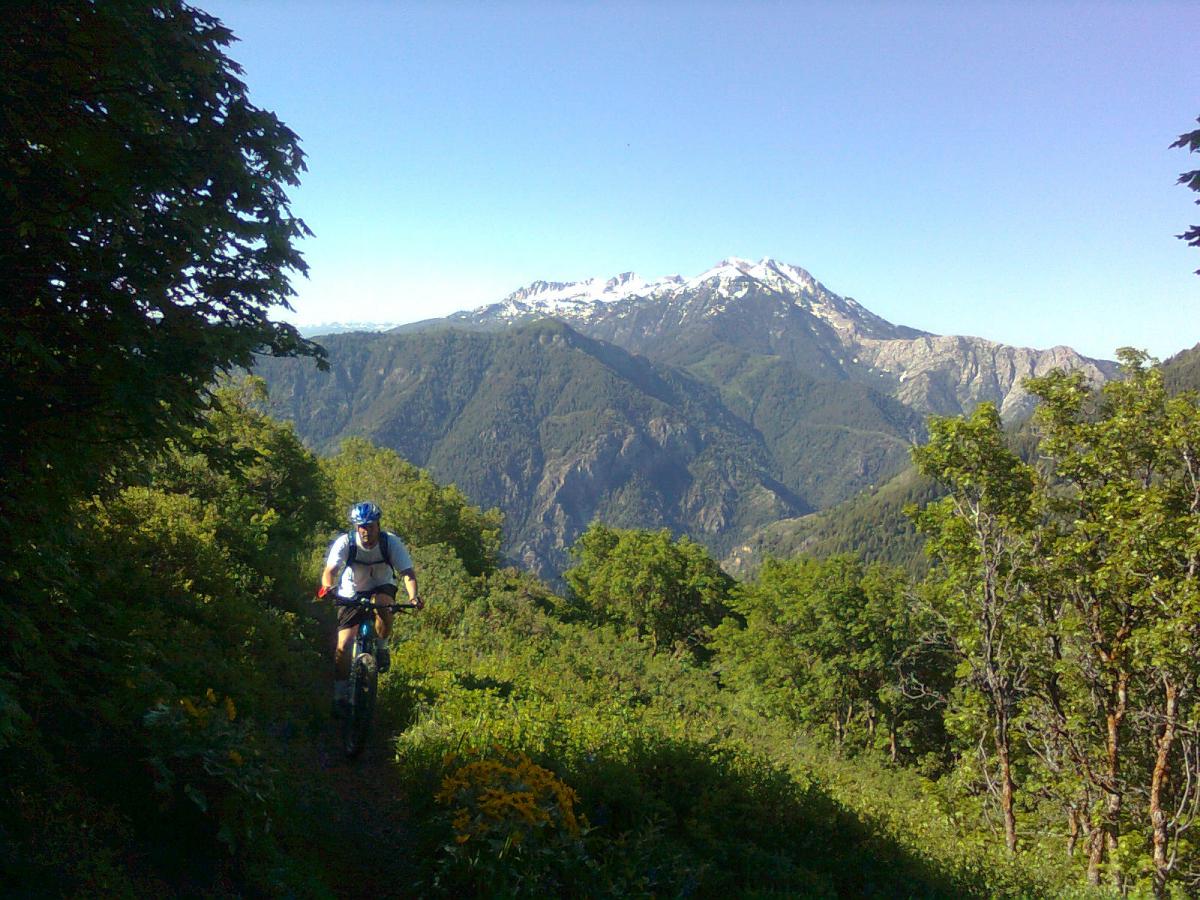
For many of us, climbing on a mountain bike is a necessary evil. We go up, so that we can go back down. Sweat and numb legs are exchanged for jumps, turns, and speed.
For others, it’s their livelihood. A long climb justifies a beer and a towering plate of nachos afterward. Or, long climbs could just be part of a training plan.
For whatever reason, be it an epic descent on the other side, or to get ready for a long-distance XC race, here are ten of the worst mountain bike climbs in the USA based on readily available trail information, reader input, Singletracks’ forums, and research.
These climbs are rated by distance, average grade, maximum grade, ascent to descent ratio, and the altitude.
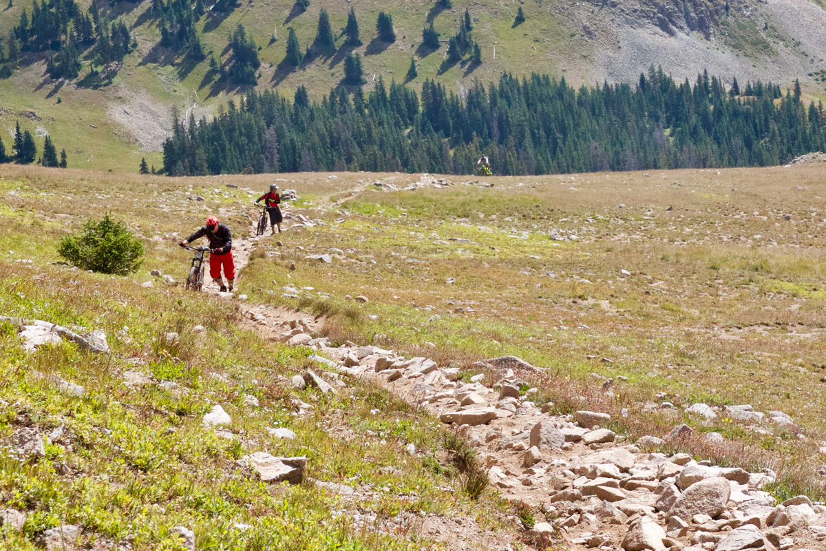
Burro Pass, Moab, Utah
Most mountain bikers in the U.S. have at least heard of Burro Pass, the starting point of the famed Whole Enchilada. At the highest point, the elevation tops out at 11,132 feet on top of the pass. The trees stop growing, the air is thinner, and it’s doubtful that anyone doesn’t hike a bike up to the top, before throwing a leg over and kicking off the descent.

Most of the climb up is around 10-15%, but it gets above 20% in some sections and is even steeper once the trail goes down. Burro Pass is usually only rideable a handful of months out of the year due to snow, opening around June or July every year. The good thing is that it’s only a little more than a mile from the shuttle drop off to the top of Burro Pass. Unless, of course, someone chooses to ride it sans shuttle, from town.
Mountaintown Creek, North Georgia
Mountaintown Creek in Northern Georgia is one example of ride that probably 75% of the time is spent climbing a gravel road, just to get to the singletrack at the end for a short and sweet descent.
The Mountaintown Creek trail itself is about six miles long with a 1,600 foot descent, but getting there is a different story. Many shuttle up, but if not, then it’s a long climb on mostly gravel road with 3,600 total feet of climbing throughout the ride and grades that top out in the upper teens on the way up.

It’s well worth the grueling climb, though, as noted by Singletracks previously, and since it crosses over the actual Mountaintown Creek about twenty times, it gives mountain bikers a chance to stay cool and wash the sweat off of their faces along the way. This trail is the centerpiece of the annual Singletracks Brutal Loop ride, and there’s a reason it’s called brutal.
Skyline Trail, Ogden, Utah
The Skyline trail in Ogden, Utah is a grinder of a time, but because of the high mountain views and scenery, it’s one of the area’s most popular trails in the summer.
There are a few different ways to start his trail, or intersect it and ride parts of it, but for the full experience, start off of State Route 39. The entire trail is 21 miles long with about 7,000 feet of climbing, and sections of the climb reach a 42% grade. The average grade is about 9%.
Mountain bikers can take Skyline to the Lewis Peak trail, also, for more rugged, mountain views. Lewis Peak adds 700 feet of ascending with a 20% max grade and 7% average grade. Turn back into town at the Pioneer trail or head east at the Ben Lomand trail before Willard Peak to cut distance off the full route.
Canyon Creek Loop, Gunnison, Colorado
Outside of the meccas of Crested Butte and Gunnison Colorado is a brutal 20-mile loop with 3,600 feet of climbing known as the Canyon Creek Loop. This loop features steep hike a bike, soul-crushing climbing, and thin air. The loop starts out above 9,000 feet and winds up to 12,500 feet above sea level before dropping back down.

At its steepest, the climb up hits a 30% grade. Most of the time though, riders will spin at around a 7% grade. A lot of the climbing is done via dirt road, and the final ascent is rounded off via singletrack and an hour of hike a bike. Stay in it, bring a lot of snacks, gels, and whatever it takes to get to the top. A ten mile descent comes after summiting.
Doctor Park, Crested Butte, Colorado
When is a seven mile descent worth thirteen miles of climbing and 3,000 feet of elevation gain? When it’s Doctor Park. Never mind that riders also have to forge a river to get there.
Now, it’s entirely possible to shuttle Doctor Park and skip the pain. But, Doctor Park can easily be turned into an all-day epic, as long as the rider knows it’s going to be an energy-sapping day.

Mountain bikers should pack dry socks or drape shoes over their neck while crossing the river if they don’t want to have soggy footwear on the worst part of the climb. After the river, it’s steep forest service road up to 11,000 feet. Most of the climbing will happen under a ten percent grade, but a few sections push it to 15%. It’ll all be worth it on the way back down.
Mill Creek Trail, Sherando Recreation Area, Virginia
At first glance, the Mill Creek Trail doesn’t look all that bad. It’s a little over five miles and almost 1,700 feet of climbing. On paper, that’s tough, but reasonable. That is, until you realize that a thousand feet of elevation gain occurs in the last mile of the trail.

Toward the final series of switchbacks on the trail, it gets very steep. The grade stays in the mid to upper teens, and hits sections of 20-24% grade.
Most people will ride Mill Creek as the main climb in the Sherando Lake Advanced Loop. That guarantees a long day, but enough descending to make it worthwhile. That whole loop is about 20 miles, and adds another 1,400 feet of climbing.
Mile Creek Trail #214, Continental Divide Trail, Yellowstone, Montana
Of course the Continental Divide Trail is full of horrendous climbs, but the Mile Creek segment is especially noteworthy. On the Montana side of Yellowstone, Mile Creek is a connector along the Divide trail, but can also be done as an out and back to reap reward from the pain. In six miles, Trail #214 gains an aching 2,500 feet of elevation, with an average grade of 8% and a max of 27%.

The Yellowstone scenery will make it worth it, though, but be aware that bears are often spotted in the area. Put a can of bear spray in a water bottle cage and play it safe.
The Grinder, Galena, Idaho
The Grinder offers a pretty good bang for your buck, but it’s expensive at first. Within the first mile, it goes up about 600 feet in elevation to 8,400 feet. After that, there’s a solid descent, but then more moderate and rolling climbs.
The Grinder trail itself is only about six miles in length and boasts 1,200 feet of climbing, but fits into a much larger package in Galena, Idaho. In 2017, it was the staple trail for the Galena Grinder, a massive cross-country race on the Grinder and surrounding trails.

Race or no race, the Grinder can be connected with multiple trails in the area for an all-day, leg-crushing ride.
Devil’s Gulch, Wenatchee, Washington
The Devil’s Gulch trail is a notoriously shuttled trail in Wenatchee, Washington. That means two things – the descent is great, and the climb isn’t, which is why riders shuttle whenever possible. As an entire loop, it’s 24 miles long, with 4,000 feet of climbing.

The good news is that the grades stay in the low teens, and it mellows out toward the top. There’s a lot of shade to be found in the area as well, and the descent is a favorite among locals, which makes it well worth the sweat.
Sheep Mountain, Missoula, Montana
Just outside of Missoula, Montana lies a gut-busting, backcountry adventure in the Rattlesnake National Recreation area. If that alone doesn’t deter mountain bikers, then let’s talk about the profile of the trail.
It’s an out and back, or can be done as a lariat with Trail #1513. As a point-to-point trail, it’s close to 15 miles, has 4,500 feet of climbing, and under 2,500 feet of descending. The average grade is about 9% and hits grades in the low 20s on the climbs.

The Sheep Mountain trail can be used to connect to dirt roads on the other side of the mountain for an easy, but still somewhat long cruise back to town, if turning back around and hitting the trail again sounds like too much.
Have you ridden a trail worse than any of these? Let us know in the comments!


9 Comments
Jul 26, 2018
I definitely agree with Shiggy.
Jul 26, 2018
Bring your Big Boy Pants for the first two miles of Mission Ridge.
Jul 23, 2018
Jul 23, 2018
The Barr trail up Pikes Peak is another one that would be really terrible, though not especially steep or technical until you get near the top. 7,000 feet of climbing over ~11 or 12 miles.
Jul 23, 2018
Jul 26, 2018
Jul 27, 2018
Jul 29, 2018
Dec 20, 2018