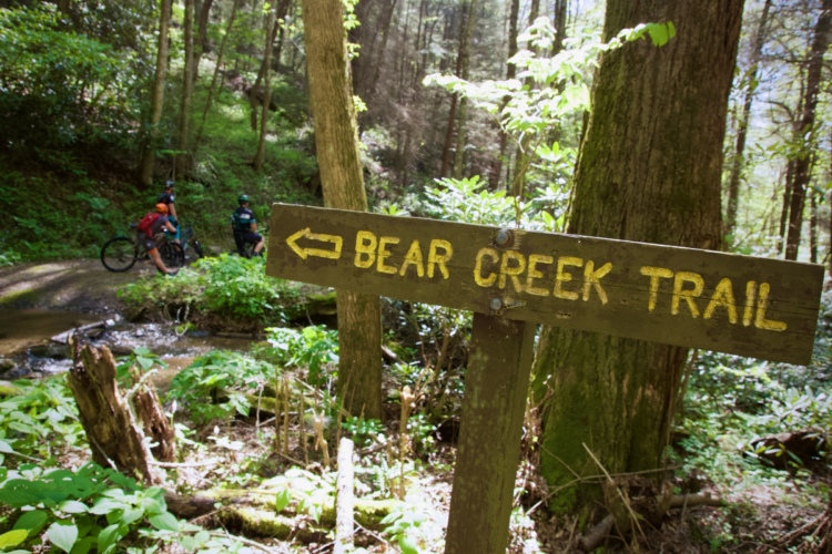
This is a singletrack downhill on an old logging roadbed, with numerous technical creek crossings. You will get wet. The train follws Mountaintown creek down the mountain. The trail is easy to follow and ends with a two mile gravel forest road ending at a paved road. You can then bactrack up the mountain or turn right on the paved road; the Bear Creek Trail entrance is just across the bridge to the right. Follow the Bear Creek trail back to FS 68 and follow the driving directions back to the trailhead. This loop is 22.8 hard miles.


 15
15

This trail is Appalachian backcountry singletrack at its finest. Plummeting down from the top of the ridge, steep, rooty trail starts of the ride right by working out those arms, legs, and brake pads. If you're truly flying down this section, it might beat you up a little, as some pretty big repeated hits are fairly regular.
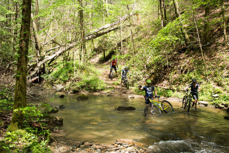
The second phase of the trail is winding, technical singletrack that crosses Mountaintown Creek quite a few times. Although you can try to ride them all, chances are you'll at least put a foot down at some point, so make sure to bring an extra pair of socks.
| ThankRode Mountiantown trail on 3/31/18 as part of Mulberry Gap/Singletracks 32mile brutal loop, which Started with 13 mile gravel road up hill climb to the trailhead (which is also driveable). 13 miles up was rewarded by a great XC downhill trail, including several short creek crossings.
| Thankjust noting that FS 64 is closed 4 miles past Potato Patch, going towards Betty Gap. This means you can NOT drive all the way to Buddy Cove Gap parking lot/Mountaintown Trailhead. But you can drive to the Three Forks lot; there's a new gate immediately after that because a section of road collapsed/closed to vehicles. Might be good to have a bear bell on this ride ... a little beyond where the road collapsed, we inadvertently treed a couple tiny baby bears. We only caught a glimpse of Mama Bear before hightailing it back the way we came.
| ThankLoved this trail!!! The downhill was an absolute blast! Of course not knowing the area we parked at the top and did it as an out and back, the back was not so fun!! Great trail!
| ThankMy new favorite trail in Georgia! It's a long slog to get to the top but the long descent is worth it. The top starts off swoopy and smooth, then transitions into steep and rocky with plenty of stream crossings. Hard to find another descent this long in Georgia. Spring scenery is excellent.
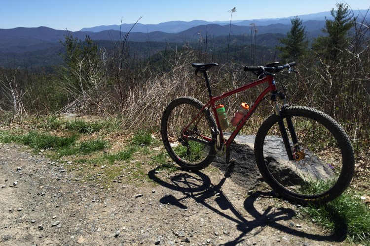
| ThankMountaintown Creek is one of the best descents in North Georgia. The top of the descent has plenty of water bars to launch off of, then it gets steeper and more technical. Lots of rock in places. Eventually the trail mellows way out and you'll cross Mountaintown Creek numerous times. Be ready to get wet. Some crossings are rideable, others are too deep.
It is tough to get to though. You can either ride it as an out and back, a shuttle, or a loop that requires a bunch of fire road climbing.
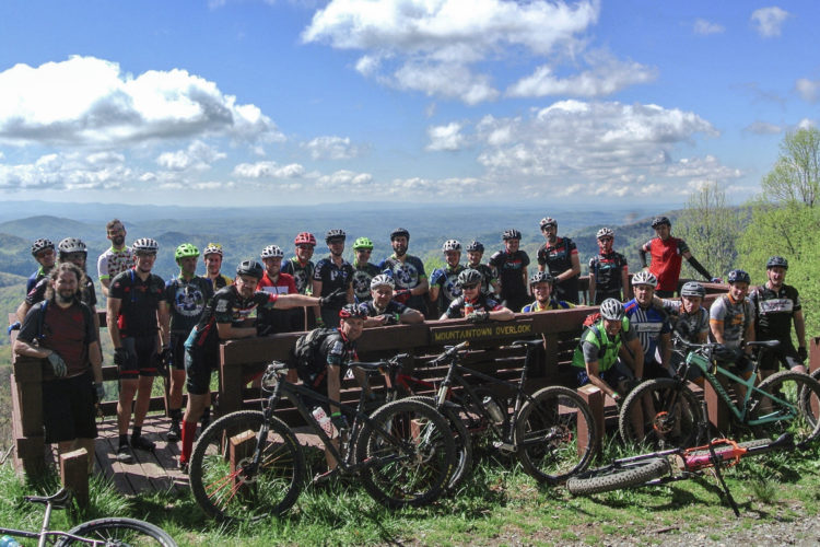
Mountaintown was in the Singletracks BrutalLoop ride which also hit up Pinhoti 1 and Pinhoti 2. If you add those trails in, the time on the gravel is worth it.
Mountaintown is remote and there are some chunky steep sections at the top. Ride smart.
| ThankDid this trail up and down. Up was pretty difficult but down was a lot of fun. It looks like someone has recently went through and cleared the trees and stuff that had fallen.
| ThankFantastic view of the river , fast fun down hill on the way in . just be ready to hike a bike out . there was lots of trees across trail so trail clean up in needed. condition of trail affects the fun factor
| ThankThis is definitely a challenging ride both ways! Much of the uphill is steep and rocky and is hike-a-bike when climbing. The ride back down is super fun though, and the views of the waterfalls and creek are awesome! It's a challenging ride, but I definitely recommend it!
| ThankThe directions listed above are a bit complicated so let me provide a simpler alternate route. From Blue Ridge, go north on GA 5 for about 4 miles. Make a left on Old Ga 2/Hwy 2/Ga State Rd 2. Keep straight on this road until it turns to gravel and you come up to the 4 way intersection of Watson Gap; approximately 10 miles. Make a left on Forest Rd 64 at Watson Gap and continue straight until you reach the Mountaintown Creek Trailhead. You'll pass the Jacks River Fields Camping area when you are about 2 miles short of your destination. I think Forest Rd 64 is closed between January and March so beware. Mountaintown Creek itself is a nice, 6 mile, semi technical ride down the mountain through several creek crossings. Most people link it up with other singletrack and forest roads in the the area because it is so short but I personally have no interest in riding the 22 mile Mountaintown Creek Loop described here by others because over 70% of it is Forest road riding. Not my thing. However, I do like linking it up with the South Fork trail and the Pinhoti Trail north of Mountaintown Creek for a nice 21 mile lolipop layout ride. Only two miles of forest road on this route. ;) Bring your A game because this lolipop loop will challenge even the pros.
| ThankThis is a tough trail! If you do the whole loop it is around 22 miles. We have done it several times. Doing the whole loop is a lot of Forest Service Road riding which I can do without. What we do now is take two cars. We drive one to the upper trailhead parking lot and park one at the bottom on Gates Chapel Road. That way we skip all the dirt road riding and just do the single track. It is an epic ride best done in warm weather. Lots of creek crossings that can be deep after a hard rain, but that is why I mountain bike and not road bike. I love the adventure! This is a great ride, but you need to be a pretty good technical rider to ride this trail. If you want to have a great epic ride...Enjoy!!!* Review edited 12/28/2009* Review edited 12/28/2009* Review edited 12/28/2009
| ThankA few really nice views, but overall not really worth the climbing. The Bear Creek part was fantastic, but after lots of fire road climbing, I hoped for more than what Mountaintown Creek ended up being. The first part obviously has had a lot of maintenance recently and there is fresh grass growing all over the trail, and after that it became a consistent mix of only sometimes rideable stream crossings, and lots of fallen trees that were too big to move. Next time I'm in the area, I'll ride all of Bear Creek or do one of the Pinhoti loops as they are worth the fireroad climbing! It was a good workout doing the 22.1 mile loop on the map here, but I won't be doing it again.
| ThankRode this trail on a wet July 2, 2004. I wasn't prepared for this ride. First it was alot more challenging than I thought and secondly it was alot more beautiful than I thought. The ride takes you down the mountain and crosses the creek numerous times. It was a great downhill but very technical with many rocks, fallen logs and loose stuff. The creek crossings were very technical and We had to walk over most of them. This downhill drops about 1500 feet over the five mile and WOW its a ride. The beauty is also wonderful. You definetly feel like you are someplace that no one has been. Definetly take a camera. Also remember what goes down must go up, and it was a heck of a climb to get back to the vehicle. It was a long ride to get to this trail but worth it.
| Thank