

Once you tip over the Continental Divide on Colorado’s I-70 heading west, there are a slew of mountain biking pit stops before you reach Utah. There’s Eagle, just west of Vail, then Glenwood Springs and Palisade, Grand Junction, and Fruita.
What folks heading west in the springtime on the way to Fruita or Moab might not know is that Rifle, seemingly another small oil and gas or ranching town nestled along the Colorado River, has added 12 miles of new mountain bike trails over the past four years with another six miles on the way at the Grand Hogback trails.
Rifle, Colorado, originally Ute Territory, was founded as a ranching town, but over the years it’s shared an economy with the oil and gas industry and followed its natural highs and lows. The Bookcliffs, or the spiny mesas along the north side of I-70 that are seen all along the western part of the state, are said to have the richest concentration of oil shale in the world, making Colorado a top producer in natural gas.
This isn’t necessarily a story of an oil town gone bust, in search of a new answer for their economy. Rifle probably won’t balk at the idea of attracting visitors and tourists, but Rifle local, trail builder and mountain bike trail advocate Aaron Mattix says that the beneficiaries and primary ridership of the area’s latest trails are its residents.

More for the locals
“I think it’s a two way win,” said Mattix, owner of Gumption Trail Works and the designer of the latest Grand Hogback trail system. “It improves quality of life for locals, for people who live here. And then it does also make us more more attractive as a tourism destination.”
But, Mattix adds, “I would say it was much more motivated by quality of life for locals, than looking to bring in tourism.”
Rifle-area mountain bikers have had access to the Hubbard Mesa area on Bureau of Land Management land for a long time, but it’s also shared with dirt bikes and OHVs and recreational shooters. Mattix calls it the “Wild West.”
A 2015 story by the Post Independent details growing conflict and how mountain bikers and other trail users have had close encounters with irresponsible shooters.
It was that kind of free-for-all use that led Mattix and others from the Rifle Area Mountain Bike Organization (RAMBO) in search of something better.
“We were starting to put more pressure on the BLM and trying to find a way to organize, to address some of these issues and see what we could do to have a better experience for mountain bikers.”
After many conversations and bringing city and land officials out to see the Hubbard Mesa trails, Mattix says the BLM pointed them toward a zone north of town. The Grand Hogback area had been cleared by Colorado Parks and Wildlife (CPW) for trail development and the BLM was ready to hand it over to RAMBO to start building.
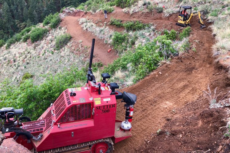
The City of Rifle allocated $80,000 for the project and RAMBO received a $160,000 grant from CPW to kick it all off. Mattix drafted a master plan and started to survey the Grand Hogback.
Lay of the land
When Mattix is surveying an area for a new trail system, he usually relies on game trails to learn the terrain and the most convenient ways to move around, but it was evident early on that few animals had been in the area and he had to familiarize himself with the hills.
“This was sort of challenging, to have like just such a blank canvas really, like not any preconceived notions of the area and also just like the lack of game there,” he said.
Mattix ran into some parts, like deep gullies and drainages that wouldn’t work for the layout, but from the road, where the trailhead would lie, the land rises gradually, making it ideal to build a stacked loop system with a steady climb.
“It was pretty exciting,” he said. “Just the way that the topography is. It’s this kind of series of stepped alluvial mesas. So you have the largest, flattest, broadest mesas down lowest and closest to the trailhead and then they kind of get progressively steeper and smaller as you go up towards the hog back.”

Riding in Rifle, Colorado
There are essentially four stacked loops at the Grand Hogback and each trail or loop climbs and falls about 300-400ft.
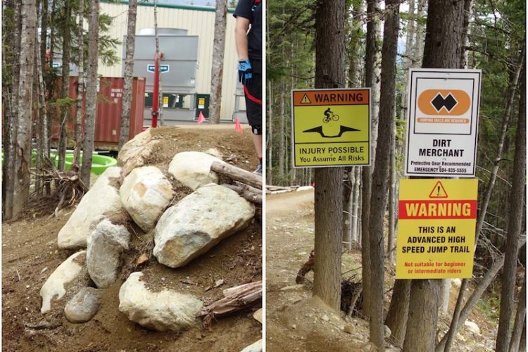
Most of the trails at the Grand Hogback are somewhere on the spectrum of green- and blue-rated, but their latest trail, Pete Rock, is an advanced singletrack with rock rolls, drops and alternate lines. And there is another smattering of new mountain bike trails one town over on I-70 in the neighboring town of New Castle, not to mention one-third of the trails at the Grand Hogback remain to be built, hopefully by the end of this year, says Mattix.
He likens the network to being a mix between the rocky and tight trails at the Lunch Loops in Grand Junction and the flowy parts of Loma, just past Fruita. Even in the heat of summer, the dirt packs down nicely and riders can find their speed.
Mattix says the shoulder seasons in spring and fall are still the best time to experience the Grand Hogback for perfect temperatures, and when they’re getting most of the trail work done. The trails will be running again on April 15 after a seasonal wildlife closure lifts.


2 Comments
Mar 26, 2024
Mar 29, 2024