

Shortly after our group made it back to the campsite, a quick ride from where the Palisade Plunge trail spits you out, someone asked me if I’d ride it again. I chewed on the question for several seconds before answering, and let out a hesitant “probably.” My reasoning, hampered by fatigue, hunger, and thirst, was that I’m sure that a friend will want to ride it at some point, and I’d take it on again if they needed a teammate.
I knew far more quickly after riding Monarch Crest, the Whole Enchilada, or Mag 7 that I would ride those epic routes again, and I have. But the reality of riding the Palisade Plunge has differed widely from expectations and for some that’s been a good thing and for others, maybe not.


The Palisade Plunge has been a vision for a handful of folks for at least a decade, says Scott Winans, the board president for COPMOBA, the Colorado Plateau Mountain Bike Association. Most of it was built at a record pace over the past two years. After years of planning, land use agreements, and trail building, the Plunge opened on July 24, 2021.
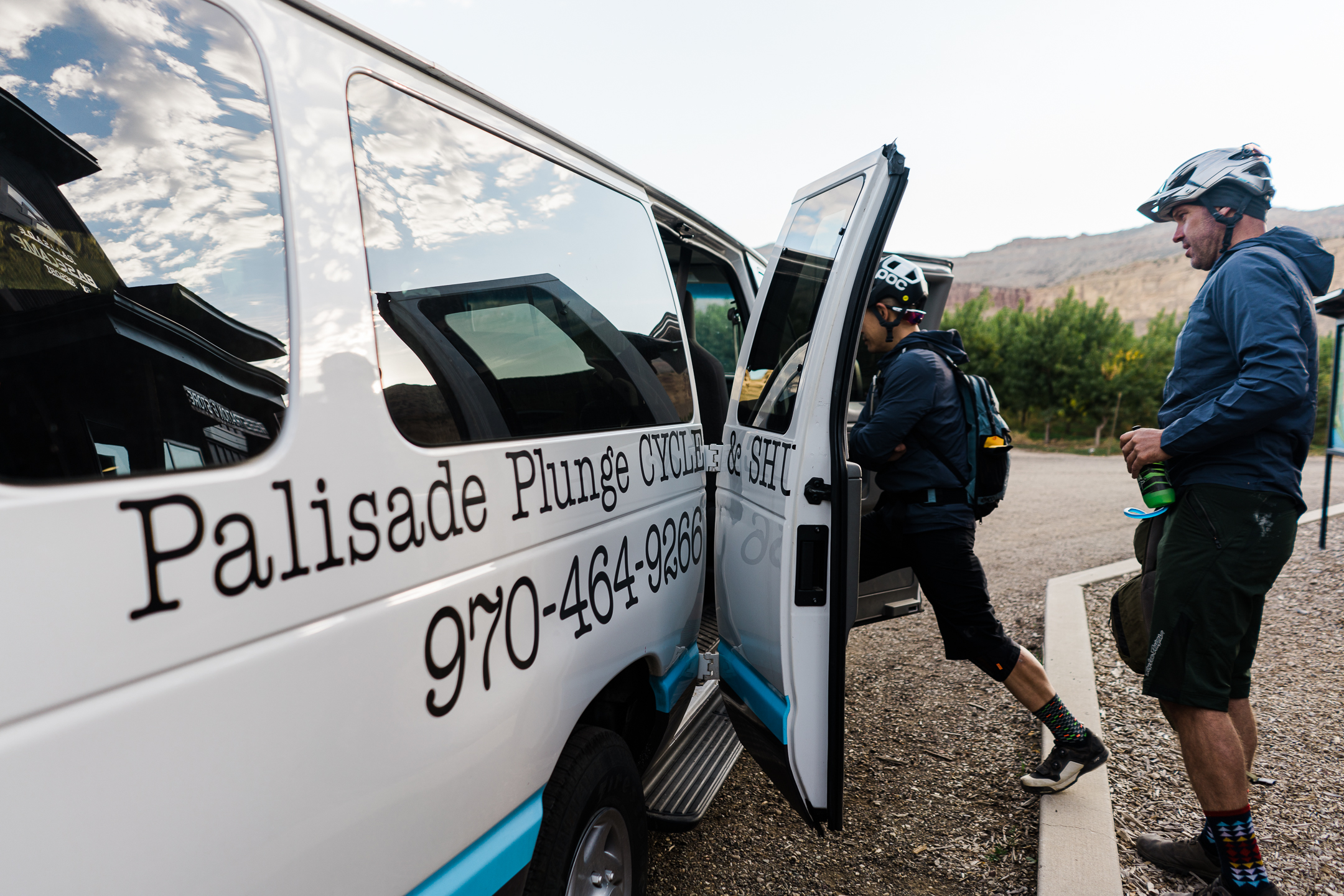
I rode the trail with a group of other journalists and a few fine folks from Pearl Izumi and Hunt to try out new apparel and wheels. We started at the very top off of Highway 65 after a pretty drive up the mesa.
The mesa top


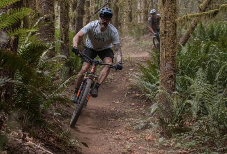
The first several miles of the Plunge happen on narrow singletrack that winds in and out of the aspens, and up and down hills and rocks. The starting elevation – according to my Strava – was 10,748 feet and you slowly chip away at the elevation for the first several miles.
We navigated through grazing land, passing blank-faced black and brown cattle, the trail hammered by their hooves and speckled with half-emerged, pointy lava rock. Much of the upper portion of the Plunge trail was rough and uneven. If you have too much air in your fork, your hands are going to let you know.
This grazing land and the arrangements between the landowners, the mountain bike association, and other partners were a landmark for COPMOBA, says Winans.
“We are not the only people who have wanted to make a trail from the top of the mesa to the valley floor. But the hurdles to doing so are huge, not only geographically and physically, but organizationally.”
Throughout the Plunge, riders will cross through land owned by the Bureau of Land Management, the Forest Service, the Town of Palisade and City of Grand Junction, through two watersheds and a Bureau of Reclamation waterway. COPMOBA also purchased a piece of land to make the trail happen, and there is an easement through more private property.

In 2016, governor of Colorado John Hickenlooper announced the initiative 16 in 2016, which highlighted 16 priority trails across the state. COPMOBA made a case for the Plunge and when it hit the list, the real work began. Winans said they had studied economic impact projections from trails like the Monarch Crest, and their own trailheads in the Grand Valley. Putting an estimated return on the Plunge made the $3.4 million price tag an easier sell.
“The Palisade Plunge will connect with miles of existing trails and offer access to stunning backcountry terrain. The BLM estimates that this project could infuse $1.9 million annually into Palisade’s economy and $5 million annually into the broader Grand Valley economy.” Winans thinks that the estimate is conservative. In either case, the project should pay for itself within a few years. A major part of that budget has and will go into expanding or building trailheads and even paving a section of road in Palisade, which is part of the full Plunge.
“You know, really it’s easy for us, the trail enthusiasts and riders to conceive of these neat ideas of a trail like this,” says Winans, “but the municipal partners, the county partners, all of that comes because they’re looking at economic impact.”
Otto’s Wall


Suddenly, our group ran out of aspens to ride through, and we were stacked against a cliff with three-foot-wide trail winding down the side. It’s wide enough to ride in a straight line, but completing a switchback on bike is a feat, especially if you’re not fond of heights.
There’s no reason to be too scared on Otto’s Wall. The Wild Rose trail, which was built by John Otto, a trail advocate who constructed the trail in the early 1900s, has about a dozen switchbacks, dropping people from the mesa top down into the Kannah Creek Basin. It’s easy to walk with a bike if need be, and easy to tell if you should or shouldn’t attempt to ride it based on your own skill level.
Otto’s Wall is a great spot for photos and dramatic views of the Grand Valley from atop the Grand Mesa. After Otto’s Wall, we’re deep in lush foliage and aspens and creek crossings; an area known as the Kannah Creek Basin that we had to climb out of, and it was physical and demanding. Rocky, technical, and punchy. Someone compared the riding through here to the east coast and it’s an apt description.
By this point, we had only done about 500 feet of climbing. I’d done 4,000 feet on a high elevation ride the week prior and Kannah Creek put the hurt on me. Fortunately, it’s a beautiful section.


The Kannah Creek Basin was another challenge that COPMOBA had to make a strong case to the USFS to utilize for the Plunge. Winans says that the agency wasn’t terribly receptive to the idea at first because of increased traffic, but routing the trail this way saved COPMOBA a ton of work and gave them access to 10 miles of existing trail.
After knocking off the mesa top, Otto’s Wall, and Kannah Creek basin, we stopped at Lands End Road for a quick lunch. An assertive chipmunk scampered around and pestered our group for lunch, literally trying to grab pieces of food from my hands. Next we dropped into Phase 1 of the Plunge and the first few miles of Phase 1 might be the most fun.
The first phase


After Kannah Creek and the intersection of Lands End Road, Phase 1 starts with flowy jumps, kickers, and berms. I’ve rarely been so appreciative to be on a flow trail, but the fast moving trail was much needed after the relentless rock from the prior 16 miles. Riders can also start at this point and shave off the upper portion of the Plunge for a shorter option.
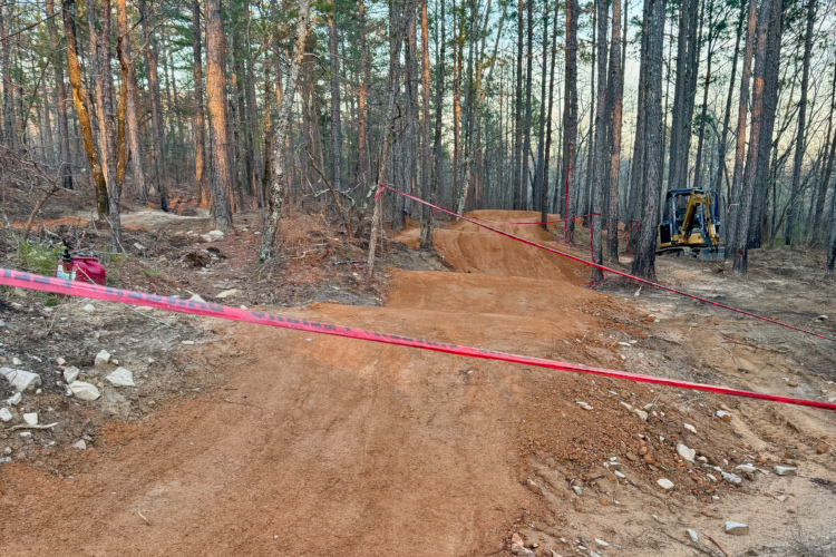
Winans says that they started building the Phase 1 portion of the Plunge first, because access was better and the weather was more cooperative. For the two years that they built the Plunge, they had multiple construction crews deployed on the trail, working for eight or nine months out of each year. He notes that some of the trail is still a little rough and will need fine tuning over the years.
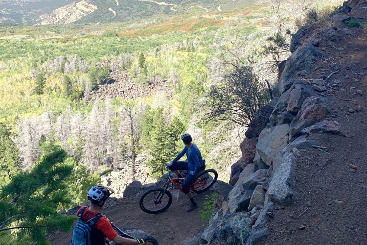
From the beginning of the Phase 1 section and on, the trail alternates between sections of fantastic flow, to techy and exposed rim riding, to sandstone climbs reminiscent of southwest Utah or Moab, and down to more exposure along narrow, bench cut trail carved onto the edges of cliffs.
There aren’t any sections on the Plunge that are anywhere near as harrowing as the Portal trail in Moab, but there are many sections where the consequences may be just as high. Riders should keep some sugary or caffeinated treats on hand to keep their mental acuity high, because almost all of Phase 1 requires a lot of focus and precision on the descents.
People looking for the thrill of smashing rocks at careless speeds, like on Porcupine Rim, aren’t going to find much of that on the Plunge. Aside from the sweet flowy sections on the upper half of Phase 1, much of the descending is deliberate and slow-going. It was impossible to stay in one gear and leave my dropper post in one position for more than a minute or two.
“I feel like I’m earning my turns all the way down,” I said somewhere deep into the ride. The Plunge is indeed a lot of work for a shuttled ride. I asked Winans about the profile in an interview a week after.


“Even though you have 6,000 feet of net descent, you don’t have that in a – as you see having ridden it, it’s very much a substantial traverse, you know, and it is not a DH experience. And it was never conceived of as that,” he says.
Winans notes that even though you’re descending around 8,000 feet and climbing around 2,000 feet, it’s over 32 miles and the average grade is about 3-4%, so for the Plunge to be a total downhill experience, it would need to be shorter by several miles. My final stats, based off my Wahoo GPS were 1,400 feet of climbing and 7,300 feet of descending over 32 miles. Average speed was about 8.5MPH and max was 23MPH.
My moving time was 3 hours and 41 minutes, but our group spent some time on the trail taking in the views, eating, and tending to mechanicals. We suffered four or five, including a puncture, a runaway shock bolt, a broken derailleur, and a broken axle. Definitely give your bike a once over before departing. The trail is as demanding on bikes as it is on the rider.
Impressive trail work continues along the final portions of the Plunge. There are steep rock gardens next to sheer drop-offs, and switchbacks around rock walls. It’s apparent on the entirety of the trail that building singletrack was a gargantuan task, and if you’re someone who nerds out over trail work, you’ll enjoy seeing much of the trail.
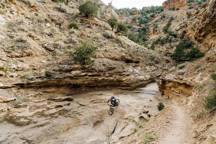
The last three miles of the Plunge are a hoot. We dropped into a wash with slickrock drops and squeezy lines between rocks and bigger rocks. This section is another highlight and a great photo opportunity and it feels appropriate to finish on a handful of fun features.
And roughly six-and-a-half hours after we had started, we’re back near the Colorado River trailhead on the edge of Palisade. You can dip in the river and grab replenishments immediately. “That was the key to this trail is that you end at a town,” says Winans.
Soaking in the Plunge


After showering, and downing a water, Coke, and chips while plopped in a camp chair, I posted some pictures on Instagram. A few friends responded, asking how it was. Some had ridden it and weren’t impressed and others had friends that had ridden it and told them they weren’t impressed. Someone in our group looked up the trail on MTB Project and noticed the blunt reviews which had garnered a 3-star average. Some are a little more pragmatic than others.
“This trail currently sucks, need[s] a lot of work.”
“Pretty bummed with my experience on this trail after all the hype.”
“Calling this one the Palisade Meander instead of the Palisade Plunge.”
Not all of the reviews are negative, but quite a few of them are. Knowing that many Coloradoans and mountain bikers were hyped for this trail, and seeing that a lot weren’t satisfied with how it turned out, I asked Winans about the comments.
“One, I know that nothing pleases everybody,” he said, “but that aside I think that an important part of it is about expectation management and that is so hard to accomplish, but also important and that’s one reason why I think the language, whether it’s a ‘backcountry epic’ language or something akin to that, is much more appropriate to helping to scope people’s thoughts before they get here.”

And while something might look like a massive descent drawing a line from the top of a nearly 11,000 feet mesa down to under 5,000 feet, when it comes to routing the trail and then digging it, things can change quite a bit. For Winans and COPMOBA, pulling the Plunge off in two years was huge.
“But, it’s a big beast and getting it built in a two-year window was an astounding accomplishment. And again, I know that that might not be important or resonate with a lot of trail riders, but I think it’s also a discussion worth having with us as why as trail consumers, get to know what it takes to create a trail. It’s no small undertaking on the folks who do it, whether it’s professionally, or on a volunteer basis are working with a lot of partners in the process and they’re big undertakings.”
As a mountain biker, some rides are motivated by their hedonistic descents, like a lift-served bike park, and some are motivated by the accomplishment, like a cross-country race. Plunge riders are likely to find both.
Key points for the Plunge

- Expect a big day in the backcountry and to earn more turns on the way down
- The Plunge is closed from 12/1 – 5/1 every year
- A mid-travel bike might work the best for agility, pedaling, and descending
- Bring at least 3L of water, and lots of food before you get on the shuttle
- Most of the riding is physically and mentally demanding, from beginning to end
- There are great views, gorgeous trees, and exceptional sections of flow trail
- There is amazing trail work throughout the route
- There are shorter, ~20 mile route options from Shirttail Point
- See COPMOBA’s Plunge page for more info and shuttle options
Show your Support
Become a Singletracks Pro Supporter today and enjoy benefits like ad-free browsing.
With your support we can provide free worldwide trail information and original content created by our team of independent journalists.


8 Comments
Oct 7, 2021
Oct 9, 2021
Oct 7, 2021
Oct 17, 2021
Oct 5, 2021
Oct 17, 2021
A real DH experience, head for Keystone and go to work, give your bike a workout.
Oct 5, 2021
It really suck that the development group couldn’t have got more money when the government spent $19 million on 1.4 miles of the silly Peaks to Plains trail.
https://www.denverpost.com/2021/08/30/peak-plains-trail-clear-creek-canyon-jeffco/
Oct 7, 2021