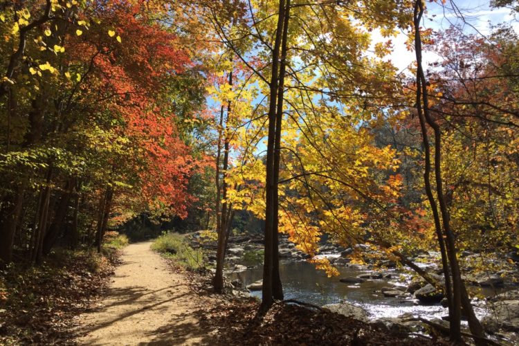
Network of singletrack, solid trail surface and quick flow allows for decent speed. Technical trail options throughout network: whoops, log jumps, downhill berm section, bridges, stream crossings, log and rock piles.
North trails and South trails separated by the Wakefield Park road. North trails are accessible from multiple points on the other side of baseball and soccer fields behind the Audrey Moore RECenter. There is a doubletrack greenway behind the park baseball fields- RIGHT turn(North) will go to Wakefield North Trails along Accotink Creek and access to the "Bowl" section,follow orange and yellow trail blazes.
LEFT(South)on greenway will lead to a tunnel crossing under Braddock Rd and on to the Lake Accotink Network trails.
To access Wakefield South trails, from Audrey Moore RECenter parking lot entrance go left across footbridge and look left for tunnel crossing under Wakefield Park road. South trails are marked with blue trail blazes.


 2
2

Great trails. There are tons of trails all around the wakefield area. Some of the trails are extremely easy and could be done by someone with zero experience, like the one along the creek. There is a large section of field where most of the more intermediate/advanced stuff is. They have redone that are so there is now a new jumpline, which is great because all the jumps are roll-able and all tabletops. There are small and big ones on the jumpline so if you are just starting then its a great area to practice. There is also a way that you go back down the hill that is full of berms, with 2 jumps at the bottom of the berms. The jumps at the bottom are extremely easy to over-shoot because they are too small for the amount of speed you get. When it rains these trails do get muddy (especially the ones along the creek) so it can take a couple days for them to become rideable again. Otherwise they are great
| ThankGreat trail. Couple really tiring climbs but definitely worth it once you get to the top.
| ThankThis is a review of the trails across Wakefield Park Road between the baseball fields and 495 known as "The Bowl." Unless you are brand new to mountain biking or just want to brush up your skills at narrow, twisty, flat cornering, skip these. They are pretty boring and don't offer much. Better off to go ride the trails on the north side of the Wakefield Power Station known at the race course.
| ThankWe have been getting a LOT of rain this year, the trails have a lot of mud, the flow section is very rough and washed out. This area has great potential with the wonderful singletrack out in the woods and the flow section under the powerlines, if the rain would let up and the trails could dry out and be repaired...
| ThankWakefield is a nice track which winds through the woods and the paths of the area which is very beautiful. The routes are not difficult and you can still choose if you want to ride those a little more technical or make the ones suitable for everyone. The only negative thing is that the place is absolutely to be avoided after the rain because there are many swampy areas full of mud; It would also be forbidden to travel most of the paths when there are those conditions.
| ThankNice park with a large network of trails that intermingle so they are in a geographically rather small area. The trails in the woods are fine but pretty similar to a lot of places in the area, so I wouldn't come here just for them. The main reason to come here is what they call the racecourse that runs under the power lines- awesome. Basically runs between the Beltway and the woods under the power lines from Americana Park on the northern end of trail system to the Power Transfer Station. At that point you hook back into the trails in the woods. There are two trails that run N-S on the edges- one along 495 side and one along woods side and then trails that go between. The go between trails are a series of S curve after S curve with awesome dirt berms- the best I've seen around DC area so far. So if you want to practice berm riding before hitting that bike park- this is a good place to come. Also some jumps and rocks placed as obstacles that are fun. Trails in the woods were fine- a few decent downhills and some roots and fallen trees that are rideable over and some rideable stream crossings with mostly just dirt twisty rolly stuff. I didn't find a lot of the woods trails too exciting, although they were fine. I parked on the southern end of trail system in the lot by the Fairfax County Parks Dept building and entered along the outfield fence of the baseball field, crossed the paved trail and took the stream trail north. Next time I will park in Americana Park so I am closer to the racecourse and just hit that all day- I could do that again and again.
| ThankGreat Trail System! Depends on where you get on, some places the trail head is hard to find
| ThankNot sure why others don't like this course more. It's a race track, not an all mountain ride. Know that going in, your are golden.
To send this trail, you really need all of your skills. There are flow DH sections, flow flats, berms of all sorts, tech sections, wood features, a few jumps...
my biggest complaint is that I can get lost...which which really only requires a small turn back to fix.
If does not have the flows and climbs of FH, but you can't race FH...so...
I suggest you ride this this track a few times in one day, first exploring, then running hard. The exploring part will allow you to finds a fun trail path... worth the extra hour out there.
| ThankOnly scratched the surface due to moist trail. Seemed like a lot out there. Doesn't seem like it would get too boring very quickly. Looks like an old school trail. Roots and loose rocks. Not much appears to be machine bench cut. Good stuff!
| Thankreally really cool trail. little bit of everything for beginner to intermediate. such a gem for being right in suburbia
| ThankNice trail system would take a few visits to know all of the paths and what direction to head on the power line trails. I was worried somebody would be coming down as I was going up on the blind turns.
| ThankThe summer rains that only last 10 minutes fill every low spot with water. The result is a thousand warm puddles full of mud. Just 10 minutes of hard rain is enough to turn Wakefield into a swamp that still needs 48-hours to dry out. So if you see the rain coming, ride hard, because after the rain, you feel bad for riding home on wet trails.
| ThankI went for their Wednesday at Wakefield race series. It was a blast. This is a new layout for 2016 and it has something for everyone! It is a 5 mile loop. Beginners do one lap, masters and sport does 2 laps, and experts do 3 laps.
Very fun, very well managed.
| ThankGreat beginner/intermediate trail
| ThankFirst time at Wakefield, and I didn't really know where the trail started. I was fortunate enough to run into three great guys (you guys know who you are) and they were kind enough to invite me along to ride with them. Thanks guys. I had a great time riding this incredible place on this incredible day, with you. You're the reason why mountain biking is so much fun: the people. You challenged me, gave me some tips, and we had some laughs.
| ThankLong story short: amazing bike park, lots of variety in the trails and obstacles... something for everyone. I'll be back!
First run on Wakefield, and I had a ball. Was unsure of where to go to start on a trail, and looked up three guys just heading out. These three guys (and you know who you are) invited me along, and showed me a great time on the trails. Thanks guys. You're the reason why mountain biking is so much fun: the people. Long story short... loved the variety of the trail system, loved the obstacles (no serious crashes... all good), and I felt tired but happy when I was done. This new guy to the area will be back!
| ThankGreat little trail close to DC. When pulling into the main lot I parked in the first lot on the right, trail starts behind the baseball field. Twisting single track with very little elevation change. This would be a great place to bring a new rider to get them used to real single track without a lot of climbing. Trails are marked, I followed yellow mostly with a few off shoots. Total trail length is around 6 miles but you can add time/ mileage by doing a few loops.
| ThankRight across Braddock from my office, what more could I want? Fun place to ride with some places to work on skills and options to challenge most beginners to intermediate riders
| ThankWakefield is a nice and convenient place to ride without having to drive a bit further out from the city. The track is mostly MC with a couple of small jumps. The knock I have with Wakefield is that their trails seem to be poorly maintained compared to other places. The flowly twisting section that comes back down the hill under the power lines is almost completely blown out on one side making it pretty useless for keeping speed. The trail markings can also be a bit confusing. Still, I find it's a good ride when I don't feel like the climbs of some of the other places around.
| ThankHas both beginner trails and intermediate. A lot of fun. One of my main go to's
| Thank