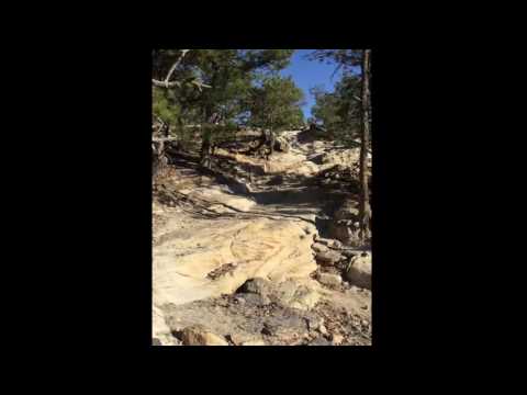
This place has a great combination of fast trails and technical sections. At times the trail is a bit wide but this allows for more speed and greater air on the jumps. Some of the hills offer great technical practice. This place is great.
 | Almond Butter | 0.5 mi | |
 | Rattle Rocks | 0.5 mi |


 2
2
Great new addition to Ute. Downhill fun!
| ThankUte Valley is a great place to ride. There is a lot of different levels of riding. It is nice to have a change of pace while riding. You can loop all sorts of different trails together for different rides so it isn't the same ride every time.
| ThankA great in town location for a ride. You can do a quick 30 minute loop or ride everything and take 2 hours.
| ThankJust rode some of the newer trail in the lower eastern portion of the park. Lots of nice technical narrow single track. I dismounted a few times. Fun ride.
| ThankThis place is an amazing riding destination, but it can piss you off. Why you may ask well ask anybody here on all of the single tracks there is a random ditch that you have to bunny hop which isn't ideal.
| ThankI've never been to Moab, but I can only imagine it being a little bit like this; I call it mini-Moab. Great rock obstacles and relatively easy climbs.
| ThankUte Valley provides an amazing Mountain Biking experience. I ride with WMBA with women of all ages and skillsets. We had an amazing ride. The terrain give nice smooth rocks and nice downhill. I love this place! It is a gem in our city!
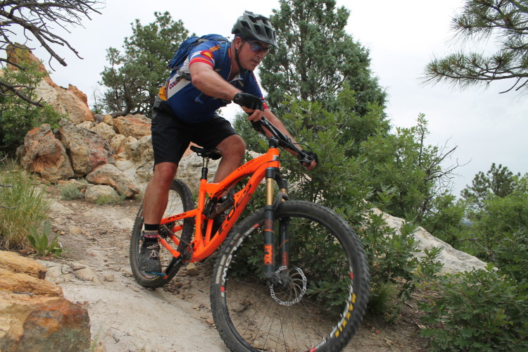
| ThankThis is a great trial for those that are intermediate and above. The trail has lots of flowy rock gardens with plenty of droppers. Down at the bottom there are a few areas that have sand but for the most part most is hard packed with rocks. There are also a few sections that are in the advanced range.
| ThankThe directions built in to the app take you to a neighborhood with no wilderness around, does anyone have a better address I could copy and paste into google maps? Thanks!
| ThankGood ride for the people who live in town. A little bit of everything .
| ThankI really like this one, you can make it long or short.
| ThankFun trail, lots to explore and a little of everything
| ThankSome fun obstacles to play around on and some short portions of trail that are nice. All in all, not a bad ride for afterwork and to keep up skills and conditioning in the winter.
| ThankGreat place for an afternoon ride. Go off the main trails and hits some smaller one and you can find some good technical riding
| ThankRode this trail 3 weeks ago on a trip to the area. Absolutely loved it. A great lessons for beginners in picking a line and negotiating rocks. Wish we had something like this in my town!!
| ThankLOVED this trail. I'm starting to do intermediate trails and this was perfect. Learned to ride rocks, roots and boulders. I did push the bike a few times. But when I rode it, it was a blast.
| ThankIt's a great trail with a lot of variety. Has big boulders and fast XC, open space and wooded trails. Not too long but tons of fun can be had!
| ThankIt swaps from dirt to rocks, with tough bits, to sand and so it is good for developing skills and fitness. Just a really top place. Views are great.
| ThankGreat trails with decent variety. The only dings are it's too short and there can be a lot of hiker traffic here depending on the day/time. Good trail for hill sprints and practicing cornering.
| ThankFun trail but a lot of the main trail is very wide. Lots of hikers as well. As others have said, a good mixture of technical up and downhill as well as some sandy and open flat spots.
| Thank