Three Peaks Trail System trail photo
See all photos (19)
×
User
Today
 
  |   Rate it:

Tags:
Level: Advanced
Length: 20 mi (32.2 km)
Surface: Singletrack
Configuration: Network
Elevation: +435/ -444 ft
Total: 20 riders
 

Mountain Biking Three Peaks Trail System

****   Add a review
#57 of 696 mountain bike trails in Utah
#1,139 in the world

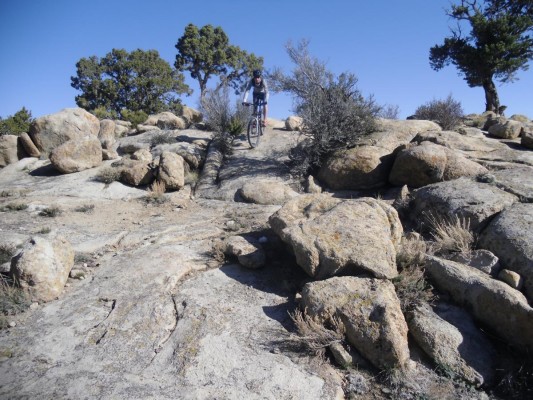
Race Loop heads up to a Ridge and plunges back down. Big Hole Loop is 7 miles intermediate with some tech, 500' of climbing. Three Peaks loop is 10.2 miles with some of the riding on pink granite. Most of the trail has pines and junipers. Expect solitude as I saw no one on these trails.

First added by abegold on Jul 12, 2012. Last updated Apr 28, 2020. → add an update
Before you go
  • Drinking water: unknown
  • Lift service: unknown
  • Night riding: unknown
  • Pump track: unknown
  • Restrooms: unknown
  • Fat bike grooming: unknown
  • E-bikes allowed: unknown
  • Fee required: unknown
This trail information is user-generated. Help improve this information by suggesting a correction.
Getting there
Northwest of Cedar City, Three Peaks recreation area is a large local park with camping. Altitude 5800'. From I-15 Center exit #59 head west on highway U-56 for 3 miles to Lund Hwy, north 5 miles to Mid Valley Rd, trun west 2 miles to Three Peaks parking.
System trails (1)
Featured in


Three Peaks Trail System Trail map

Add to or improve this map // Share this map on your website

Local Info

Club Sponsor

-

Local Bike Shop

Trail checkins

Richard Hoffman (on Oct 12, 2019)
What's this?

Upcoming Events

None.
Add one

Trail conditions

Good (on Sep 21, 2019)
login to update

Camping & Lodging

Coming soon!

Three Peaks Trail System videos

Add a video
We don't have any videos of this trail yet. Add one here.

Mountain Bike Trails Near Cedar City, Utah

| 0 mi
****
Intermediate | 3.6 mi
****
Intermediate | 1 mi
| 0 mi

Add a review

Rating
 
Difficulty
 
Review

Reviews

    Loading reviews...

Rider questions