Located along the east branch of Soquel Creek and including portions of Amaya Creek and Fern Gulch Creek, the Forest contains redwood, mixed hardwoods, and riparian ecosystems.
Soquel is geologically active, with the San Andreas and Zayante Faults passing through the property.
There are several natural springs and small marshes found in closed depressions, known as sag ponds.
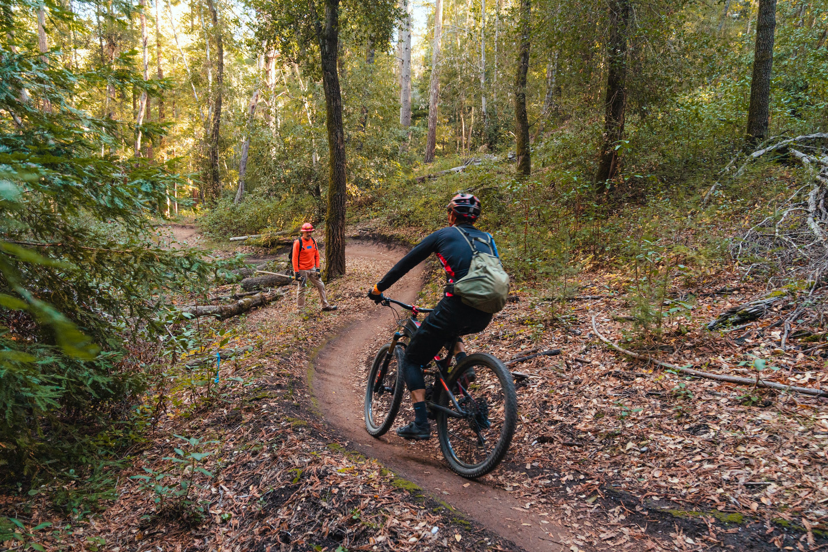
Visitors enjoy hiking, bicycling, picnicking and horseback riding.
There are no restrooms and no developed water sources in the forest so please bring your own drinking water.
Hours for use are dawn to dusk; day use only.
Horses and mountain bikes need to stay on trails or roads.
Pets are welcome but must be on a leash.
No smoking or fires of any kind are allowed in the forest.
No firearms or motorized vehicles are allowed in the forest.
---
There are two main access methods on your bike:
You can either climb up Highland Way (the long route), or start across the bridge through the
fireroad.
If you climb up Highland Way, continue on the road for approx 2 miles until the first gravel fireoad off to the right. Continue the climb into the Forest of Nisene Marks. At the sign, take the fireroad
down to the left and do a little more climbing until you see a singletrack trail to the right.
You can take the singletrack up through the woods (relatively easy climbing, with one short steep uphill) but the fireroad will join up at the end of the singletrack run. Go left on the fireroad for yet more climbing. Take another left onto Aptos Creek Rd and cross over the gate for yes, still more climbing. You will eventually get to a clearing where you can take a right onto the Ridge trail and take a glimpse at the trail map.
Off of the ridge trail, you have a few options for getting back downhill: Sawpit, Tractor, Braille, Sulphur Springs trails.
Tractor trail is a fun long singletrack downhill, well worth the climb. A little bumpy at first,
but smooths out so you can go top speed. When you spit out on the fireroad, head right for a gradual climb back out towards the bridge where you parked. Though there is a lot of climbing in the Demo Forest, it is mostly on fireroad and in the shade. You will be glad you did it because the downhill really pays off!
 | Aptos Fire Road | 12 mi | |
 | Big Ride | 50 mi | |
 | Braille Trail | 1 mi | |
| Demo Forest Flow Trail | 3 mi | |
| Hihn's Mill road | 5 mi | |
 | Ridge trail | 4 mi | |
| Sawmill trail | 1 mi | |
 | Sulphur Springs trail | 1 mi | |
| Tractor trail | 1 mi |


 11
11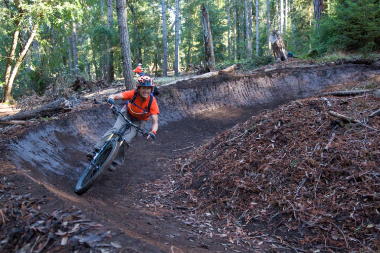


Nothing technical about this ride. Just a lot of elevation change. The scenery is great. Make sure you bring a lot of water. The temp can get up there in certain parts. I rode this fire break to get to to the flow trail. It is the best rail I have ridden in the central coast. It is a must for any mountain biker that come through the area. It is about 30 minutes of downhill.
| ThankRode this yesterday... WOW! The climbs up to the top and back to the parking lot were about 4.5 miles each. But each was gradual and not painful. I hate climbing but I would do this again and again! Anyway, Flow was super fun but tiring. I believe it's about 4 miles long. We rested twice, but that was because of me. I consider myself a beginner, maybe intermediate but going down the descent was tiring for me. I started cramping up on my upper left thigh the moment we entered Flow. Lots of berms, 2-3 foot drops. Can't wait to go back.
| ThankI'll call this 4 stars but hear me out. First I'm stingy with the 5 stars. The Flow and Braille sections are worthy of 5 stars - absolutely killer! But the to and from to get to the singletrack is a LOT of fire access road climbing. To get in and out my app says about 10 miles and 2600 feet elevation. Worth it? YES, but be prepared.
| ThankGreat trail.
| ThankGreat trails the flow trail is great. There is some uphill at the end but not to bad. You could easily do this on a basic hardtail.
| ThankI agree.
| ThankBeautiful Flow trail. It is amazing would recommend it to anyone. Not for beginners tho must have at least 120 mm of travel becasue very rough in some parts.
| ThankThis trail is one of the best on the west coast. There are a few long climbs, but Braille and Flow make it worth it!
| ThankAwesome flow and a nice climb this place is really nice.It doesn't have many features but it's still one of the best trails in SC
| ThankGreat, fun trail not for beginners but is awesome with lots of obstacles and technical sections
| ThankSo whats the difference between this and the one listed as "Big Ride"?
| ThankAs of last Sunday April 2nd 2017, all the trails have been closed due to storm damage. Highland drives was open, but the trailhead at the bottom was locked up tight. At the top the tape was removed, but it may not be legally open. I need my flow trail fix soon!
| ThankThe Flow trail was one of the best trails I've ever ridden. Cannot wait to go back to SC and ride again!
| ThankReally sweet area to ride through! We usually start at the bottom then ride the road to the top, and bomb down! I could spend hours there!
| ThankDemo Forrest is absolutely the must-do area in Santa Cruz...Period! Tons of work by the guys from Ibis ensure these trails will be in great shape year round.
| ThankThere a many different routes, so pick your poison. I am one who never mindss the opportunity to mash some pedals in order to earn some DH fun. In Demo Forest there is definitely some work to be done in the earning department. It's a slow steady climb to get to the Forrest, but once you're there, you'll forget you just climbed to get there. Amazing flowing DH rides with GREAT natural terrain features, huge banking turns, and even a few spots to create some white-knuckled riding. A day of riding Sawpit, Braille, and Flow will give you PLENTY of fun and remind your legs why carbs are important when you pedal back to the car. You'll take a puff or two with all the climbing, but EPIC flowing downhills make it every bit worth it.
Great single track, and flow trail, be ready for climbing!
| ThankFirst time riding here and I want more. It was so much fun enjoying the flow trail. I am getting spoiled riding all these trails in California. I plan on visiting many more times this year.
| ThankThis morning we are off to Downieville.
The flow trail on Demo is about 4 miles long. Feels 10 times longer than Camp Tamarancho. The Braille trail is a fun technical decent.
| ThankReview is for the FLOW TRAIL that is now complete: Amazing design and flow. Dizzyingly fast descent on very well maintained berms. Great skill building area. Take the shuttle up from Aptos ($25) or ride 15 miles up the fire road. RIde the Ridge Trail to access (now) 4 very good descents, including the Flow Trail.
| ThankHighly recommend calling one of the local "Guides": Dave @ Shuttle Smith Adventures
| Thank831-234-3383. WELL worth it! Shuttles up and back, very knowledgeable and the owner recently placed #3 in his class at the recent Sea Otter Classic Downhill! He knows these trails well. Call him!