Latest mountain bike news

Garmin Edge 205 cycling GPS device displaying the main menu with options for History, Training, Navigation, and Settings.
  6
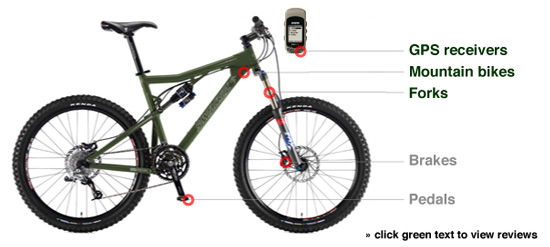
An image of a mountain bike with labeled components including GPS receivers, mountain bike frame, forks, brakes, and pedals. The bike is depicted in an olive green color. There is also a small digital device shown at the top of the image.
<!-- wp:paragraph -->
<p><img id="image149" title="edge.jpg" src="https://images.singletracks.com/blog/wp-content/uploads/2007/03/edge.jpg" alt="edge.jpg" width="150" height="195" align="left">I got <a href="http://www.singletracks.com/mountain-bike/reviews/gear.php?gearID=188">my first GPS receiver</a> for Christmas in 2000 and since then I've purchased and tested a number of offerings from Garmin including the <a href="http://www.singletracks.com/mountain-bike/reviews/gear.php?gearID=192">Vista</a>, <a href="http://www.singletracks.com/mountain-bike/reviews/gear.php?gearID=202">Forerunner</a>, and now the Edge. After using the <a href="http://www.singletracks.com/mountain-bike/reviews/gear.php?gearID=194">Garmin Edge 205</a> for a short afternoon I have to say this is easily my favorite GPS for mountain biking.</p>
<!-- /wp:paragraph -->

<!-- wp:paragraph -->
<p>The first thing I noticed about the Edge 205 was its size-- much thinner and lighter than the bulky eTrex series. The unit came with two bike mounts (you can configure the software to track multiple bikes as well) that secure to your stem or handlebars using two zip ties (no tools required). The default configuration is to mount the unit to your stem but I found that my stem is a bit too steep to get a good view of the screen while riding. I'm guessing this configuration is a bit more stable than handlebar mounting since your stem experiences less tilting while thrashing the trails. The Edge clips into the mount from the side which is also an improvement over the eTrex-- no more popping out as you bomb down a rocky trail.</p>
<!-- /wp:paragraph -->

<!-- wp:paragraph -->
<p>Out at the trail I immediately appreciated the improved battery configuration. The unit didn't turn itself off once (a big problem with the eTrex series) even as I motored through rocky and rooty sections of singletrack trail. The built-in rechargeable battery keeps the unit small and tight though this can be somewhat limiting on longer or more remote rides with no access to a power source. You can recharge the batteries using the USB connection or included power cord, a nice feature for rides close to home.</p>
<!-- /wp:paragraph -->

<!-- wp:paragraph -->
<p>Another huge improvement over the eTrex and Forerunner is the improved satellite antenna. The Edge never lost its signal even in densely forested terrain that previously caused problems for my eTrex Vista, though I suspect Garmin simply turned off the annoying "lost signal" messages. My map turned out great with little overlap even though the trail I rode (<a href="http://www.singletracks.com/php/trail.php?id=625">Lake Crabtree</a>) is a tight network with plenty of doubling back.</p>
<!-- /wp:paragraph -->

<!-- wp:paragraph -->
<p>The data screens on the Edge 205 are nicely simplified so you don't spend lots of time scrolling between useless screens (like the compass screen on the eTrex). Sadly, though, the Edge 205 doesn't give you an elevation plot screen, a <strong>HUGE</strong> disappointment and major oversight on Garmin's part (the 305 gives you this screen but why should you have to pay an extra $100 to view data it's <em>already</em> collecting?). You can view elevation data on your computer once you download the GPS data but it's nice and often important to have access to altitude data on the trail. Adding waypoints on the go is a bit cumbersome but the large Start/Stop and Lap buttons on the top front of the unit are handy for managing trip data.</p>
<!-- /wp:paragraph -->

<!-- wp:paragraph -->
<p>Garmin offers a PC and Mac OS X version of its Training Center software for the Edge and I'm truly impressed with the software (it is <em>free</em> after all). The maps have major highways built in so you can orient yourself and you can plot all kinds of data like elevation, heart rate, etc. (though you'll need the 305 to track heart rate and cadence data). You can export your data in XML format but sadly it's Garmin proprietary markup. Converting the data to GPX (a more standard format) requires the use of additional software, though I found <a href="http://www.gpsvisualizer.com/convert">GPS Visualizer's online conversion utility</a> worked fine.</p>
<!-- /wp:paragraph -->

<!-- wp:image -->
<figure class="wp-block-image"><img src="https://images.singletracks.com/blog/wp-content/uploads/2007/03/edgesoftware.jpg" alt="edgesoftware.jpg"/></figure>
<!-- /wp:image -->

<!-- wp:paragraph -->
<p>If you're looking for a good GPS unit to take mountain biking, the Garmin Edge 205 is easily the best we've seen (though in the very near future we'll probably upgrade to the 305). The improved satellite reception, small form factor, included software, and simplified interface make the Edge series the perfect replacement for your cycling computer or recreational GPS unit.</p>
<!-- /wp:paragraph -->

<!-- wp:paragraph -->
<p>Note: I bought my Garmin Edge 205 on Amazon last week for around $120 which is a crazy deal (the MSRP is over $250). <a href="http://www.amazon.com/exec/obidos/ASIN/B000BKP7ZW/philremlyriarch">Get yours today</a> while the deal lasts!</p>
<!-- /wp:paragraph -->
<!-- wp:paragraph -->
<p><img id="image149" title="edge.jpg" src="https://images.singletracks.com/blog/wp-content/uploads/2007/03/edge.jpg" alt="edge.jpg" width="150" height="195" align="left">I got <a href="http://www.singletracks.com/mountain-bike/reviews/gear.php?gearID=188">my first GPS receiver</a> for Christmas in 2000 and since then I've purchased and tested a number of offerings from Garmin including the <a href="http://www.singletracks.com/mountain-bike/reviews/gear.php?gearID=192">Vista</a>, <a href="http://www.singletracks.com/mountain-bike/reviews/gear.php?gearID=202">Forerunner</a>, and now the Edge. After using the <a href="http://www.singletracks.com/mountain-bike/reviews/gear.php?gearID=194">Garmin Edge 205</a> for a short afternoon I have to say this is easily my favorite GPS for mountain biking.</p>
<!-- /wp:paragraph -->

<!-- wp:paragraph -->
<p>The first thing I noticed about the Edge 205 was its size-- much thinner and lighter than the bulky eTrex series. The unit came with two bike mounts (you can configure the software to track multiple bikes as well) that secure to your stem or handlebars using two zip ties (no tools required). The default configuration is to mount the unit to your stem but I found that my stem is a bit too steep to get a good view of the screen while riding. I'm guessing this configuration is a bit more stable than handlebar mounting since your stem experiences less tilting while thrashing the trails. The Edge clips into the mount from the side which is also an improvement over the eTrex-- no more popping out as you bomb down a rocky trail.</p>
<!-- /wp:paragraph -->

<!-- wp:paragraph -->
<p>Out at the trail I immediately appreciated the improved battery configuration. The unit didn't turn itself off once (a big problem with the eTrex series) even as I motored through rocky and rooty sections of singletrack trail. The built-in rechargeable battery keeps the unit small and tight though this can be somewhat limiting on longer or more remote rides with no access to a power source. You can recharge the batteries using the USB connection or included power cord, a nice feature for rides close to home.</p>
<!-- /wp:paragraph -->

<!-- wp:paragraph -->
<p>Another huge improvement over the eTrex and Forerunner is the improved satellite antenna. The Edge never lost its signal even in densely forested terrain that previously caused problems for my eTrex Vista, though I suspect Garmin simply turned off the annoying "lost signal" messages. My map turned out great with little overlap even though the trail I rode (<a href="http://www.singletracks.com/php/trail.php?id=625">Lake Crabtree</a>) is a tight network with plenty of doubling back.</p>
<!-- /wp:paragraph -->

<!-- wp:paragraph -->
<p>The data screens on the Edge 205 are nicely simplified so you don't spend lots of time scrolling between useless screens (like the compass screen on the eTrex). Sadly, though, the Edge 205 doesn't give you an elevation plot screen, a <strong>HUGE</strong> disappointment and major oversight on Garmin's part (the 305 gives you this screen but why should you have to pay an extra $100 to view data it's <em>already</em> collecting?). You can view elevation data on your computer once you download the GPS data but it's nice and often important to have access to altitude data on the trail. Adding waypoints on the go is a bit cumbersome but the large Start/Stop and Lap buttons on the top front of the unit are handy for managing trip data.</p>
<!-- /wp:paragraph -->

<!-- wp:paragraph -->
<p>Garmin offers a PC and Mac OS X version of its Training Center software for the Edge and I'm truly impressed with the software (it is <em>free</em> after all). The maps have major highways built in so you can orient yourself and you can plot all kinds of data like elevation, heart rate, etc. (though you'll need the 305 to track heart rate and cadence data). You can export your data in XML format but sadly it's Garmin proprietary markup. Converting the data to GPX (a more standard format) requires the use of additional software, though I found <a href="http://www.gpsvisualizer.com/convert">GPS Visualizer's online conversion utility</a> worked fine.</p>
<!-- /wp:paragraph -->

<!-- wp:image -->
<figure class="wp-block-image"><img src="https://images.singletracks.com/blog/wp-content/uploads/2007/03/edgesoftware.jpg" alt="edgesoftware.jpg"/></figure>
<!-- /wp:image -->

<!-- wp:paragraph -->
<p>If you're looking for a good GPS unit to take mountain biking, the Garmin Edge 205 is easily the best we've seen (though in the very near future we'll probably upgrade to the 305). The improved satellite reception, small form factor, included software, and simplified interface make the Edge series the perfect replacement for your cycling computer or recreational GPS unit.</p>
<!-- /wp:paragraph -->

<!-- wp:paragraph -->
<p>Note: I bought my Garmin Edge 205 on Amazon last week for around $120 which is a crazy deal (the MSRP is over $250). <a href="http://www.amazon.com/exec/obidos/ASIN/B000BKP7ZW/philremlyriarch">Get yours today</a> while the deal lasts!</p>
<!-- /wp:paragraph -->
A detailed map of the Hackney Wick area, highlighting major landmarks such as Valley Park, Eastway Cycle Circuit, and Eton Manor Sports Ground. Roads, recreational areas, and various facilities are clearly labeled, providing a comprehensive overview of the neighborhood's layout.
<!-- wp:paragraph -->
<p><img id="image149" title="edge.jpg" src="https://images.singletracks.com/blog/wp-content/uploads/2007/03/edge.jpg" alt="edge.jpg" width="150" height="195" align="left">I got <a href="http://www.singletracks.com/mountain-bike/reviews/gear.php?gearID=188">my first GPS receiver</a> for Christmas in 2000 and since then I've purchased and tested a number of offerings from Garmin including the <a href="http://www.singletracks.com/mountain-bike/reviews/gear.php?gearID=192">Vista</a>, <a href="http://www.singletracks.com/mountain-bike/reviews/gear.php?gearID=202">Forerunner</a>, and now the Edge. After using the <a href="http://www.singletracks.com/mountain-bike/reviews/gear.php?gearID=194">Garmin Edge 205</a> for a short afternoon I have to say this is easily my favorite GPS for mountain biking.</p>
<!-- /wp:paragraph -->

<!-- wp:paragraph -->
<p>The first thing I noticed about the Edge 205 was its size-- much thinner and lighter than the bulky eTrex series. The unit came with two bike mounts (you can configure the software to track multiple bikes as well) that secure to your stem or handlebars using two zip ties (no tools required). The default configuration is to mount the unit to your stem but I found that my stem is a bit too steep to get a good view of the screen while riding. I'm guessing this configuration is a bit more stable than handlebar mounting since your stem experiences less tilting while thrashing the trails. The Edge clips into the mount from the side which is also an improvement over the eTrex-- no more popping out as you bomb down a rocky trail.</p>
<!-- /wp:paragraph -->

<!-- wp:paragraph -->
<p>Out at the trail I immediately appreciated the improved battery configuration. The unit didn't turn itself off once (a big problem with the eTrex series) even as I motored through rocky and rooty sections of singletrack trail. The built-in rechargeable battery keeps the unit small and tight though this can be somewhat limiting on longer or more remote rides with no access to a power source. You can recharge the batteries using the USB connection or included power cord, a nice feature for rides close to home.</p>
<!-- /wp:paragraph -->

<!-- wp:paragraph -->
<p>Another huge improvement over the eTrex and Forerunner is the improved satellite antenna. The Edge never lost its signal even in densely forested terrain that previously caused problems for my eTrex Vista, though I suspect Garmin simply turned off the annoying "lost signal" messages. My map turned out great with little overlap even though the trail I rode (<a href="http://www.singletracks.com/php/trail.php?id=625">Lake Crabtree</a>) is a tight network with plenty of doubling back.</p>
<!-- /wp:paragraph -->

<!-- wp:paragraph -->
<p>The data screens on the Edge 205 are nicely simplified so you don't spend lots of time scrolling between useless screens (like the compass screen on the eTrex). Sadly, though, the Edge 205 doesn't give you an elevation plot screen, a <strong>HUGE</strong> disappointment and major oversight on Garmin's part (the 305 gives you this screen but why should you have to pay an extra $100 to view data it's <em>already</em> collecting?). You can view elevation data on your computer once you download the GPS data but it's nice and often important to have access to altitude data on the trail. Adding waypoints on the go is a bit cumbersome but the large Start/Stop and Lap buttons on the top front of the unit are handy for managing trip data.</p>
<!-- /wp:paragraph -->

<!-- wp:paragraph -->
<p>Garmin offers a PC and Mac OS X version of its Training Center software for the Edge and I'm truly impressed with the software (it is <em>free</em> after all). The maps have major highways built in so you can orient yourself and you can plot all kinds of data like elevation, heart rate, etc. (though you'll need the 305 to track heart rate and cadence data). You can export your data in XML format but sadly it's Garmin proprietary markup. Converting the data to GPX (a more standard format) requires the use of additional software, though I found <a href="http://www.gpsvisualizer.com/convert">GPS Visualizer's online conversion utility</a> worked fine.</p>
<!-- /wp:paragraph -->

<!-- wp:image -->
<figure class="wp-block-image"><img src="https://images.singletracks.com/blog/wp-content/uploads/2007/03/edgesoftware.jpg" alt="edgesoftware.jpg"/></figure>
<!-- /wp:image -->

<!-- wp:paragraph -->
<p>If you're looking for a good GPS unit to take mountain biking, the Garmin Edge 205 is easily the best we've seen (though in the very near future we'll probably upgrade to the 305). The improved satellite reception, small form factor, included software, and simplified interface make the Edge series the perfect replacement for your cycling computer or recreational GPS unit.</p>
<!-- /wp:paragraph -->

<!-- wp:paragraph -->
<p>Note: I bought my Garmin Edge 205 on Amazon last week for around $120 which is a crazy deal (the MSRP is over $250). <a href="http://www.amazon.com/exec/obidos/ASIN/B000BKP7ZW/philremlyriarch">Get yours today</a> while the deal lasts!</p>
<!-- /wp:paragraph -->
A smiley young man in a helmet and protective gear interacts with a young boy in a camouflage jacket during a performance or demonstration, with a crowd of spectators in the background. The two are kneeling next to a measuring stick, suggesting an educational activity or stunt demonstration.
Two men dressed in vintage golf attire stand on a grassy landscape, one holding a golf club. They appear to be engaged in conversation, with a classic golf course setting in the background. The image is in black and white, emphasizing the historical context.
  1
<!-- wp:paragraph -->
<p><img id="image149" title="edge.jpg" src="https://images.singletracks.com/blog/wp-content/uploads/2007/03/edge.jpg" alt="edge.jpg" width="150" height="195" align="left">I got <a href="http://www.singletracks.com/mountain-bike/reviews/gear.php?gearID=188">my first GPS receiver</a> for Christmas in 2000 and since then I've purchased and tested a number of offerings from Garmin including the <a href="http://www.singletracks.com/mountain-bike/reviews/gear.php?gearID=192">Vista</a>, <a href="http://www.singletracks.com/mountain-bike/reviews/gear.php?gearID=202">Forerunner</a>, and now the Edge. After using the <a href="http://www.singletracks.com/mountain-bike/reviews/gear.php?gearID=194">Garmin Edge 205</a> for a short afternoon I have to say this is easily my favorite GPS for mountain biking.</p>
<!-- /wp:paragraph -->

<!-- wp:paragraph -->
<p>The first thing I noticed about the Edge 205 was its size-- much thinner and lighter than the bulky eTrex series. The unit came with two bike mounts (you can configure the software to track multiple bikes as well) that secure to your stem or handlebars using two zip ties (no tools required). The default configuration is to mount the unit to your stem but I found that my stem is a bit too steep to get a good view of the screen while riding. I'm guessing this configuration is a bit more stable than handlebar mounting since your stem experiences less tilting while thrashing the trails. The Edge clips into the mount from the side which is also an improvement over the eTrex-- no more popping out as you bomb down a rocky trail.</p>
<!-- /wp:paragraph -->

<!-- wp:paragraph -->
<p>Out at the trail I immediately appreciated the improved battery configuration. The unit didn't turn itself off once (a big problem with the eTrex series) even as I motored through rocky and rooty sections of singletrack trail. The built-in rechargeable battery keeps the unit small and tight though this can be somewhat limiting on longer or more remote rides with no access to a power source. You can recharge the batteries using the USB connection or included power cord, a nice feature for rides close to home.</p>
<!-- /wp:paragraph -->

<!-- wp:paragraph -->
<p>Another huge improvement over the eTrex and Forerunner is the improved satellite antenna. The Edge never lost its signal even in densely forested terrain that previously caused problems for my eTrex Vista, though I suspect Garmin simply turned off the annoying "lost signal" messages. My map turned out great with little overlap even though the trail I rode (<a href="http://www.singletracks.com/php/trail.php?id=625">Lake Crabtree</a>) is a tight network with plenty of doubling back.</p>
<!-- /wp:paragraph -->

<!-- wp:paragraph -->
<p>The data screens on the Edge 205 are nicely simplified so you don't spend lots of time scrolling between useless screens (like the compass screen on the eTrex). Sadly, though, the Edge 205 doesn't give you an elevation plot screen, a <strong>HUGE</strong> disappointment and major oversight on Garmin's part (the 305 gives you this screen but why should you have to pay an extra $100 to view data it's <em>already</em> collecting?). You can view elevation data on your computer once you download the GPS data but it's nice and often important to have access to altitude data on the trail. Adding waypoints on the go is a bit cumbersome but the large Start/Stop and Lap buttons on the top front of the unit are handy for managing trip data.</p>
<!-- /wp:paragraph -->

<!-- wp:paragraph -->
<p>Garmin offers a PC and Mac OS X version of its Training Center software for the Edge and I'm truly impressed with the software (it is <em>free</em> after all). The maps have major highways built in so you can orient yourself and you can plot all kinds of data like elevation, heart rate, etc. (though you'll need the 305 to track heart rate and cadence data). You can export your data in XML format but sadly it's Garmin proprietary markup. Converting the data to GPX (a more standard format) requires the use of additional software, though I found <a href="http://www.gpsvisualizer.com/convert">GPS Visualizer's online conversion utility</a> worked fine.</p>
<!-- /wp:paragraph -->

<!-- wp:image -->
<figure class="wp-block-image"><img src="https://images.singletracks.com/blog/wp-content/uploads/2007/03/edgesoftware.jpg" alt="edgesoftware.jpg"/></figure>
<!-- /wp:image -->

<!-- wp:paragraph -->
<p>If you're looking for a good GPS unit to take mountain biking, the Garmin Edge 205 is easily the best we've seen (though in the very near future we'll probably upgrade to the 305). The improved satellite reception, small form factor, included software, and simplified interface make the Edge series the perfect replacement for your cycling computer or recreational GPS unit.</p>
<!-- /wp:paragraph -->

<!-- wp:paragraph -->
<p>Note: I bought my Garmin Edge 205 on Amazon last week for around $120 which is a crazy deal (the MSRP is over $250). <a href="http://www.amazon.com/exec/obidos/ASIN/B000BKP7ZW/philremlyriarch">Get yours today</a> while the deal lasts!</p>
<!-- /wp:paragraph -->
  1
A person wearing a gray hoodie and a white cap is seen in a seated position, resting their head on one hand. The individual is wearing a black glove on one hand and appears to be in a public space, possibly a bank. A timestamp indicates the image was captured on January 19, 2007, at 09:22:58.
<!-- wp:paragraph -->
<p><img id="image149" title="edge.jpg" src="https://images.singletracks.com/blog/wp-content/uploads/2007/03/edge.jpg" alt="edge.jpg" width="150" height="195" align="left">I got <a href="http://www.singletracks.com/mountain-bike/reviews/gear.php?gearID=188">my first GPS receiver</a> for Christmas in 2000 and since then I've purchased and tested a number of offerings from Garmin including the <a href="http://www.singletracks.com/mountain-bike/reviews/gear.php?gearID=192">Vista</a>, <a href="http://www.singletracks.com/mountain-bike/reviews/gear.php?gearID=202">Forerunner</a>, and now the Edge. After using the <a href="http://www.singletracks.com/mountain-bike/reviews/gear.php?gearID=194">Garmin Edge 205</a> for a short afternoon I have to say this is easily my favorite GPS for mountain biking.</p>
<!-- /wp:paragraph -->

<!-- wp:paragraph -->
<p>The first thing I noticed about the Edge 205 was its size-- much thinner and lighter than the bulky eTrex series. The unit came with two bike mounts (you can configure the software to track multiple bikes as well) that secure to your stem or handlebars using two zip ties (no tools required). The default configuration is to mount the unit to your stem but I found that my stem is a bit too steep to get a good view of the screen while riding. I'm guessing this configuration is a bit more stable than handlebar mounting since your stem experiences less tilting while thrashing the trails. The Edge clips into the mount from the side which is also an improvement over the eTrex-- no more popping out as you bomb down a rocky trail.</p>
<!-- /wp:paragraph -->

<!-- wp:paragraph -->
<p>Out at the trail I immediately appreciated the improved battery configuration. The unit didn't turn itself off once (a big problem with the eTrex series) even as I motored through rocky and rooty sections of singletrack trail. The built-in rechargeable battery keeps the unit small and tight though this can be somewhat limiting on longer or more remote rides with no access to a power source. You can recharge the batteries using the USB connection or included power cord, a nice feature for rides close to home.</p>
<!-- /wp:paragraph -->

<!-- wp:paragraph -->
<p>Another huge improvement over the eTrex and Forerunner is the improved satellite antenna. The Edge never lost its signal even in densely forested terrain that previously caused problems for my eTrex Vista, though I suspect Garmin simply turned off the annoying "lost signal" messages. My map turned out great with little overlap even though the trail I rode (<a href="http://www.singletracks.com/php/trail.php?id=625">Lake Crabtree</a>) is a tight network with plenty of doubling back.</p>
<!-- /wp:paragraph -->

<!-- wp:paragraph -->
<p>The data screens on the Edge 205 are nicely simplified so you don't spend lots of time scrolling between useless screens (like the compass screen on the eTrex). Sadly, though, the Edge 205 doesn't give you an elevation plot screen, a <strong>HUGE</strong> disappointment and major oversight on Garmin's part (the 305 gives you this screen but why should you have to pay an extra $100 to view data it's <em>already</em> collecting?). You can view elevation data on your computer once you download the GPS data but it's nice and often important to have access to altitude data on the trail. Adding waypoints on the go is a bit cumbersome but the large Start/Stop and Lap buttons on the top front of the unit are handy for managing trip data.</p>
<!-- /wp:paragraph -->

<!-- wp:paragraph -->
<p>Garmin offers a PC and Mac OS X version of its Training Center software for the Edge and I'm truly impressed with the software (it is <em>free</em> after all). The maps have major highways built in so you can orient yourself and you can plot all kinds of data like elevation, heart rate, etc. (though you'll need the 305 to track heart rate and cadence data). You can export your data in XML format but sadly it's Garmin proprietary markup. Converting the data to GPX (a more standard format) requires the use of additional software, though I found <a href="http://www.gpsvisualizer.com/convert">GPS Visualizer's online conversion utility</a> worked fine.</p>
<!-- /wp:paragraph -->

<!-- wp:image -->
<figure class="wp-block-image"><img src="https://images.singletracks.com/blog/wp-content/uploads/2007/03/edgesoftware.jpg" alt="edgesoftware.jpg"/></figure>
<!-- /wp:image -->

<!-- wp:paragraph -->
<p>If you're looking for a good GPS unit to take mountain biking, the Garmin Edge 205 is easily the best we've seen (though in the very near future we'll probably upgrade to the 305). The improved satellite reception, small form factor, included software, and simplified interface make the Edge series the perfect replacement for your cycling computer or recreational GPS unit.</p>
<!-- /wp:paragraph -->

<!-- wp:paragraph -->
<p>Note: I bought my Garmin Edge 205 on Amazon last week for around $120 which is a crazy deal (the MSRP is over $250). <a href="http://www.amazon.com/exec/obidos/ASIN/B000BKP7ZW/philremlyriarch">Get yours today</a> while the deal lasts!</p>
<!-- /wp:paragraph -->
<!-- wp:paragraph -->
<p><img id="image149" title="edge.jpg" src="https://images.singletracks.com/blog/wp-content/uploads/2007/03/edge.jpg" alt="edge.jpg" width="150" height="195" align="left">I got <a href="http://www.singletracks.com/mountain-bike/reviews/gear.php?gearID=188">my first GPS receiver</a> for Christmas in 2000 and since then I've purchased and tested a number of offerings from Garmin including the <a href="http://www.singletracks.com/mountain-bike/reviews/gear.php?gearID=192">Vista</a>, <a href="http://www.singletracks.com/mountain-bike/reviews/gear.php?gearID=202">Forerunner</a>, and now the Edge. After using the <a href="http://www.singletracks.com/mountain-bike/reviews/gear.php?gearID=194">Garmin Edge 205</a> for a short afternoon I have to say this is easily my favorite GPS for mountain biking.</p>
<!-- /wp:paragraph -->

<!-- wp:paragraph -->
<p>The first thing I noticed about the Edge 205 was its size-- much thinner and lighter than the bulky eTrex series. The unit came with two bike mounts (you can configure the software to track multiple bikes as well) that secure to your stem or handlebars using two zip ties (no tools required). The default configuration is to mount the unit to your stem but I found that my stem is a bit too steep to get a good view of the screen while riding. I'm guessing this configuration is a bit more stable than handlebar mounting since your stem experiences less tilting while thrashing the trails. The Edge clips into the mount from the side which is also an improvement over the eTrex-- no more popping out as you bomb down a rocky trail.</p>
<!-- /wp:paragraph -->

<!-- wp:paragraph -->
<p>Out at the trail I immediately appreciated the improved battery configuration. The unit didn't turn itself off once (a big problem with the eTrex series) even as I motored through rocky and rooty sections of singletrack trail. The built-in rechargeable battery keeps the unit small and tight though this can be somewhat limiting on longer or more remote rides with no access to a power source. You can recharge the batteries using the USB connection or included power cord, a nice feature for rides close to home.</p>
<!-- /wp:paragraph -->

<!-- wp:paragraph -->
<p>Another huge improvement over the eTrex and Forerunner is the improved satellite antenna. The Edge never lost its signal even in densely forested terrain that previously caused problems for my eTrex Vista, though I suspect Garmin simply turned off the annoying "lost signal" messages. My map turned out great with little overlap even though the trail I rode (<a href="http://www.singletracks.com/php/trail.php?id=625">Lake Crabtree</a>) is a tight network with plenty of doubling back.</p>
<!-- /wp:paragraph -->

<!-- wp:paragraph -->
<p>The data screens on the Edge 205 are nicely simplified so you don't spend lots of time scrolling between useless screens (like the compass screen on the eTrex). Sadly, though, the Edge 205 doesn't give you an elevation plot screen, a <strong>HUGE</strong> disappointment and major oversight on Garmin's part (the 305 gives you this screen but why should you have to pay an extra $100 to view data it's <em>already</em> collecting?). You can view elevation data on your computer once you download the GPS data but it's nice and often important to have access to altitude data on the trail. Adding waypoints on the go is a bit cumbersome but the large Start/Stop and Lap buttons on the top front of the unit are handy for managing trip data.</p>
<!-- /wp:paragraph -->

<!-- wp:paragraph -->
<p>Garmin offers a PC and Mac OS X version of its Training Center software for the Edge and I'm truly impressed with the software (it is <em>free</em> after all). The maps have major highways built in so you can orient yourself and you can plot all kinds of data like elevation, heart rate, etc. (though you'll need the 305 to track heart rate and cadence data). You can export your data in XML format but sadly it's Garmin proprietary markup. Converting the data to GPX (a more standard format) requires the use of additional software, though I found <a href="http://www.gpsvisualizer.com/convert">GPS Visualizer's online conversion utility</a> worked fine.</p>
<!-- /wp:paragraph -->

<!-- wp:image -->
<figure class="wp-block-image"><img src="https://images.singletracks.com/blog/wp-content/uploads/2007/03/edgesoftware.jpg" alt="edgesoftware.jpg"/></figure>
<!-- /wp:image -->

<!-- wp:paragraph -->
<p>If you're looking for a good GPS unit to take mountain biking, the Garmin Edge 205 is easily the best we've seen (though in the very near future we'll probably upgrade to the 305). The improved satellite reception, small form factor, included software, and simplified interface make the Edge series the perfect replacement for your cycling computer or recreational GPS unit.</p>
<!-- /wp:paragraph -->

<!-- wp:paragraph -->
<p>Note: I bought my Garmin Edge 205 on Amazon last week for around $120 which is a crazy deal (the MSRP is over $250). <a href="http://www.amazon.com/exec/obidos/ASIN/B000BKP7ZW/philremlyriarch">Get yours today</a> while the deal lasts!</p>
<!-- /wp:paragraph -->
A person wearing a winter outfit is standing on a pile of snow, triumphantly holding a bicycle above their head. The background features a clear, cold sky, emphasizing a winter setting.
A colorful map of a park or recreational area featuring labeled pathways, buildings, and natural landscapes. The layout includes various zones designated by letters and includes trails, open spaces, and a river or water feature along one edge.
A promotional image featuring a cyclist on a scenic mountain trail, with text describing the exhilaration of outdoor adventure in Tennessee. The message emphasizes physical challenges and the joy of releasing burdens through activities like biking in the Great Smoky Mountains. The Tennessee logo and website are also included.
Two emergency medical service (EMS) personnel on bicycles at night. One person, wearing a helmet and a jacket with "EMS" on the back, is turned to the side while the other, also in a helmet, is sitting on their bike, engaged in conversation. Both are dressed in reflective gear for visibility. The background includes urban structures and street lighting.
A bright red mountain bike with a lightweight aluminum frame, featuring thick tires designed for off-road terrain, a front suspension fork, and multiple gears. The bike is equipped with disc brakes and has a sleek, modern design suitable for outdoor cycling adventures.
  1
A group of mountain bikers races along a dirt trail surrounded by greenery, with a mountain peak in the background and a helicopter flying overhead under a clear blue sky.
<!-- wp:paragraph -->
<p><img id="image149" title="edge.jpg" src="https://images.singletracks.com/blog/wp-content/uploads/2007/03/edge.jpg" alt="edge.jpg" width="150" height="195" align="left">I got <a href="http://www.singletracks.com/mountain-bike/reviews/gear.php?gearID=188">my first GPS receiver</a> for Christmas in 2000 and since then I've purchased and tested a number of offerings from Garmin including the <a href="http://www.singletracks.com/mountain-bike/reviews/gear.php?gearID=192">Vista</a>, <a href="http://www.singletracks.com/mountain-bike/reviews/gear.php?gearID=202">Forerunner</a>, and now the Edge. After using the <a href="http://www.singletracks.com/mountain-bike/reviews/gear.php?gearID=194">Garmin Edge 205</a> for a short afternoon I have to say this is easily my favorite GPS for mountain biking.</p>
<!-- /wp:paragraph -->

<!-- wp:paragraph -->
<p>The first thing I noticed about the Edge 205 was its size-- much thinner and lighter than the bulky eTrex series. The unit came with two bike mounts (you can configure the software to track multiple bikes as well) that secure to your stem or handlebars using two zip ties (no tools required). The default configuration is to mount the unit to your stem but I found that my stem is a bit too steep to get a good view of the screen while riding. I'm guessing this configuration is a bit more stable than handlebar mounting since your stem experiences less tilting while thrashing the trails. The Edge clips into the mount from the side which is also an improvement over the eTrex-- no more popping out as you bomb down a rocky trail.</p>
<!-- /wp:paragraph -->

<!-- wp:paragraph -->
<p>Out at the trail I immediately appreciated the improved battery configuration. The unit didn't turn itself off once (a big problem with the eTrex series) even as I motored through rocky and rooty sections of singletrack trail. The built-in rechargeable battery keeps the unit small and tight though this can be somewhat limiting on longer or more remote rides with no access to a power source. You can recharge the batteries using the USB connection or included power cord, a nice feature for rides close to home.</p>
<!-- /wp:paragraph -->

<!-- wp:paragraph -->
<p>Another huge improvement over the eTrex and Forerunner is the improved satellite antenna. The Edge never lost its signal even in densely forested terrain that previously caused problems for my eTrex Vista, though I suspect Garmin simply turned off the annoying "lost signal" messages. My map turned out great with little overlap even though the trail I rode (<a href="http://www.singletracks.com/php/trail.php?id=625">Lake Crabtree</a>) is a tight network with plenty of doubling back.</p>
<!-- /wp:paragraph -->

<!-- wp:paragraph -->
<p>The data screens on the Edge 205 are nicely simplified so you don't spend lots of time scrolling between useless screens (like the compass screen on the eTrex). Sadly, though, the Edge 205 doesn't give you an elevation plot screen, a <strong>HUGE</strong> disappointment and major oversight on Garmin's part (the 305 gives you this screen but why should you have to pay an extra $100 to view data it's <em>already</em> collecting?). You can view elevation data on your computer once you download the GPS data but it's nice and often important to have access to altitude data on the trail. Adding waypoints on the go is a bit cumbersome but the large Start/Stop and Lap buttons on the top front of the unit are handy for managing trip data.</p>
<!-- /wp:paragraph -->

<!-- wp:paragraph -->
<p>Garmin offers a PC and Mac OS X version of its Training Center software for the Edge and I'm truly impressed with the software (it is <em>free</em> after all). The maps have major highways built in so you can orient yourself and you can plot all kinds of data like elevation, heart rate, etc. (though you'll need the 305 to track heart rate and cadence data). You can export your data in XML format but sadly it's Garmin proprietary markup. Converting the data to GPX (a more standard format) requires the use of additional software, though I found <a href="http://www.gpsvisualizer.com/convert">GPS Visualizer's online conversion utility</a> worked fine.</p>
<!-- /wp:paragraph -->

<!-- wp:image -->
<figure class="wp-block-image"><img src="https://images.singletracks.com/blog/wp-content/uploads/2007/03/edgesoftware.jpg" alt="edgesoftware.jpg"/></figure>
<!-- /wp:image -->

<!-- wp:paragraph -->
<p>If you're looking for a good GPS unit to take mountain biking, the Garmin Edge 205 is easily the best we've seen (though in the very near future we'll probably upgrade to the 305). The improved satellite reception, small form factor, included software, and simplified interface make the Edge series the perfect replacement for your cycling computer or recreational GPS unit.</p>
<!-- /wp:paragraph -->

<!-- wp:paragraph -->
<p>Note: I bought my Garmin Edge 205 on Amazon last week for around $120 which is a crazy deal (the MSRP is over $250). <a href="http://www.amazon.com/exec/obidos/ASIN/B000BKP7ZW/philremlyriarch">Get yours today</a> while the deal lasts!</p>
<!-- /wp:paragraph -->
  1
Line graph showing ride log data for speed over a period from January 27, 2007, to February 14, 2007. The vertical axis indicates speed in miles per hour, ranging from 6.8 to 8.9 mph, while the horizontal axis displays dates. A blue line represents the average speed of 7.61 mph. Data points are plotted to show fluctuations in speed throughout the given time period.
Three mountain bikers ride on a grassy slope with wildflowers, while a chairlift runs overhead against a backdrop of mountains and a blue sky with fluffy clouds.
  3
A person in a red shirt performs a jump on a bicycle over a small blue vehicle in a forested area, with trees visible in the background. A dog is seen on the ground nearby.
<!-- wp:paragraph -->
<p><img id="image149" title="edge.jpg" src="https://images.singletracks.com/blog/wp-content/uploads/2007/03/edge.jpg" alt="edge.jpg" width="150" height="195" align="left">I got <a href="http://www.singletracks.com/mountain-bike/reviews/gear.php?gearID=188">my first GPS receiver</a> for Christmas in 2000 and since then I've purchased and tested a number of offerings from Garmin including the <a href="http://www.singletracks.com/mountain-bike/reviews/gear.php?gearID=192">Vista</a>, <a href="http://www.singletracks.com/mountain-bike/reviews/gear.php?gearID=202">Forerunner</a>, and now the Edge. After using the <a href="http://www.singletracks.com/mountain-bike/reviews/gear.php?gearID=194">Garmin Edge 205</a> for a short afternoon I have to say this is easily my favorite GPS for mountain biking.</p>
<!-- /wp:paragraph -->

<!-- wp:paragraph -->
<p>The first thing I noticed about the Edge 205 was its size-- much thinner and lighter than the bulky eTrex series. The unit came with two bike mounts (you can configure the software to track multiple bikes as well) that secure to your stem or handlebars using two zip ties (no tools required). The default configuration is to mount the unit to your stem but I found that my stem is a bit too steep to get a good view of the screen while riding. I'm guessing this configuration is a bit more stable than handlebar mounting since your stem experiences less tilting while thrashing the trails. The Edge clips into the mount from the side which is also an improvement over the eTrex-- no more popping out as you bomb down a rocky trail.</p>
<!-- /wp:paragraph -->

<!-- wp:paragraph -->
<p>Out at the trail I immediately appreciated the improved battery configuration. The unit didn't turn itself off once (a big problem with the eTrex series) even as I motored through rocky and rooty sections of singletrack trail. The built-in rechargeable battery keeps the unit small and tight though this can be somewhat limiting on longer or more remote rides with no access to a power source. You can recharge the batteries using the USB connection or included power cord, a nice feature for rides close to home.</p>
<!-- /wp:paragraph -->

<!-- wp:paragraph -->
<p>Another huge improvement over the eTrex and Forerunner is the improved satellite antenna. The Edge never lost its signal even in densely forested terrain that previously caused problems for my eTrex Vista, though I suspect Garmin simply turned off the annoying "lost signal" messages. My map turned out great with little overlap even though the trail I rode (<a href="http://www.singletracks.com/php/trail.php?id=625">Lake Crabtree</a>) is a tight network with plenty of doubling back.</p>
<!-- /wp:paragraph -->

<!-- wp:paragraph -->
<p>The data screens on the Edge 205 are nicely simplified so you don't spend lots of time scrolling between useless screens (like the compass screen on the eTrex). Sadly, though, the Edge 205 doesn't give you an elevation plot screen, a <strong>HUGE</strong> disappointment and major oversight on Garmin's part (the 305 gives you this screen but why should you have to pay an extra $100 to view data it's <em>already</em> collecting?). You can view elevation data on your computer once you download the GPS data but it's nice and often important to have access to altitude data on the trail. Adding waypoints on the go is a bit cumbersome but the large Start/Stop and Lap buttons on the top front of the unit are handy for managing trip data.</p>
<!-- /wp:paragraph -->

<!-- wp:paragraph -->
<p>Garmin offers a PC and Mac OS X version of its Training Center software for the Edge and I'm truly impressed with the software (it is <em>free</em> after all). The maps have major highways built in so you can orient yourself and you can plot all kinds of data like elevation, heart rate, etc. (though you'll need the 305 to track heart rate and cadence data). You can export your data in XML format but sadly it's Garmin proprietary markup. Converting the data to GPX (a more standard format) requires the use of additional software, though I found <a href="http://www.gpsvisualizer.com/convert">GPS Visualizer's online conversion utility</a> worked fine.</p>
<!-- /wp:paragraph -->

<!-- wp:image -->
<figure class="wp-block-image"><img src="https://images.singletracks.com/blog/wp-content/uploads/2007/03/edgesoftware.jpg" alt="edgesoftware.jpg"/></figure>
<!-- /wp:image -->

<!-- wp:paragraph -->
<p>If you're looking for a good GPS unit to take mountain biking, the Garmin Edge 205 is easily the best we've seen (though in the very near future we'll probably upgrade to the 305). The improved satellite reception, small form factor, included software, and simplified interface make the Edge series the perfect replacement for your cycling computer or recreational GPS unit.</p>
<!-- /wp:paragraph -->

<!-- wp:paragraph -->
<p>Note: I bought my Garmin Edge 205 on Amazon last week for around $120 which is a crazy deal (the MSRP is over $250). <a href="http://www.amazon.com/exec/obidos/ASIN/B000BKP7ZW/philremlyriarch">Get yours today</a> while the deal lasts!</p>
<!-- /wp:paragraph -->
A screenshot of a webpage displaying mountain bike trails in Colorado, specifically listing trails near Crested Butte. The list includes names such as "Doctor Park," "Dyke," "Farris Creek," and "Reno / Flag / Bear / Deadman," along with corresponding icons for photos and trail rankings.
Alt tag: "Logo for Biking Gear featuring an image of a cycling shoe in black, orange, and blue."
A person riding a mountain bike on a narrow, winding trail through a wooded area with bare trees and fallen leaves. The cyclist is wearing a helmet and outdoor clothing. The scene captures the natural environment of the trail, emphasizing the adventure of mountain biking.
Cover art for the video game "Downhill Domination" for PlayStation 2, featuring a mountain biker racing downhill. The background includes rugged terrain and mountains, with the game's title prominently displayed at the top. The artwork has vibrant colors, emphasizing action and excitement.
  2
<!-- wp:paragraph -->
<p><img id="image149" title="edge.jpg" src="https://images.singletracks.com/blog/wp-content/uploads/2007/03/edge.jpg" alt="edge.jpg" width="150" height="195" align="left">I got <a href="http://www.singletracks.com/mountain-bike/reviews/gear.php?gearID=188">my first GPS receiver</a> for Christmas in 2000 and since then I've purchased and tested a number of offerings from Garmin including the <a href="http://www.singletracks.com/mountain-bike/reviews/gear.php?gearID=192">Vista</a>, <a href="http://www.singletracks.com/mountain-bike/reviews/gear.php?gearID=202">Forerunner</a>, and now the Edge. After using the <a href="http://www.singletracks.com/mountain-bike/reviews/gear.php?gearID=194">Garmin Edge 205</a> for a short afternoon I have to say this is easily my favorite GPS for mountain biking.</p>
<!-- /wp:paragraph -->

<!-- wp:paragraph -->
<p>The first thing I noticed about the Edge 205 was its size-- much thinner and lighter than the bulky eTrex series. The unit came with two bike mounts (you can configure the software to track multiple bikes as well) that secure to your stem or handlebars using two zip ties (no tools required). The default configuration is to mount the unit to your stem but I found that my stem is a bit too steep to get a good view of the screen while riding. I'm guessing this configuration is a bit more stable than handlebar mounting since your stem experiences less tilting while thrashing the trails. The Edge clips into the mount from the side which is also an improvement over the eTrex-- no more popping out as you bomb down a rocky trail.</p>
<!-- /wp:paragraph -->

<!-- wp:paragraph -->
<p>Out at the trail I immediately appreciated the improved battery configuration. The unit didn't turn itself off once (a big problem with the eTrex series) even as I motored through rocky and rooty sections of singletrack trail. The built-in rechargeable battery keeps the unit small and tight though this can be somewhat limiting on longer or more remote rides with no access to a power source. You can recharge the batteries using the USB connection or included power cord, a nice feature for rides close to home.</p>
<!-- /wp:paragraph -->

<!-- wp:paragraph -->
<p>Another huge improvement over the eTrex and Forerunner is the improved satellite antenna. The Edge never lost its signal even in densely forested terrain that previously caused problems for my eTrex Vista, though I suspect Garmin simply turned off the annoying "lost signal" messages. My map turned out great with little overlap even though the trail I rode (<a href="http://www.singletracks.com/php/trail.php?id=625">Lake Crabtree</a>) is a tight network with plenty of doubling back.</p>
<!-- /wp:paragraph -->

<!-- wp:paragraph -->
<p>The data screens on the Edge 205 are nicely simplified so you don't spend lots of time scrolling between useless screens (like the compass screen on the eTrex). Sadly, though, the Edge 205 doesn't give you an elevation plot screen, a <strong>HUGE</strong> disappointment and major oversight on Garmin's part (the 305 gives you this screen but why should you have to pay an extra $100 to view data it's <em>already</em> collecting?). You can view elevation data on your computer once you download the GPS data but it's nice and often important to have access to altitude data on the trail. Adding waypoints on the go is a bit cumbersome but the large Start/Stop and Lap buttons on the top front of the unit are handy for managing trip data.</p>
<!-- /wp:paragraph -->

<!-- wp:paragraph -->
<p>Garmin offers a PC and Mac OS X version of its Training Center software for the Edge and I'm truly impressed with the software (it is <em>free</em> after all). The maps have major highways built in so you can orient yourself and you can plot all kinds of data like elevation, heart rate, etc. (though you'll need the 305 to track heart rate and cadence data). You can export your data in XML format but sadly it's Garmin proprietary markup. Converting the data to GPX (a more standard format) requires the use of additional software, though I found <a href="http://www.gpsvisualizer.com/convert">GPS Visualizer's online conversion utility</a> worked fine.</p>
<!-- /wp:paragraph -->

<!-- wp:image -->
<figure class="wp-block-image"><img src="https://images.singletracks.com/blog/wp-content/uploads/2007/03/edgesoftware.jpg" alt="edgesoftware.jpg"/></figure>
<!-- /wp:image -->

<!-- wp:paragraph -->
<p>If you're looking for a good GPS unit to take mountain biking, the Garmin Edge 205 is easily the best we've seen (though in the very near future we'll probably upgrade to the 305). The improved satellite reception, small form factor, included software, and simplified interface make the Edge series the perfect replacement for your cycling computer or recreational GPS unit.</p>
<!-- /wp:paragraph -->

<!-- wp:paragraph -->
<p>Note: I bought my Garmin Edge 205 on Amazon last week for around $120 which is a crazy deal (the MSRP is over $250). <a href="http://www.amazon.com/exec/obidos/ASIN/B000BKP7ZW/philremlyriarch">Get yours today</a> while the deal lasts!</p>
<!-- /wp:paragraph -->
  3
<!-- wp:paragraph -->
<p><img id="image149" title="edge.jpg" src="https://images.singletracks.com/blog/wp-content/uploads/2007/03/edge.jpg" alt="edge.jpg" width="150" height="195" align="left">I got <a href="http://www.singletracks.com/mountain-bike/reviews/gear.php?gearID=188">my first GPS receiver</a> for Christmas in 2000 and since then I've purchased and tested a number of offerings from Garmin including the <a href="http://www.singletracks.com/mountain-bike/reviews/gear.php?gearID=192">Vista</a>, <a href="http://www.singletracks.com/mountain-bike/reviews/gear.php?gearID=202">Forerunner</a>, and now the Edge. After using the <a href="http://www.singletracks.com/mountain-bike/reviews/gear.php?gearID=194">Garmin Edge 205</a> for a short afternoon I have to say this is easily my favorite GPS for mountain biking.</p>
<!-- /wp:paragraph -->

<!-- wp:paragraph -->
<p>The first thing I noticed about the Edge 205 was its size-- much thinner and lighter than the bulky eTrex series. The unit came with two bike mounts (you can configure the software to track multiple bikes as well) that secure to your stem or handlebars using two zip ties (no tools required). The default configuration is to mount the unit to your stem but I found that my stem is a bit too steep to get a good view of the screen while riding. I'm guessing this configuration is a bit more stable than handlebar mounting since your stem experiences less tilting while thrashing the trails. The Edge clips into the mount from the side which is also an improvement over the eTrex-- no more popping out as you bomb down a rocky trail.</p>
<!-- /wp:paragraph -->

<!-- wp:paragraph -->
<p>Out at the trail I immediately appreciated the improved battery configuration. The unit didn't turn itself off once (a big problem with the eTrex series) even as I motored through rocky and rooty sections of singletrack trail. The built-in rechargeable battery keeps the unit small and tight though this can be somewhat limiting on longer or more remote rides with no access to a power source. You can recharge the batteries using the USB connection or included power cord, a nice feature for rides close to home.</p>
<!-- /wp:paragraph -->

<!-- wp:paragraph -->
<p>Another huge improvement over the eTrex and Forerunner is the improved satellite antenna. The Edge never lost its signal even in densely forested terrain that previously caused problems for my eTrex Vista, though I suspect Garmin simply turned off the annoying "lost signal" messages. My map turned out great with little overlap even though the trail I rode (<a href="http://www.singletracks.com/php/trail.php?id=625">Lake Crabtree</a>) is a tight network with plenty of doubling back.</p>
<!-- /wp:paragraph -->

<!-- wp:paragraph -->
<p>The data screens on the Edge 205 are nicely simplified so you don't spend lots of time scrolling between useless screens (like the compass screen on the eTrex). Sadly, though, the Edge 205 doesn't give you an elevation plot screen, a <strong>HUGE</strong> disappointment and major oversight on Garmin's part (the 305 gives you this screen but why should you have to pay an extra $100 to view data it's <em>already</em> collecting?). You can view elevation data on your computer once you download the GPS data but it's nice and often important to have access to altitude data on the trail. Adding waypoints on the go is a bit cumbersome but the large Start/Stop and Lap buttons on the top front of the unit are handy for managing trip data.</p>
<!-- /wp:paragraph -->

<!-- wp:paragraph -->
<p>Garmin offers a PC and Mac OS X version of its Training Center software for the Edge and I'm truly impressed with the software (it is <em>free</em> after all). The maps have major highways built in so you can orient yourself and you can plot all kinds of data like elevation, heart rate, etc. (though you'll need the 305 to track heart rate and cadence data). You can export your data in XML format but sadly it's Garmin proprietary markup. Converting the data to GPX (a more standard format) requires the use of additional software, though I found <a href="http://www.gpsvisualizer.com/convert">GPS Visualizer's online conversion utility</a> worked fine.</p>
<!-- /wp:paragraph -->

<!-- wp:image -->
<figure class="wp-block-image"><img src="https://images.singletracks.com/blog/wp-content/uploads/2007/03/edgesoftware.jpg" alt="edgesoftware.jpg"/></figure>
<!-- /wp:image -->

<!-- wp:paragraph -->
<p>If you're looking for a good GPS unit to take mountain biking, the Garmin Edge 205 is easily the best we've seen (though in the very near future we'll probably upgrade to the 305). The improved satellite reception, small form factor, included software, and simplified interface make the Edge series the perfect replacement for your cycling computer or recreational GPS unit.</p>
<!-- /wp:paragraph -->

<!-- wp:paragraph -->
<p>Note: I bought my Garmin Edge 205 on Amazon last week for around $120 which is a crazy deal (the MSRP is over $250). <a href="http://www.amazon.com/exec/obidos/ASIN/B000BKP7ZW/philremlyriarch">Get yours today</a> while the deal lasts!</p>
<!-- /wp:paragraph -->
<!-- wp:paragraph -->
<p><img id="image149" title="edge.jpg" src="https://images.singletracks.com/blog/wp-content/uploads/2007/03/edge.jpg" alt="edge.jpg" width="150" height="195" align="left">I got <a href="http://www.singletracks.com/mountain-bike/reviews/gear.php?gearID=188">my first GPS receiver</a> for Christmas in 2000 and since then I've purchased and tested a number of offerings from Garmin including the <a href="http://www.singletracks.com/mountain-bike/reviews/gear.php?gearID=192">Vista</a>, <a href="http://www.singletracks.com/mountain-bike/reviews/gear.php?gearID=202">Forerunner</a>, and now the Edge. After using the <a href="http://www.singletracks.com/mountain-bike/reviews/gear.php?gearID=194">Garmin Edge 205</a> for a short afternoon I have to say this is easily my favorite GPS for mountain biking.</p>
<!-- /wp:paragraph -->

<!-- wp:paragraph -->
<p>The first thing I noticed about the Edge 205 was its size-- much thinner and lighter than the bulky eTrex series. The unit came with two bike mounts (you can configure the software to track multiple bikes as well) that secure to your stem or handlebars using two zip ties (no tools required). The default configuration is to mount the unit to your stem but I found that my stem is a bit too steep to get a good view of the screen while riding. I'm guessing this configuration is a bit more stable than handlebar mounting since your stem experiences less tilting while thrashing the trails. The Edge clips into the mount from the side which is also an improvement over the eTrex-- no more popping out as you bomb down a rocky trail.</p>
<!-- /wp:paragraph -->

<!-- wp:paragraph -->
<p>Out at the trail I immediately appreciated the improved battery configuration. The unit didn't turn itself off once (a big problem with the eTrex series) even as I motored through rocky and rooty sections of singletrack trail. The built-in rechargeable battery keeps the unit small and tight though this can be somewhat limiting on longer or more remote rides with no access to a power source. You can recharge the batteries using the USB connection or included power cord, a nice feature for rides close to home.</p>
<!-- /wp:paragraph -->

<!-- wp:paragraph -->
<p>Another huge improvement over the eTrex and Forerunner is the improved satellite antenna. The Edge never lost its signal even in densely forested terrain that previously caused problems for my eTrex Vista, though I suspect Garmin simply turned off the annoying "lost signal" messages. My map turned out great with little overlap even though the trail I rode (<a href="http://www.singletracks.com/php/trail.php?id=625">Lake Crabtree</a>) is a tight network with plenty of doubling back.</p>
<!-- /wp:paragraph -->

<!-- wp:paragraph -->
<p>The data screens on the Edge 205 are nicely simplified so you don't spend lots of time scrolling between useless screens (like the compass screen on the eTrex). Sadly, though, the Edge 205 doesn't give you an elevation plot screen, a <strong>HUGE</strong> disappointment and major oversight on Garmin's part (the 305 gives you this screen but why should you have to pay an extra $100 to view data it's <em>already</em> collecting?). You can view elevation data on your computer once you download the GPS data but it's nice and often important to have access to altitude data on the trail. Adding waypoints on the go is a bit cumbersome but the large Start/Stop and Lap buttons on the top front of the unit are handy for managing trip data.</p>
<!-- /wp:paragraph -->

<!-- wp:paragraph -->
<p>Garmin offers a PC and Mac OS X version of its Training Center software for the Edge and I'm truly impressed with the software (it is <em>free</em> after all). The maps have major highways built in so you can orient yourself and you can plot all kinds of data like elevation, heart rate, etc. (though you'll need the 305 to track heart rate and cadence data). You can export your data in XML format but sadly it's Garmin proprietary markup. Converting the data to GPX (a more standard format) requires the use of additional software, though I found <a href="http://www.gpsvisualizer.com/convert">GPS Visualizer's online conversion utility</a> worked fine.</p>
<!-- /wp:paragraph -->

<!-- wp:image -->
<figure class="wp-block-image"><img src="https://images.singletracks.com/blog/wp-content/uploads/2007/03/edgesoftware.jpg" alt="edgesoftware.jpg"/></figure>
<!-- /wp:image -->

<!-- wp:paragraph -->
<p>If you're looking for a good GPS unit to take mountain biking, the Garmin Edge 205 is easily the best we've seen (though in the very near future we'll probably upgrade to the 305). The improved satellite reception, small form factor, included software, and simplified interface make the Edge series the perfect replacement for your cycling computer or recreational GPS unit.</p>
<!-- /wp:paragraph -->

<!-- wp:paragraph -->
<p>Note: I bought my Garmin Edge 205 on Amazon last week for around $120 which is a crazy deal (the MSRP is over $250). <a href="http://www.amazon.com/exec/obidos/ASIN/B000BKP7ZW/philremlyriarch">Get yours today</a> while the deal lasts!</p>
<!-- /wp:paragraph -->
A group of cyclists racing on a mountainous road, with one cyclist mid-air performing a jump above the others. The background features a clear blue sky and mountainous terrain, with onlookers observing the scene.
A vintage red bicycle with a yellow helmet rests on a stage, framed by greenery. The bike is accented by chrome details and a rear basket, and is positioned in front of a large, abstract gray star on a dimly lit background.
<!-- wp:paragraph -->
<p><img id="image149" title="edge.jpg" src="https://images.singletracks.com/blog/wp-content/uploads/2007/03/edge.jpg" alt="edge.jpg" width="150" height="195" align="left">I got <a href="http://www.singletracks.com/mountain-bike/reviews/gear.php?gearID=188">my first GPS receiver</a> for Christmas in 2000 and since then I've purchased and tested a number of offerings from Garmin including the <a href="http://www.singletracks.com/mountain-bike/reviews/gear.php?gearID=192">Vista</a>, <a href="http://www.singletracks.com/mountain-bike/reviews/gear.php?gearID=202">Forerunner</a>, and now the Edge. After using the <a href="http://www.singletracks.com/mountain-bike/reviews/gear.php?gearID=194">Garmin Edge 205</a> for a short afternoon I have to say this is easily my favorite GPS for mountain biking.</p>
<!-- /wp:paragraph -->

<!-- wp:paragraph -->
<p>The first thing I noticed about the Edge 205 was its size-- much thinner and lighter than the bulky eTrex series. The unit came with two bike mounts (you can configure the software to track multiple bikes as well) that secure to your stem or handlebars using two zip ties (no tools required). The default configuration is to mount the unit to your stem but I found that my stem is a bit too steep to get a good view of the screen while riding. I'm guessing this configuration is a bit more stable than handlebar mounting since your stem experiences less tilting while thrashing the trails. The Edge clips into the mount from the side which is also an improvement over the eTrex-- no more popping out as you bomb down a rocky trail.</p>
<!-- /wp:paragraph -->

<!-- wp:paragraph -->
<p>Out at the trail I immediately appreciated the improved battery configuration. The unit didn't turn itself off once (a big problem with the eTrex series) even as I motored through rocky and rooty sections of singletrack trail. The built-in rechargeable battery keeps the unit small and tight though this can be somewhat limiting on longer or more remote rides with no access to a power source. You can recharge the batteries using the USB connection or included power cord, a nice feature for rides close to home.</p>
<!-- /wp:paragraph -->

<!-- wp:paragraph -->
<p>Another huge improvement over the eTrex and Forerunner is the improved satellite antenna. The Edge never lost its signal even in densely forested terrain that previously caused problems for my eTrex Vista, though I suspect Garmin simply turned off the annoying "lost signal" messages. My map turned out great with little overlap even though the trail I rode (<a href="http://www.singletracks.com/php/trail.php?id=625">Lake Crabtree</a>) is a tight network with plenty of doubling back.</p>
<!-- /wp:paragraph -->

<!-- wp:paragraph -->
<p>The data screens on the Edge 205 are nicely simplified so you don't spend lots of time scrolling between useless screens (like the compass screen on the eTrex). Sadly, though, the Edge 205 doesn't give you an elevation plot screen, a <strong>HUGE</strong> disappointment and major oversight on Garmin's part (the 305 gives you this screen but why should you have to pay an extra $100 to view data it's <em>already</em> collecting?). You can view elevation data on your computer once you download the GPS data but it's nice and often important to have access to altitude data on the trail. Adding waypoints on the go is a bit cumbersome but the large Start/Stop and Lap buttons on the top front of the unit are handy for managing trip data.</p>
<!-- /wp:paragraph -->

<!-- wp:paragraph -->
<p>Garmin offers a PC and Mac OS X version of its Training Center software for the Edge and I'm truly impressed with the software (it is <em>free</em> after all). The maps have major highways built in so you can orient yourself and you can plot all kinds of data like elevation, heart rate, etc. (though you'll need the 305 to track heart rate and cadence data). You can export your data in XML format but sadly it's Garmin proprietary markup. Converting the data to GPX (a more standard format) requires the use of additional software, though I found <a href="http://www.gpsvisualizer.com/convert">GPS Visualizer's online conversion utility</a> worked fine.</p>
<!-- /wp:paragraph -->

<!-- wp:image -->
<figure class="wp-block-image"><img src="https://images.singletracks.com/blog/wp-content/uploads/2007/03/edgesoftware.jpg" alt="edgesoftware.jpg"/></figure>
<!-- /wp:image -->

<!-- wp:paragraph -->
<p>If you're looking for a good GPS unit to take mountain biking, the Garmin Edge 205 is easily the best we've seen (though in the very near future we'll probably upgrade to the 305). The improved satellite reception, small form factor, included software, and simplified interface make the Edge series the perfect replacement for your cycling computer or recreational GPS unit.</p>
<!-- /wp:paragraph -->

<!-- wp:paragraph -->
<p>Note: I bought my Garmin Edge 205 on Amazon last week for around $120 which is a crazy deal (the MSRP is over $250). <a href="http://www.amazon.com/exec/obidos/ASIN/B000BKP7ZW/philremlyriarch">Get yours today</a> while the deal lasts!</p>
<!-- /wp:paragraph -->
Children in cowboy attire participate in a lively dance in a gymnasium, surrounded by an audience. Some children wear hats and bandanas, while others are dressed in casual clothing. The atmosphere is festive, with many spectators watching the performance from the sidelines.
  1
<!-- wp:paragraph -->
<p><img id="image149" title="edge.jpg" src="https://images.singletracks.com/blog/wp-content/uploads/2007/03/edge.jpg" alt="edge.jpg" width="150" height="195" align="left">I got <a href="http://www.singletracks.com/mountain-bike/reviews/gear.php?gearID=188">my first GPS receiver</a> for Christmas in 2000 and since then I've purchased and tested a number of offerings from Garmin including the <a href="http://www.singletracks.com/mountain-bike/reviews/gear.php?gearID=192">Vista</a>, <a href="http://www.singletracks.com/mountain-bike/reviews/gear.php?gearID=202">Forerunner</a>, and now the Edge. After using the <a href="http://www.singletracks.com/mountain-bike/reviews/gear.php?gearID=194">Garmin Edge 205</a> for a short afternoon I have to say this is easily my favorite GPS for mountain biking.</p>
<!-- /wp:paragraph -->

<!-- wp:paragraph -->
<p>The first thing I noticed about the Edge 205 was its size-- much thinner and lighter than the bulky eTrex series. The unit came with two bike mounts (you can configure the software to track multiple bikes as well) that secure to your stem or handlebars using two zip ties (no tools required). The default configuration is to mount the unit to your stem but I found that my stem is a bit too steep to get a good view of the screen while riding. I'm guessing this configuration is a bit more stable than handlebar mounting since your stem experiences less tilting while thrashing the trails. The Edge clips into the mount from the side which is also an improvement over the eTrex-- no more popping out as you bomb down a rocky trail.</p>
<!-- /wp:paragraph -->

<!-- wp:paragraph -->
<p>Out at the trail I immediately appreciated the improved battery configuration. The unit didn't turn itself off once (a big problem with the eTrex series) even as I motored through rocky and rooty sections of singletrack trail. The built-in rechargeable battery keeps the unit small and tight though this can be somewhat limiting on longer or more remote rides with no access to a power source. You can recharge the batteries using the USB connection or included power cord, a nice feature for rides close to home.</p>
<!-- /wp:paragraph -->

<!-- wp:paragraph -->
<p>Another huge improvement over the eTrex and Forerunner is the improved satellite antenna. The Edge never lost its signal even in densely forested terrain that previously caused problems for my eTrex Vista, though I suspect Garmin simply turned off the annoying "lost signal" messages. My map turned out great with little overlap even though the trail I rode (<a href="http://www.singletracks.com/php/trail.php?id=625">Lake Crabtree</a>) is a tight network with plenty of doubling back.</p>
<!-- /wp:paragraph -->

<!-- wp:paragraph -->
<p>The data screens on the Edge 205 are nicely simplified so you don't spend lots of time scrolling between useless screens (like the compass screen on the eTrex). Sadly, though, the Edge 205 doesn't give you an elevation plot screen, a <strong>HUGE</strong> disappointment and major oversight on Garmin's part (the 305 gives you this screen but why should you have to pay an extra $100 to view data it's <em>already</em> collecting?). You can view elevation data on your computer once you download the GPS data but it's nice and often important to have access to altitude data on the trail. Adding waypoints on the go is a bit cumbersome but the large Start/Stop and Lap buttons on the top front of the unit are handy for managing trip data.</p>
<!-- /wp:paragraph -->

<!-- wp:paragraph -->
<p>Garmin offers a PC and Mac OS X version of its Training Center software for the Edge and I'm truly impressed with the software (it is <em>free</em> after all). The maps have major highways built in so you can orient yourself and you can plot all kinds of data like elevation, heart rate, etc. (though you'll need the 305 to track heart rate and cadence data). You can export your data in XML format but sadly it's Garmin proprietary markup. Converting the data to GPX (a more standard format) requires the use of additional software, though I found <a href="http://www.gpsvisualizer.com/convert">GPS Visualizer's online conversion utility</a> worked fine.</p>
<!-- /wp:paragraph -->

<!-- wp:image -->
<figure class="wp-block-image"><img src="https://images.singletracks.com/blog/wp-content/uploads/2007/03/edgesoftware.jpg" alt="edgesoftware.jpg"/></figure>
<!-- /wp:image -->

<!-- wp:paragraph -->
<p>If you're looking for a good GPS unit to take mountain biking, the Garmin Edge 205 is easily the best we've seen (though in the very near future we'll probably upgrade to the 305). The improved satellite reception, small form factor, included software, and simplified interface make the Edge series the perfect replacement for your cycling computer or recreational GPS unit.</p>
<!-- /wp:paragraph -->

<!-- wp:paragraph -->
<p>Note: I bought my Garmin Edge 205 on Amazon last week for around $120 which is a crazy deal (the MSRP is over $250). <a href="http://www.amazon.com/exec/obidos/ASIN/B000BKP7ZW/philremlyriarch">Get yours today</a> while the deal lasts!</p>
<!-- /wp:paragraph -->
Logo featuring the word "XTERRA" in bold, stylized text, with a graphic element resembling an "X" stamped above it. The design has a textured, distressed look, predominantly in dark text with a maroon accent.
Aluminum roller rack for bicycle maintenance, featuring adjustable rollers and a sturdy frame.
  1
<!-- wp:paragraph -->
<p><img id="image149" title="edge.jpg" src="https://images.singletracks.com/blog/wp-content/uploads/2007/03/edge.jpg" alt="edge.jpg" width="150" height="195" align="left">I got <a href="http://www.singletracks.com/mountain-bike/reviews/gear.php?gearID=188">my first GPS receiver</a> for Christmas in 2000 and since then I've purchased and tested a number of offerings from Garmin including the <a href="http://www.singletracks.com/mountain-bike/reviews/gear.php?gearID=192">Vista</a>, <a href="http://www.singletracks.com/mountain-bike/reviews/gear.php?gearID=202">Forerunner</a>, and now the Edge. After using the <a href="http://www.singletracks.com/mountain-bike/reviews/gear.php?gearID=194">Garmin Edge 205</a> for a short afternoon I have to say this is easily my favorite GPS for mountain biking.</p>
<!-- /wp:paragraph -->

<!-- wp:paragraph -->
<p>The first thing I noticed about the Edge 205 was its size-- much thinner and lighter than the bulky eTrex series. The unit came with two bike mounts (you can configure the software to track multiple bikes as well) that secure to your stem or handlebars using two zip ties (no tools required). The default configuration is to mount the unit to your stem but I found that my stem is a bit too steep to get a good view of the screen while riding. I'm guessing this configuration is a bit more stable than handlebar mounting since your stem experiences less tilting while thrashing the trails. The Edge clips into the mount from the side which is also an improvement over the eTrex-- no more popping out as you bomb down a rocky trail.</p>
<!-- /wp:paragraph -->

<!-- wp:paragraph -->
<p>Out at the trail I immediately appreciated the improved battery configuration. The unit didn't turn itself off once (a big problem with the eTrex series) even as I motored through rocky and rooty sections of singletrack trail. The built-in rechargeable battery keeps the unit small and tight though this can be somewhat limiting on longer or more remote rides with no access to a power source. You can recharge the batteries using the USB connection or included power cord, a nice feature for rides close to home.</p>
<!-- /wp:paragraph -->

<!-- wp:paragraph -->
<p>Another huge improvement over the eTrex and Forerunner is the improved satellite antenna. The Edge never lost its signal even in densely forested terrain that previously caused problems for my eTrex Vista, though I suspect Garmin simply turned off the annoying "lost signal" messages. My map turned out great with little overlap even though the trail I rode (<a href="http://www.singletracks.com/php/trail.php?id=625">Lake Crabtree</a>) is a tight network with plenty of doubling back.</p>
<!-- /wp:paragraph -->

<!-- wp:paragraph -->
<p>The data screens on the Edge 205 are nicely simplified so you don't spend lots of time scrolling between useless screens (like the compass screen on the eTrex). Sadly, though, the Edge 205 doesn't give you an elevation plot screen, a <strong>HUGE</strong> disappointment and major oversight on Garmin's part (the 305 gives you this screen but why should you have to pay an extra $100 to view data it's <em>already</em> collecting?). You can view elevation data on your computer once you download the GPS data but it's nice and often important to have access to altitude data on the trail. Adding waypoints on the go is a bit cumbersome but the large Start/Stop and Lap buttons on the top front of the unit are handy for managing trip data.</p>
<!-- /wp:paragraph -->

<!-- wp:paragraph -->
<p>Garmin offers a PC and Mac OS X version of its Training Center software for the Edge and I'm truly impressed with the software (it is <em>free</em> after all). The maps have major highways built in so you can orient yourself and you can plot all kinds of data like elevation, heart rate, etc. (though you'll need the 305 to track heart rate and cadence data). You can export your data in XML format but sadly it's Garmin proprietary markup. Converting the data to GPX (a more standard format) requires the use of additional software, though I found <a href="http://www.gpsvisualizer.com/convert">GPS Visualizer's online conversion utility</a> worked fine.</p>
<!-- /wp:paragraph -->

<!-- wp:image -->
<figure class="wp-block-image"><img src="https://images.singletracks.com/blog/wp-content/uploads/2007/03/edgesoftware.jpg" alt="edgesoftware.jpg"/></figure>
<!-- /wp:image -->

<!-- wp:paragraph -->
<p>If you're looking for a good GPS unit to take mountain biking, the Garmin Edge 205 is easily the best we've seen (though in the very near future we'll probably upgrade to the 305). The improved satellite reception, small form factor, included software, and simplified interface make the Edge series the perfect replacement for your cycling computer or recreational GPS unit.</p>
<!-- /wp:paragraph -->

<!-- wp:paragraph -->
<p>Note: I bought my Garmin Edge 205 on Amazon last week for around $120 which is a crazy deal (the MSRP is over $250). <a href="http://www.amazon.com/exec/obidos/ASIN/B000BKP7ZW/philremlyriarch">Get yours today</a> while the deal lasts!</p>
<!-- /wp:paragraph -->
<!-- wp:paragraph -->
<p><img id="image149" title="edge.jpg" src="https://images.singletracks.com/blog/wp-content/uploads/2007/03/edge.jpg" alt="edge.jpg" width="150" height="195" align="left">I got <a href="http://www.singletracks.com/mountain-bike/reviews/gear.php?gearID=188">my first GPS receiver</a> for Christmas in 2000 and since then I've purchased and tested a number of offerings from Garmin including the <a href="http://www.singletracks.com/mountain-bike/reviews/gear.php?gearID=192">Vista</a>, <a href="http://www.singletracks.com/mountain-bike/reviews/gear.php?gearID=202">Forerunner</a>, and now the Edge. After using the <a href="http://www.singletracks.com/mountain-bike/reviews/gear.php?gearID=194">Garmin Edge 205</a> for a short afternoon I have to say this is easily my favorite GPS for mountain biking.</p>
<!-- /wp:paragraph -->

<!-- wp:paragraph -->
<p>The first thing I noticed about the Edge 205 was its size-- much thinner and lighter than the bulky eTrex series. The unit came with two bike mounts (you can configure the software to track multiple bikes as well) that secure to your stem or handlebars using two zip ties (no tools required). The default configuration is to mount the unit to your stem but I found that my stem is a bit too steep to get a good view of the screen while riding. I'm guessing this configuration is a bit more stable than handlebar mounting since your stem experiences less tilting while thrashing the trails. The Edge clips into the mount from the side which is also an improvement over the eTrex-- no more popping out as you bomb down a rocky trail.</p>
<!-- /wp:paragraph -->

<!-- wp:paragraph -->
<p>Out at the trail I immediately appreciated the improved battery configuration. The unit didn't turn itself off once (a big problem with the eTrex series) even as I motored through rocky and rooty sections of singletrack trail. The built-in rechargeable battery keeps the unit small and tight though this can be somewhat limiting on longer or more remote rides with no access to a power source. You can recharge the batteries using the USB connection or included power cord, a nice feature for rides close to home.</p>
<!-- /wp:paragraph -->

<!-- wp:paragraph -->
<p>Another huge improvement over the eTrex and Forerunner is the improved satellite antenna. The Edge never lost its signal even in densely forested terrain that previously caused problems for my eTrex Vista, though I suspect Garmin simply turned off the annoying "lost signal" messages. My map turned out great with little overlap even though the trail I rode (<a href="http://www.singletracks.com/php/trail.php?id=625">Lake Crabtree</a>) is a tight network with plenty of doubling back.</p>
<!-- /wp:paragraph -->

<!-- wp:paragraph -->
<p>The data screens on the Edge 205 are nicely simplified so you don't spend lots of time scrolling between useless screens (like the compass screen on the eTrex). Sadly, though, the Edge 205 doesn't give you an elevation plot screen, a <strong>HUGE</strong> disappointment and major oversight on Garmin's part (the 305 gives you this screen but why should you have to pay an extra $100 to view data it's <em>already</em> collecting?). You can view elevation data on your computer once you download the GPS data but it's nice and often important to have access to altitude data on the trail. Adding waypoints on the go is a bit cumbersome but the large Start/Stop and Lap buttons on the top front of the unit are handy for managing trip data.</p>
<!-- /wp:paragraph -->

<!-- wp:paragraph -->
<p>Garmin offers a PC and Mac OS X version of its Training Center software for the Edge and I'm truly impressed with the software (it is <em>free</em> after all). The maps have major highways built in so you can orient yourself and you can plot all kinds of data like elevation, heart rate, etc. (though you'll need the 305 to track heart rate and cadence data). You can export your data in XML format but sadly it's Garmin proprietary markup. Converting the data to GPX (a more standard format) requires the use of additional software, though I found <a href="http://www.gpsvisualizer.com/convert">GPS Visualizer's online conversion utility</a> worked fine.</p>
<!-- /wp:paragraph -->

<!-- wp:image -->
<figure class="wp-block-image"><img src="https://images.singletracks.com/blog/wp-content/uploads/2007/03/edgesoftware.jpg" alt="edgesoftware.jpg"/></figure>
<!-- /wp:image -->

<!-- wp:paragraph -->
<p>If you're looking for a good GPS unit to take mountain biking, the Garmin Edge 205 is easily the best we've seen (though in the very near future we'll probably upgrade to the 305). The improved satellite reception, small form factor, included software, and simplified interface make the Edge series the perfect replacement for your cycling computer or recreational GPS unit.</p>
<!-- /wp:paragraph -->

<!-- wp:paragraph -->
<p>Note: I bought my Garmin Edge 205 on Amazon last week for around $120 which is a crazy deal (the MSRP is over $250). <a href="http://www.amazon.com/exec/obidos/ASIN/B000BKP7ZW/philremlyriarch">Get yours today</a> while the deal lasts!</p>
<!-- /wp:paragraph -->
Two types of face masks designed for respiratory protection, featuring a sleek design and filters. The top mask has a textured surface and a valve, while the bottom mask is more streamlined with a circular filtration element. Both masks are shown from different angles.
Logo for ActionProfiles, an action sports network, featuring the text "Check out our profile at ActionProfiles" and the tagline "The Action Sports Network" on a dark background.
A man wearing a black cap and a red cycling jersey stands outdoors, with trees and a road sign in the background. He has a serious expression on his face.
<!-- wp:paragraph -->
<p><img id="image149" title="edge.jpg" src="https://images.singletracks.com/blog/wp-content/uploads/2007/03/edge.jpg" alt="edge.jpg" width="150" height="195" align="left">I got <a href="http://www.singletracks.com/mountain-bike/reviews/gear.php?gearID=188">my first GPS receiver</a> for Christmas in 2000 and since then I've purchased and tested a number of offerings from Garmin including the <a href="http://www.singletracks.com/mountain-bike/reviews/gear.php?gearID=192">Vista</a>, <a href="http://www.singletracks.com/mountain-bike/reviews/gear.php?gearID=202">Forerunner</a>, and now the Edge. After using the <a href="http://www.singletracks.com/mountain-bike/reviews/gear.php?gearID=194">Garmin Edge 205</a> for a short afternoon I have to say this is easily my favorite GPS for mountain biking.</p>
<!-- /wp:paragraph -->

<!-- wp:paragraph -->
<p>The first thing I noticed about the Edge 205 was its size-- much thinner and lighter than the bulky eTrex series. The unit came with two bike mounts (you can configure the software to track multiple bikes as well) that secure to your stem or handlebars using two zip ties (no tools required). The default configuration is to mount the unit to your stem but I found that my stem is a bit too steep to get a good view of the screen while riding. I'm guessing this configuration is a bit more stable than handlebar mounting since your stem experiences less tilting while thrashing the trails. The Edge clips into the mount from the side which is also an improvement over the eTrex-- no more popping out as you bomb down a rocky trail.</p>
<!-- /wp:paragraph -->

<!-- wp:paragraph -->
<p>Out at the trail I immediately appreciated the improved battery configuration. The unit didn't turn itself off once (a big problem with the eTrex series) even as I motored through rocky and rooty sections of singletrack trail. The built-in rechargeable battery keeps the unit small and tight though this can be somewhat limiting on longer or more remote rides with no access to a power source. You can recharge the batteries using the USB connection or included power cord, a nice feature for rides close to home.</p>
<!-- /wp:paragraph -->

<!-- wp:paragraph -->
<p>Another huge improvement over the eTrex and Forerunner is the improved satellite antenna. The Edge never lost its signal even in densely forested terrain that previously caused problems for my eTrex Vista, though I suspect Garmin simply turned off the annoying "lost signal" messages. My map turned out great with little overlap even though the trail I rode (<a href="http://www.singletracks.com/php/trail.php?id=625">Lake Crabtree</a>) is a tight network with plenty of doubling back.</p>
<!-- /wp:paragraph -->

<!-- wp:paragraph -->
<p>The data screens on the Edge 205 are nicely simplified so you don't spend lots of time scrolling between useless screens (like the compass screen on the eTrex). Sadly, though, the Edge 205 doesn't give you an elevation plot screen, a <strong>HUGE</strong> disappointment and major oversight on Garmin's part (the 305 gives you this screen but why should you have to pay an extra $100 to view data it's <em>already</em> collecting?). You can view elevation data on your computer once you download the GPS data but it's nice and often important to have access to altitude data on the trail. Adding waypoints on the go is a bit cumbersome but the large Start/Stop and Lap buttons on the top front of the unit are handy for managing trip data.</p>
<!-- /wp:paragraph -->

<!-- wp:paragraph -->
<p>Garmin offers a PC and Mac OS X version of its Training Center software for the Edge and I'm truly impressed with the software (it is <em>free</em> after all). The maps have major highways built in so you can orient yourself and you can plot all kinds of data like elevation, heart rate, etc. (though you'll need the 305 to track heart rate and cadence data). You can export your data in XML format but sadly it's Garmin proprietary markup. Converting the data to GPX (a more standard format) requires the use of additional software, though I found <a href="http://www.gpsvisualizer.com/convert">GPS Visualizer's online conversion utility</a> worked fine.</p>
<!-- /wp:paragraph -->

<!-- wp:image -->
<figure class="wp-block-image"><img src="https://images.singletracks.com/blog/wp-content/uploads/2007/03/edgesoftware.jpg" alt="edgesoftware.jpg"/></figure>
<!-- /wp:image -->

<!-- wp:paragraph -->
<p>If you're looking for a good GPS unit to take mountain biking, the Garmin Edge 205 is easily the best we've seen (though in the very near future we'll probably upgrade to the 305). The improved satellite reception, small form factor, included software, and simplified interface make the Edge series the perfect replacement for your cycling computer or recreational GPS unit.</p>
<!-- /wp:paragraph -->

<!-- wp:paragraph -->
<p>Note: I bought my Garmin Edge 205 on Amazon last week for around $120 which is a crazy deal (the MSRP is over $250). <a href="http://www.amazon.com/exec/obidos/ASIN/B000BKP7ZW/philremlyriarch">Get yours today</a> while the deal lasts!</p>
<!-- /wp:paragraph -->
<!-- wp:paragraph -->
<p><img id="image149" title="edge.jpg" src="https://images.singletracks.com/blog/wp-content/uploads/2007/03/edge.jpg" alt="edge.jpg" width="150" height="195" align="left">I got <a href="http://www.singletracks.com/mountain-bike/reviews/gear.php?gearID=188">my first GPS receiver</a> for Christmas in 2000 and since then I've purchased and tested a number of offerings from Garmin including the <a href="http://www.singletracks.com/mountain-bike/reviews/gear.php?gearID=192">Vista</a>, <a href="http://www.singletracks.com/mountain-bike/reviews/gear.php?gearID=202">Forerunner</a>, and now the Edge. After using the <a href="http://www.singletracks.com/mountain-bike/reviews/gear.php?gearID=194">Garmin Edge 205</a> for a short afternoon I have to say this is easily my favorite GPS for mountain biking.</p>
<!-- /wp:paragraph -->

<!-- wp:paragraph -->
<p>The first thing I noticed about the Edge 205 was its size-- much thinner and lighter than the bulky eTrex series. The unit came with two bike mounts (you can configure the software to track multiple bikes as well) that secure to your stem or handlebars using two zip ties (no tools required). The default configuration is to mount the unit to your stem but I found that my stem is a bit too steep to get a good view of the screen while riding. I'm guessing this configuration is a bit more stable than handlebar mounting since your stem experiences less tilting while thrashing the trails. The Edge clips into the mount from the side which is also an improvement over the eTrex-- no more popping out as you bomb down a rocky trail.</p>
<!-- /wp:paragraph -->

<!-- wp:paragraph -->
<p>Out at the trail I immediately appreciated the improved battery configuration. The unit didn't turn itself off once (a big problem with the eTrex series) even as I motored through rocky and rooty sections of singletrack trail. The built-in rechargeable battery keeps the unit small and tight though this can be somewhat limiting on longer or more remote rides with no access to a power source. You can recharge the batteries using the USB connection or included power cord, a nice feature for rides close to home.</p>
<!-- /wp:paragraph -->

<!-- wp:paragraph -->
<p>Another huge improvement over the eTrex and Forerunner is the improved satellite antenna. The Edge never lost its signal even in densely forested terrain that previously caused problems for my eTrex Vista, though I suspect Garmin simply turned off the annoying "lost signal" messages. My map turned out great with little overlap even though the trail I rode (<a href="http://www.singletracks.com/php/trail.php?id=625">Lake Crabtree</a>) is a tight network with plenty of doubling back.</p>
<!-- /wp:paragraph -->

<!-- wp:paragraph -->
<p>The data screens on the Edge 205 are nicely simplified so you don't spend lots of time scrolling between useless screens (like the compass screen on the eTrex). Sadly, though, the Edge 205 doesn't give you an elevation plot screen, a <strong>HUGE</strong> disappointment and major oversight on Garmin's part (the 305 gives you this screen but why should you have to pay an extra $100 to view data it's <em>already</em> collecting?). You can view elevation data on your computer once you download the GPS data but it's nice and often important to have access to altitude data on the trail. Adding waypoints on the go is a bit cumbersome but the large Start/Stop and Lap buttons on the top front of the unit are handy for managing trip data.</p>
<!-- /wp:paragraph -->

<!-- wp:paragraph -->
<p>Garmin offers a PC and Mac OS X version of its Training Center software for the Edge and I'm truly impressed with the software (it is <em>free</em> after all). The maps have major highways built in so you can orient yourself and you can plot all kinds of data like elevation, heart rate, etc. (though you'll need the 305 to track heart rate and cadence data). You can export your data in XML format but sadly it's Garmin proprietary markup. Converting the data to GPX (a more standard format) requires the use of additional software, though I found <a href="http://www.gpsvisualizer.com/convert">GPS Visualizer's online conversion utility</a> worked fine.</p>
<!-- /wp:paragraph -->

<!-- wp:image -->
<figure class="wp-block-image"><img src="https://images.singletracks.com/blog/wp-content/uploads/2007/03/edgesoftware.jpg" alt="edgesoftware.jpg"/></figure>
<!-- /wp:image -->

<!-- wp:paragraph -->
<p>If you're looking for a good GPS unit to take mountain biking, the Garmin Edge 205 is easily the best we've seen (though in the very near future we'll probably upgrade to the 305). The improved satellite reception, small form factor, included software, and simplified interface make the Edge series the perfect replacement for your cycling computer or recreational GPS unit.</p>
<!-- /wp:paragraph -->

<!-- wp:paragraph -->
<p>Note: I bought my Garmin Edge 205 on Amazon last week for around $120 which is a crazy deal (the MSRP is over $250). <a href="http://www.amazon.com/exec/obidos/ASIN/B000BKP7ZW/philremlyriarch">Get yours today</a> while the deal lasts!</p>
<!-- /wp:paragraph -->
  2
A wooden seesaw positioned on a grassy area, surrounded by lush green foliage. The seesaw is balanced on a central pivot with one side elevated, suggesting readiness for play.
  3
A person in a pink outfit performing a trick on a bicycle, launching off a ramp over water, with mountains in the background.
A unique hybrid bicycle featuring a ski in place of the front wheel and a traditional rear wheel, showcasing a bright red frame. The background is simple and light, with the text "GET ONE." positioned at the top.