
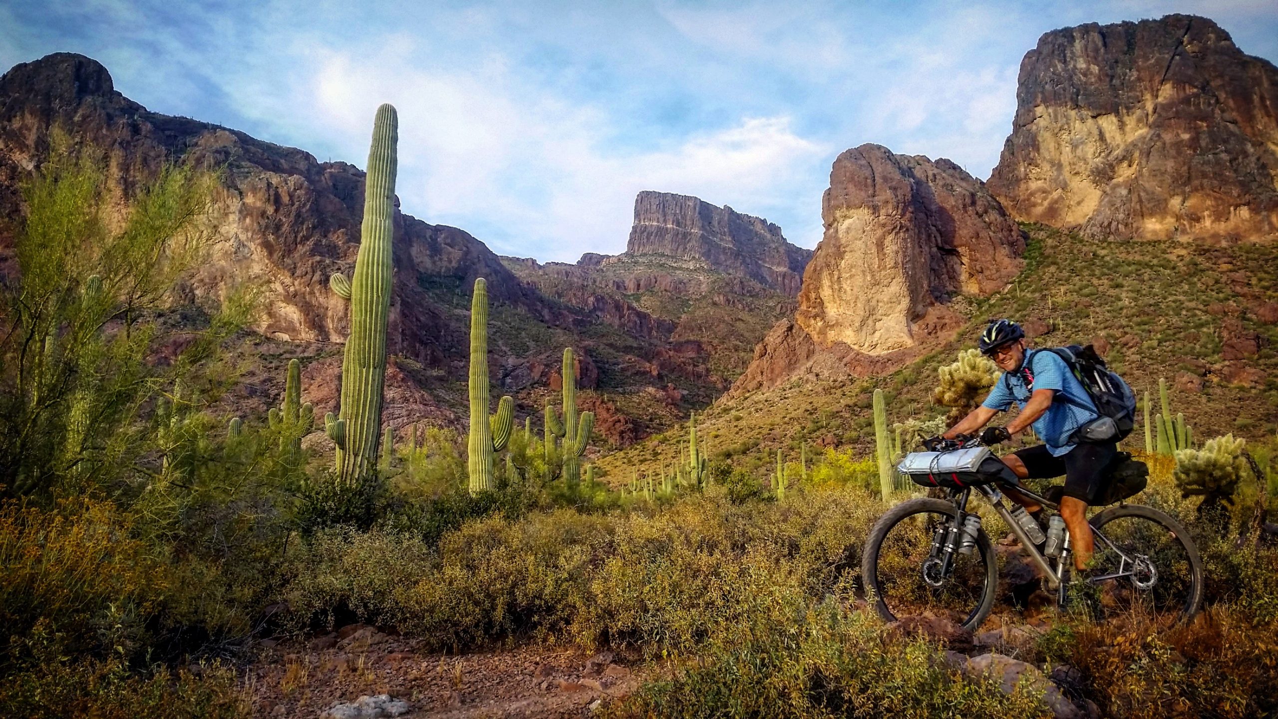
The Arizona Trail Race started roughly 15 years ago, according to John Schilling, the ride director for the semi-official race. The AZT race is somewhere between 300 to 800 miles long, depending on the route. Participants sign up a month before lining up near the border between Arizona and Mexico, and over the following days and weeks traverse up and over some of the state’s hardest mountains and through one of the nation’s driest climates.
At the end of the race, there may or may not be anyone to greet the finishers. A celebration, like water, food, and bike parts, would be the responsibility of the racer. Schilling hopes finishers get a high five though.
The AZT race kicked off again at the end of October after a break in 2020. Schilling says that it went off without a hitch. We caught up with the man behind the race to learn the ins and outs and what makes the race so special.
How did the AZT race start?
So it was the brainchild of Scott Morris. I believe the 300 was run a few years ahead of the 750, I want to say in 2005. Scott was living in Tucson at the time going to [the University of Arizona], and he has a degree in computer science and he was smart enough to parlay that degree into mountain biking, like developing Topo-Fusion software.
I want to say that back then, the Great Divide was going and I guess that’s what sort of sparked his interest, but using more singletrack. At the time, the Arizona Trail was still being built, but not all the dots were connected yet. So in place of where the trail was missing, could we find dirt roads that parallel it in the meantime? And he and a couple of friends of ours were able to piece together a route and as they say, the rest is history.
Those subsequent years, maybe three people would show up or four or five people gave it a shot. And each year, more and more trail was built, so he was constantly tweaking the route. And, I want to say it was 2010 I think is when he decided to give or put together the full route for the Mexico to Utah run.
In 2019, Scott decided he wanted to step away. He wasn’t spending much time in Arizona so he reached out to me to see if I wanted to help out and take over the director duties.
After 2019, I retired the 750 and made the 800. Over the years, the ATA (Arizona Trail Association) is constantly evaluating the trail to make it better and their ultimate goal is to have 800 miles border to border, 100% singletrack, which is pretty awesome. Right now, there’s a lot of singletrack. I don’t know what the exact mileage is, but it’s probably closer to 600.
It all sounds like a very grassroots type of race, is that right?

That’s exactly it and that’s how Scott started it, that’s how I want to keep it rolling. It’s showing up, more or less for bragging rights. People always ask me, “what do I get if I finish?” And I’m like, “hopefully a high five if somebody is there waiting for you,” but if you follow the events that’s usually not the case.
It’s all part of the allure and the challenge, to do all the planning yourself and figure out logistics, which for some people is pretty daunting especially coming from out of state and even within here. They’re point to point rides and that makes it tough for everyone involved. For the 300, we have a shuttle company from Tucson that offers their services but for the 800 it’s a little different.
But, the self-support aspect of it, I’ve always enjoyed that. You’re not relying on anyone but you. If you do complete the 800, the ATA considers that a full traversal of the Arizona Trail, even though you have to go around Wilderness areas on bikes, so in a sense, you do get something for the 800 because you fill out a completion form and pay for shipping and you get this awesome Arizona Trail 800 copper belt buckle. But other than that, hopefully, you look back fondly and say “yeah, I did that.”
Registration opens up one month ahead of the race, and everyone says “I’m going to do it next year,” but until their name shows up on that list, you never know.
What are the differences between the 300 and 800 routes?

Next year, both options will start at the border. The actual Arizona Trail starts at Border Monument 102, but it’s in the Coronado National Monument, so we can’t get bikes to that point and it’s currently closed right now anyway. Historically, the 750 started at the closest dirt road to that monument but with the border wall construction last year, we didn’t want to compete with construction traffic. Now, it’s stopped, but Border Monument 103 was barely a half-mile away from that and it’s a great spot to start the race. It’s almost like a giant dirt cul de sac.
So it’s down pretty much in the middle of nowhere. If you’re looking at a map and see Sierra Vista, it’s obviously a little south of that, but a little west of Sierra Vista over Montezuma Pass.
The 300 terminates at Pickett Post trailhead which is just east of Phoenix near the town of Superior. The 800 starts at the Mexico border and ends at the Utah border.
If you start down near the border and work your way up to Utah, is it mostly ascending that way?
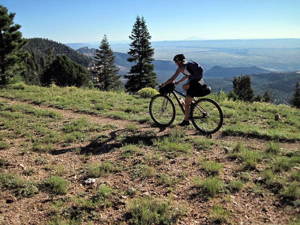
No, actually it’s constantly up, down, up, down, because really the borders start and the Utah are very close in the same elevation. I think it might actually be a little higher at the Mexico border. But, that said, most of Northern Arizona, you’re in the high country. So as soon as you get above Payson and Pine, you’re hovering around 7,000 feet most of the way aside from dropping into the Grand Canyon. And the last few miles off of the Kaibab plateau is a 1,500 foot descent where you can see the finish line right below you. But even in Southern Arizona, up on Mt. Lemmon in Tucson, you still climb up and over 8,000 feet.
How do people feed and support themselves through the route?
Believe it or not, even though it’s the desert it tends to be hot no matter if it’s run in April or October. There’s actually quite a bit of water in the desert, you just have to do your research and know where it is is, and it’s there. And there’s actually a lot of reliable sources, whether it’s stores or a campground or something. And for the most part, especially on the 300 portion, you’re rarely riding more than 30 or 40 miles between very reliable water sources.
As far as food goes, at least for the 300 route, there’s at least two resupplies directly on route. Of course, that’s dependent on speed and store hours. Usually, even the really fast guys, they might miss the first one, but they are usually set up for the second one and there are options to go slightly off route if there’s a 24 hour Circle K or something. There’s one in Tucson and one in Oracle. So resupply isn’t a big issue for this race.
The ATA does have cache boxes along the route and those are public but we tend to tell people, obviously, you’re allowed to use those, the water is there, it’s public use… but in the spirit of trying to keep it a level playing field for everybody and not draining any hiker stashes, it’s encouraged to be self-supported.
Hikers will go out and cache it and write their name on it, and we tell people not to use that, because someone’s life could very well depend on it.
But we tell people just assume that when you get to a cache box, it’s going to be empty, so plan accordingly.
And there are rules about not wandering off the route more than 1%?

Over the years, there are spots where it’s a little tricky where the route crosses a dirt road, but then the trail parallels that road for a couple of miles and in the past maybe some riders went on the road and essentially missed a few miles of the route. And we never really had anything defined, and at what point are you no longer doing the race route?
All that means is that is like if you miss a section, people said: “oh my god, I have an asterisk.” Well, it doesn’t mean your DQ’d, it’s just a note. You still get an official finish time, you’re in the standings, it’s just to let people know you missed the two miles coming out of Kelvin or something. But you’ve got to have some kind of definition on that.
Where are the Wilderness areas?
One, right at the start at the Huachuca Mountains. Both the 300 and the 800 start with bypasses. That was one of the changes I made for both routes this year and going forward.
The second one is currently near the town of Patagonia right after the Canelo Hills near Mount Wrightson. That’s one of the ATA projects they’re currently working on, 13.5 miles of singletrack to bypass the Wilderness over there which is fantastic. I went over there and rode the new stuff to check it out, and they have about 8 miles built and it is fantastic.
After the Mount Wrightson Wilderness you’re on the AZT for a pretty long time and until you come near Tucson and then we have to go around, there’s a Wilderness section near Rincon Peak on the east side of Tucson which ends up working out alright because that puts you on line for a couple of resupplies and a climb up and around some Jeep roads and back on the AZT for a little bit.
People also climb up to go around the Four Peaks Wilderness. The next really big and final area starts from the Mazatal Wilderness. So there’s like five or six of them total. Pretty much from Pine all the way to Utah, you’re on the AZT. That said, part of it is Jeep roads here and there but for the most part it’s a lot of singletrack.
How has the route evolved? It sounds like it changes a bit from year to year.

That’s really not the intent. All the changes that we see in the future [will be] because the ATA has been out changing the route and adding more singletrack, and getting rid of a Jeep section. And they’re always doing minor reroutes and stuff like that.
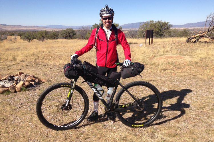
What kind of bike do most people ride?
There’s a pretty good mix of full suspension and hardtails. There’s no right or wrong or perfect answer. People want to know if the route is gravel friendly, and I’m always hesitant to tell somebody “no, don’t do that,” because who am I to say? But you want to increase your odds of finishing, right? And you also want to have a good time, because even on a good day when everything is going perfectly, this is really hard. So I would strongly advise against a gravel bike.
That said, people ask about single speed, and yeah, bring it. If that’s what you ride, bring a single speed, just gear down appropriately. But it’s a pretty steady mix of everything. At the end of the day it boils down to what do you normally ride and what are you most comfortable on? This is a rugged trail so keep that in mind. But we had a guy complete the 750 on a unicycle in 23 days.
How does it work through the Grand Canyon?

So the stipulation from the Park Service that allows us to use the AZT through there is you have to disassemble your bike and you cannot ride below the rim. No rolling of the bike. You can take your pack off and rest, but you can’t roll your tires along the trail at all. And that’s 21 miles of that with 5,000 feet down and 6,000 feet up. And I tell people if they’re questioning their ability to do that full hike in one push, get a permit (to camp). There’s two official campgrounds down there, the Bright Angel and the Cottonwood campgrounds.
How else do you think the race will evolve?
This year it was nice being out there and seeing how many new faces there are. You get your regulars, but it was a good crop of riders this year and in general, a really fun group. And there seems to be more and women out there doing it, which is fantastic.
I haven’t really thought about what it will look like in five years, and hopefully kind of the same other than little route tweaks. It’s like, we have a good thing running here, so let’s just keep that going.
Anything else you’d like to add?

Anyone that’s thinking about doing this, just do some research at least. You don’t have to spend every waking second on it, although I know some people do, but have some idea what you’re getting into. It’s an awesome route. I’ve lined up for it a bunch of times. I haven’t finished every time because sometimes the AZT wins. Sometimes you win. That’s just the way it goes.
Next year’s race is slated for October 20, 2022. Registration opens a month prior so start your planning now.
This interview has been edited for length and clarity.
Visit the Arizona Trail Race site for more info about the next race.


3 Comments
Dec 10, 2021
Dec 11, 2021
Dec 13, 2021