From the trailhead the first 3 miles will take you to Anderson Hollow Rd. Cross over and you will begin the South loop. The South loop is just under 3 miles and will bring you back to Anderson Hollow Rd. Take a left on Anderson Hollow Rd and ride over the culvert and you will see the Beginning of the North loop which is just over 4 miles long. This will once again bring you to Anderson Hollow Rd. Continue on this road to where you originally crossed over after the first 3 miles, take the left and you will be on the last 3 miles back to the trailhead. If you are pressed for time you can park near the culvert on Anderson Hollow Rd and just do the loops or one of the loops. This trail is rocky and rooty but a great place for speed training or to bring a beginner. It's not technical or too hilly. Max elevation gain is about 413 feet. In fact it feels almost all downhill for the first 6 miles. The North loop will take you on a slight uphill for just over 2 miles either way you ride it and then you'll get a 2 mile downhill ride followed by the last 3 miles of gradual incline up.


Well maintained and good flow. The trail is built for mountain biking with no unrideable climbs or descents .
| ThankIt had really windy single track lot of janky rock work I bet theirs a lot you can hit if you want to at the end it has a uphill that has some obsticals that get gradually harder as you go up. I road this with my dad and my brother about 2 miles in I was going up this curvy uphill graveling turned my front wheel and slid on the gravel and split my knee open my dad told me to kick some dirt on it which would be kinda of hard because it was on my knee but I got up and rode it wasent till a few hours later that I dicided to get it checked out well I need 5 stitches the crazy part is that I finished the trail with a hole in my knee. It was a great trail a must ride
| ThankI'm a novice so take this with a grain of salt.
| ThankThis trail is beautiful. I love the Ozarks. The trail was fun and difficult at the same time. No crazy drops or technical obstacles but there were a lot of rock gardens to navigate and the elevation changes had me panting pretty hard. I'm riding an older 26" Trek hardtail with front suspension so that makes the rocks more difficult than someone with 27.5- 29" wheels.
I'm from SE KS so the elevation was also a factor.
I had a few wipeouts but nothing serious. I still had fun.
NOTE: If riding in spring-early fall WEAR LOTS OF BUG REPELLANT. The ticks and chiggers are thick. I sprayed with bug spray but my feet and ankles still got attacked once I sweat it off.
Probably my favorite set of trails at Lake of the Ozarks. There are two Loops and an out and back. The two Loops are a little easier although there is some climbing. The Out and back has more technical features including rock bridges. The two Loops go by some creeks and a lake. In general just a really fun ride. The best part is on a hot day when you're done riding Honey Creek he was right there and deep enough to cool off in.
| ThankFast and flowy sums it up. This trail is 95% maintained by a few dedicated local riders.
| ThankEnjoy!
(If you'd like to help,remove the tree fall off the trail as you see fit).
I only took the flathills trail and the hollow road back to parking. The 3 mile flathill trail was smooth in some areas while the majority of it has roots, rocks, and fallen trees with one man made obstacle consisting of a fallen tree and branches made as a ramp to negotiate. This section is intermediate because of these technical areas. Effort is light to moderate as the hills and grades are not too steep. You can get a lot of speed in many of the sections. Good ride.
| ThankOur favorite home away from home trails. Something for everyone depending on how aggressively you choose to ride. We love these trails. They shed water quickly and stay rideable when many others in mid Missouri close.
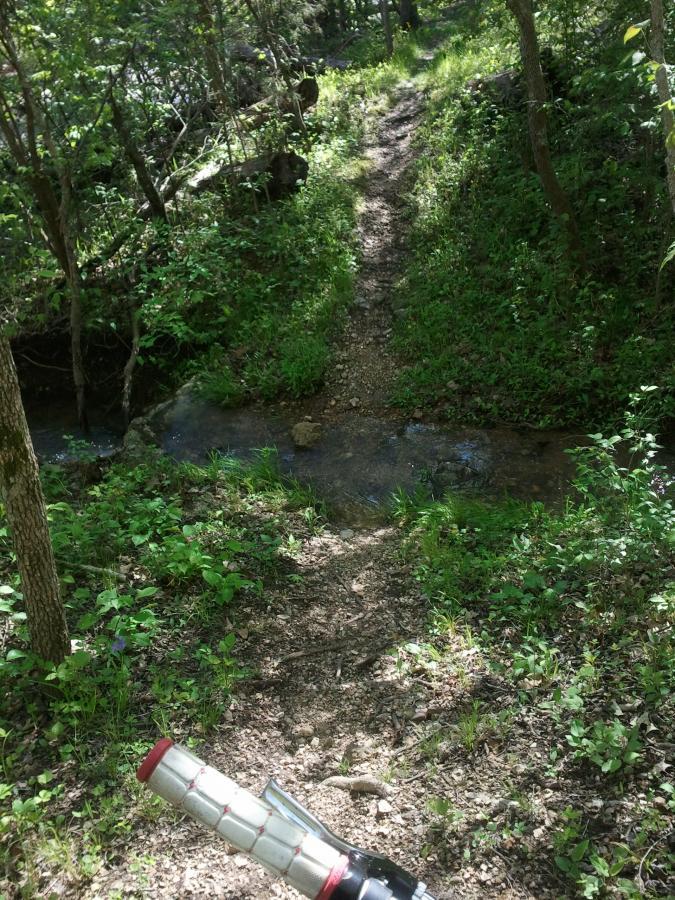
| ThankThis is a beautiful trail through the Ozarks. It is rugged and rocky in many areas, especially on the north loop, and as a beginning mountain biker, I would say that the south loop is a beginner trail with a really fun stream bed crossing, and the north loop is an advanced trail because of the terrain, narrow slopes, and rock gardens. As a beginner, I made it through the north loop with a couple places where I had to walk, but it was good exposure to a more challenging trail. The feeder trail which goes from the trailhead parking lot seemed to be an intermediate trail with rocks, roots, and some challenging, curvy stream crossings. This time of year, it was difficult to see the trail because of the leaves, and the trail tags on the trees are helpful. It is a great place to be out in the woods with the ability to choose from three types of trails all in one area. No air bridges, trail varies in width.
| ThankVery flowy trail so leave the big bike at home (wish I did). Mildy technical but fast at times so it's great for advanced riders too. I was surprised to see so many cars at the Anderson Hollow TH as I almost got blocked in! Beware of a long gravel road to this trailhead if you are in a small vehicle like I was. Mccubins TH is off a paved road BUT you have to pack a lot in if traveling from there. Not much else to choose from in the area but this was plenty for one afternoon as I clocked about 16 miles and 1200ft of elevation gain!
| ThankRode on 22 March 15 and it was in good shape with only a few wet spots. Saw only one other vehicle there, but no riders on trail.
| ThankThis is a great set of trails. I have ridden it many times with my brothers and it is a great ride every time. The shorter loop (2.25 m) is easier than the others but still has enough obstacles to keep an intermediate to advanced rider on tier toes. The other two trails are somewhat harder, also very fun. The trails are easy to find and well marked, so you would definitely have to try to get lost. I would strongly suggest these trails to all levels of riders; I love them.
| ThankThis trail is fast, has great flow and is overall in great condition. Take an extra tube, just in case, because the rocks are sharp. This is a great trail for beginners because there is nothing too technical and the climbs are not tough. This trail also offers something for advanced riders as well. The great flow and speed in the downhills keep it exciting.
| ThankThis is definitely a beginner track, but its super fun. Anyone should ride this track if they're in the area. I recommend this track to anyone
| ThankIts been a few years since I've been on this trail. It has matured nicely during that time. There is now a parking lot near the low water bridges where most people start. The trail is very well layed out along contours of the hilly terrain so there are no lung busting hills (one extended climb on some old double track on the north loop). Rocky and fun as it winds through the trees, this trail is great for a spin after a hard day at work. Good place to introduce new riders to some nice singletrack.
| ThankFun fast trail. Currently a lot of loose rock due to the drought, but not a lot of bugs because of it. Good place for a fun quick weekend ride.
| Thankgood trail fun quick ride, it is however a little tough for an 8 year old. Only made it through the first 4 miles and did not get through the loops. However will try again next time.
| ThankFound this trail while on vacation from Ohio. Great ride, some nice rock gardens on the downhill. Bottom of section of trail is a very easy ride; the uphill on the way back was a good climb back to the car. I rode it in July when it was over 100 degrees; probably even more enjoyable in cooler weather. Take bug spray during the spring and summer.
| ThankReally fun,fast trail.
| ThankNothing technical except 2 maybe 3 log jumps.
Fast Fast Fast.
Lots of ticks!!
Everything you've probably heard about this trail is true. Hardly any climbs, feels as if you're going down hill most of the time. I would of enjoyed this trail more if i wouldn't have busted my seat post halfway through my ride.
| ThankEasy ride. Great place to bring a beginner due to lack of lung busting climbs. Fun trail.
| Thank