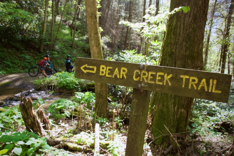
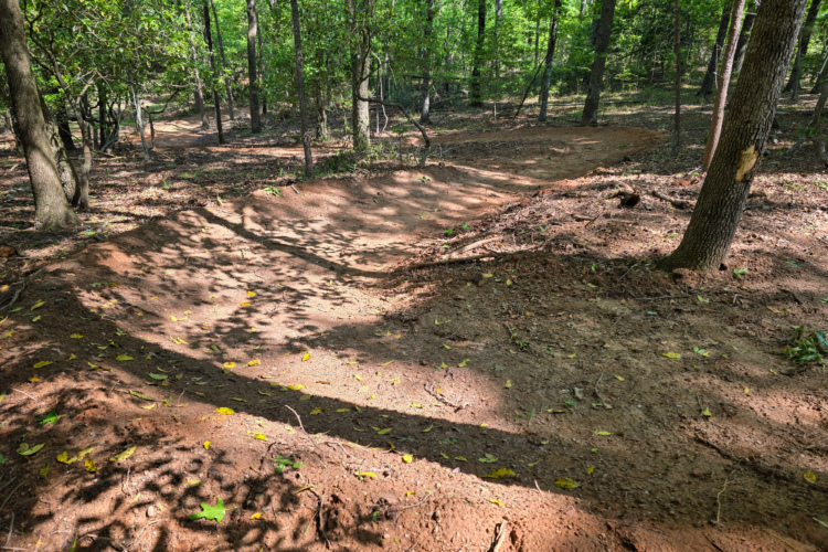
singletracks is mountain biking
Sign In | Create Your Account | Site Map | Help  


Singletracks Trail Work Day @ Lake Hartwell (GA): Sat. April 23, 2011

Monday, April 18th, 2011

This Saturday I’ll be heading to Lake Hartwell on the Georgia/South Carolina border to help with the trail work day at Paynes Creek, soon to be SORBA’s newest mountain bike trail. Assuming all goes well and plenty of volunteers show up this weekend, the official grand opening is scheduled for the following weekend, April 29.

This is a great opportunity to volunteer for a number of reasons:

  1. Helping build new trails is exciting and it’s a chance to preview the course before it’s officially open!
  2. Trail work days are a great chance to meet other mountain bikers.
  3. Singletracks is giving away free trail membership certificates ($19.99 value) to EVERYONE who works this Saturday.
  4. The weather is going to be fantastic and any excuse to spend time outside is a good one.
  5. There’s a free lunch for the volunteers.
  6. It’s a good chance to learn trail building techniques from the pros while getting a “hands on” application of best practices.
  7. Giving back to the trails always feels good and if you ride often it’s the right thing to do. If you’ve never volunteered before, this is your chance!

Full details are available here and on the SORBA calendar. See you Saturday!

New Bike Trails at Paynes Creek on Lake Hartwell (GA) Opening in April – With Your Help

Thursday, March 17th, 2011

photos courtesy recreation.gov

SORBA is working with the US Corps of Engineers to open a brand new 6.7-mile mountain bike trail loop in the Paynes Creek recreation area on Lake Hartwell on the GA/SC border off I-85. Professional trailbuilders have already cut the rough trails (the same crew that built FATS) and SORBA is organizing two work days to get the finishing touches complete in time for an April 29 grand opening!

Singletracks is all about new mountain bike trails and so we’re offering free trail memberships ($19.99 value) to everyone who volunteers on the April 23 trail work day. There’s also a trail work day this Saturday for those who can’t make it April 23 and it looks like the weather should be amazing!

Paynes Creek offers camping and access to beautiful Lake Hartwell which means this new trail system should become an instant classic. The topography in the area is rolling and although I haven’t seen the site yet, I predict these trails will be both fast and family-friendly.

Details, including links to directions and start times can be found on this forum thread. Check in and let us know if you can make it!

My Arch Nemesis: The Ellusive Thurmond Epic

Wednesday, January 19th, 2011

As mountain bikers we all have an arch nemesis – something that keeps beating us.  It might be a steep technical climb, a man-made stunt, or a rock garden you just can’t seem to clean.

My current MTB nemesis is a local route known as the Thurmond Epic.  It combines the Bartram Trail, Keg Creek trail, and two trails inside Mistletoe State Park: the Rock Dam and Cliatt Creek Nature Loop.  It’s about 67 miles long, and 58 of those miles are singletrack.  As of this writing, no one has ever ridden the entire route – even though I’ve tried twice.

Attempt 1 – The Scorcher

My first attempt was with a group of friends in June and was not a smart idea.  A recent wind storm had left over 20 downed trees on Keg Creek, and temperatures that day went up into the high 90’s.  The heat was just too much for any of us to handle.  We made it 37 miles to the Mistletoe park office before calling it a day.  We all vowed to try again once the weather cooled off.

Attempt 2 – Long Way Alone

I made a second try in December and none of my usual riding buddies were able to go, so I went solo.  The first 30 miles were fun and good until I was on the singletrack that leads into the back side of the Rock Dam trail where the track suddenly seemed to disappear.  It’s a very rarely ridden trail with pink flagging to mark the way but suddenly there was no more flagging, and the heavy leaf cover gave me no chance to see the trail on the ground.  I got off the bike and walked around for nearly 20 minutes trying to find the trail, or some flagging, but had no luck.  I was about to give up and turn around, but then I noticed a blue blaze on a tree on the other side of a creek.  Ah ha!  The Rock Dam trail has blue blazes!

I did some bushwhacking across the creek and continued on the Rock Dam trail.  Everything was going well until I crashed hard and unexpectedly in an off-camber corner.  I slammed my thigh into some roots and tweaked my knee a bit.  I sat there for a while, then finally got up and continued on.  I had to walk all the climbs, my knee was really hurting, and my single speed didn’t let me gear down to spin easily.

I finally made it to the park office 5 hours after starting the ride.  I was done, my knee was killing me, and I still had 25+ miles of singletrack left to ride.  I decided to take the road back instead.  Fifteen boring (and cold) miles later I arrived back at my car, 6.5 hours after leaving that morning. I had 53 miles under my tires which is not a bad day -  but I was disappointed. The Thurmond Epic had beaten me again.  I’m definitely not giving up and I’ll be back to try it again – but next time I’m bringing some friends.  My latest attempt proved that it’s a long ride by yourself.

So what’s been giving you trouble on the trail lately?  Tell us about it in the comments section below.

A Taste of Winter Mountain Biking on Pinhoti Trail

Thursday, December 2nd, 2010

Sometimes you just gotta go for a ride. Greg (Goo), Jeremy (GoldenGoose), and I were looking for a place to ride on Wednesday and after our first two choices – Dawson Forest (closed for hunting) and Blankets Creek (closed for wet trails) – fell through, we finally settled on Tatum Lead/Pinhoti, a route none of us had ridden before.  Jeremy’s guidebook rated the 15-mile route “very difficult” and we were stoked to see what this section of the 100+ mile Pinhoti Trail had to offer.

It rained all day Tuesday in Atlanta and when we arrived at the trailhead Wednesday afternoon around 1pm we could still see snow on top of the surrounding peaks (yes, snow in Georgia). The thermometer in the car read 38 degrees and with the breeze it was easily much colder. Luckily the route began climbing the paved road immediately so we were able to warm ourselves up a bit.

After climbing about 2 miles and 500 vertical feet on highway 52 we realized we missed our turn onto Tatum Lead road and ended up backtracking about a mile to the dirt road. Tatum Lead road quickly joined up with the Pinhoti Trail which at this point follows a nondescript forest road that’s open to motorized vehicles. The descent down this road was fun with small berms but I sorta dreaded climbing back up this road on our return.

At about the 3-mile mark we passed the turn-off for the Pinhoti Trail and continued on the forest road, entering the Rock Creek ATV area. Much to my surprise, the ATV trails were in great shape and flowed downhill really well. In fact, the water breaks on the descent down to Rock Creek reminded me of some of the groomed DH trails at Northstar, albeit much wider and without the sculpted, banked turns. Sadly the downhill was over quickly and we began our ascent back up the road toward the Pinhoti trail.

For the next two miles or so the Pinhoti Trail follows Peeples Lake Road which was mostly flat as it follows Baker Branch creek. This area was full of makeshift campsites and roads leading in several directions but fortunately the trail is well marked. We crossed Baker Branch creek at least 4-5 times and after the first few crossings I resigned myself to cold, wet feet for the rest of the ride.

From Peeples Lake Road the trail started getting steep – too steep for us to ride in some spots. All told we climbed over 800 feet in just a mile and a half on this section. At the top of the climb we joined back up with our previous route and kept climbing back toward Tatum Lead Road.

On the way back we turned off Tatum Lead road before the highway, staying on the Pinhoti Trail, where we found some of the best riding of the day! The trail quickly left the wide gravel road and lead into some great singletrack cut into the side of the hill. This section only lasted about a mile before returning to highway 52 but it was definitely the highlight of the trip.

At the end of the day we rode about 17 miles with 2,800 feet of climbing which ain’t too shabby. The Pinhoti trail continues past the spot where we parked and it was tempting to keep riding the singletrack but with the sun setting it was starting to get even colder. Not to worry – I’m sure we’ll be back soon to explore even more!

Mountain Biking Through History

Tuesday, November 23rd, 2010

Mountain bike trails can have many different features that draw the rider in and create an enjoyable outdoor experience.  These different features could include challenging, rewarding climbs, rough, technical tread, amazing flow, man-made stunts, or gorgeous views – and the list goes on and on.

Historical trail features are particularly interesting to me and whenever I ride a trail with a bit of history I feel a deeper connection with my surroundings.  While this historic element is not present on every mountain bike ride, many trails go past historic sites containing relics of a time long gone or are themselves pieces of history. Here are just a few examples that come to mind.

Bull Mountain, Georgia


This rusted hulk from a time long past lies just off the Bull Mountain trail outside of Dahlonega, Georgia.  The truck isn’t located anywhere near a road, but the mountain bike trail lies on an old road bed that must have once been passable by trucks like this.  I wish I knew why this truck was parked and abandoned miles up this mountain in the North Georgia forest, and what it had been used for.  The mystery is intriguing, and every time I roll by this truck I at least have to glance at it and wonder what stories it would tell if it could talk.

Johnson Peak, Montana

Based on the large windows on all sides of this building, I’m guessing this dilapidated shack used to be a forest fire lookout post.  There’s no longer a view from this spot, but the trees surrounding the cabin look relatively young in comparison to the rest of the forest, indicating that at one time you probably could have seen for miles from this vantage point.

Canada Creek, Georgia


I imagine these silos once had a barn to go with them and if they did, it’s no longer there.  When I rounded this corner and rode right beneath these looming concrete structures, I couldn’t help thinking: “How cool is this?” The nearby land in this sunken valley along Canada Creek looked like it had been farmed at one time.  Now, the whole area is wild and looks like it’s only used by rednecks mudding in their 4×4′s.

Tsali: Left Loop, North Carolina


photo posted by ositoking.

This chimney from an old homestead on the Tsali trails is really representative of a lot of unsung historic sites all across the nation.  If I had $10 for every old fireplace I’ve seen while riding I’d probably be a rich man.  However, that doesn’t detract from the interest and the history of this particular location.  Where the Left Loop trail now runs used to be someone’s kitchen/living room.  I wonder if it was a sizeable house, or just a small cabin? We’ll probably never know…

These are only a handful of the historical sites that I have noticed along the bike trail.  I’ve stumbled across many old foundations, graves long forgotten, the remains of old bridges, and more. Trails like these are more than just another ride through the woods, another statistic on your training log; they are a ride through history!

What trails have you ridden that pass by a historical site or have their own historical significance?

Greg Heil (singletracks screen name: Goo) has mountain biked trails all across the nation and is currently a member of the Airborne Flight Crew. He writes a mountain bike blog that’s choc-full of useful, objective mountain bike information.

Extreme MTB Racin’ in North Georgia: Fools Gold 100

Thursday, August 26th, 2010

fools-gold-100

Brenda Simril (Motor Mile) and Sue Haywood caked in Georgia red clay and loving it.

This past weekend the annual Fool’s Gold 100 took place in the north Georgia mountains near Dahlonega with some of the most extreme weather conditions we’ve heard of in a mountain bike race. A dirty century mountain bike ride is tough on any day and the course through the Bull /Jake Mountain trail system is a killer with nearly 14,000 of feet of climbing (at least that’s what we heard). The Fool’s Gold 100 is part of the National Ultra Endurance (NUE) series so it attracts some of the country’s best XXC mountain bikers.

Overnight rains lingered into the morning and the race started off under a flood watch issued for the area. Jeff Schaulk was the fastest around the first 50 mile lap in 4:15:26 and reported his brake pads had been completely ground down from the gritty, wet conditions. Christian Tanguy finished just minutes behind Schaulk and both riders asked race director Eddie O’Dea to cancel the race (and the second 50 mile lap) for the safety of the other riders.

fools-gold-100-start

NUE series leader, Jeff Schalk (Trek Mtn Coop), in the lead pack

Singlespeed rider Harlan Price ran into similar brake problems during the race:

After Aid four, there was a straight, nasty, steep descent. I was fully into it before realizing that I had
NO BRAKES. I decided to try to ride it out, reaching speeds up to 30-40mph, scard sh**less, and jus’
holdin’ on! It was then that I realized I wouldn’t make the upcoming turns and had to dump it. The
bike was in the trees and I slid thirty feet downhill suffering bruised ribs and requiring eight stitches.

Tanguy asked if I was ok and then went on. In the process I lost the bead on my tire but quickly made
the repair and moved on. After crossing the finish line, I pretty much broke down upon learning about
the 50 mile cut. I was gonna do it but it wouldn’t have been good.

Out of 300 riders who started the day, only 180 finished. The last rider crossed the 50-mile finish line after 9 hours, 56 minutes on the bike. Talk about dedication!

If you’re looking for a challenge on the mountain bike (and a good time, I swear!) mark your calendar for next year’s Fools Gold 100 – this is a race that will not disappoint.

My Mountain Bike Time Trial @ Mt. Tabor Park

Tuesday, August 3rd, 2010

img_0723

Last Tuesday I drove out to Mt. Tabor Park near Dallas, GA west of Atlanta for the Six Pack mountain bike time trial. This is a super low key and old school event which is right up my alley. When I asked the guy sitting at the start table what time the race started he replied, “whenever you’re ready.” Awesome. The entry fee? A six pack of beer (or $6 for those who are underage).

The Six Pack Time Trial is actually a series of races held on Tuesday nights during the month of July. I had never ridden the relatively new trails at Mt. Tabor Park which gave me the perfect excuse to show up for the competition. After a leisurely pre-ride of the 3.5 mile long loop I was ready to race!

img_0706

The big loop at Mt. Tabor Park has a little bit of everything – from fast hardpack to rocky, rooty creekside stretches and from winding, switchback trails to flat, tight pine forests where the saplings practically reach out and grab the edges of your bars. The trail also features some sharp turns to help control riders’ speed and if you don’t know they’re coming they can suck the momentum right out from your wheels. Paulding SORBA has instituted alternating travel directions on the trails and on this particular evening we raced the loop clockwise.

Right out of the gate from the parking lot I got off to a fast start on the hardpack singletrack but less than a quarter mile in I dropped my chain (not unusual for me, I’ve been meaning to install a chain retention device). The rest of the hardpack section (part of which is called “Rocks of Doom”) went smoothly except for occasionally overshooting some of the tight reversals.

From my pre-ride I knew the rocky, rooty creek section would be a challenge so I concentrated on picking the most efficient lines and keeping my tires on the ground. Unfortunately I completely lost my rear wheel around one turn and had to jump off the bike for a second time, this time jogging with the bike a bit to regain my composure.

Climbing out the creek section was tiring and even more so considering I was only halfway through the loop. It’s amazing how much pressure the word “race” adds to a ride, even if there’s no one around you! I blasted up and down through the switchback sections to the pine forest trail section aptly named “Pine Pong.”

Pine Pong is one of those trails that takes intense concentration to ride quickly. There’s a ton of wheel and body movement and any slight miscalculation could easily knock you off the bike without a moment’s notice. Early on I dropped my chain and dismounted for the third time to get things back on track. Soon after I got a bit of a scare when I scraped my shoulder against a tree but it wasn’t quite enough to toss me off the bike.

I crossed the finish line with a time of 20 minutes something which seemed decent (the time keeper asked if I had done the long or short loop which is a good sign I suppose). Initially I was anxious to find out how my time compared to everyone else but after cooling down I realized it didn’t really matter. Time trails like this are really about racing against yourself and seeing how you stack up against the trail when you give it everything you’ve got. By that measure I have some room to improve for next time but I had a blast going all out!

Epic Cross-State and Cross-Country Mountain Bike Trails

Thursday, July 22nd, 2010

colorado_trail_map

Much of the Colorado Trail is open to mountain bikes.

Ever since I can remember I’ve always been fascinated with trails (go figure). I got into backpacking as a teenager and I quickly became obsessed with the 2,175 mile long Appalachian Trail. For a kid that’s too young to drive, the idea of a hiking trail stretching from Georgia to Maine is practically mind-blowing. Unfortunately bikes aren’t allowed on the AT (or the Pacific Crest Trail on the west coast) which makes it the slow lane for cross country expeditions.

Fortunately the idea of cross-state and cross-country (as in nation) mountain bike trails is gaining momentum. Just last month the annual Great Divide mountain bike race wrapped up and the winner rode his bike all 2,745 from Canada to the Mexican border in a scorching 17 days, 16 hours. Of course not all of us have the stamina (or the time off work) to ride across the US on our mountain bikes so more accessible cross-state routes are being established.

This year the 750-mile Arizona Trail Race covered the entire state of Arizona from Utah to Mexico for the first time. And here in Georgia, Dave Muse and his crew successfully completed the Trans North Georgia from South Carolina to Alabama in May and will be hosting an unofficial race along the route later this summer. For those who think this might be an easy ride, the mountain bike route is 350 miles long with 56,000 feet of climbing so bring an extra set of legs! There’s also the Colorado Trail that stretches from Denver to Durango and although some sections are closed to bikes, it’s possible to find alternate bike-friendly routes around closed areas.

Outside the US the concept of long distance mountain bike trails is taking off as well. Israel plans to spend $30 million to build 3,100 miles of bike trails in the Negev and around the Sea of Galilee. The first section of the Sea of Galilee trail opened this summer and will eventually circle the entire sea, giving tourists an interesting way to experience the history of the region.

This summer I’ll be taking my first overnight mountain biking trip via the San Juan hut system from Durango, CO to Moab, UT and I’m super stoked. In fact I’m already eying other long distance mountain bike rides like the Tahoe Rim Trail around Lake Tahoe and the BC Bike Race from Vancouver to Whistler.

Epic mountain bike routes seem to be good for regional tourism and for that reason we’ll probably continue to see more cross-state routes being designated. Even technology like the SPOT Satellite Messenger is playing a role in making long distance mountain bike trails safer and more accessible. Does your state have an official (or unofficial) cross-state mountain bike route yet? If not, get out there with a GPS and start exploring!

DIY Mountain Bike Time Trial

Friday, April 2nd, 2010

pic_01
Johnathan Tisdale going for the win on a carbon fiber 29er with a paper plate on the bars. All photos courtesy of Andy Jordan’s Bicycle Warehouse.

Do you wish your local area had more mountain bike events?  More chances to hang out with other riders and have a good time?  I did too, so last summer I joined forces with a friend of mine who works at a local bike shop and we put on a four-race time trial series on a local trail with an emphasis on fun, not competition.  The trail was a short 2.7 mile loop inside the city limits and the entry fee was only $5.  It was short and cheap enough that even non-racers came out and gave it a go.  Our first race had 10 riders, and zero spectators.  By the final race, we had over 20 racers, and just as many spectators. Here’s how we did it and what we learned so you can go put on a race yourself!

Partner up

If you want to put on a race series, you’re going to want some help.  There are two good places to look for help: local bike shops and your local advocacy organization.  Both can promote the event to a wide audience through meetings, e-mail lists, and word of mouth.  It also gives organizations a chance to earn some ‘trail cred’ with the community.  Your local club and bike shop probably have a waiver that can be used to keep you from being liable if someone gets hurt.  I was already a member of the local SORBA chapter and when I pitched the idea to the president he was all for it.  So was everyone else, they just needed someone to lead the way – I bet you’ll find the same in your area.  Having some help will also give you a chance to race.

pic_02
A National Mountain Bike Patroller provided support at our time trial series.

Land use permissions and weather

Before you get a big group of people together with a few stop watches, be sure to get permission from the land manager.  Most managers will be very open to the idea but some may not.  If you don’t get permission and end up getting caught, the land manager may quit allowing mountain bikers access to the trails – clearly that’s the last thing you want!

If the trail will be hurt by riding it in wet conditions, you need a rain plan.  The best way is to just postpone the race a week and that’s exactly what we did on one occasion.  Let people know what the plan is and where to look for updates.  We used the local SORBA chapter’s forums and the bike shop’s e-mail list to keep racers posted.

Pre-race preparations

Get the trail in shape before the race.  Go through the local advocacy group and organize a work party if needed.  If some work happens, let the land manager know the trail benefited from the event – they’ll be happy to let you do it again.

Be sure you take everything you need to the race.  Print out registration sheets and waivers and whatever else you might need.  Take several pens and markers and make sure they all work.  Bring two stop watches (just in case one of them dies) and make sure the batteries are good.  Create number plates and find a way to attach them to bikes. We used paper plates and zip ties – they’re cheap and encourage the ‘just for fun’ atmosphere.  It’s hard to be too serious with a paper plate on your bike!

Staying on course

You need to mark the course – every possible turn, intersection, etc. needs to be marked.  Don’t assume people know the way or can tell which way is right.  Signs with arrows will work but it’s better to physically block people from going the wrong way. When riders are hammering really hard with their head down they may blow right past a sign.  We used ‘race tape’ and downed tree limbs to keep people from making wrong turns.  It’s best to mark the course the day of the race so there’s less time for people to tear down whatever you put up.

pic_03
Make your race a family-friendly event and you’ll have more spectators.

Race day

Get to the trail really early.  Get all your stuff ready and start registering people as soon as they show up.  If you have separate classes, assign each class a certain range of numbers (beginners are 100-199, sport class is 200-299, etc).

Bring plenty of noisemakers to up the fun factor.  Cowbells are the classic and bullhorns are great for “broadcasting” words of encouragement to the racers.

Awards

Remember – KISS (Keep It Simple Stupid).  If you’re putting on an event focused on fun, you don’t need big trophies or awards.  We awarded the money from entry fees to the fastest three racers and awarded some tiny trophies to the top 3 in each class.  We got the trophies at a dollar store and they cost about $0.25 a piece.  We customized them by writing the class and place on the trophies and decorated them with worn out chains and cassette cogs (which the bike shop had plenty of).

pic_04
All he won was a customized dollar store trophy – but look how happy he is!

Make it happen

That’s pretty much it.  We kept things as simple as possible, and everyone had a great time.  I handled timing at the first two races, and got to race in the last two.  I even made it on the podium once!  I can honestly say I had just as much fun running the event as I did racing.

So if you want some local weeknight racing in your town – step up and make it happen!

dgaddis has been a singletracks member since 2007 and is a member of SORBA-CSRA and IMBA’s National Mountain Bike Patrol. He lives in Augusta, GA, home of the IMBA Epic Forks Area Trail System (FATS) and host to the 2010 IMBA World Summit.

Mountain Biking During Hunting Season

Wednesday, November 11th, 2009

hunting_2

This past weekend I rode at the SORBA CSRA Bike Fest at Clarks Hill Lake in east-central Georgia and the weather was absolutely perfect. This was my first time riding the Bartram Trail / West Dam and at the end of the day I clocked more than 22 miles in the saddle across the fast, flowy singletrack. SORBA CSRA is busy working on extending this section of the Bartram Trail to connect to other area trails and it won’t be long before you can string together 40+ miles of singletrack in a single ride.

hunting_1

Anyway, it turns out it’s hunting season which means mountain bikers need to take extra precautions to stay safe on the trail. Bike Fest organizers did a good job spreading the word so I stopped to buy a $2 hunter safety vest on my way to the trail that day. I learned a few more tips about biking during hunting season that I thought I’d share here.

  • Avoid riding during dawn and dusk hours. It turns out this is prime hunting time, especially during deer season, plus the low light conditions make it difficult to make out colors and shapes in the forest. If you think you might be caught on the trail in the early evening, bring a light or two to make yourself more visible. The best time of day to ride during hunting season is mid-day.
  • Wear orange and/or bright colors. You can pick up a cheap orange safety vest at most outdoor shops and it’s well worth the investment. Avoid wearing camo patterns on your clothes, Camelbak, etc.
  • Don’t be afraid to make a little noise. Hunters may not like to hear this but making noise with a bell or even your voice will let them know you’re not an animal. Several years ago I was riding with some friends and after beating everyone to the top of a climb I started yelling to let them know I was first. Little did I know there was a hunter in a tree stand not 20 yards away and he was pissed I had scared his deer. He fired his gun into the air to scare me and it worked. Hey, at least he knew I wasn’t a deer and he wasn’t aiming the gun at me :)
  • Check for closures with local land managers. Some trails are closed to bikers at certain times to minimize conflicts with hunters. Make sure you know when those times are and observe them.
  • Be alert. Sure, hunters need to look out for us but it’s a good idea to look for them as well. Be particularly alert around forest clearings and look for orange hunters’ vests wherever you are. If you see a hunter, give a wave and make eye contact if you can.

hunting_3

This poor guy didn’t survive his encounter with a hunter :)

Be careful riding this fall, particularly if you ride in areas shared with hunters. And watch out for those leaves on the trail too – those things can be slippery and they usually hide the nastiest rocks and roots :)

Newest IMBA Epic Mountain Bike Trails

Wednesday, October 14th, 2009

Singletracks member Outdoornut clued me in to the latest issue of IMBA Trail News where they talk about the 5 newest IMBA Epic trails added this year. Here’s a summary from east to west.

pinhoti

photo posted by rodrodriguez2003

Pinhoti Trail (North Georgia). The Pinhoti Trail is sorta like Kokopelli’s younger, forested brother with 100 miles of point-to-point singletrack linking some of the best riding spots in north Georgia. If you like technical riding with a decent amount of climbing, Pinhoti is your man.

spruce_knob1

photo posted by Outdoornut

Spruce Knob (Seneca, WV). Outdoornut gives Spruce Knob 5-stars and it’s easy to see why from the photos. The main 15-mile loop is comprised of technically demanding rocky and rooty singletrack set amid pristine scenery. IMBA helped get this area removed from the 2009 Wild Monongahela Act which would have prohibited mountain bikes in the area so ride it now and enjoy!

copper_harbor

photo posted by copperhippie

Copper Harbor Trails (Copper Harbor, MI). This is actually the second trail in Michigan to receive IMBA Epic status and from what we’ve read here on singletracks the trail is “Totally AWESOME!!!!!!!!!!!!!!!!!!!!!!!!!!!!”. Extensive wood bridges make this trail both sustainable AND fun to ride.

curt_gowdy_sp_bike

photo posted by dauw

Curt Gowdy State Park (Cheyenne, WY). We’re pretty stoked to see Rowdy Gowdy got the Epic nod after just a few years on the scene. The trails at Curt Gowdy have something for everyone and feature scenery that’s tough to beat.

smith_creek

photo posted by bstill30

Plains of Abraham (Mt. St. Helens, WA). Singletracks members may know this one as Smith Creek Epic but now that it’s an IMBA Epic I suppose it’s time to get prim and proper with the trail description. :) This is rugged, beautiful terrain and if you plan to tackle this one you may want to consider bstill30′s advice and pack “energy bars, warm clothes, and a flashlight for good measure.” Awesome.

Harbins Park MTB Ride Report

Wednesday, July 22nd, 2009

mtb-trail-sign

Last month I wrote about a somewhat disappointing MTB trail recon trip to middle Georgia and I actually got a lot of sympathy (though that wasn’t my intent at all). The fact is I love riding new and unfamiliar trails and even the stinkers give me satisfaction since I get to check another MTB trail off my list.

Yesterday morning the weather was cool and dry so I snuck out to scope the newly constructed trails at Harbins Park in rural Gwinnett County about 35 miles east of Atlanta. The reviews I read on singletracks gave conflicting information and I really wasn’t sure if there were 4 miles or 11 miles of trail and whether there was even any singletrack at all. This time I packed info on a “backup trail” nearby just in case Harbins Park was a dud.

Harbins Park is only about 4 miles down the road from Tribble Mill (and 8 miles from Ft. Yargo as the crow flies) but the two trail systems couldn’t be any more different. For one thing, all the mountain bike trails in Harbins Park are purpose-built for biking and are single-use meaning you won’t run into any hikers or equestrians on the trails (they have their own dirt). The loops closest to the parking lot feature fairly wide trails with sharp, twisting turns being the only real “technical trail features” (TTFs).

trail

All the trails were cut using machines so they’re a couple feet wide right now but over time will become more narrow as vegetation fills back in. From what I could tell there wasn’t a lot of hand work done on the trails after the machines came through and there are several rough spots where things aren’t quite smoothed out yet.

Most of the main, large loop is solid beginner territory but I pressed on to the far loop marked with a dashed line on park maps. I wasn’t sure if this meant the trails were still under construction or what but they ended up being some of the best I’ve ridden in a while. To enter this section you have to ride over some large rocks piled up on the side of the paved path which seems like a good way to weed out the newbs – kinda like the “you must be this tall to ride the ride” signs at Six Flags. If you fall on the rocks, you’re not ready :)

bermed-trail

The back section features much steeper climbs and some short downhill runs with jumps and bermed turns – an unexpected surprise for sure! In fact the entire back loop is really just a miles-long pump track through the woods and has incredible flow – I felt like I could ride around and around for hours. There’s even a super steep granite downhill that transitions into a bermed turn and for about 100 yards you feel like you’re riding somewhere in Utah.

granite-dh

The park facilities are top notch with restrooms, a bike wash area, and great maps and signage throughout. In fact I think I may have found the nicest MTB Trail sign anywhere in the world – and there are two of these in the main parking lot! There’s also a paved multi-use trail that intersects the mountain bike trails in a couple places making it easy to skip ahead or take a shortcut after a long day.

Harbins Park is a county park and the trails were built with the help of the Gwinnett Area Trail Riders (GATR). This place is a great example of how sustainable trails can be built with all MTB skill levels in mind and how destination trails can potentially benefit the local economy. I know I’ll be back soon – and next time I’m bringing my friends!


Site Map | Advertise | Partners | Contact Us | Terms | Privacy
Campground Reviews | Hiking Trails | Trail Running | Skiing / Snow Sports | Mountain Biking
Copyright 2012 Blue Spruce Ventures LLC | Atlanta, GA
singletracks.com is yet another slick Review App