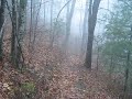
Extremely difficult climbing with a wicked fast downhill. Great when ridden as a out and back. Can add Flat creek trail or lake Blue Ridge trail for more length.
Park on Aska Rd trail head ride up over the several false summits then check your brakes and scream down to stanley gap trail head. Turn around and head back. Add the flat creek loop on the way back for an awesome day...


 15
15

I started this brutal climb at the Deep Gap parking lot off Aska Road. The first section up to the Flat Creek intersection was the steepest and it didn't get much easier after that. Less steep but more roots and washout. After an approximately 1000 ft elevation gain in 2.5 miles at the intersection of the Benton MacKaye trail I decided to turn around. The downhill was a blast but I was riding alone so I was cautious as you can gain some serious speed. Rode this on a short travel 29er, next time I be taking my Ripmo. One of the most difficult climbs in Georgia but well worth the effort. If this trail is rated intermediate then most trail in Georgia should be rated beginner.
| ThankAwesome trail with lots of stream crossings, waterfalls and streams
| ThankStanley Gap is classic Appalachian trail that runs the ridge before plummeting down trail, steep, rooty, and loose, to the parking lot below. The climb in the beginning maybe a little brutal, but believe me, it is well worth it (especially if you continue your descent onto the flowy Green Mountain Trail).
| ThankStarted from Aska Trails car park 171 Shady Falls Rd & rode it clockwise as advised, along the gravel road which runs beside the river. Total distance was 13.8 miles. Approx 3 miles asphalt. 3 miles gravel. 8 miles singletrack. Most of the uphill is the first 8 miles (asphalt/gravel & singletrack). The last 2 miles of singletrack, back to the car park, is a gentle uphill. I will try it counter_clockwise to see which i prefer, but most ppl recommend clockwise. The singletrack is narrow, with roots & stones, but all rideable if you are not a novice. It is one of the harder trails cardo wise in North Georgia, slightly harder than Jake/Bull mtn, but it is shorter & used the same energy as the 30 mile Jake Mtn loop. Overall Stanley Gap loop is a great ride.
| ThankDownhills are fun-tastic, climbs are long and will tedt you.
| ThankLots of fun going down but you earn every bit of it on the climbs.
| ThankNot enough reward for all the climbing. Many riders choose to do this one as an out-and-back so you're almost guaranteed to encounter opposing traffic on your descent.
| ThankSuch a great descent! You have to work for it though. Some people ride it as an out and back. I prefer to ride it as a loop though.
Park at the Deep Gap lot on Aska Road. Turn right on Aska Road out of the parking lot. Stay on Aska Road for a few miles to Stanley Creek Road. Eventually the pavement will turn to gravel and will begin climbing.
And you'll keep climbing. Eventually, you'll take a right and get on the trail. Cross the Benton MacKaye Trail and keep climbing.
The climbing just gets steeper and steeper. Eventually you'll top out and then you'll rip down the mountain. The descent is legit. Chunky and fast.
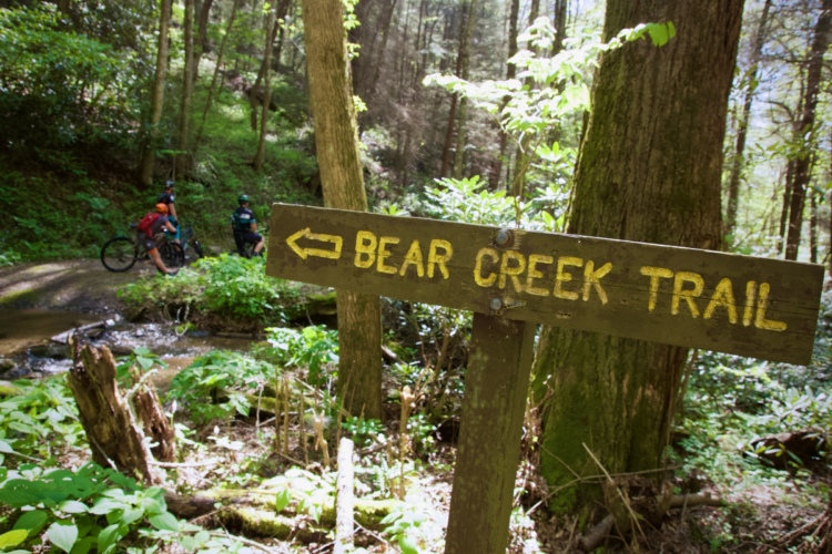
Add the Flat Creek Loop at the bottom before heading back to the parking lot. That'll give you a 15ish mile ride with about 3000 feet of climbing.
| ThankPark at trailhead on Aska Road. The first section is the hardest climbing up to the second Flat Branch Connector. Not so bad after that but be prepared for technical sections of inclines and roots. Overall one of the tougher trails in the area. Got some pics here on my Flickr photostream that I took while hiking: http://flic.kr/p/p5CaFV
I used to ride this regularly as part of a long loop training ride. I would park my jeep on the southern trailhead on Rock Creek / Stanley Gap Road. I would take Rock Creek Road to Aska Road. Then right on Shady Falls Road. Then Long Branch to Green Mountain. Here there is a choice. Ride directly to the Stanley Gap trailhead or continue on the Green Mountain trail system. I eventually worked my way back out to Aska Road north of the parking lot / trailhead for Stanley Gap. This requires riding south a ways on Aska Road to get to the Stanley Gap Trailhead. Then the real work begins on Stanley Gap.
| ThankThird time I have ridden this. My God. Prepare yourself for a 2 mile uphill from the start if you hang a right from the start. I looked into my buddy's eyes and only saw darkness. The two mile climb is worth it because if you turn at the trail split at the top of Stanley Gap, prepare yourself for downhill euphoria. Keep your mouth closed because the bugs are coming your way. Overall, awesome, fast ride with deadly uphills.
| ThankFive miles in, 5 miles out, and the climbs, at times brutal and technical, are at both ends and are probably close to 3 miles. The downhills are a lot of fun but no better the ones on Flat Creek, in my opinion. Overall, great ride, but it totally kicked my butt.
| ThankSteep ascent at times lots of roots. Super fast downhill lots of fur just be ready to climb. Can be rode as a out and back or shuttle or even a loop with some paved and gravel road time
| ThankThis my favorite type of trail: You're either climbing or you're descending and both come in big chunks at a time.
| ThankYou essential climb 2.5 miles to the summit, scream 2.5mi downhill and turn around and do the whole thing in reverse.
5 mile out and back that will SERIOUSLY put it to you. ~1500 ft of elevation gain in about 2 miles. Bring your lungs, your tech skill, and some good brakes because you will need them! Can be ridden as an out and back or there are several loop options available. See Jon Parham's Off the Beaten Track or check out SORBAs website for the loop options. This trail is epic when ridden by itself, add it to Flat Creek, Green Mt, and Long Branch and you can make a 20 mile loop of all day bliss. NOT for beginners.
| ThankThis was a sweet ride. A grueling singeltrack climb, and a blistering fast, rock descent on beautiful bench cut singletrack were the highlights of this ride! Loved those gnarly downhills, absolutely killer! The trail was very "single," nice and narrow... not the wide doubletracky c*** that is evident a lot of places such as bull mountain. Nice singletrack!
| Thank