
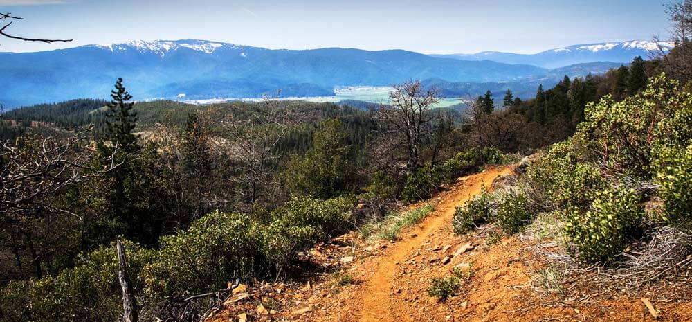
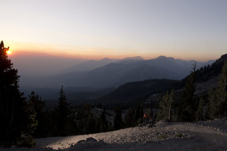
If anyone isn’t aware yet: mountain bike destinations make a lot of money. Build a solid trail network or two or three of them around a community, and if the word gets out then mountain bikers will likely come from all over to ride the trails, stop for a beer and dinner afterwards, and maybe even stay the night to do it again the next day.
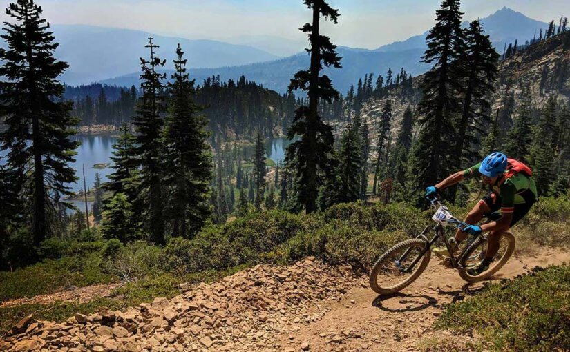
This is happening all over the world, in communities large and small, populated and rural. This has been happening for quite a while in the Sierra Nevadas and most mountain bikers have at least heard of Downieville and the Downieville Classic, which is a historic mountain bike race that helps fund the trails in the area.
The Downieville Classic is put on by the Sierra Buttes Trail Stewardship (SBTS). The regional trail advocacy group was founded in 2003 and has since built 93 miles of trail and maintained over a thousand miles of trail in the Sierras.
Unfortunately, many of the towns in the Sierras are struggling to stay above water as mining and timber economies have gone by the wayside and left residents without jobs, and towns without a purpose.
With the success that Downieville has seen because of mountain biking, Greg Williams, founder of the SBTS, thought about how that success could spread to other communities in the Sierras. Residents in other communities started to ask him if they could also get some mountain bike trails that might drive tourism and bring back jobs that have vanished over the years.
Williams and the SBTS came up with a grand plan and started to pitch it to community leaders and non-profit organizations in the Sierras. The ‘Connected Communities’ plan caught on quickly. SBTS was awarded a $360,525 grant from Sierra Nevada Conservancy to begin the plan to construct 300+ miles of new multi-use trails connecting 15 rural Sierra mountain communities.
In total, the $360,525 for phase one of the project is a small portion of what they’ll need altogether, as the projected cost for Connected Communities is $10M, but the SBTS is confident that the rest will fall into place.
Connected Communites will focus on the Northern Sierra Nevadas, including the towns of Loyalton, Sierraville, Sierra City, Downieville, Quincy, Graegle, Portola, Taylorsville, Greenville, Chester, Westwood, Susanville, Jonesville, Truckee, and Verdi, Nevada.
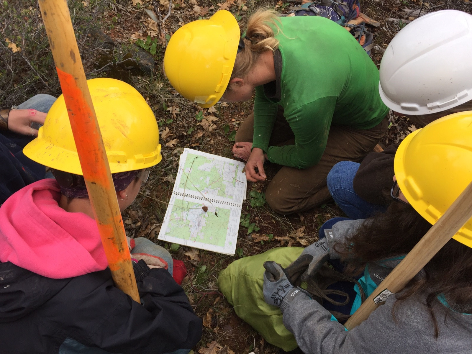
The first phase involves trail inventory, planning, and mapping of new network trails. The second phase will consist of environmental analyses on 300 miles of new trail. The projected cost for phase two is almost $800,000. Phase 3 is the most expensive phase and the digging portion for new trails. The projected cost for building 300 miles of new trail is about $8M.
Because the Connected Communities plan is so large and ambitious, we got on the phone with Williams and talked in detail about what Connected Communities is and how they plan to revive the economies of former mining and timber towns with the ten-million-dollar project.

How did the idea for Connected Communities come about?
For us, we’ve completed 100 individual projects and have been steadily expanding our trail programs, but at the same time in our region, our neighboring communities are saying, ‘what about us? Would recreation fit here?’ [We asked], how do we bring other communities into this that are in the Lost Sierra region where the jobs are typically timber and mining, and now those jobs are gone so we’re losing population, and mostly what we’re losing are working families.
So we’re trying to bring those jobs back, and with recreation, since there’s so much public land here and National Forest, you’re not going to put in a strip mall or soccer stadiums. Really, the trails are our tool. They’re accepted, the Forest Service knows how to deal with them and we know how to attract the funding. It was kind of looking at a big regional map and a book full of Post-It notes, and I put together this pitch for this gathering called Mountain Ventures Summit. So I went there, and I was a presenter and pitched this idea of Connected Communities.
One of the people in the room was Bob Kingman, and he’s the executive director of the Sierra Nevada Conservancy and he stood up and said he wanted to fund it.
So we started to work with the conservancy and reached out to county supervisors and city councils, and the Forest Service and everyone was supportive. For the first time in our region’s history, everybody was on board, so it started to come to fruition.
What is the economic background of these towns in the Sierras? It sounds like they are mostly former mining and timber towns, but some might also be former ski destinations.
Correct. The town next to mine is called Johnsville. There was a ski resort there, but that’s since closed down, and there’s a ski resort in Susanville called Diamond Mountain and it’s still active, but we’re definitely not Tahoe, which is an hour away.
When the Forest Service owns 70% of the land in your county, you’re kind of fucked. If you or I owned that property, we’d be paying property taxes that go toward maintaining roads or keeping schools open, or public services. Traditionally, the way that the Forest Service conducted business in the past, there’s a timber community and then there’s someone harvesting timber in your region, so you would get a kickback from the receipts on the timber that would help pay property taxes. When the Forest Service stopped doing any timber projects and the mines closed down, there was no income coming off of the land, so the counties end up broke.
So, between Plymouth and Sierra county, we went from being two of the richest during the gold rush and richest during the timber boom. Now, we’re two of the poorest in California and we’re losing population because we’re losing jobs. Then what you end up with is a community that’s section 8 welfare and bottom of the barrel, and you lose a lot of talent from your community.
Now what we’re finding especially here in Quincy where we’re doing a bunch of trail development, is this new resurgence of working families and young people that are into the outdoors that want to live here because now there are recreational opportunities. At the same time, restaurants are opening, we’ve got a brewery, and Main street stays open on the weekend since there’s tourism, and that’s where these other communities are asking about Connected Communities.
So it’s largely centered on bolstering the economy through the service industry?
The service industry, but also job creation from the start, like planning, project management for the layout of the trails, local biologists and archeologists to do the surveys. And, we’ll be hiring locals to build the trails, so there’s job creation right from the get-go, but the end result is the vibrance of the community. Whether there’s the service industry or they work remotely, it’s attractive for them to live there because there is high quality recreation right from the main street.
How does interconnectedness between towns with Connected Communities change things? How much of a difference does this make for residents?
It’s kind of a two-part plan. The linear connections that go from one town to the next, but there’s also planning that will be done, that right around the towns, mainly connecting the main streets, and figuring out how to make the main streets the trailheads.

We have the Pacific Crest trail that runs through our county, but it doesn’t come close enough to the town for anyone to spend their money, to stay at the motels or eat at the restaurants, so there’s no true economic impact from that trail. So the idea is that each one of these towns, you can start from the downtown, not get in a car. You can hike, ride a bike, a motorcycle, a horse – however you want to get around in these towns.
And the appeal of having this grand trail system to draw people in from far away places. We have this huge population base in California and interstates that run right past our county, with people going to Oregon, and Colorado, and Utah to recreate. We want to retain those people.
Ideally, each one of these towns will have its own flavor of trails and character, so if you like big, gnarly rides, you can go to Downieville. If you like fast and flowy singletrack, you can go to Quincy.
A large part of this trail project is connected to educating people about clean water and that’s from Proposition 68. What do recreation trails have to do with California’s clean drinking water and watershed health?
This one’s pretty interesting in the fact that we didn’t get funded for recreation, we got funded for rebuilding communities and typically that is targeted to fuel reduction; as in ‘how do we keep these towns from catching on fire?’ But the Conservancy saw this and said, ‘if we don’t have people that are living in the woods and are connected to the land, we’re totally fucked.’ So they see this as tying people to the land, keeping people in town, and creating an economy, so it’s not a recreation based grant which is pretty unique.
In terms of the watersheds, we’re at the headwaters of the Yuba and the Feather rivers. Over 65% of California’s clean drinking water comes from our region. So we can highlight that, and to get people to come out from the city and come experience public lands and learn about where it comes from and the watersheds, and to learn about these fuel reduction projects.
The reason California is in such shitty shape now, is because every time there was a logging project, it would get litigated by people that lived in San Francisco or wherever that want to stop the logging. So we’re trying to educate people that you need to manage the forest and that there’s a responsible way.
What is the distance between communities? Is it possible to ride from town to town?
Yeah, for sure. For the towns that are further apart, say 50-miles or so, we’re targeting places that have campgrounds, and part of this is targeting the potential for overnight huts. And these trails are going to be multi-use, so we’re targeting everybody. Dirt bikers can easily get from town to town, you can spend as many days out there bikepacking as you want.
For the PCT, it’s this cool, national, scenic trail, but it’s very limited for the user groups. It’s only hikers and equestrians. The idea here is that it’s for everyone.
With a total projected cost of $10M, how will you fund the rest of it?
One of the main sources of funding will be the California Off-Highway Vehicle Funds. Here in California, if you purchase a motorcycle, whether it’s a true dirt bike that’s not street legal, you buy a sticker, or you have a license plate that you’re paying registration, (or taxes paid at California fuel pumps) — those funds go into the California Off-Highway Vehicle Fund, and that generates about $30M a year, and of that, you can apply for planning which is to do the environmental work, like the NEPA and the CEQA, and once that’s complete you can apply for the development, which is to build it out. Once it’s built, you can apply for ground operations, which covers ongoing maintenance, so it’s a real robust program.
We’re already very familiar with it and we’ve been successful with bringing in about $4M or $5M between Downieville and Quincy. Also, we use the funds to hire local trail crews and pay them a real wage. We call it ‘house-buying wages,’ so our trail crew makes good enough money that they can buy a house, raise a family, eat at the restaurants, and participate in their communities.
As well as our corporate sponsors. Santa Cruz just launched their Paydirt program, Patagonia has been a huge supporter, and REI. We put on these three big events and our goal is to net 100 grand per event, and we’re able to take those funds and leverage additional grant funding. Just years of practice and developing these methods and that’s how we plan to get it done in the next ten years.
Does using volunteers in phase three cut down the projected cost at all?
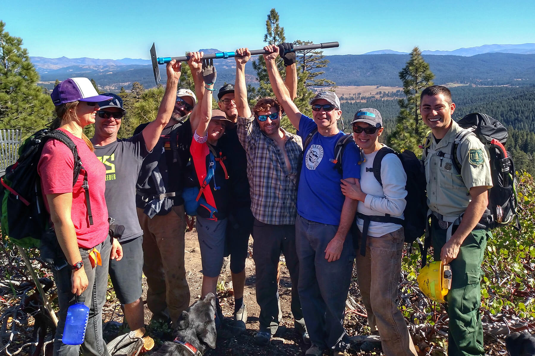
It does. With a typical OHV grant, you’re going to need to come up with a minimum of 26% match on those funds, so we use volunteers for that. Last year in total we had about 1,400 volunteers and 600 of those were under the age of 18, so we’re really savvy with getting kids out from the schools and onto the trails to help, so they understand why we do what we do.
They also get more familiar with their backyard and environment. People come from hundreds of miles of to volunteer at our trail work days. A big part of that is to make it fun. You’re going to dig in the dirt, but a big part of that is to go on an adventure and get partied down.
By using volunteers it brings our cost per foot down, and by using a local trail crew is a big thing, versus hiring a contractor, which you might not know where they come from. And, contractors can’t use volunteers because you’re under a bid. Because we’re a non-profit, we’re under those funds which is good because we’re able to maximize those public funds.
What is the timeline that Connected Communities would be forecasted to start seeing economic benefits for these towns?
We’re already seeing benefits in Quincy, Downieville, and Graegle. We’ve actually done some economic development studies with Chico State University that show how people value trails, why they live where they live, why it’s important to them.
The next phase will really dial in what the economic impact is of those trails. Part of this is already in the works. We’re already connecting Downieville to Quincy, and Quincy to Taylorsville. While we’re launching this project, it’s already years into development. Now it’s getting funded to do the rest of it.


1 Comments
Mar 13, 2020