
Before ending our epic mountain bike trip, we made two final stops in Peru to ride the Salkantay Epic and to visit Machu Picchu.
Salkantay Epic
At 6,271m (20,574′), Salkantay Mountain is the highest peak in the Vilcabamba mountain range of the Peruvian Andes. The name Salkantay comes from the Quecha word sallqa, which means savage, wild, uncivilized. This is a fantastically appropriate name for the epic ride we completed in November 2017.
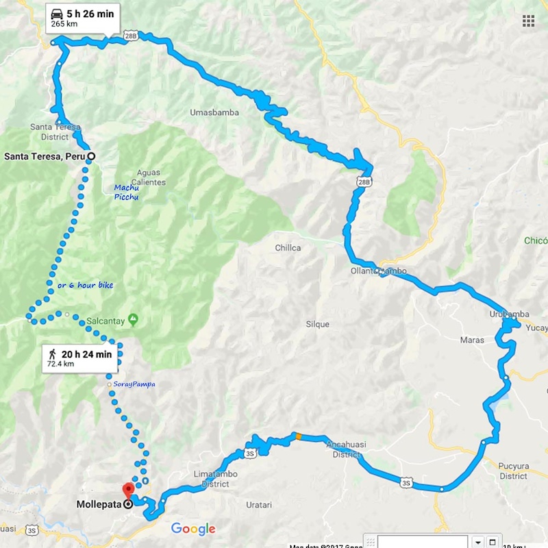
The Salkantay Trek is another alternative to the classic Inka Trail which begins near Ollantaytambo and runs west to Machu Picchu. The Salkantay Trek can be hiked in 4-10 days, but by bike it can be completed in one looong day. This map from one of the tour operators provides a good overview of the route. (The map is inverted so N-S coordinates are reversed.)
Interestingly, the main sundial at Machu Picchu points toward the Southern Cross constellation during the rainy season when the constellation lies directly above Salkantay’s summit. This alignment shows the Inca’s reverance toward Salkantay and their belief in Salkantay’s control over the weather in this region. I asked someone from Colombia why the Inca didn’t build temples like the Aztec and Mayans. He said it was because they believed the mountains housed the spirits (apu) of the gods.


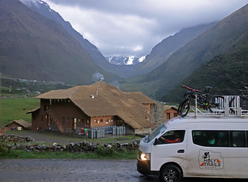
There are two places to begin the Salkantay Trek by bike or foot. One is in the town of Mollepata, 98km from Cusco. Trekking from Mollepata takes adventurers to Soraypampa at 3,870m where there are private accommodations, not normally available to general public. However, because Diego seems to know just about everyone in the tourism industry in Peru, through our trip with Holy Trails MTB we were able to secure private accommodations at the luxurious Salkantay Lodge, part of the gucci Mountain Lodges of Peru.
Staying in Soraypampa saved an hour’s drive from Mollepata and provided a good night’s sleep in comfort at the Mountain Lodge. Campgrounds are available but weather is frequently inclement at this elevation. It was below freezing in the morning and rained overnight, so if you do camp, prepare accordingly.


We had to delay our Salkantay ride by one day since the gods decided to make it rain. Fortunately there are other rides in the towns of Curahuasi and Abancay for days just like this, so we weren’t left sitting around. It’s nice to have contingency plans and locals to show you around!

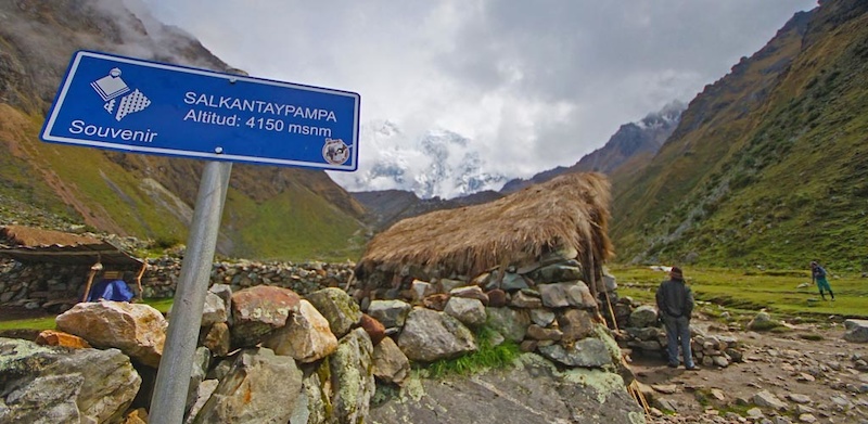
On the morning of our ride from Soraypampa, we met our porter Victor who loaded up his horses with our bikes. We took the advice of our local guides to conserve as much energy as possible for the ride, letting the horses and porters do the work for the 5km, 750m hike from 3,870m at Soraypamp to the pass at 4,650m. The hike ended up taking us and hour and a half. While it’s doable under one’s own power, this is not a trivial undertaking at elevation.
The popularity of the Salkantay Trek has provided new economic opportunities for locals who have lived in this area for generations. This includes, but is not limited to, the owners of the horses carrying our bikes. Utilizing a porter service along the Salkantay is a personal choice but to us, this was money well spent and a way to contribute to the local economy.


We made it through pretty much the only weather window that would be open for the next two weeks. Much credit goes to our local guides, their patience, and a bunch of blessing from Apu Salkantay, which allowed us to tackle this ride!
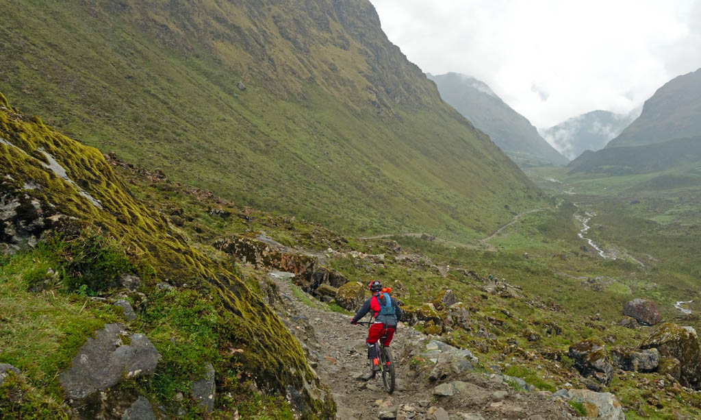
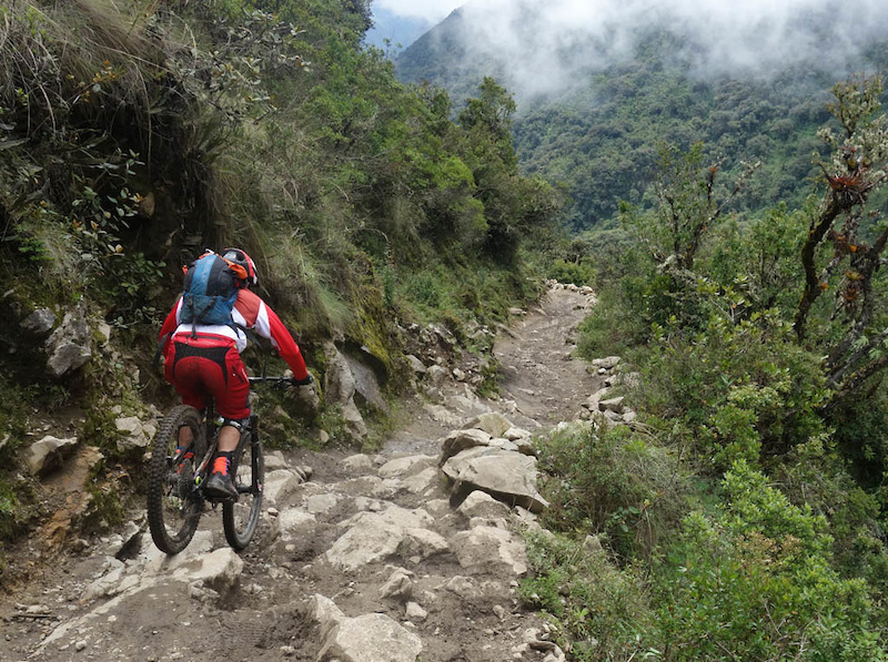
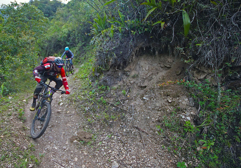
The first leg of the descent from the pass was 6km long, descending to 3,920m through the alpine on a legitimately technical, albeit wide, trail. Following the alpine section, the next 12km section down to 2,750m was wider since this section sees more use from the local communities. These sections are also shared by the horses and porters who support the trekkers, and were relentlessly technical. Thanks to the previous day’s rain, they were even more so.
The weather closed in as soon as we got to Abra Salkantay pass, which is a shame because the views of the backside of Salkantay and Humantay (a 5,473m massively glaciated peak) are said to be impressive.

To train for this descent, I suggest doing at least three top-to-bottom Whistler bike park laps, but throw in head-sized boulders instead of berms and rollers. We were happy to be on our bigger bikes on these sections. Shar was on a Pivot Firebird, I was on a Cove Hustler, and the locals were riding Devinci Spartans.


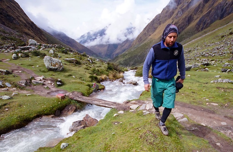
The next 11km, 780m descent was on singletrack that the horses do not use, so it was much more flowy and less technical. This section has a decent amount of climbing but is a blast. It’s obviously a different animal than the Salkantay-Humantay alpine. The trail drops from cloud-forest jungle to pure tropical jungle with steep banks demanding concentration and Rio Santa Teresa churning below. That excitement is just what one needs to complete the ride!


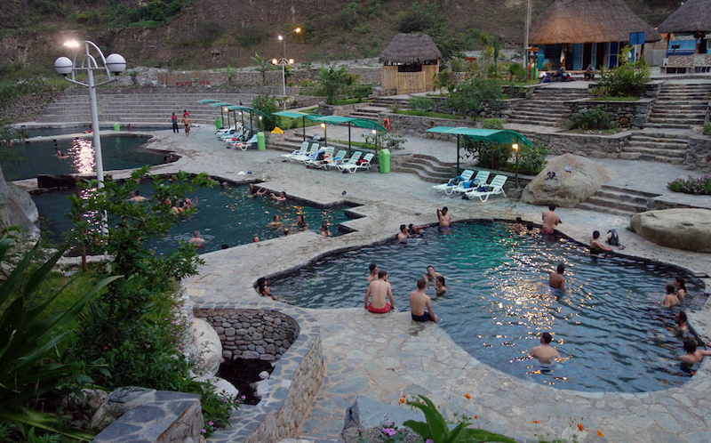
The final 15km and 670m of descending was on the road through the lower communities. We finished our ride at the town of Santa Teresa and the Cocalmayo Hotspring. Our total ride time, including the hike and resting, was 8 hours. Fortunately Wilberth, our tireless shuttle driver, drove 265km to pick us up on the other side. He beat us by 30 minutes just in time to deliver the cold beer. Ahhhhh.

Machu Picchu
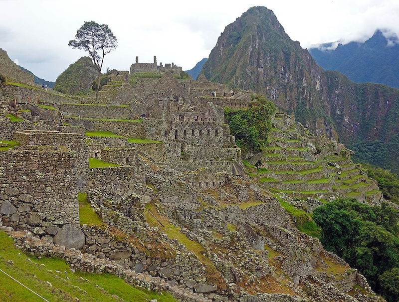
No trip to Peru is complete without including a stop at Machu Picchu. Since it was named a UNESCO Site in 1983, and chosen as one of the “New 7 Wonders of the World” in 2007, Machu Picchu has seen over 1 million visitors each year since 2012.
It is possible to visit Machu Picchu in a one day trip from Cusco, or a 4-5 day trek on the Inca trail from Ollantaytambo or Santa Teresa via Salkantay.
We decided to take a moderate-length, 2-day trip, which is perfect for non-hikers and people who want to be less rushed than doing it in a single day.
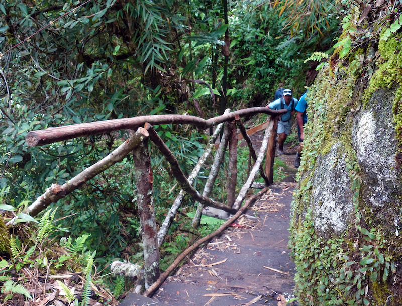
We made our travel arrangements through Holy Trails MTB partner Peru Outdoor Experiences. The two day trip started at Urubamba with the first train from Ollantaytambo to Aguas Calientes. The train dropped us off at Km104 where we started our hike. The hike is about 8.5km, with an elevation gain of 870m. It took us 6 hours to get to Machu Picchu at a very relaxing pace.


Willie was our guide and was able to give us a lot of great interesting information during the hike as well as at Machu Picchu. When we arrived at Machu Picchu it was drizzling and overcast, but the views we had did not disappoint. Thanks to the weather, the crowds were relatively small. We decided to continue the tour into Machu Picchu instead of returning the next day since we had time.
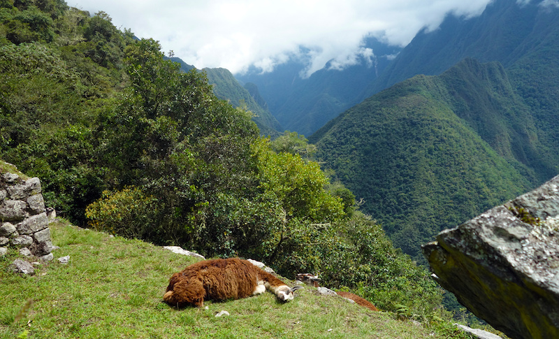
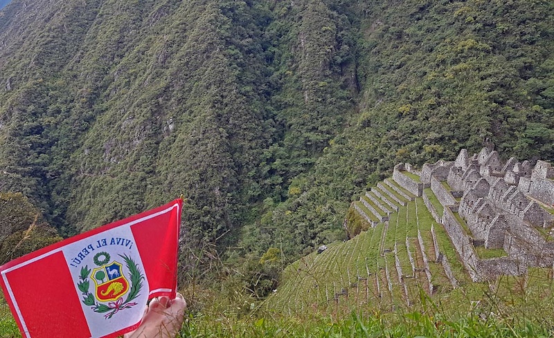


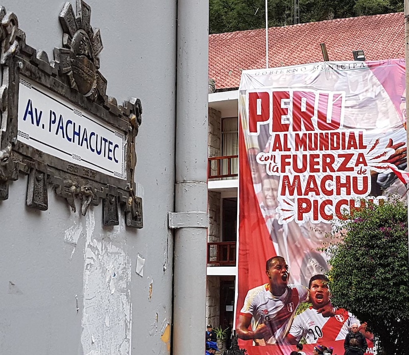
Built by the 9th Inka Emperor Pachacuti in 1450 and abandoned during the Spanish conquest in 1572, Machu Picchu did not serve the kingdom long, nor is it clear how the place was inhabited. Machu Picchu is 80km from Cusco, and sits at 2,430m in an elbow of the Urubamba river. The site was never discovered by the Spanish and was covered by vegetation before it was brought to the world’s attention by Hiram Bingham in 1911. Machu Picchu has three main areas: agricultural terraces, an urban area, and an upper and lower town.

Sitting in the saddle of the mountains, Machu Picchu and Huayna Picchu are difficult to see from the valley below, easy to defend, and both get water from above so the flow can’t be blocked. During the time of the Inca, there were only two ways to get to the site: through the Inti Punku and the Inca Bridge.

Where to stay
Salkantay Lodge
Salkantay Lodge is part of the Mountain Lodges of Peru chain. The public can’t book here; guests need to have connections or take part in a guided trip. The alternative to staying at this rather pleasant lodge is to camp in one of the high-elevation campgrounds. This isn’t a bad choice if the weather is pleasant, but Salkantay tends to make its own weather!


Aguas Caliente
Peru Outdoor Experiences arranged accommodations at the Waman Hotel. We had heard that Aguas was a tourist trap and that customer service was indifferent, so honestly we didn’t expect much. Instead we were pleasantly surprised by the hotel being clean, with excellent customer service, and a huge breakfast!
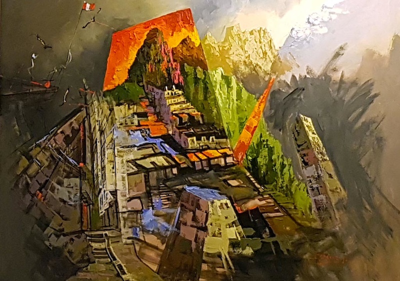
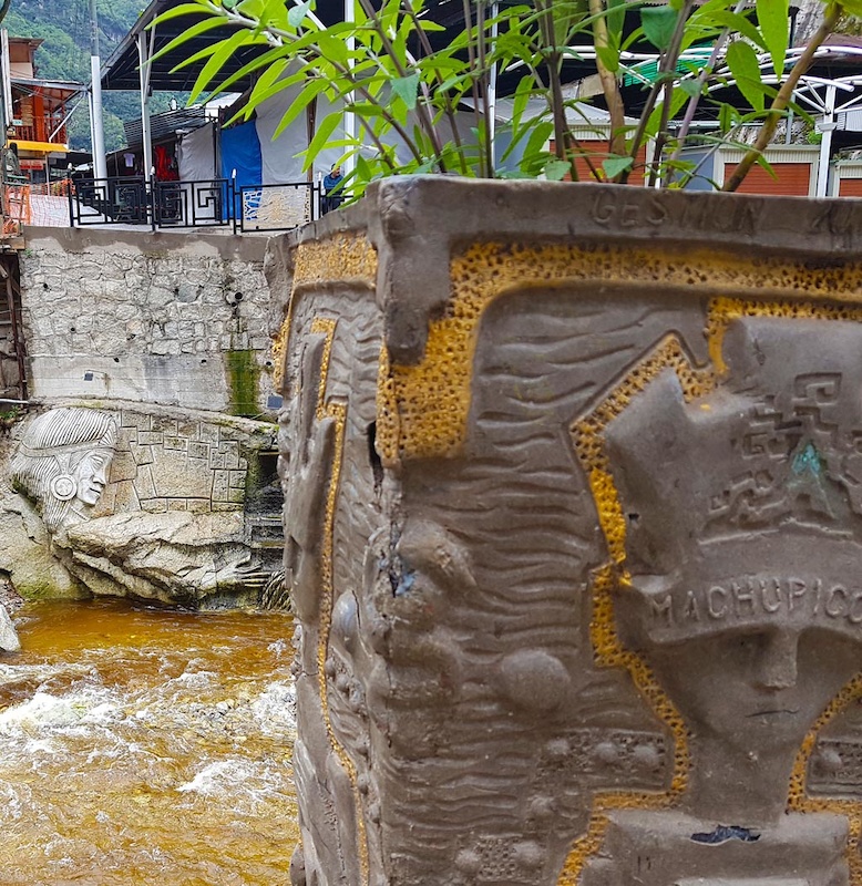
Aguas Caliente itself is a pretty town. There are no cars there so it’s remarkably quiet. Perhaps we lucked out by not visiting during the height of tourist season. The people were pleasant, the streets were clean, and the shops and restaurants were chill.

Read more about our Salkantay ride and visit to Machu Picchu on our personal blog.
This is the final installment in a series about mountain biking in Peru. Click here to get started at part 1.


1 Comments
Mar 28, 2020
https://www.salkantaytrekking.com/