

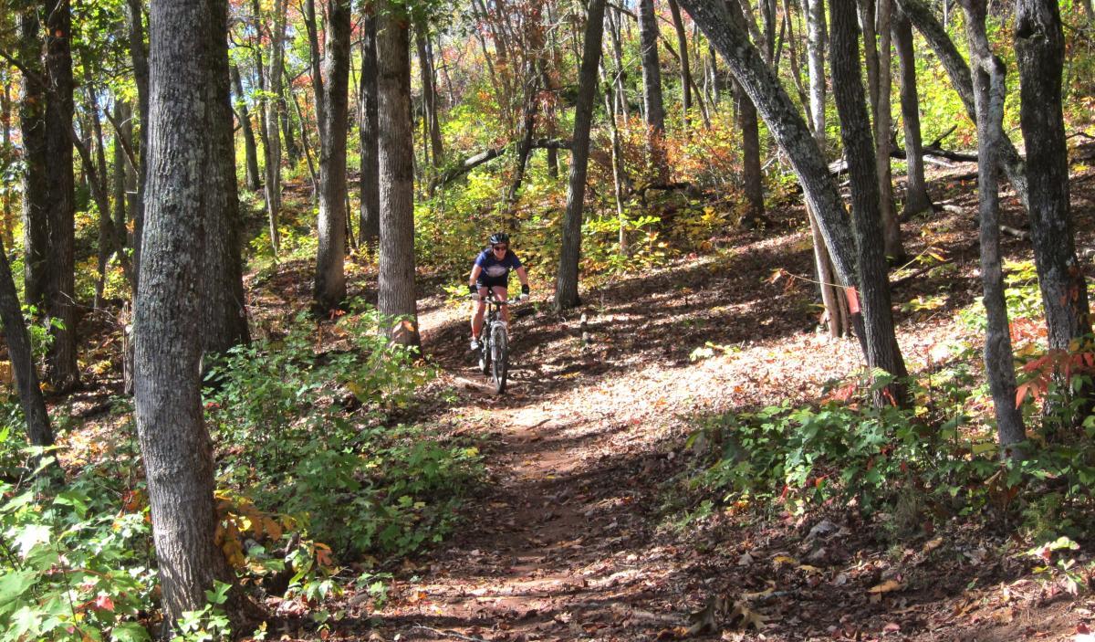
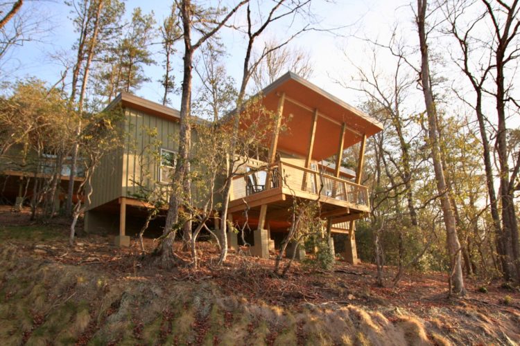
If you’re a serious mountain biker, you’ve either ridden in western North Carolina or you’ve already got it on your bucket list — or you damned well should have it written down by now. It’s gnarly, it’s fast, it’s steep and treacherous in a lot of places, and it’s home to some of the finest singletrack on the planet.
What if you’re a flat-lander who’s never been to WNC before and is — frankly — a little intimidated by the hype? Or what happens when you have a newbie riding partner that you want to introduce to the glory of riding in WNC? It’s very easy to underestimate the terrain and end up on something that’s way above their current skill level. Trust me, if they end up crashing hard on Trace Ridge, or slogging through endless river crossings down in South Mills River, it’s probably going to be the last time they join you on a ride.
So that’s the challenge: find a handful of trails in this fat tire wonderland that fledgling riders can conquer and enjoy, without too much risk of physical or psychological harm. Something that will push their limits a little bit, make them breathe hard once in a while, and give them a taste of adventure.
But it can’t be too heinous, too long, too steep, too exposed, or too much air. Can’t include dicey river crossings, cliff faces, boulder fields, or rattlesnake dens. That probably cuts out 90% of the rides to be found in these mountains, just sayin’. Still, there are some gentle gems tucked away out here, hiding in the shadows of their forbidding cousins. So here are eight of the easiest trails in western North Carolina (plus an honorable mention), ones that’ll give newbie folks a chance to fall in love with riding too.
Jackrabbit Recreation Area, Hayesville
If you want someone new to get hooked on mountain biking, I honestly can’t think of a better trail system to do it than Jackrabbit. This nested set of loops totals about 12 miles of singletrack, covering a small peninsula that juts out into Lake Chatuga. It’s a swoopy little playground full of dips and hops, with trails that dance through the trees and paint a smile on your face. Jackrabbit was laid out specifically with mountain bikers in mind, meaning that nearly every curve is radiused to allow you to carve through without braking. There’s nothing scary about it, just pure fat tire fun, and anyone with the skills to pedal a bicycle will be able to handle it. There’s very little elevation change, as well as a number of spots where you can roll right down to the lake’s edge for a snack break or even a dip.
The main White loop is only about four miles long, with four other short (1.5mi-3.2mi) loops peeling off one after another. That makes it perfect for tailoring the ride length as needed.
There’s an inner Yellow trail that offers up some really sweet rollercoaster action. Or if you find Jackrabbit a touch too tame — or if your newbie friend is feeling a bit too cocky — then take the shortcut over the Orange trail for a surprising challenge: nearly straight up the fall line, no switchbacks, full of really loose rock plates and snaky roots. As much as I hate to admit it, I’ve dabbed every single I’ve tried to climb it. Dropping down it is slick and sketchy, and a good spot for your friend to acquire their first scar.
Tsali Recreation Area, Bryson City
All four of the loops at Tsali are fairly flat and forgiving… for western North Carolina, at least. For many of us, Tsali was our introduction to mountain biking out in the Big Woods. They’re all gorgeous trails, rolling through the rhododendrons along the edge of Lake Fontana, offering magnificent views of the Great Smoky Mountains National Park. Thompson and Mouse Branch Loops are ideal rides for newbies, offering a sampling of everything that makes a great trail — roots, rocks, humps and dips, creek crossings, climbs and descents — served up with a main dish of smooth, undulating track wandering through the trees.

While all of the Tsali trails can be conquered by game beginners, some of the climbs on the Right Loop and the Left Loop (especially up to the overlooks) can be grinders. Left Loop in particular, after the small landslides it suffered last year, has gained several hungry rock sections that would be intimidating.
Thompson Loop
Thompson Loop is the stuff that fledgling mountain bikers’ dreams are made of: 8 miles of easy climbs and twisty, smooth track liberally sprinkled with fun little hops and dips. Near the end, a stretch of easy doubletrack leads you to the top of Thompson’s downhill, which is the longest and best run at Tsali. You get about 1/2 mile of screaming doubletrack, then a half-mile of quick singletrack switching through the trees, followed by another sweet 1/2 mile of fast creekside running, with some rocks and root laces thrown in for flavor.
Thompson is the type of trail that beginners will love, while their experienced riding partners can still have a blast. You can toodle through Thompson in two hours, or you can stand and crank through it in about 35 minutes, and either way, it’s a great ride. One last bonus: that awesome downhill at the end of Thompson can be done as a shuttle run, by having someone drop you off at the gated forest road (FS 2551) up near the top of the paved road. A short ride down the forest road brings you to the intersection just before the downhill starts.
Mouse Branch Loop
Mouse Branch, Thompson’s co-joined twin, is a super-fun introductory trail, with the reward of a spectacular overlook waiting at the far end. It’s got some great flow to it, some tight mountain laurel tunnels, and even a bit of ripping downhill if you’re so inclined. There’s really only one climb of any note, plus a gentle grade along some old doubletrack on the way out.
One piece of advice from a guy who’s enjoyed this trail probably 50 times: Running Mouse counter-clockwise is always the better choice. I know, I know, the sign says “Recommended route <– (clockwise)”. But that means you start off with a lame-o doubletrack ride, make a painful climb through the clearcut, have to double back to visit the overlook (that section of trail is signed one-way), then end the trail with a long grind up through a bunch of small roots, rocks, and dips. Riding it counter-clockwise instead, you begin your trip with a jazzy, mile-long run dotted with lots of little roots and hops. Then there’s a straight run out to the overlook, a jamming downhill across the clearcut, and a gradual doubletrack climb back out. If you’ve never followed Mouse Branch CCW, just try it one time and see if your smile quotient doesn’t at least double.
Pisgah National Forest, Brevard
Spencer Branch
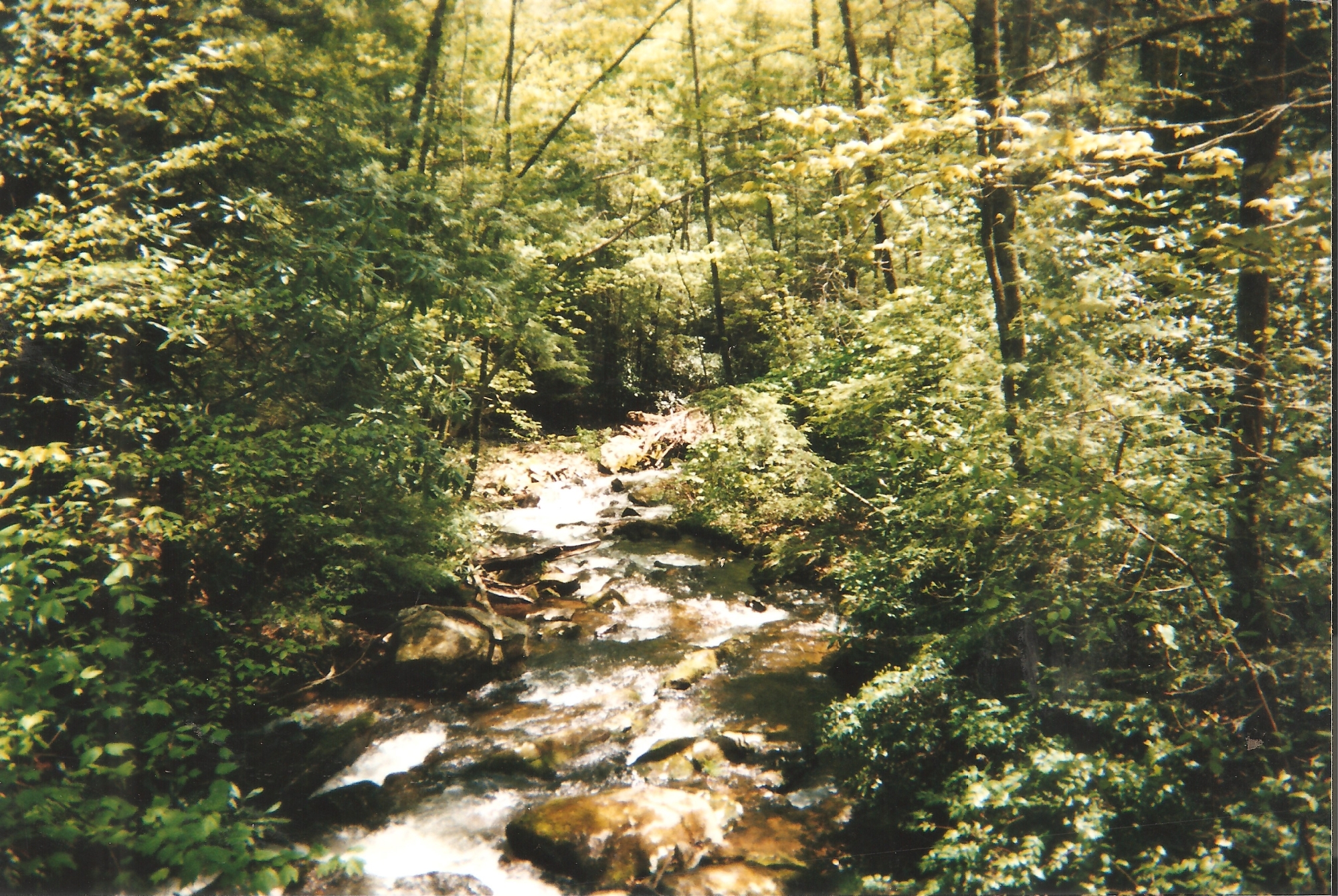
If you’re riding in Pisgah proper but you want to break in your newbie friend/partner/kids gently, then take them on a run down the lower section of the Spencer Branch trail. This piece of Spencer Branch winds gently down through a little valley. It’s surprisingly smooth, with plenty of small rooty hops and creek crossings to keep it interesting. Some of the creek banks are guarded by tough root lacing, and the log crossing over the creek is enough to make anyone sweat. It’s a sweet little two-mile slice of true Pisgah singletrack, and its only fault is that it’s over too soon.
From the popular Trace Ridge trailhead, set off along gated forest service road FS 5097, the Never-Ending Road. After about four miles winding through the forest, a signed entrance for Spencer Branch will appear on the right, heading up the mountain; this is definitely not the section of trail you want. Keep going another 1/2 mile, and you’ll find a second sign for Spencer Branch and a clear trail dropping down to the left. That’s your ride.

Spencer Branch eventually brings you out down by the old Hendersonville Reservoir, and from there it’s an easy one-mile pedal back up to the trailhead. Spencer Branch does intersect with several other trails (Middle Prong, Fletcher Creek, Big Creek), but they’re usually clearly marked, and they all end up at the reservoir in any case.
Pink Beds
You may be surprised to hear it, but there actually is a trail that is almost completely level, tucked away between the peaks of Pisgah forest. The Pink Beds trail, which starts directly behind the Cradle of Forestry, has no more than 40 or 50 feet of elevation gain for its entire length. It’s mostly smooth track, with a smattering of roots and small rocks, and the occasional log to grind. Beautiful, beautiful scenery, and during June the rhododendrons and mountain laurel can turn the trail into a pink-walled tunnel.
Note that the trail itself is a loop, but only the northern half of it is open for bike traffic. Which is just as well, since the beavers are constantly extending their terrain and flooding the far end of the trail. If there’s a dry route, you can make a loop of it using forest service roads 476 and 1206, or just enjoy the trail both ways as an out-and-back.
Bent Creek, Asheville
Explorer Loop
Bent Creek is a terrific fat tire playground located about 15 minutes from the microbrew capital that is Asheville. The trails here can vary from mild to wild, so choosing the right ride for your crew’s comfort is important. But at Bent Creek, that’s easy: the trails on the south side of the paved road (Wesley Branch Road) are fairly calm and forgiving, while those on the north side start to get much steeper and challenging.

For a great beginner’s loop starting from the Hardtimes trailhead, follow Hardtimes Road and Bent Creek Road (both are gated forest service roads closed to traffic) around Lake Powhatan, then keep an eye out for the entrance to Deerfield Loop. A spur mid-way around Deerfield will lead you to the Explorer Trail, which serves up a decent climb and then a charging run back down over the hill. Finishing up with the other half of te Deerfield Loop brings you back to Lake Powhatan. It’s a great introduction, and it gives you a chance to feel things out before venturing up onto the bigger trails.
Deep Creek, Bryson City
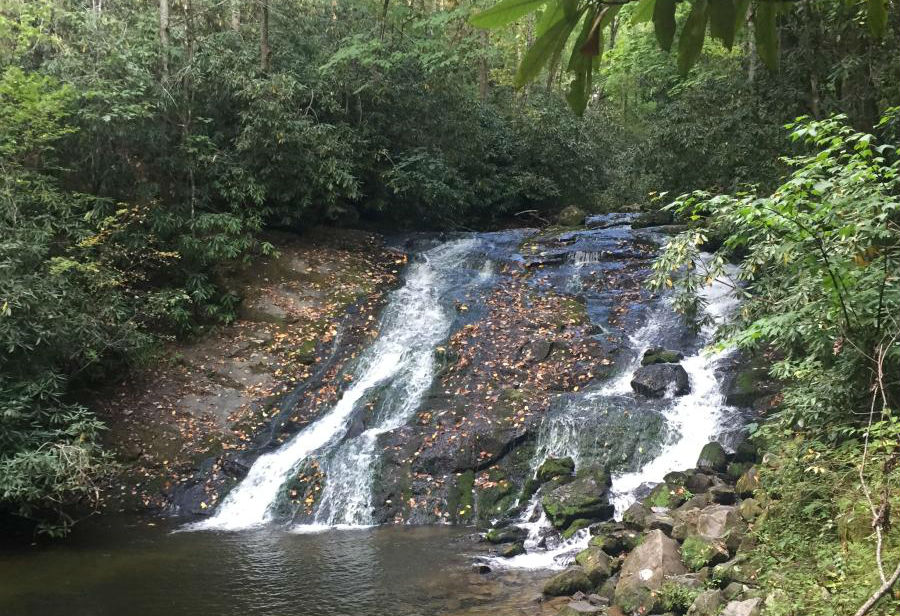
Just to be clear, Deep Creek is a gated, hard-packed forest service road; it’s not a singletrack ride. But sometimes you need a nice, gentle way to get someone used to being on a bike, yet you still want to be out surrounded by the woods. Deep Creek offers a casual ride through a gorgeous temperate rainforest past three exceptionally-beautiful and accessible waterfalls. Both Deep Creek Trail and Indian Creek Trail follow their namesake waterways, with about 5 or 6 miles of gentle to slightly more challenging grades. Since either way is an out-and-back, the return trip is always a long cruiser.
Deep Creek is one of the official entrances to the Great Smoky Mountains National Park, and it boasts a nice campground, picnic spots, and bathroom facilities. I would be remiss in not mentioning that the tubing along Deep Creek, particularly after a rain, is badass. If you’re in western North Carolina in the summertime, tubing down Deep Creek should be on your list. Foot traffic through the area can be heavy during the summer when the water is high and the tubing is good. But the trail/road is 16-20 feet wide, with plenty of room for passing. Note that in some places it’s a long drop off the side and down to the creek, so be especially careful with small ones.
Fontana Village Trail System, Fontana Dam
Hoor Hollow Trail
The 20 miles of trails at Fontana Village vary greatly, from the easy, old doubletrack along Upper Lewellyn, to the crazy pitches and creek beds of First Blood. It’s a great place for gradually building a new rider’s skills and confidence. Hoor Hollow is a sweet little piece of singletrack right at the edge of the village that anyone can handle, and that everyone will love. It’s mostly smooth track that can be run at any speed. After a short entrance climb, the trail serves up a pair of quick descents, then a gorgeous, swoopy run through the rhododendrons. Add in a couple of switchbacks, some nice hops, and a high-speed, teeth-chattering turn under the power lines, and you have a petite taste of just about everything a good trail should offer.
Hoor Hollow starts at the upper entrance to Fontana, just across Highway 28 from the well-signed Lewellyn Cove trailhead. Then a mile later, it spits you back out with a huge grin on your face, right across from The Pitstop café at the lower entrance to the village. To make another run, you just pedal up through the village, past the pool and general store, and return to the trailhead. You can easily knock out a quick loop in 15 minutes, and I’ve often nabbed it as a pre-breakfast adrenaline shot while everyone else is still rolling out of bed.
One caution: At the tail end, Hoor Hollow drops you back out onto Highway 28, and I mean right on it. The end comes up quickly, just after a short, hoppy descent, and it can be a scary surprise if there’s traffic rolling by. So I advise that you never let a small child or really inexperienced rider lead on this ride.
Side note: During the season, Fontana Village also offers two outdoor pools and a lazy river, a great frisbee golf course, tennis courts, a ballfield, several restaurants and cafes, a killer 4th of July fireworks show, and the craziest Hillbilly Mini-Golf course you’ve ever seen. It’s an excellent place to bring the family or a group of friends to ride and relax in the heart of the forest.
Shout Out to Dupont State Forest

One obvious trail system that I did not include in this list of awesome beginner spots is Dupont State Forest near Hendersonville. This wasn’t an oversight; it’s just that Dupont has so many choices — over 80 miles of trails — it would be tough to pick out only one. Many of Dupont’s trails are old road beds that lead you on level, scenic rides over old bridges. It can be an easy pedal all day if you want, and the waterfalls are absolutely gorgeous.
Once new riders have their bearings and are hungry for something more, give them a taste of Ridgeline’s high-speed flow, or the lunar landscape of the Dupont slickrock. Maps of this area are easily available and are strongly recommended, as it can be easy to get turned around.


1 Comments
Feb 23, 2019