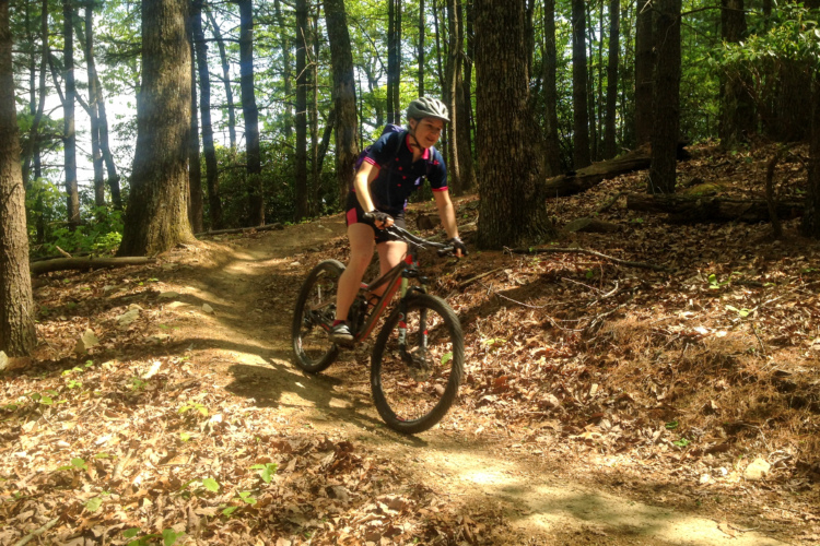
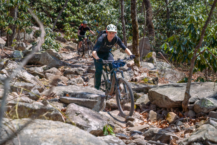
DuPont State Recreational Forest is a vast, expansive area with about 80 miles of singletrack and doubletrack trails. Here in DuPont, you'll find a little bit of everything, ranging from gorgeous trails with rushing waterfalls, easy doubletrack, challenging, technical singletrack, steep slickrock, and flowy dirt descents.
Be sure to check out the Big Rock, Burnt Mountain, and Cedar Rock trails in order to experience the excellent East Coast slickrock! Also, you have to make sure to descend the Ridgeline Trail (#65)--talk about flowy and fast!
The route options in DuPont are myriad, so be sure to reference the GPS maps uploaded here for a variety of options to choose from.
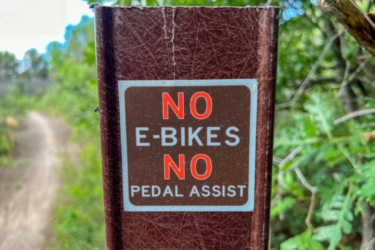
Note: DuPont State Recreational Forest is not open to e-bikes.
 | 5 Falls Dupont Sf | 12 mi | |
 | Airstrip Trail | 0.5 mi | |
 | Big Rock Trail #3 | 1 mi | |
| Bridal Veil Falls | 0.1 mi | |
| Buck Forest Road #8 | 3 mi | |
| Buckhorn Creek Road #10 | 1 mi | |
| Burnt Mountain Trail #11 | 2 mi | |
| Cascade Trail | 1.1 mi | |
| Cedar Rock Trail #16 | 2 mi | |
| Corn Mill Shoals Trail #19 | 1.3 mi | |
| Hickory Mountain Loop | 1 mi | |
| Hickory Mountain Road #33 | 1 mi | |
| Hilltop Trail | 0.8 mi | |
| Hooker Creek Trail | 2 mi | |
| Isaac Heath Trail | 0.7 mi | |
| Jim Branch Trail #41 | 1 mi | |
| Kids Bike Loop | 1 mi | |
 | Lake Imaging Road #45 | 2 mi | |
| Little River Trail #51 | 0.5 mi | |
| Micajah Trail (#54) | 1 mi | |
| Mine Mountain | 2 mi | |
| Nooks Trail #57 | 1 mi | |
| Reasonover Creek Trail | 3 mi | |
| Ridgeline Trail #65 | 1.1 mi | |
| Rock Quarry Road | 2 mi | |
| Tarklin Branch Road #80 | 2 mi | |
| Turkey Knob | 1.1 mi | |
| Wilkie Trail, #90 | 1 mi |


 17
17

Just a gravel road that leads from Conservation Road (gravel also) to Bridal Veil Falls. The falls is one of the best photo-op spots in the forest, so the road get a fair amount of traffic.
| ThankGood loop to sandwich between Rocky Ridge and Ridgeline for a ride full of climbs and fun, fast descents.
| ThankA fun rolling natural trail with no extreme rock or root obstacles. Tag it to the end of Issac Heath for a short 2 mile speedy section. Explore Grassy Creek Falls at the end.
| ThankGreat trail to use as a connector to either Jim Branch or Hilltop Trail (depending on your direction). Nothing technical, just a rolling ride of gentle intermingled climbs and descents.
| ThankA gravel road used by anyone that rides much in DuPont State Forest to reach some of the best single track trails there.
| ThankTrail is basically a gravel road out of the Corn Mills Shoal parking area (near Cedar Rock and Burnt Mountain trails) but if ridden from Bridal Vail Falls it is a challenging climb over an abundance of roots and narrow slivers of slick rock that leads you to Laurel Ridge, Cart (tough) and Mime Mountain trails. Those trails form an entertaining loop with Reasonover Creek Trail when riding out of Fawn Lake Access Area. Plenty of photo-ops on that ride…..creek crossings, a lake and waterfall.
| ThankFun trail with intertwined sections of slight climbing and downhill flow. Great way to end a Fawn Lake area ride. Start with Reasonover and slide over to Bridal Veil Falls for iconic DuPont photo opportunities. Jump on Shelter Rock to Corn Mills Shoal (climbing) to Laurel Ridge Trail and on to Mine Mountain Trail where up top out at almost 3100’ before a quick DH blast back to the parking lot.
| ThankIntermediate trail, though the majority of riders won’t clear the loop without a couple of walk arounds…. up or down!
| ThankFun ride with plenty of roots and even a bit of North Carolina slick rock. One of the most narrow trails in the park; lots of “Roadie” tunnels and close vegetation. Pair up with the Cedar/Big Rock Trail and/or Burnt Mountain for a solid tour.
Place has it all. The slick rock and tech trails are great. I thought Turkey nob(maybe) was the best trail we hit. Ridgeline was as expected, flowy, fast an fun. Place is worth the trip!
| ThankThis is a special place. If you're looking for tech go down the road to Pisgah. DuPont is all about the flow; lots and lots of it. I've ridden the eastern and western portions and they both offer up some stiff climbing and a heap of ripping fast downhill. The sheer scope of the place might be a bit much to wrap your head around at first, but I've found it's best to just turn down a trail and see what's up. I haven't been disappointed yet. Copious amounts of gravel are a great bonus and also a great way to link up sections of singletrack. The only major drawback is crowds, but I just go at dawn and I usually avoid that problem.
| ThankOne of the better descents in DuPont. A little more natural and less manicured than Ridgeline.
| ThankI LOVE this trail!
| ThankHONEYMOON SHRED! Dupont State Forest Mountain Biking with Red Wolf! https://youtu.be/AeF2C6LZ7qc
| ThankGood scenery. Some cool tech. Some good flow. Lots of very nice singletrack. Huge area with truly epic mileage available. The area actually rides like a group of different areas all interconnected, but not all the connections are great. Some trails are really just rehabbed roads or very wide crushed rock "trails." Best to concentrate on one area at a time to maximize the fun factor.
| ThankThe climb to the top and the descent are in great shape. the access trails and access fire roads are almost like little creek beds and full of water from the recent downpours. Still great, but just be ready to get wet.
Even though the trail width is a good bit more than 6 inches, i still rated it according to the grade and drops. There are plenty of good drops on this trail. Some are between knee and waist high. Have fun, but be careful.
| ThankGreat trails for all abilities. Took the family and a great day. Highly recommend to everyone.
| ThankAbsolutely my favorite section of DuPont.
| ThankOne of the best places in the state, and one of the best on the east coast. This place has a ton to offer, I just wish it was a bit closer!
| ThankVery smooth and fun Singletrack. Had a lot of fun. Beautiful Fall views. Either direction is fun, but I preferred the south-to-north direction as the downhill is longer. If you have time, ride both ways!
| ThankGreat trail overall. I took the counter-clockwise route from Fawn Lake Parking Lot. Smooth flowing, beautiful views and ends at a nice lake. Either direction would probably be a great ride.
| Thank