

Any opinions expressed in this story are the author’s own, and may or may not represent the opinions of Singletracks.com.
In August of 2018, Sharon and I went on a road trip to Montana to ride some of the best mountain bike trails before they disappear.
Montana boasts a disproportionate share of mountain-bike-able alpine trails compared to other US states, and many of these trails are located in federal lands administered by the United States Forest Service. Sadly, the USFS in this area is embarking on various courses of actions which are likely to close some of these trails to mountain-biking over the next few years. For this reason, we felt we had to see these gems before mountain bikers became lumped in with common criminals for the act of riding bikes on trails.


USFS lands are administered by different Regions which have broad discretion in making land-use decisions. Most of Montana is under USFS Region 1. To many mountain bikers, especially those in our group, USFS Region 1 seems to be the unit most opposed to mountain biking.
In addition to sharing information about the great mountain bike trails we experienced on our trip, this three-part series will also explore how the USFS Region 1 manages recreation in the lands under its jurisdiction. Sadly it appears this region of the USFS tends to exclude mountain bikers and other groups from public lands while giving preference to hikers and horseback riders.
Our fear is that some (or possibly all) of the trails featured in this series may be closed to mountain-biking for reasons of “preservation.” (Preservation for what, and for whom, are valid questions.)
The Bitterroot Valley

I don’t feel compelled to ride alpine or subalpine trails regularly. These are rare treasures enjoyed when weather is good and conditions are perfect. Alpine trails are fragile beasts, not to be ridden (and consequently abused) when wet. In Montana, like other areas, alpine access generally isn’t easy, and the riding season is short due to the need to wait for snowmelt. This means the window to ride in the alpine is narrow.
Our first stop was the Bitterroot Valley close to Hamilton, Montana in the southwestern corner of the state. Here, two groups who both enjoy the outdoors have clashed with lawsuits, suing one another to press their views.
On one side, mountain bikers and motorized users local to the Valley have a broad view that they should be allowed to recreate on federal lands. On the other side, Wilderness advocates have a more restrictive view asserting that hiking, skiing, and horseback riding are the only activities that should be allowed.
Mountain bikers and motorized trail users won a short-lived reprieve following an early July 2018 court decision holding that the US Forest Service process closing trails to biking was broken. However, Wilderness advocates are tenacious litigants. Mountain bikers enjoyed sanctioned riding along the 110 miles of alpine Montana trails in the Bitterroot valley for all of one day. These trails were once again shut down in early August 2018 following Wilderness advocates’ lawsuits to close bike trails while the Forest Service “fixes” their broken process by pretending to consult the public.
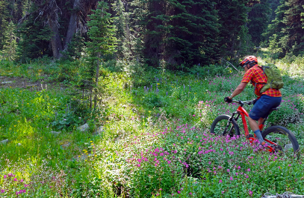
Roostercomb – Kent Lake
Rooster Comb to Kent Lake via 313 – Bitterroot Valley Montana August 10, 2018
On the first day in Montana we rode Roostercomb – 313 – Kent Lake as an out-and-back with Lance Pysher of the Bitterroot Backcountry Cyclists who showed us around. These are uncrowded trails with a wonderfully technical backcountry flavor; there’s not a berm in sight.
For us sea-level-dwellers, this ride is surprisingly hard starting at 2,300m and topping out at 2,650m (about 8,700ft.). It is an out-and-back 14km, which sounds relatively short. However, Bitterroot trails are quite technical and you’ll always find yourself fighting for speed amongst all the roots and rocks. Lance cautions that many visitors to the region consistently overestimate the amount of ground they will cover. Anticipate this and budget your time accordingly.
Of note, the 313 Trail (aka Rock Creek Divide Trail) is rarely ridden in its full length — we sampled but a small section. The length — about 50km — is not the issue. The issue is its remoteness and the haphazard nature of its maintenance. Mountain bikers were the primary maintainers of this trail, and following their exclusion were forbidden from doing any work. The USFS is, of course, under-resourced. Accordingly, Trail #313 is mostly used as a connector for other trails, as in this ride.


Crystal Creek
On this day of our trip, 180km (110mi) in the Montana Bitterroots, representing a quarter of the singletrack in the area and some of the best alpine trails, became illegal.
In the spirit of cooperation and goodwill to all, the Wilderness movement obtained a trail closure order banning bikes and motos from a good chunk of US Forest Service lands. We were camping at Como Lake without cell service and only found out about this after aborting a ride due to a rear shock hardware explosion on (the suddenly illegal) Razorback Ridge. This was a shame as Razorback had just recently seen tons of maintenance by mountain bikers following the short-lived re-opening and bike legitimization earlier in the summer.
We made do by heading off to ride the still-legal Crystal Creek trail and found that the quality of trails in the area is still acceptable with a good level of jank and a distinct absence of golden berms. Crystal Creek is a short ride that can be made much longer as part of a route that the BBTC has dubbed “Macho Nachos,” a 43.2km-long ride with 1,200m of climbing and 2,290m of descending, a healthy ratio!


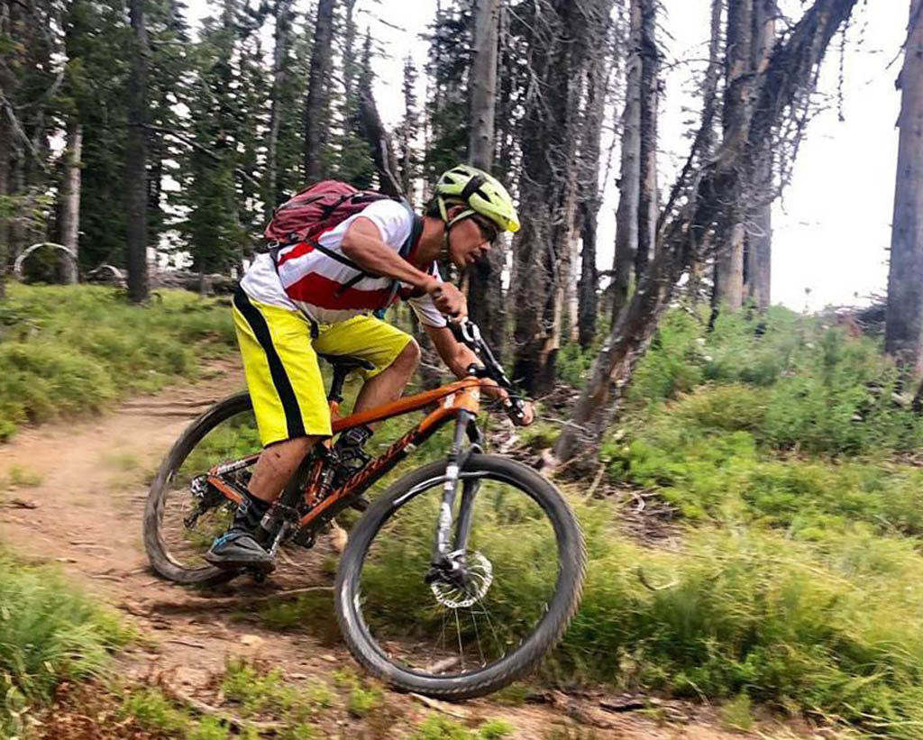


On the downhill

Wilderness and the Bitterroots
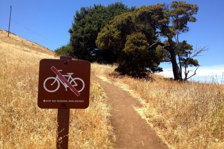
Bitterroot trails were re-opened in early July 2018 then subsequently closed in August 10, 2018. In announcing this closure, the Bitterroot National Forest (which is part of US Forest Service Region 1), confirmed that “trails in Bitterroot WSAs are closed to mountain bikes.” There is an opportunity for mountain-bikers to provide comments on the US Forest Service’s decision (comment by November 18, 2018) about closing trails in the Bitterroots. Whether the USFS will be swayed or politely shelve input into G for Garbage is to be seen.
One might ask why these trail are forbidden for mountain-biking? Crowds aren’t the issue; there aren’t enough users in the Bitterroot valley to create conflict. Hamilton is the largest town in the valley with 4,700 people. Missoula has 73,000 people but at 55km away, it’s far enough that riding the Bitterroot trails is a weekend endeavor.
Maintenance isn’t the issue; mountain-bikers contribute overwhelming volunteer resources. Following the month and a half of trails being legitimized for biking, the small (approximately 50 person) Bitterroot Backcountry Cyclists mountain-bike volunteer group managed to put in some 250 volunteer hours, clearing 500 trees and 20+ miles of trail.
The issue is the US Forest Service Region 1. Their default position is to manage public use of public land as anti-bike. Look for more on the the US Forest Service (Region 1)’s anti-bike stance and the alphabet soup of wilderness designations in part 2 of this series.


19 Comments
Nov 7, 2018
My question to you is about the local wildlife. Do you take any precautions due to the grizzly bear and mountain lion populations in the area?
Nov 8, 2018
In the Bitterroots wildlife encounters are with black bears mostly and for them keep the noise level high and keep alert (as always). Further east it's grizzlys which may be also encountered. For that be even more careful. It does not hurt to carry bear spray and bangers and know how to use them
Nov 8, 2018
It all starts with the head of USFS R1. Horribly opinionated about bikes, and how they should be restricted.
Nov 9, 2018
https://memberleap.com/action.php?orgcode=SDMB&laid=211085
Nov 9, 2018
In all things, balance. Hiking, equestrian, biking, moto, etc.-- there is room for all in Montana, and taking back historically open, and minimally impacted trails is unforgivable.
Nov 11, 2018
Section 101 Purpose: This includes high timber mandates based on numbers not science.
"to create an immediate, predictable, and increased flow of wood fiber with commercial value"
Section 205: Releases all Montana WSAs managed by the BLM
Section 206: Releases all of the Sapphire WSA on Bitterroot National Forest Land
Nov 8, 2018
Nov 9, 2018
Nov 9, 2018
Nov 9, 2018
Sheesh. I'm out.
Nov 9, 2018
“Mountain bikers and motorized trail users won a short-lived reprieve following an early July 2018 court decision holding that the US Forest Service process closing trails to biking was broken”
Motorized users didn’t win any reprieve. Sadly, the bikers allied with the motorized users in their lawsuit. If they had won then these pristine areas would now be motorized areas.
“However, Wilderness advocates are tenacious litigants.”
Wilderness advocates did not litigate this case. The mountain bikers, atv’ers and snowmobilers did. They sued the US Forest Service and wilderness advocates joined the case as amicus to the defendant.
“ Mountain bikers enjoyed sanctioned riding along the 110 miles of alpine Montana trails in the Bitterroot valley for all of one day.”
Not that it matters but they were allowed to ride in the areas until the judge’s clarification which was about one month.
“These trails were once again shut down in early August 2018 following Wilderness advocates’ lawsuits to close bike trails while the Forest Service “fixes” their broken process by pretending to consult the public.”
Again, wilderness advocates did not sue anybody but asked the judge for a clarification on his ruling.
“In the spirit of cooperation and goodwill to all, the Wilderness movement obtained a trail closure order banning bikes and motos from a good chunk of US Forest Service lands.”
The wilderness movement did not obtain a trail closure – the judge closed the trails until the Forest Service takes comments from the public on the trails and issues a decision. They have only the ability to ask the Forest Service and the Courts that the laws be followed and enforced. The mountain bike community is harming their credibility with this kind of stuff and should rein it in.
Nov 9, 2018
You also know we have tried to work with you and members of other quiet use coalition to find a solution for the Sapphires and Blue Joint WSA. The answer from FOB and MWA continues be that the only acceptable designation you will accept is wilderness designation for all of it. That doesn't leave much room for dialog. We are willing to sit down any time with you, FOB, the backcountry horsemen, and MWA to find a solution that finds some new wilderness and some alternative designations that keep these areas wild, protect corridors for Grizzlies like the one that made it as far as Stevensville, and also acknowledges that bike have been a compatible quiet use for 30 years
Nov 8, 2018
Nov 9, 2018
Nov 19, 2018
Nov 9, 2018
The Mountain Bikers are being manipulated by Senator Daines and Rep Gianforte who want to release those WSAs to logging. There are lots of big trees up there and if those WSAs are designated Wilderness as they should be, logging will never happen. If bikers have access to WSAs, they will fight to keep them out of the Wilderness system. Then, Daines and Gianforte can get them released by Congress. Don't believe they will be protected by the Roadless Rule. Utah and Alaska are working to change that designation to allow logging even as we speak.
This is really about leaving some places untouched so wildlife can thrive and natural processes can occur without human intervention. The forest protects our water sources that protect our fisheries that protect us. We have to leave something untouched and untrammeled. That is what the Wilderness act is all about. It is not about access.
Nov 10, 2018
Our Congressmen are not manipulating mountain bikers. When there are multimillion dollar industries (I'm talking about Wilderness groups) pushing to remove bicycles from every inch with no compromise and no proof of environmental degradation... this is what happens.
Nov 9, 2018
Nov 18, 2018
The first reason it’s obvious is that Mountain Bikes are not allowed in Wilderness Areas. All agencies that manage Wilderness Areas (National Park Service, Fish and Wildlife Service, Bureau of Land Management and even the Forest Service) agree that mountain bikes are banned from Wilderness Areas. Therefore allowing mountain bikes in the WSA’s created by the Montana Wilderness Study Area Act of 1977 would not be maintaining the “Wilderness Character” of those Areas.
Also, letting mountain bikers continue to ride in these WSAs will make them become more attached to these areas. They will become more opposed to the creation of those Wilderness Areas. This is not maintaining the “potential for inclusion in the Wilderness Preservation System.”
The Sapphire and Blue Joint Wilderness Study Areas were created by an Act of Congress in 1977. The comment period for that law was in 1977. Nothing that happens in a Travel Plan in 2018 should have any effect on those Wilderness Study Areas.
The only way the status of those two Wilderness Study Areas will change is if Congress decides on whether they should become Wilderness Areas. In the meantime, the Forest Service must follow the Montana Wilderness Study Area Act of 1977 when managing these areas.