

During my recent trip to Richmond, Virginia for the Dominion Riverrock Festival, I seized the opportunity to get out of the city on Sunday to explore a trail I’d never ridden before. Pocahontas State Park, located about 20 miles from downtown Richmond, was my destination.
I had attempted to ride Pocahontas during my 2012 visit, but was thwarted by the complex interstate interchanges of downtown Richmond and ended up riding Poor Farms instead. This year, armed with an updated Google Maps app with turn-by-turn voice directions and the Singletracks mobile app, I was ready to tackle Pocahontas!
At 7,950 acres in size, Pocahontas State Park is the largest state park in Virginia. Within the park there are three lakes, numerous campgrounds, a multitude of facilities, and about 52 miles of multi-use trails open to mountain bikes.
When I first arrived in the park, I knew we had about 40 miles of trails mapped in the Singletracks app, so I figured I would just find some singletrack, ride for a couple hours, navigate my way back to my starting point, and then head back to Richmond. I drove into the park for a few miles until I saw a likely parking spot, pulled over, and pulled out my bike.
As I was getting ready to roll out, I saw another rider prepping his gear, and decided to ask for trail recommendations. He led me to an area full of serpentine singletrack, and I was off!
While I was exploring the singletrack he had pointed out, I was shocked to realize these trails weren’t even included on the Singletracks map! (Although they are now.) In all, I rode about 10 miles of trails that weren’t yet mapped, bringing the total number of trail miles on our map to about 50.

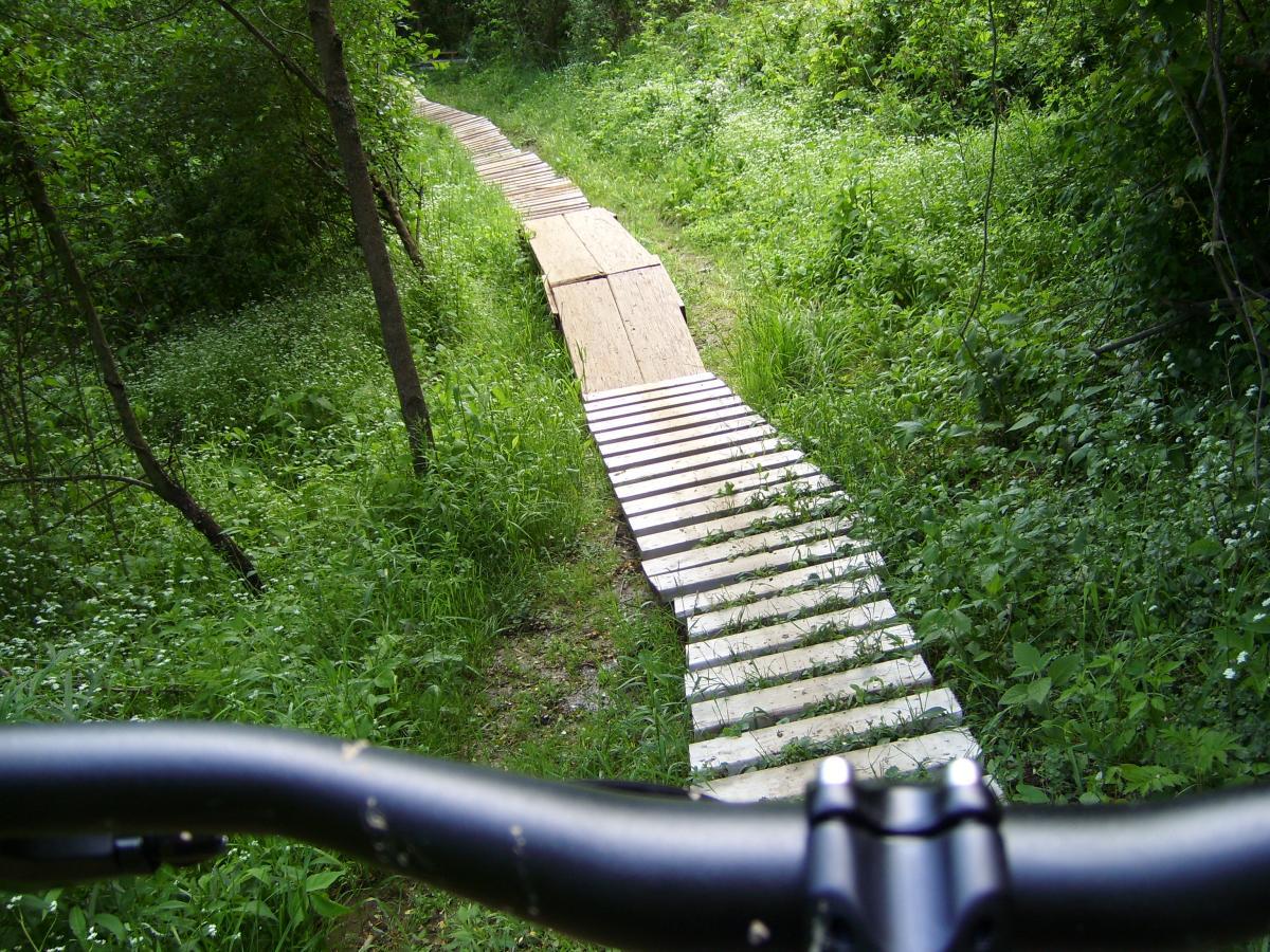
As for the trails I did ride, they were marked easy, intermediate, and advanced. The advanced trail also had an optional skills area that consisted of a few short bridges, some very long log rides, numerous log-overs, one big teeter totter, a few rock gardens, one or two small jumps, and a couple small drops. Despite a skull and crossbones sign at the entrance to the skills area, the advanced trail and skill area could all be ridden competently on a cross country bike.
Unfortunately, there wasn’t much climbing and descending to be had at Pocahontas, either. Eastern Virginia is quite flat, but the trails did make good use of any small dips or rises that they could find.

In the end, while I had a great ride at Pocahontas, I still didn’t feel like I truly got to experience the scope of the park. While much of the other 40 miles of “trail” is actually gated gravel road (or so I hear), there’s undoubtedly some more excellent singletrack to be had!
The real story here at Pocahontas is the sheer size of the place. There aren’t many state “parks” out there where one can ride for over 50 miles and not have to retrace the same dirt twice–and this is especially true in crowded suburban areas near large metropolitan centers.
Having Pocahontas State Park this close to Richmond is a true treasure for the locals! I can tell you one thing: if I lived in Richmond and was still training for my dirty century, Pocahontas State Park would be my regular stomping grounds!
Your Turn: Have you ever ridden at Pocahontas State Park? What were your impressions?


7 Comments
Jun 25, 2013
PSP trail map can be found here: http://www.dcr.virginia.gov/state_parks/documents/pocahontas.pdf
Jun 25, 2013
Next time I'm in that area, I'll definitely make sure to hit up that side of the park!
Jun 26, 2013
Jun 26, 2013
Jun 26, 2013
Jun 27, 2013
Jun 26, 2013