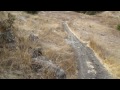
Santa Teresa Park comprises over 1,600 acres, and sits in the southeast corner of San Jose, off of Bernal Road, near the Junction of Highway 85 and 101. The park is an excellent place to visit in the spring, between the rains. Wildflowers are in full bloom and are abundant. The creeks are running and the wild turkey are roaming about. The trails here can be quite exposed and hot during the summer - add at least 10 degrees to the readings for San Jose. The park is mostly closed during winter as the clay-filled soil is much too soft to ride on. If the soil is wet at all the park will not be open (Santa Clara County has a trail closure line you can call and check). The terrain is mostly hardpack/loose-over-hardpack with some serious rocks to boot.
There can be some equestrian (horse) traffic, but there is usually none on weekends - though there are more hikers on weekends. I've not found it to be a problem.
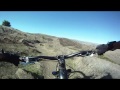
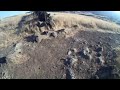
For mountain bikers, the most popular trail in this park is probably descending Rocky Ridge. This is a very fun, technically intermediate level trail. If you're a beginner and have not ridden over a lot of rocks before, parts of this trail will seem quite advanced to you at first. Full-suspension bikes are probably your best bet here. The top of the trail is flowy, turning into more serious rocky terrain in the second third of the trail. It's roughly a 2-mile descent and over 500 of elevation to get to the bottom of the trail, which is the center of the park.
There are many fun and quite steep ways to get to the top of Rocky Ridge trail. You can do an up-and-back on the trail itself, or park in any of there areas in or out of the park and make a loop out of it (there is a parking charge inside the park). Most mountain bikers stick to the trails south and east of Bernal avenue, since they contain the most single track. Either direction on Ohlone or Hidden Springs trails is great. Get ready for some steep climbing. Unfortunately, there is no way to shuttle to the top of Rocky Ridge - you're going to have to climb.
Stile Ranch is another favorite - this one is good technical practice if Rocky Ridge is too daunting for you. The switchbacks are very tight, and there are a lot of them, so prepare for some serious turning fun. Heading from north to south on this trail seems to be the best direction.
There are several ways to make loops and interconnect these various trails, and they are all very enjoyable. Don't miss Coyote Peak, which affords views of all the major mountains in the Bay Area - on clear days you can literally see the entire ring of mountains surrounding the bay. There are occasional wild boar, lots of wild turkey, deer, snakes, tarantulas, Northern Harriers and other birds of prey. Apparently the county plans to bring cattle back to the park to control non-native grasses (see the meeting minutes on the Friends of Santa Teresa County Park page).
Here's a good article on the park by Lars Thomsen of Trail Head Cyclery:
http://freehubmag.com/2010/05/santa-teresa-park-from-trail-head-cyclery/
 | Hidden Springs Trail | 4 mi | |
| Ohlone to Rocky Ridge and Stiles Ranch loop | 10 mi | |
| Rocky Ridge Trail | 6 mi |


| ThankI'd give this area a 3.5 if I could, so I rounded up to 4 out of 5. That being said, it is probably my favorite place to ride (vs. Quicksilver and Sierra Azul) that is within riding distance of my house, since there is single track that can be (legally) ridden. Rocky Ridge and Stile are the best / most challenging trails, with technical rock gardens to negotiate on several points on each trail. These trails can be ridden on a hardtail, but I'd expect that the trails would be more enjoyable on a FS bike. Some flowy singletrack in other areas of the park, but it is pretty limited, particularly when compared to Demo Forest or Fort Ord.
There is a lot of clay in the ground in this area, so avoid riding there if it has rained, even a small amount. I generally find that the trails wind up coating my tires with "clayey" mud in no time flat if it is damp.
| ThankIt's really a fun little trail that's always evolving due to local builders adding small features here and there.
| ThankIt's a relatively small park but it's quite fun.
Definitely a nice local trail and is great for keeping in shape but I wouldn't go out of your way to check it out. There are far better trails around the Bay Area.
| ThankJason, it sounds like you're driving up and parking in the lot. I would take stiles ranch instead of hidden springs, climbs are much easier.
| ThankI ride from my house so I start out most likely where you ended up at the bottom and I agree, it's not fun lol but it is doable
Fun ride if you live nearby, not worth traveling for
| ThankGrew up here and me and my friend would always ride the hard stuff but also pretty mellow stuff has every thing
| ThankI have been riding this park for 20 years. I absolutely love it. It never seems to stop challenging me, no matter which trail I ride. Im 56, and can still ride up rocky ridge, without losing too much gas.. I ride there a couple times a week from the back side of the park. Thru the parking lot up to coyote peak , then back down the ridge. Back thru the parking and take the trail tht goes down to Bernl thn home from there.. Bout a 3 hour or so ride..
| ThankGreat park. I go here very often, about 4-5 times per week, minimum. I recommend starting from the bottom of Online by Bernal road, climbing to Coyote peak through Hidden Springs, then coming down on Rocky Ridge. Style Ranch is also a great loop.
| ThankGreat route for locals and for those looking for a new place to ride that don't live too far away.
| ThankThis loop is only 10 miles but you'll get roughly 1700 feet of ascent.
Haven't explored the area much but so far have not found any super-fun parts. The rock portion is ok but not as fun as it could have been - it is neither technical nor fast... Personally I would rate the trail at 2.5/5 when compared to my favorite trails.
| ThankI found this trail by complete accident one afternoon while riding with my brother. Thankfully we both ride full suspension bikes. By accident I mean we started from the bottom and made our way up this trail and it was pretty difficult at times but not impossible. The rocks were tight, the dirt was sticky and the weather was perfect. GREAT challenge and a lot of fun. Take music, concentrate on balance and never give up! Haven't gone down it yet but there's always tomorrow
| ThankLots of fun. I actually found this trail by accident after riding in from another one. I haven't explored all of it yet, but the parts I have ridden on are the most fun I've had on a bike. If you're riding a cheapy bike like mine, make sure you replace all the weak parts because my derailleur snapped after I finished a hard ride on it
| ThankI recently got back into mountain biking after a 25 year layoff. I'm 50 now and my doctor recommended exercising to reduce my colesterol and drop some lbs. Santa Teresa Park is close by my home, so I do about half my riding there. I split my riding between paved bike path and single track. I ride a 1980s vintage Miyata Ridge Runner with no suspension. I do Rocky Ridge and Stiles Ranch with no problem. The trail is not too long, but fun and has some challenges. You're either climbing or descending the steep hills in this area. My biggest challenge is traction while climbing the loose gravel, so I'm sure some suspension would help. I'm looking forward to a new 29er next year that will only cost an arm. Any recommendations?
| ThankThe descents were pretty fun and climbs definitely not for the feint of heart. A word of warning, however, if the signs say the trail is closed bet on rangers being there to hand out tickets.
| ThankDecent ride. Good if you're short on time (especially travel time). If you follow the route on the map you can get here, it'll be more of a challenge on the climbs than the descent. The climbs can get pretty tough, though. Lots of rocks and loose over hardpack. Beware, however, some changes to the trail structure:
| ThankFrom C to D, you'll have to climb the hill instead of turning left, which will lead to to a tight descent and a fireroad that loops around the back of the hill. From M back to the trailhead, you'll have to follow the road, there's no longer a connection from the road to the trail. I'll try to upload a new map after I've gotten all of the other turns right. ;>* Review edited 7/17/2008
It is a great ride. Make it whatever you want. Easy, advanced and test your skills on trails such as Rocky Ridge. The whole park is about 12 miles. This may be approximately 2-3 hours depending on skill level. It is a great little secret because it is never crowded and the horses are not a problem.
| ThankThis is a great place to ride and a great workout. Excellent for a after work ride. Going up stile ranch trail is a great workout, and then take the rocky ridge up hill for a great technical challenge. After you complete those two trails, stop at the top enjoy the view and take in the great accomplishment.
| ThankFor fun ride up Rocky Ridge it is all doable. It took me a couple tries before I could make it up everything but I got there so can you. This is good for afterwork or when you have an hour or so to burn
| ThankThere are some short loops here but my favorite and most nerve-wracking part is Ranch(?) Trail. It's tightly wound, rocky, singletrack switchbacks. The views are nice and there are some steep climbs/descents when you're in the mood. The trails here turn into mud with the consistency of wet modeling clay when it rains so consider yourself warned. They used to hold the Sizzler Classic Race here. Do they still do that? Oh, if you want a warm-up park at the bottom of the hill before the park and ride up the road to feel a little lactic acid build-up.
| Thank