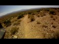
There are many places to start this loop from really as it crosses other trails and the main road twice. The 15 mile loop can be cut in half or about more by either the Tonto Tank tr or the Bluff tr (very fun) that bisects the main loop. Most of this trail is pretty wide open desert riding, fun and fast it has a bit of a roller coaster feel to its flow. From the Pemberton there are several trails that lead out like spokes from a hub, the Scenic Loop tr is a 3 mile loop that is popular with the equestrian group. The Rock Knob tr, the Coach Whip trail is access to the Windmill tr that goes up and over the mountains to the Gateway Trail system. The Dixie Mine tr leads to the site of an abandon mine and also joins trails that lead to the Bell Pass (Lost Dog area) and also into the community of Fountain Hills.
These trails are all well signed however it is advisable to pick up a free map at the Visitors Center for all the side trails but the Pemberton Loop itself is easily done without a map.
If you happen to run across horse crap on the trails we cant really blame the equestrian folks as there are about a dozen wild horses roaming the park here too. They are friendly and sometimes approachable but I don't think we are going to potty train them any time soon.


April 2019. Trail is perfect right now. Weather is great, blooming flowers and low dust. This trail is beginner level and a low impact ride.
| ThankGreat ride, fast and flowy, and lots of intersecting trails allow for a ride of anything from 5-15 miles or more. I'll definitely be back.
| ThankI'll call it 3 stars, but there's nothing wrong with this trail. Just understand that's its pretty flat, virtually zero tech - a very good trail for a beginner or you just want some miles. Going clockwise, the first roughly half is gentle climb and second half is mostly a nice long flowy decent.
| ThankUPDATE: Just did Brown's Ranch Perimeter Loop. Enjoyed it more than Pemberton.
Nice loop. Fast & flowy. No big climbs and no big descents, but still fun, especially for beginners. Basically zero tech.
| ThankThe Pemberton loop, like all of McDowell Mtn Park's trails, are a real treat for anyone who likes smooth flowing rides through the desert. They even periodically groom the trails with a sweeper. Wouldn't have believed it until I saw it in action couple of days ago. The Pemberton does have a couple of short rocky mildly technical sections but overall it's just fun to ride.
| ThankWe are newbies of last 4 months and Granite to Lariat to Pemberton is fun and relatively easy. What a nice view and ride.
| ThankThis is a very nice 15 mile loop. If you start at the lower parking lot and head counter-clockwise, you'll start off on a slight downhill that turns into a fairly decent climb for about half of the loop. Once you get to the top of the loop you'll begin a very nice downhill that can get interesting as it does have some switchbacks and sharp turns. Overall this is a very fun trail.
| ThankGreat trail for beginners. Clockwise there are a couple rocky climbs but the rest of the trail is nice. Second half is mostly downhill.
| ThankRiding the loop clockwise is more fun because you get a few challenging climbs. Great trail for all abilities.
| ThankPemberton trail is one of the best mountain bike trails you will find in the Phoenix area, for all skill levels. Pemberton is pretty easy, but then take the off shoots to Coach Whip, Dixie Mine and Windmill for some extra climbs. If you are really feeling up to it, take Windgate Pass up to the saddle.
| Thank