The seven year old Hidden Falls Regional Park, located in the foothills between Auburn and Lincoln, has been expanded from its original 221 acres to 1,200 acres. Already built during the first phase was an observation deck allowing close-up views of the 30 foot waterfall that gives the park its name, multiple-use trails, picnic areas, and fishing access.
The expansion offers new sweeping views of the Sacramento Valley to the Sutter Buttes and beyond. Two new bridge crossings connect trail users to both sides of the Coon Creek watershed. You can also enjoy more picnic areas and a second observation deck above another waterfall.
The park is open from sunrise to sunset, 365 days a year at no charge to visitors.
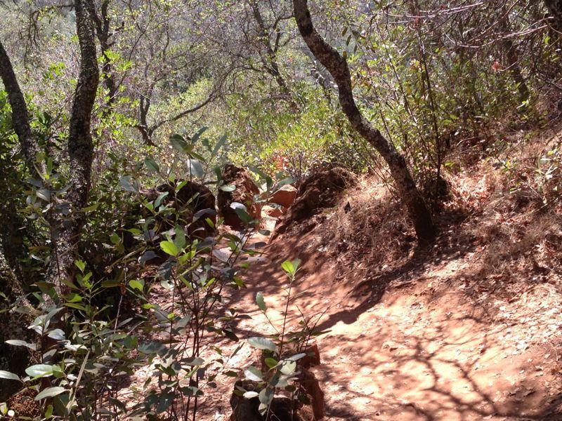
Trails range from easy (fire access roads) to difficult (single track switchbacks).
Trails are very well done, some of the best new trail I have been on. Four interconected loops which would be good for new riders to expaned their skill level. We had fun doing the loops in differant ways, most climbs are on the short side. Will be a 10 rating when it is done with more miles.
IMPORTANT!: Reservations are required on the weekends and other high use days. Please visit the Placer County website at https://www.placer.ca.gov/Facilities/Facility/Details/Hidden-Falls-Regional-Park-53


Excellent ride spots with very little technical riding as far as obstacles but LOTS of climbing and it all starts out as a downhilll but when you head back to the car it is all way up hill. Very well maintained trails. Lots of hikers in the first 1 mile and also watch out for the horses. I would rate this as middle beginner if you are in shape for the climbing. If you are not in shape the climbs will get old quickly especially the last climb out of the park.
| ThankThis was a great ride. There was some people and horses to share the trail with on a Saturday afternoon, but about 2 miles in there was nobody. It is a diverse trail system with everything from beginner to advanced obstacles. It has some steep gravel roads that can be slippery to climb, but also has alternative trails. The views were very nice, and many trails run along the creek and falls. It also had some black diamond technical sections. Overall, any rider level can have lots of fun here, it has trails for every skill level. Also it may be useful to note that the descent is first, so you have to climb out at the end of the day. On Saturdays and Sundays, it is required to make an online reservation for a parking space, which can be made on the hidden falls website. It also shows the fees for all day parking and part day.
| ThankSuper fun ride. Some steep hills make it difficult to climb, can be slippery at times due to loose gravel. I wouldn't call it easy for those reasons but maybe intermediate.
| ThankI'm just getting started on a MTB after a few years on a road bike. Hidden Falls is a blast, trails from beginner to very technical. Be prepared for some good climb to get back to the parking lot.
| ThankThis trail system is becoming my go to trail system now. It's a good work out with 1400 ft in just 11 miles of riding.
| ThankPlenty of shade with little sun exposure. Just make sure you arrive early to get parking space.
I can't wait for the new section and parking to be added.
I've been riding this area for the past four weeks.
Pros. The trails are really well maintained
Trail Maps at every trail intersection
A lot of different types of trail to ride
Cons. The parks trails can get very busy
| Thankwith hikers at peak hours
Parking is very limited
I would suggest not going on a holiday weekend. Cars were parking half a mile or more from the park. I plan on a weekday trip some day soon. Also plan your trip as they lock the gates a half hour after dusk.
| ThankI will post more after my next visit seeing I'm just getting back into biking after 6 months I cut my trip short.
Fun trail system, not far off the beaten path and easy to find. Only issue I had was beating myself up and then having to climb back out! Lots of fun trails, nothing insane or crazy, but enough to keep things interesting. Not Downieville by any stretch of the imagination, but definitely a fun way to spend an afternoon or early morning...be nice to the horsey folks! Pro tip...go when its dry!
| ThankThis park is good for beginners and others who are looking for a moderate ride. Most trails are relatively wide for single track. The one downside is that this place is frequented by horses and they leave s**t all over. It's also a dust bowl in the summer so it is best ridden once it starts to rain until late spring.
| ThankHave to disagree with most about this system. Probably because I don't like finishing on climbs. All trails are in a bowl, there are literally dozens of options to choose from but you will be criss-crossing heavily used hiking trails full of day use families spread across the width of the trails. It was hot and I was irritated by the shear number of people at this location. I would not recommend unless your local and looking for a quick workout (but then why not just go to Foresthill Divide?)
| ThankA very nice park. They revamped the whole park recently, adding a large amount of trails. There are some pretty long climbs, but almost nothing technical, if you don't count the falls access trail which is not supposed to be ridden on anyway. Oh, and the views are magnificent.
| ThankThey've completed the main trail and it now goes past the falls. Still a fun trail with the beginning being much wider than singletrack but a fun downhill section nonetheless. Connect the other trails for an even better ride.
| ThankThis place is awesome,second trip,took my adult son and he and i had a blast,so from easy going "old guy" to a fit 22 year old,,,,great ride!
| ThankThis is a great trail system. All the trails are very well maintained and signed to make it as easy as possible to follow. The steepness throughout the system is very manageable for all experience levels yet enjoyable no matter if you are a beginner or an expert. The views are great all around and the river/stream adds to the total experience. If you need a break there are multiple benches and decks that over look the river/stream and small waterfalls. Be aware of an abundance of poison oak closer to the streams edge. Get there early as it gets full quick with horses, hikers and runners. If you come up behind a horse back rider make sure and stop will before the horse and let the rider know you are approaching so you do not spook the horse.
Overall, this is one of my new favorite areas to mtn bike and hike.
| ThankPretty nice trail for a quick ride after work or a warm-up for beginners. The begining is a fun downhill and the trail was in great shape, especially for this time of the year. Moderate climbs, with the longest coming at the end of the ride (remember that fun downhill at the begining of the ride!) Scenery is very nice. More advanced riders can take some of the trails that branch of the main trail (Poppy trail I believe) for a longer and more entertaining ride. The trails are very clearly marked with a trail map at every junction.* Review edited 7/25/2012* Review edited 7/25/2012
| ThankThe trails are very smooth. Great trail for beginners. Some sections are surprisingly fast. Get to the trail early before the horseback riders and hikers. If you want to pull directions up on google, search hidden falls regional park.
| ThankIt was a little muddy in november but still rideable some stratigery required on some of the loops but its over all the loops are well built and it will be good when they create more trail length.
| ThankShort loops and they're still working on the trail that goes to the falls. All in all though... and good beginner trail.
| ThankThis is a new park with ongoing trail construction. It centers on one main trail which descends from the parking area for about a mile. At this point you have your choice of several loops from 1/4 mile to 1.7 miles with varying difficulty ratings. The trails are in excellent condition and the scenery is great. Because it's a new park it lacks the crowds of the more popular trails in the area. Most of the climbs are easy to moderate and are of a short duration except when climbing back to the parking area. This ascent is a moderate climb with little change in degree of slope. It's a great spinner's climb. All in all this is a great place for beginners to seasoned riders.
| Thank