The Stagecoach Trail is fire road. It's fun to go fast, but beware there are lots of joggers that use this trail and there's a 15mph sign. If you park at the top, you could go down Manzanita by continuing down from where you parked at the end of Russell rd. Go down the hill and make a left at Canyon rd I believe (just keep going downhill). That road will turn to dirt and there's a green gate, after the gate about 100 yds maybe, on the left is Manzanita. Manzanita is pretty technical in places, but it's a sweet singletrack in the bushes that dumps off about half way down Stagecoach. From there you could ride back up a little ways and catch the Flood trail (or if you went down Stagecoach from where you parked, you'll hit Flood trail on you left). Flood goes up the hill a little bit and then turns down for a pretty sweet downhill that will dump back off on Stagecoach. Take stagecoach all the way down. Or if you're feeling up to it, there is a chute that dives down right after a 15mph sign. It says no bikes. Expert only on that preferably on a DH bike.


Almost all mud, and they need to do trail work to have the puddles drain.
| ThankDepending which way you go it can be grueling or lots of fun.. nothing too technical.
| ThankFun system of trails. There's a couple other trails that branch off of these that are a good ride as well. Good views, Moderate climbing and fast downhill make this system a must ride. Combine it with Clementine, Connector, Foresthill, Culvert and Confluence for an Epic Ride!
| ThankFun short ride. I parked off of Russel Rd. Trail starts out as a fire road then narrows a bit. About 300yds after the start off the trail there is a turn off in the left. This lead up to a very scenic doubletrack with a few benches on the side so you can stop and look out at the canyon and the foresthill bridge. It starts going downhill pretty fast then leads to a large uphill back up to Russel rd. it is much more in going back as it is very fast and rocky and there are a few jumps and berms. Definitely have your brakes checked out before going on this trail as it is very rocky.
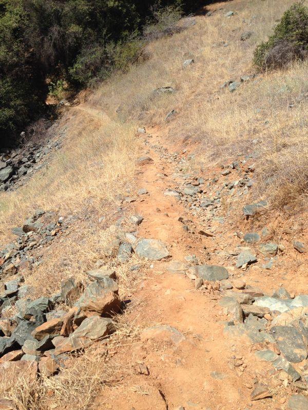
| ThankA fast but rocky downhill (shale rock) that leads to the American River...and the option to extend your ride several miles. Just remember: what goes down must come back up...the ascent is not overly steep but don't try it on a hot (85+ degrees) day. Beautiful panoramic views make this fire road trail all the more appealing as a challenge that feeds your head and tests your bdy.* Review edited 8/24/2012
| Thank