×

|
Rate it:
Tags:
Level: Beginner
Length: 15 mi (24.1 km)
Surface: Singletrack
Configuration: Network
Elevation: +556/ -401 ft
Total: 53 riders
Mountain Biking Glory Hole
#165 of 1,015 mountain bike trails in California
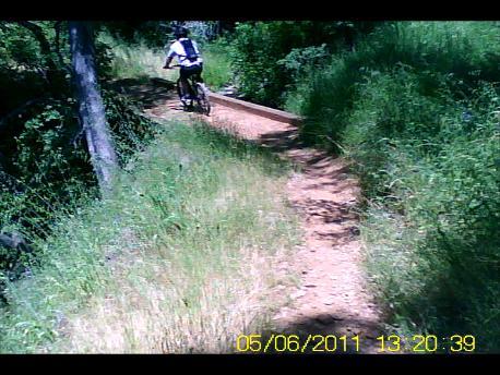
About 15 miles of very fast, hard packed, rolling single-track. Four different loops connected by the Frontier Trail. Except for the Tower Climb, which contains 8 uphill switchbacks, nothing technical. Great place to ride year round but a little hot in the summer. Huge lake recreation area so bring the family along while you ride. Maps, videos and photos at my site: http://arnica.csustan.edu/mtbike
First added by searsandrewj on Jan 1, 2003. Last updated Apr 30, 2020. → add an update
Before you go
- Drinking water: unknown
- Lift service: unknown
- Night riding: yes
- Pump track: unknown
- Restrooms: unknown
- Fat bike grooming: unknown
- E-bikes allowed: unknown
- Fee required: unknown
This trail information is user-generated. Help improve this information by suggesting a correction.
Glory Hole recreation area is on New Melones Reservoir off of Hwy 49, about 4 miles south of Angels Camp, which is about 60 miles east of Modesto.
System trails (1)


Seems like most people here rode up the tower climb trail. It is best to ride down and it can get very fast and fun. We just went up the fire road across from the bottom parking lot and then came down the trail back to the bottom parking lot. It is not too bad for sorta beginners (cause we are). A great something to do when camping.
| ThankAfter paying the $8.00 at the gate, I parked at the second lot on the left down the road a short distance across from the first turn off, signs are posted in the lot for biking. Wanting to start at the bottom first, I rode the nothern single that starts across the street from the parking lot that followed the paved road to Brushy trail loop, a little rocky the first half following the road north but once the road was out of site the trail became more remote and tree lined, very nice trail not much climbing or difficult spots in this section. When I arrived back at the parking area were I started I took the trail from the parking lot and headed up and south east, a bit of a climb on this 3 or 4 mile looped route with switch backs toward the top. I came out at the upper parking lot close to the entry station, then down the paved road very fast back to the lower lot where I was parked. All together about 16 miles most of the trail was nice, a little rocky in places but a good ride in total.
| ThankFun easy single track. Several trail options, all easy to find. Angels Camp loop is 3 miles exactly. Easy uphill nice downhills, repeat for workout. Warning this area really gets hot even on cool days.
| ThankI was very please with this trail, i rode angels creek, buck brush, frontier, gold rush. Had to cut the ride short due to a flat. Some areas are very rocky, some required a little climb but nothing major. Areas like the buck brush and angels creek can get some good downhill speed. The weather today was prefect, not hot or cold with slight wind. The weather in the summer will be very hot, can get up to 100+. The pros, great beginner trail, good downhill speed, great workout with decent climb. The cons, some areas are very rocky, a lot of torns, angel access road gate was closed * Review edited 10/20/2012
| ThankRode it in November. Nice riding weather, it was not hot. I cant say too much except it was good to see a change in scenery. The tower climb was a little difficult as we had to ride it up at the end of the trip. Hit a 15 mile loop.
| ThankRode this the Carson trail as well as the Tower climb. Wow, lots of fun but very hot today (92 by 10:00 a.m). Bring plenty of water. Tower climb was tough for my 46 yr old, in fair shape, body but was very rewarding to make it to the top, (did I mention I had to stop and walk a few times!) Overall lots of fun and not crowded
| ThankNothing technical except the tower climb with its switchbacks. Mostly hard, fast, flowing singletrack. In all, a very fun ride since most trails let you cook right along and really get into the flow.
| ThankNote that the western trails (Gold Rush, and frontier to the west side of the access road) are overgrown with thorny ground cover. Since those trails are flat and relatively boring I'd suggest giving them a pass unless you wish to track up every inch available.
Water refills are available at the north end of goldrush, in the camping area. Other faucets (Buck Brush, Angels Creek) are currently broken.
I rode the Angels Creek Trail and the Carson Creek Trail last weekend. Both single track trails are in excellent shape. They are both about 2.5 mile loops each. I spoke with one of the Rangers and they are in the process of making some new trails over at the Tuttletown recreation area. I think they have done an excellent job so far.
| ThankKinda weak nothing special, good for newbys
| Thank