The first stage of the ride travels on a single track trail along
the historic Centerville flumes that were built during the gold
rush period of the late 1800's and early 1900's
(for more history visit the Centerville Museum).
Most of the first half flume trail is dirt but the latter half is
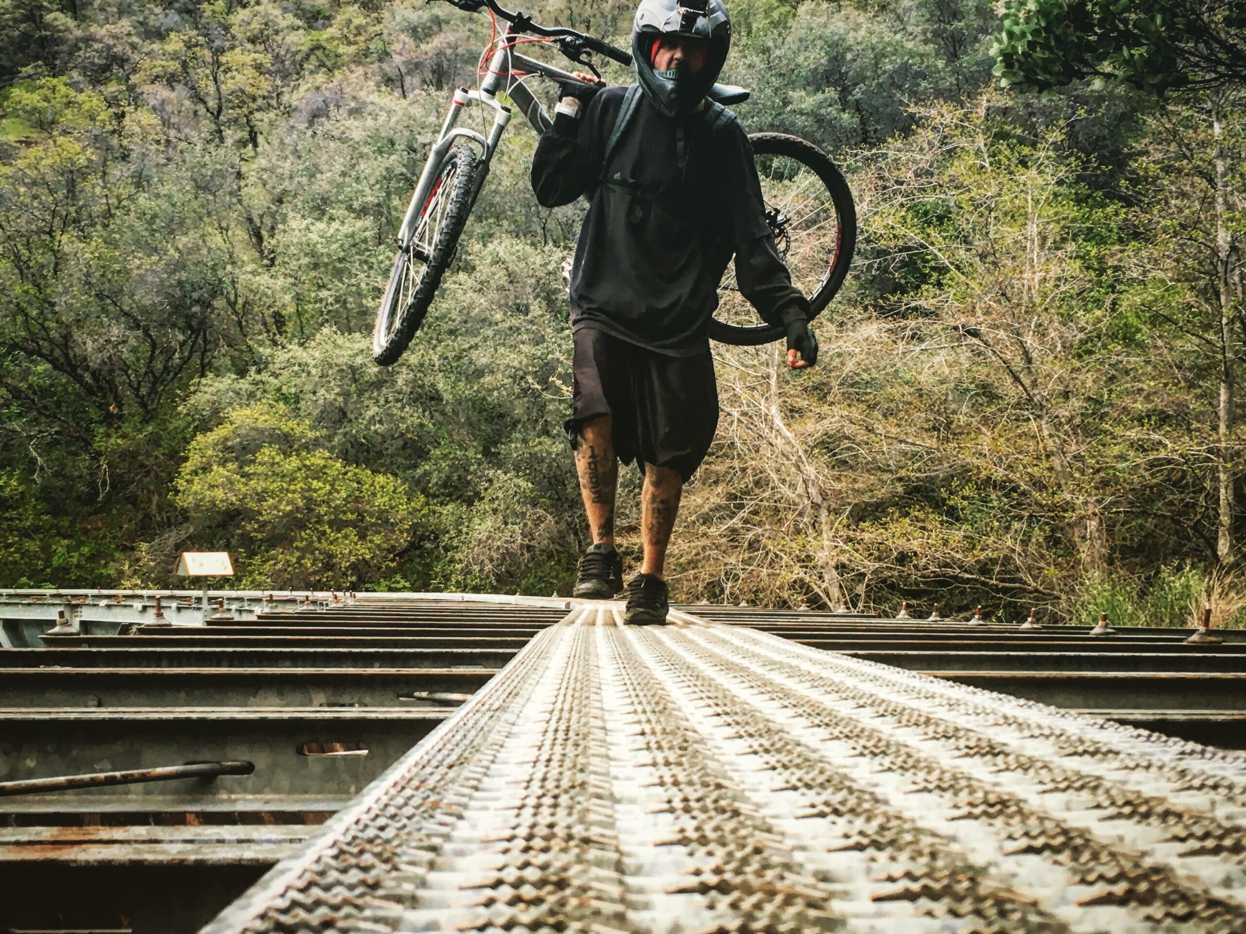
mostly 1 foot wide metal platforms on top of the flumes.
Some of these metal platforms are very long, possibly 1/2 mile in length.
For a shorter ride there are bridges at several locations along the first half
that connect to roads leading up to Centerville Rd and back to Centerville.
Depending on your skill level the metal platforms can be ridden by bike
but some are a bit wobbly so if you are at all uncertain of the situation it
is best to walk across them.
The views from the flume trail are quite spectacular.
The hillside is so steep that nothing man made, other than the flumes themselves,
can be seen in any direction.
There are many waterfalls along the cliffs and the sound of the raging river
can be heard below.
At about half way along the flumes you can see several gigantic rock formations that
protrude hundreds of feet out from the forest and are flat on either side.
There are rattle snakes in these areas (tall grass, rocks) so keep an
ear out for their hissing rattle.
At the end of the flume trail is the De Sabla Powerhouse.
Up De Sabla Powerhouse Rd is an almost 1500 ft 4-5 mile grind up to Magalia.
At the top it is short trip to the De Sabla Reservoir to cool off in the water.
From Magalia the fastest way down is along Humbug, Nimshew and then Centerville road.
The first section is paved but most of Centerville road is a dirt.
The road can get quite bumpy at times but for the most part it is decently
maintained.
Once back at Centerville it is a short walk down to the Centerville Powerhouse for
a swim in the refreshing water.


Fun nice easy and adrenaline filled ride hoping to post new vids soon jus wished I knew where the entrance was to begin
| Thank