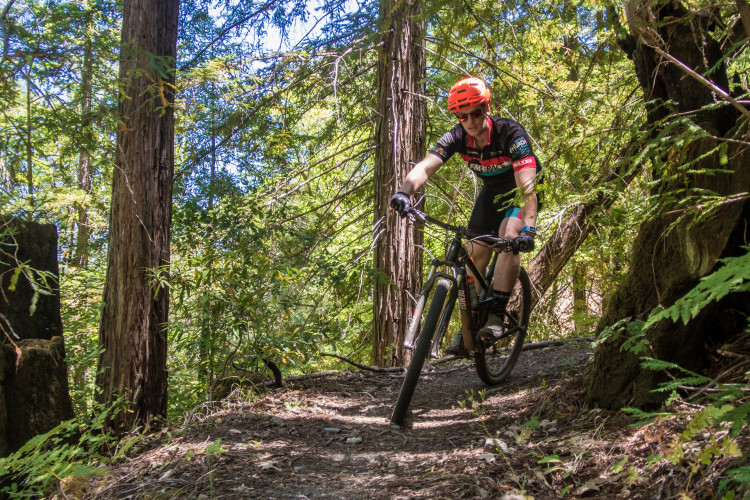
"This place is a mtb playground. There are too many good routes to list. I recommend climbing the Spring Creek trail to the Canyon Trail, and continue climbing up to the Marsh trail. Here you have a decision to make; either ride the fun, fast singletrack known as South Burma trail, or continue to the Two Quarry Trail. The Two Quarry trail is a dream for the technically minded rider. This trail is not for the timid, advanced riders only. From the bottom of Two Quarry climb back up Warren Richardson, and then ride down Rough Go. Hold onto your handlebars as your hands and wrists become fatigued flying down this tasty quick section of trail.
 | Spanish Wall | 2 mi |


 1
1
My first ride in Annadel after the Sonoma fires. The park just re-opened (and half of the park is still closed to hikers, bikers, and horses due to the fires). I rode up Richardson. The 2 Quarry cutoff is closed and you can see that the fire came within feet of Richardson. Further up Richardson the fire literally came to the edge of the road, and in some cases - jumped the road. There are piles of brush/clearings along the fireroad that I am sure were done by the fire fighters.
Thanks to all the fire fighters, park rangers, and other volunteers for all your efforts in the North Bay!
| ThankMy home park. I live 1/2 mile from entrance and ride 3-4 times per week. Lot's of variety from long uphill fireroads (Richardson and Canyon) to very technical single track (Steve's Trail) and super fun down hills.
| ThankSome awesome singletrack, especially if you ride with a local.
A few of the climbs and trails are super wide and kind of meh, but there are some standout trails like Burma and Ridge Trail.
| ThankSpring Creek and South Burma were fast and fun. Climbing Cobblestone was challenging and you'll see lots of rocks striped like zebras from all the previous pedal strikes.
| ThankI tried following the directions to the trail head but it took me to a residential area. Just ended up parking on Montgomery drive north of Spring Lake then rode to where the trail started. Two Quarry Trail down then rode back up Warren Richardson Trail. Two Quarry Trail was alright. The only thing that made it technical was that it had lots of loose bumpy rocks. Kind of annoying actually. Rough Go Trail going down from Richardson Trail was lots of fun however, and it was my favorite part of the ride. Lots of really nice technical rock gardens. Definitely gets the forearms nice a sore.
| ThankEpic Riding near Santa Rosa. I rode 25 of the 35 miles offered. Great technical climbs and downhill bombs. Go enjoy!
| ThankFun technical trails all over Annadel. Some trails include berms. Great place for intermediate and advanced riders.
| ThankDry and in great condition right now!
| ThankAnnadel has a lot to offer with 50 miles of trails most of them fairly technical and a little rough on a hardtail. Rocky.
| ThankThis is a decent place to ride. Check out the full review and video at:
| Thankhttp://getsomeadventures.com/mountain-biking-for-all-levels-at-annadel-state-park/
I went up Marsh and down Burma to Rough Go. This is a fun loop for all levels. Nothing too steep and the rocks are smooth, but the trails are very fast and fun.
| ThankImo biggest waste of time a friend dragged me their and wasn't thrilling at all
| ThankGreat spot for an easy ride or a technical day out. I really like "rough go" and "South Burma." would not recommend a hard tail on those unless you are hard core.
| Thank50 miles of trails with a great volunteer run visitor center to get you started on your ride!
| ThankGood little trail system. I rode pretty much everything here in a day. Good intermediate trails. Nothing too technical. A little rocky in places but nothing real hard. There are fireroad options if you don't like the rocks. Beautiful area that ranges from open meadows and oaks to some nice pine forest areas.
| ThankDefinitely my favorite trail in the area. Not for absolute beginners but if you've gotten bored of China Camp/Tamarancho and the like, this would be a good next step that would challenge you.
You can also loop together some more technical trail relatively easily. Spend at LEAST two hours here--EASILY the whole day if you want it!
| ThankSome nice trails, in a beautiful setting.
Decent rocks and tech, without being extreme.
Some trail junctions have no signage, which can be difficult for newcomers.
Quiet during the week, but hikers and horses both use the area.
| ThankTrail is highly technical. Lots of rocks. Very hot in summer. First four miles is technical uphill climb. Trail leads through small pine forest, great views. The descent back to road is amazing! Fast rooty, rocky with a couple switchbacks, this ride will make your teeth hurt but leave you grinning. Destination ride for tech riders, downhill riders will have fun here as well. XC riders or hardtail riders probably will not have as much fun here.
| ThankI just moved to Santa Rosa from Colorado and this park is a blast! There is a little bit of everything here. I am so happy to have this in my backyard!
Rough-Go is great for a technical climb. Spring Creek and North Burma are awesome for fast descents. Just watch out for hikers on Spring Creek. Apparently South Burma was just redone and is super smooth. Ridge Trail reminds me of the segment of the Colorado Trail near Buffalo Creek.
| ThankWe took the suggested fire road to the top, by the lake. Then went on the north side of the lake, then back down N Burma.
| ThankThis set of trails looks to have been made by hikers. Burma was pretty steep, and would have been a tough climb, with sections >15% grade. The trails around the lake were good, mostly flat.
The trails we rode were also quite rocky.
We also road Boggs, which was a much better ride. Boggs trails were obviously made by bikers. I suggest you skip Annadel and try Boggs. A bit farther drive, but well worth it.