
The Adventure Cycling Association (ACA) is about to change the way cyclists ride across the country. In 2026, the Missoula-based nonprofit will launch the Golden Gravel Trail, a fully researched and vetted bike-friendly dirt route crafted specifically for gravel riders and bikepackers — its first major west-to-east dirt corridor in decades.
The route’s debut commemorates the ACA’s 50th anniversary — for 50 years, the Missoula-based organization has been mapping cycling routes across the U.S. — while addressing a modern trend: the desire for more dirt.
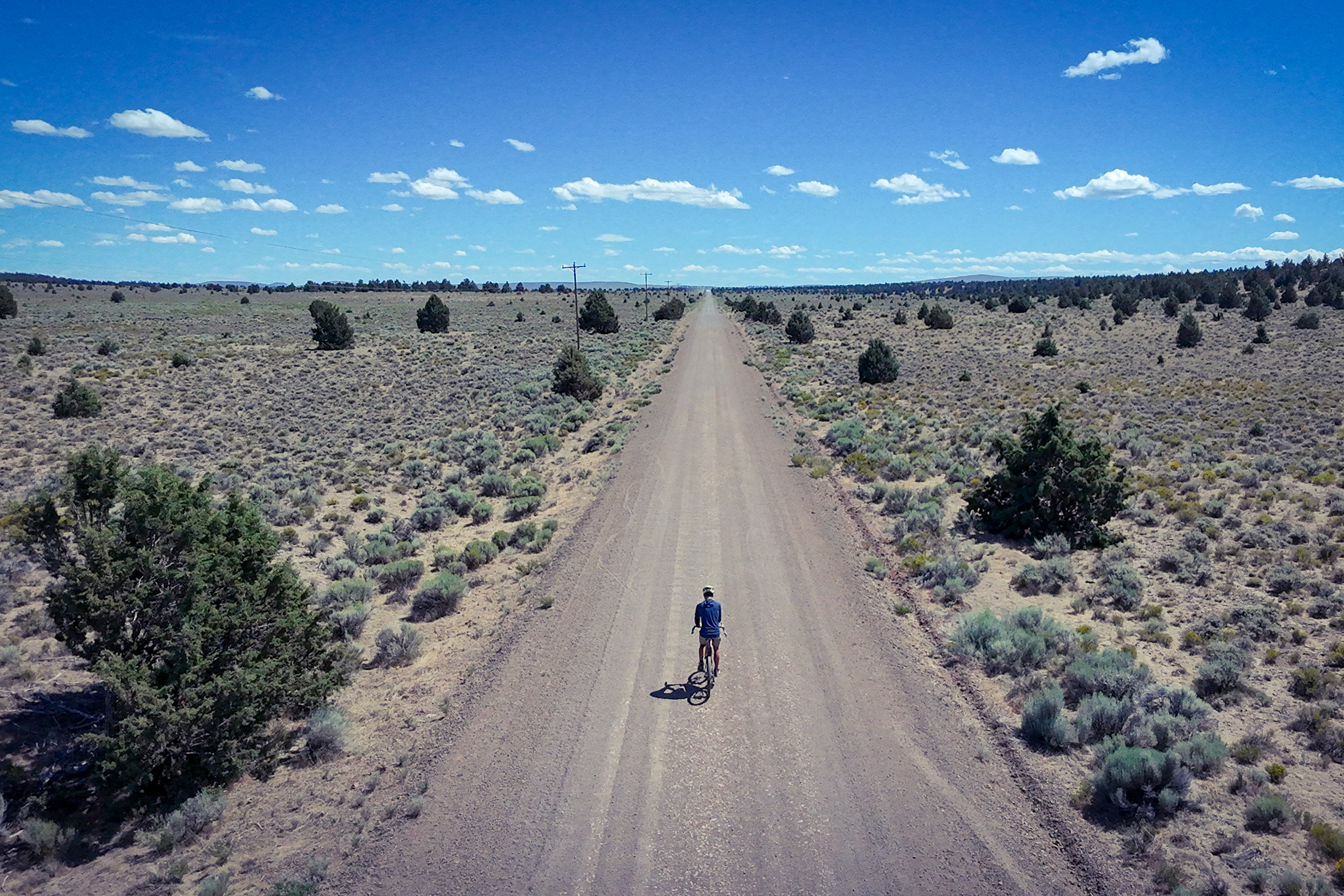
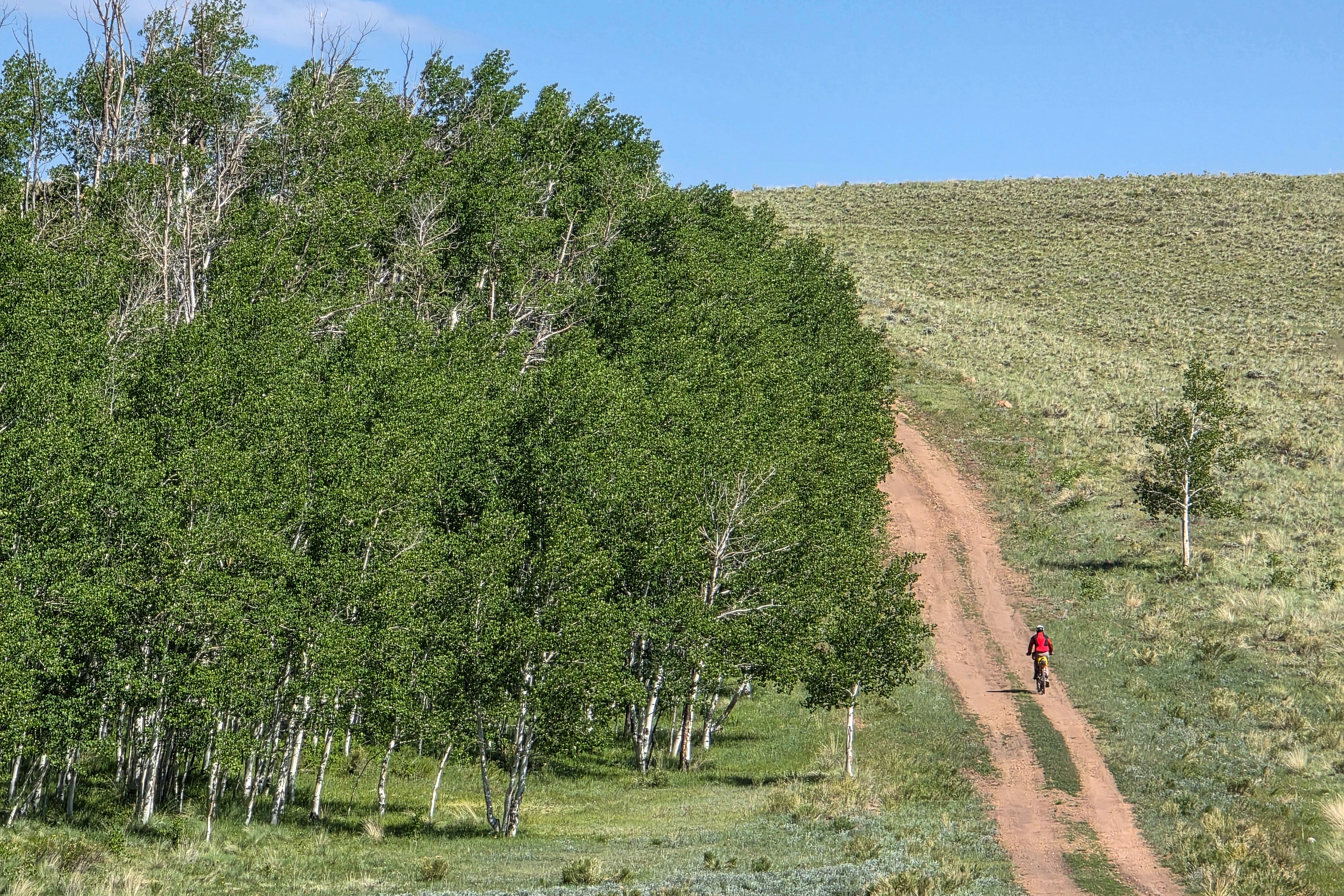
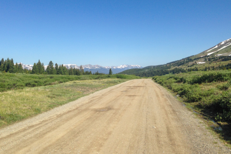
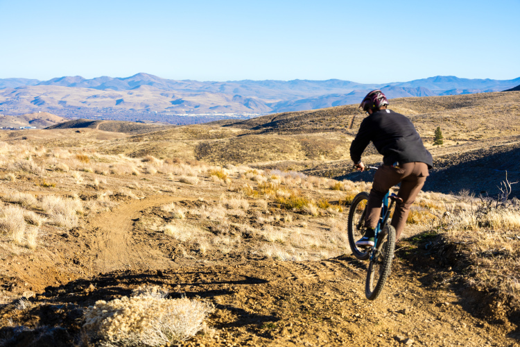
The 3,700-mile Golden Gravel Trail unfurls across eight states, from the Pacific Ocean to the Mississippi River, and serves up a smorgasbord of surfaces. Think: towering tree-lined forest service roads in Oregon, desert washboard in Utah, chunky, slow, high-altitude passes in Colorado, and fast-rolling hardpack in the Midwest. Roughly 70 percent is unpaved; the rest is on lightly trafficked paved backroads.
According to ACA cartographer and route-builder Amy Wally, the Golden Gravel Trail heeds a call that riders have increasingly been making.
“While most of our current network is paved, the rising popularity of bikepacking made it clear it was time to add another epic gravel route,” Wally said. “People crave the wild, remote, scenic beauty that America has to offer, and as a route designer, I’m thrilled to create low-traffic, safe ways for them to experience it.”
From idea to epic
The Golden Gravel Trail began as a spark in ACA’s 50th-anniversary brainstorming sessions. Several staffers sat down early in 2024 to sketch out a route with just one requirement: it had to be “epic,” a loosely defined term that usually means at least 1,000 miles. The winning concept came from Jenn Hamelman, ACA’s then-Routes Director, who remembered a 2017 Adventure Cyclist story by Sarah Swallow about bikepacking the TransAmerica Trail (TAT).
The original TAT runs roughly 5,000 miles from Oregon to North Carolina and was designed for motorcycles. That meant numerous sections on busy highways, rugged jeep trails, and long, remote stretches without services or water. Still, its bones were good, and Wally and the ACA route team decided to use it as a blueprint for their new gravel epic. To avoid the pavement-heavy eastern end, they cut the route short at the Mississippi River, trimming about 1,300 miles.
Then began the meticulous work of reshaping a moto route into something bicycle-friendly. Wally and her team analyzed every mile with an eye toward traffic levels, road surface, refueling access, water reliability, and overall appeal.
The goal, she said, was “to design a bikepacking route that minimized traffic, maximized gravel roads, incorporated bike infrastructure where possible, and kept resupply and water stops within reasonable distances.”
“Above all,” she added, “we wanted this route to be enjoyable: beautiful scenery, quality gravel roads, and charming resupply towns were key considerations throughout the process.”
The team used everything at their disposal — satellite imagery, Google Street View, topo maps, traffic counts, Ride with GPS heatmaps, intel from local bike shops, and YouTube videos — to turn a decades-old moto route into a modern, bikeable gravel traverse.
The biggest design choice: a cross-country gravel route that isn’t the GDMBR
For a route team with a blank canvas of gravel roads, one of the biggest decisions was where not to go. The Great Divide Mountain Bike Route (GDMBR), the ACA’s flagship bikepacking route and the backbone of the Tour Divide race, already traces the Rockies from north to south. With the Golden Gravel Trail, the ACA wanted to chart a different kind of cross-country epic.
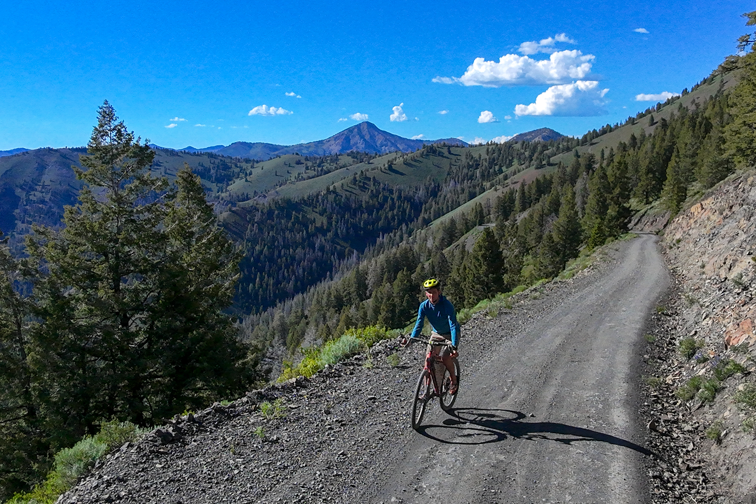
That becomes clear the moment the route leaves the Oregon coast. From there, it takes long, meditative climbs through Oregon’s deep forests and the wide-open solitude of the Ochoco Mountains and Malheur National Forest. It continues that theme in Idaho, rolling from Idaho Falls toward Ketchum on classic mountain dirt roads that feel remote but are threaded close enough to small towns to keep logistics manageable.
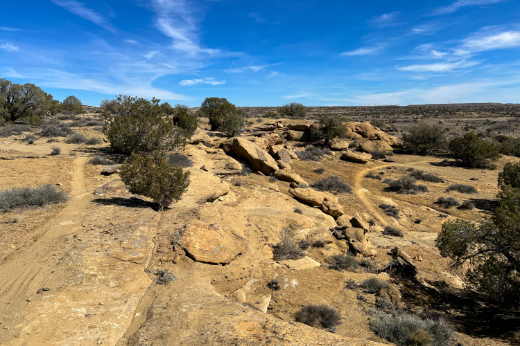
Then, the trail tips into northern Utah, where it’s routed high across the Wasatch Plateau. It then heads south into the otherworldly sandstone labyrinth of the San Rafael Swell. Riders can pop into Moab for a rest and resupply (or a few days of mountain biking?) before climbing through the La Sals en route to Colorado.
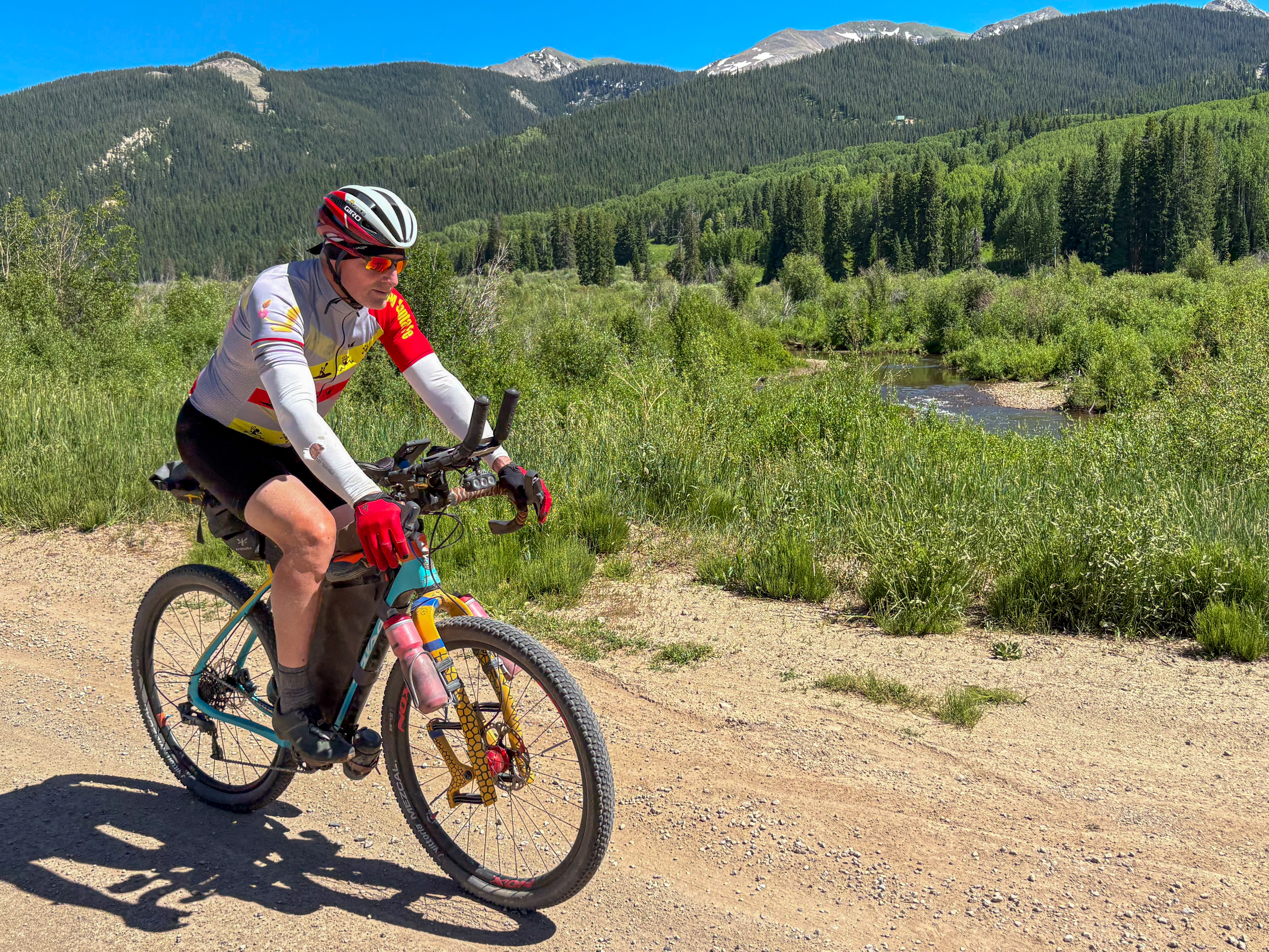
In Colorado, the ACA team had the opportunity to create a wholly different experience from the GDMBR. Instead of tracing the spine of the Rockies, the Golden Gravel Trail sweeps east-west across the state, from the high-desert plateaus around the Paradox Valley to remote mining towns like Tincup and Pitkin. It then drops into the eastern shadow of the Sangre de Cristo Mountains before meandering toward Pueblo. The trail exits the state in the far southeastern corner.
Near Salida, the Golden Gravel Trail overlaps the GDMBR for about 58 miles, just enough for riders to stop and swap stories.
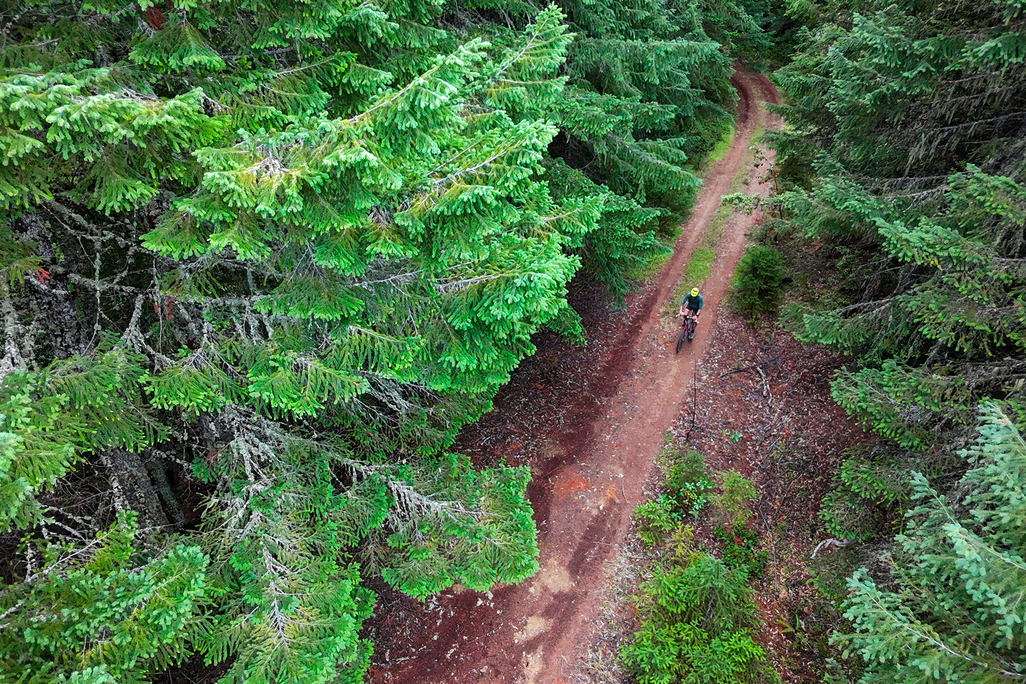
From Colorado, the route nibbles the corner of southwestern Kansas before marching steadily eastward across northern Oklahoma. And while the trajectory across Missouri toward the Mississippi River looks straightforward on paper, the Ozark Plateau is anything but: it’s rife with punchy climbs, ridge-and-holler terrain, and notoriously deep, technical gravel.
Wally describes linking together a route of this scope as “piecing together a giant puzzle, constantly balancing access to services with the best gravel roads.” Gravel offers nearly infinite routing possibilities in the U.S. With the Golden Gravel Trail, the ACA had to ensure that every turn was chosen to preserve a big-backcountry feeling while still offering the predictability and accessibility ACA riders rely on.
Route scouts
Designing on a map is one thing; proving it works on the ground is another. Before anyone pedaled the Golden Gravel Trail, ACA route researchers had already driven the length of it. According to Wally, the team typically scouts by car first because it’s the only efficient way to cover thousands of miles.
“Paying someone to cover a route by car over a few weeks is far faster and cheaper than having them cycle it over several months,” she said. “Experienced cyclists know what to look for, even behind the wheel, and they can quickly pivot to scout alternatives if issues arise.”
For the Golden Gravel Trail, she divided the 3,700-mile corridor into three roughly 1,200-mile sections, allowing researchers to work concurrently. They drove 100–200 miles a day, stopping often to check campgrounds, talk with locals, roll out nearby stretches on their bikes, and gather the granular details that maps can’t capture.
The final test required a rider. That turned out to be Sarah Swallow, the original inspiration for the route and an ACA ambassador, who spent late summer 2025 pedaling the trail from Oregon to Colorado.
“Traveling by bicycle is obviously a lot different because you are truly dependent on the route, the creek crossings, and the town resupplies,” Swallow said.
Her job was to experience the trail as riders will: to find its friction points, its magic, and its practical realities. She rode everything from the deep ponderosa forests of Oregon to the high-desert mesas of Colorado, noting where resupplies came too far apart, and also what set the new route apart.
One stretch in Oregon stood out. “From the South Fork of the John Day River through the Ochoco Mountains and Malheur National Forest — it was wild and remote, with massive ponderosa pine and Douglas fir trees, and lots of water and shade, which was unexpected and appreciated.”
Swallow’s takeaways echoed ACA’s design intentions. Compared to the TransAmerica Trail she rode in 2015, she found that the ACA had “replaced all the frustrating ATV trails with good gravel and dirt roads” and had increased access to towns, allowing for more frequent resupply.
“I think the accessibility and predictability of riding an ACA dirt road route that travels west to east is very exciting,” she said. The Golden Gravel Trail may feel wild, but it never leaves riders guessing about whether they can safely get to the next town, water source, or campsite.
Why it matters — and who it’s for
The Golden Gravel Trail marks a significant evolution for Adventure Cycling. Until now, ACA’s major off-pavement offerings were limited to the GDMBR, the Idaho Hot Springs Loop, and the Arkansas High Country Route. Creating a west-to-east gravel corridor both honors ACA’s legacy and embraces the preferences of modern riders: long, challenging dirt routes that balance adventure with accessibility.
The design philosophy is deliberate. ACA built a route that prioritizes rideability, predictable resupply intervals, safer traffic conditions, and varied scenery — the kind of thoughtful engineering that makes multi-day gravel riding feel challenging but not overwhelming. It fills a gap between the wildness of the GDMBR and the quick-hit bikepacking overnighters many gravel riders cut their teeth on.
The Golden Gravel Trail will be released in March 2026 as a free digital-only route on Ride with GPS with turn-by-turn navigation, notes, and service info. It’s built to be updated in real time — a practical move for a dirt route that crosses eight states and thousands of acres of public lands.
For 50 years, the ACA has vetted, mapped, and maintained routes that spider across the United States. With the Golden Gravel Trail, riders will get all the reliability, safety, and scenic magic the ACA is known for — just with a whole lot more dirt.
What riders can expect
- Distance: The route spans roughly 3,700 miles (some sources say 3,688 mi) and traverses eight U.S. states from the Pacific Coast (Oregon) to the Mississippi River (Missouri)
- Terrain: mostly off-pavement — roughly 70% gravel/dirt/mixed surface — cutting across rolling Ozark hills, Great Plains, deserts, alpine passes, and other diverse landscapes
- Elevation: the route includes substantial climbing — elevation gain is in the ballpark of 234,000–234,500+ feet, with the highest point hitting around 12,034ft at Cumberland Pass, Colorado
- Resupply: Predictable resupply windows of 50–100 miles, with a few longer gaps in remote zones
- Bike choice: Climbs and rolling terrain suited to loaded gravel bikes or light bikepacking setups
Know about a new trail project we should cover? Whether you’re breaking ground on the next must-ride destination or putting the finishing touches on a neighborhood flow trail, we want to hear about it. Drop us a line at [email protected] with high-quality photos of your build, plus details like trail mileage, location, difficulty, and what makes it special. We’re always on the hunt for the next great trail story, and there’s a good chance your project could be featured in an upcoming article.


2 Comments
Dec 20, 2025
Jan 8, 2026
Coming from the UK transport to and from start / end would need to be sorted.