

The Cohutta Cat is a meandering, 290-mile bikepacking route through remote regions of North Georgia and Tennessee. Daniel Jessee, the creator of the route, named it after Mulberry Gap’s housecat. As he puts it on his site:
The Cohutta Cat is named after the most vicious housecat you’ve ever met. The cat can be cute and lovable to you one minute, and the next she will be stalking the many dogs that call Mulberry Gap home. That’s precisely what this route is: warm and fuzzy with amazing scenery one second; thigh-busting climbs and lengthy segments between resupply the next.
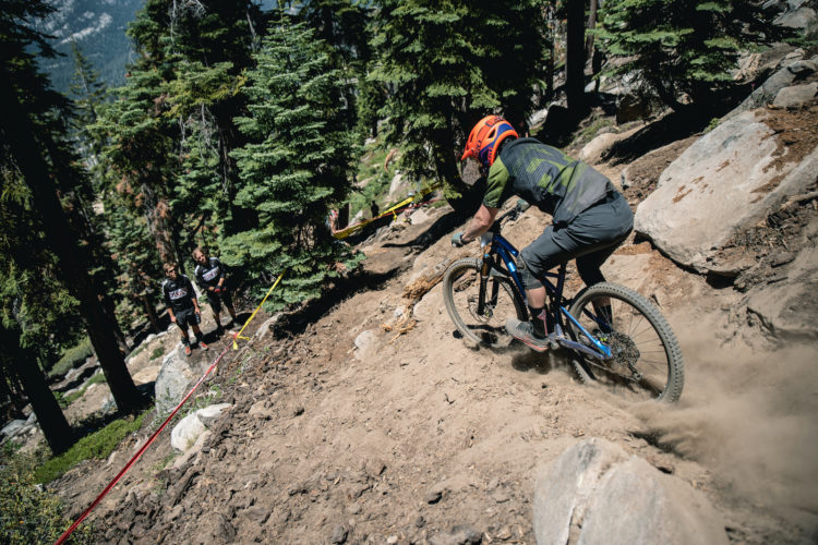
The route is available to ride anytime, but I joined 26 other riders for the second annual group departure from Mulberry Gap in early November. On a damp but warm fall morning we all set out to take on steep, grueling climbs and screaming descents, without much flat in between.
Day 1

My initial plan was to cover the route over four days, averaging around 75 miles per day, but with long rides like this, you never quite know how things will go until you’re out in the woods. I got a slow start to the day and spent too much time fiddling with the setup on my bike. I hadn’t gone on a proper shakedown ride before the Cohutta Cat for various personal reasons. Immediately, I remembered why it’s such a vital step.

I lost one of my water bottles just a handful of miles into the ride, and not too long after that, my dry bag and flip flops popped out of my seatpost harness. Once I rearranged my bags I felt strong, so I opted to push well past the 75-mile mark to the Thunder Rock Campground in Tennessee.


Other riders told me there were full facilities at Thunder Rock, including hot showers. After riding soaked from sweat and rain all day long, a hot shower sounded too good to pass up. Ninety-five miles and 14,000 feet of climbing lay between the start at Mulberry Gap and the campground. The final 20 miles from Parksville Lake to Thunder Rock were among the toughest of the day, filled with squishy singletrack and towering gravel climbs.

I made it though, rolling into the campground around midnight. After a lengthy shower, I set up camp, made a pack of ramen noodles, and crashed out around 1:00 AM.
Day 2

I woke up at 6:00 AM and it was drizzling. The dreary, wet weather sapped any motivation I had to get an early start. Instead, I went back to sleep for a couple hours. Emerging from my tent around 8:00, I discovered all the other riders had already left. I took my time packing up, making breakfast, and rolling out. Ample photo opportunities of the Ocoee River and surrounding fall colors further delayed progress.


After riding along the river, I climbed up to the Brushy Creek trail for a few miles of flowing, fun singletrack. The trail was rejuvenating, at least until I hit Highway 64 and found out nearly all the disc-side spokes on my rear wheel had lost tension. I only lost a few minutes tensioning them roadside with the ultra-handy Blackburn Wayside multi-tool. With that crisis averted, I headed into Ducktown, TN, to get lunch and resupply.
[see_also id=’200700′]
With a belly full of fast food, I hit the road again. The sun came out for a bit, drying me out, and boosting my morale. Soon the pavement ended as I climbed a Forest Service road along Tumbling Creek in the Cohutta Wildlife Management Area. As the climb progressed, the clouds and rain returned.

I made it to the town of Blue Ridge — the largest town on the route — around 4:40 PM, got a couple mediocre BBQ sandwiches, a few items from the Food Lion grocery store, and rolled out just before sunset.


The next part of the route took me around the north side of Lake Blue Ridge. It was beautiful with the sun setting and the moon coming up. Past the lake I turned onto a creepy, dark doubletrack. For two hours the road served up the same pattern: slight climb, slight descent to the left, sharp right into a muddy low spot, into the next climb. The moon hung in the same spot in the sky. I thought this must be what purgatory feels like. The only break to the monotony was the occasional group of good ol’ boys with their coon dogs out hunting.
When that road finally ended, a few rapid miles on smooth pavement was my reward. That was over all too soon, of course. I pushed on until about midnight, deciding to stop right after I crossed the Toccoa River Swinging Bridge. Exhausted, I rolled out my sleeping pad and bag. As soon as I laid down, I felt drops of rain hit my face. Reluctantly, I dug through my gear and set my tent up.
Day 3

The third morning of the Cohutta Cat was another wet one. It was warm, but still. I woke up earlier than Saturday and spent less time breaking camp. A 10-mile climb was the first order of business. All the rain softened the gravel road and fog kept visibility to about 50 yards. Needless to say, it was a long slog southward toward Bull Mountain.

My pace slowed even more on the singletrack sections of Jake Mountain and Bull Mountain. I stopped on the backside of Bull and made a lunch of Campbell’s Tomato Soup with sliced up bits of beef jerky and Cheez-Its. Similar to Purgatory Road from the night before, I felt as if I had been sucked into a time vortex. Eventually I came out on Nimblewill Gap road and faced yet another stout, 5-mile gravel climb.

At the top of Nimblewill, nearly two hours later, it was getting late in the day. My food supplies were running low and very little in the way of civilization lay between me and Blue Ridge, 40 miles away. My only hope was the Toccoa Riverside Restaurant on Aska Road, near the Stanley Gap trail. Not even sure if they would be open, I hammered the next 20 miles to get there with my fingers crossed.


As luck would have it, they were still open. I gorged myself on a shrimp po’boy, fried green tomatoes, and fries, and chugged a couple large Cokes. On the way out I snagged a couple packs of Cheetos and some Airheads. I turned onto some singletrack a little ways down Aska Road from the restaurant. At the trailhead, someone had left a cooler with some mini Cokes in it. Thinking I’d probably want one later, I slipped a can into my frame bag.

I didn’t realize until it was too late that the route didn’t take us straight through downtown Blue Ridge. Instead, we skirted the south side of town, bypassing all the stores. It’s my own fault for not checking earlier, but there was no way I was backtracking at this point. There were only 30 miles left to get back to Mulberry Gap, how hard could it be?
It turns out, very, very hard is the answer to that question. On the other side of Highway 76 I headed up into a neighborhood of vacation homes. The road was ferociously steep. I didn’t bother attempting to ride the climb, but even pushing the bike uphill was exhausting. Coming down the backside was a wild ride on a dark, one lane road with tight turn after tight turn.
At this point my legs and mind were as fried as the po’boy I ate for dinner. Any slight rise meant I was walking. Each step meant progress, though. With 15 miles to go, I dug my flask of whiskey and the mini can of Coke from my bag. I took a big slug of whiskey, slammed the Coke, and kept walking.
Just before 4:00 AM I rolled into Mulberry Gap’s steep driveway and pushed my bike up to the barn. After signing in, I took a shower, and passed out in the back of my truck.

Epilogue

The Cohutta Cat is far and away, the hardest ride I have ever done. If asked to describe it in a single word, I would say, “relentless.” Compared to the climbs on the Steamboat Ramble I did earlier this year, the Cohutta Cat climbs are for shorter. But it’s the grades that will get you on the Cohutta Cat. I may have climbed 4,000 feet at a time on the Ramble, but that was over the course of 20 miles. On the Cohutta Cat I climbed 1,500-2,000 feet in 5 miles or less, and did that over, and over, and over. The descents are equally as steep, so what takes two hours to climb on one side takes just 15 minutes to get down on the other. Descents that steep also require complete concentration, lest you find yourself spilling your body and gear across the road traveling at 40 MPH.
Of the 26 riders who started this year, and impressive 16 finished the full route — two others cut off a bit of the course. Each and every one of them is a card-carrying badass. If you think you’re badass enough to tussle with the Cohutta Cat, consider signing up for the group ride in 2018. Should you finish, your only prize is your pick of cat-themed patches brought by the other riders.
Which patch did I choose? A big, fat cat sitting inside a giant donut above the words, “No Regrets.”
Indeed.
If you choose to use Daniel Jessee’s route, please consider making a donation to Bikepacking Roots. Our group ride raised over $300 for the organization this year.


6 Comments
Nov 20, 2017
Nov 20, 2017
Bike: Zen Trail, 29er steel hardtail
Fork: SR Suntour Aion 120mm travel
Drivetrain: Shimano SLX 11-speed with a 46T cassette
Cranks: Rotor Rex with 32T oval ring and power meter
Brakes: Avid Elixir Trail 7
Wheels: American Classic/WTB
Tires: WTB Riddler rear/Vigilante front
Saddle: WTB Pure
Seatpost: Thomson Elite
Bars: Gravity 777mm flat bar
Grips: Ergon GA2
Pedals: Shimano XT
Bags: Bike Bag Dude custom made frame bag, handlebar roll, top tube bag, and feed bags
Blackburn Outpost seatpost bag and harness
GPS: Garmin Edge 520
Light: CatEye Volt 1600 lumen
Bar extender: Cheap thing off Amazon to give me more space
Battery pack: Anker 20100
Phone: iPhone 6s with backup of route
Camera: Nikon J1
Tent: MSR Freelite 1
Sleeping pad: NeoAir XLite
Sleeping bag: Flume UL 30
Stove: JetBoil
Rain jacket: Endura MTR Shell
Warm layer: Wool jersey
Multi-tool: Blackburn Wayside
Pump: OneUp Components EDC 100cc pump
Let me know if you have any specific questions about the gear.
-Aaron
Nov 20, 2017
Add an extra day and enjoy a little camp fire time at night before you pass out for the next day.
Nov 21, 2017
Nov 21, 2017
Nov 20, 2019