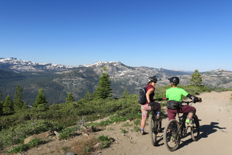
Amazing views and wildflowers in summer. This section goes past Watson Lake (side trail loops around) and includes short meadow crossings. Several side trails and fire roads to explore. Easy access to Northstar Resort trails.
Rode this in reverse, Brockway Summit to Tahoe City. Got shuttled to Brockway. Absolute blast. Mix of climbing (smooth and technical), and great, challenging descents. The trail's pretty rocky, so it'll beat you up some and you need to be on your game the whole time. Not for beginners, you need to be in good shape and know how to ride techie stuff. The final (long) descent into Tahoe City is good & rocky, so when you're tired you gotta fight through it. I think you drop about 1000 more feet than you gain going this direction. Great views. Solid Rim-job.
Snowed overnight in Tahoe City, and some snow at the resorts.
Have never ridden on snow before, so took my AM bike out anyway - knowing it was going to be sketchy.
The first couple of miles out of Tahoe City were lung-busting but mostly rideable. After that, the snow was more continuous and the riding wasn't. Would be good on a fat bike perhaps, but not with 2.3" tyres.
Enjoyed the views though - beautiful scenery and forest
We shuttle from Tahoe City to Brockway Summit. I recommend starting from this direction if mountain biking, the climbing is a little less brutal. The trail is 19.2 miles of technical no room for error killer single track. The views are surreal. I would say most of the trail is within the forest so you will enjoy fresh air and the smell of pine trees and mule ears. The only complaint I have is I wish I was in better shape so I could keep up with my buddy Ryan.
Great ride, not for beginners. Lots of technical rock climbs and downs. Views all around this trail are amazing. Parked at Safeway in Kings Beach and got a ride to the top of 267. Caught a bus in Tahoe City for $1.75 and rode back to Kings beach. Great alternative to a shuttle.


 1
1
Rode this in reverse, Brockway Summit to Tahoe City. Got shuttled to Brockway. Absolute blast. Mix of climbing (smooth and technical), and great, challenging descents. The trail's pretty rocky, so it'll beat you up some and you need to be on your game the whole time. Not for beginners, you need to be in good shape and know how to ride techie stuff. The final (long) descent into Tahoe City is good & rocky, so when you're tired you gotta fight through it. I think you drop about 1000 more feet than you gain going this direction. Great views. Solid Rim-job.
| ThankSnowed overnight in Tahoe City, and some snow at the resorts.
| ThankHave never ridden on snow before, so took my AM bike out anyway - knowing it was going to be sketchy.
The first couple of miles out of Tahoe City were lung-busting but mostly rideable. After that, the snow was more continuous and the riding wasn't. Would be good on a fat bike perhaps, but not with 2.3" tyres.
Enjoyed the views though - beautiful scenery and forest
We shuttle from Tahoe City to Brockway Summit. I recommend starting from this direction if mountain biking, the climbing is a little less brutal. The trail is 19.2 miles of technical no room for error killer single track. The views are surreal. I would say most of the trail is within the forest so you will enjoy fresh air and the smell of pine trees and mule ears. The only complaint I have is I wish I was in better shape so I could keep up with my buddy Ryan.
| ThankGreat ride, not for beginners. Lots of technical rock climbs and downs. Views all around this trail are amazing. Parked at Safeway in Kings Beach and got a ride to the top of 267. Caught a bus in Tahoe City for $1.75 and rode back to Kings beach. Great alternative to a shuttle.
| Thank