×

|
Rate it:
Tags:
Level: Intermediate
Length: 10 mi (16.1 km)
Surface: Singletrack
Configuration: Other
Elevation: +243/ -225 ft
Total: 22 riders
Mountain Biking Supply Ponds
#49 of 113 mountain bike trails in Connecticut
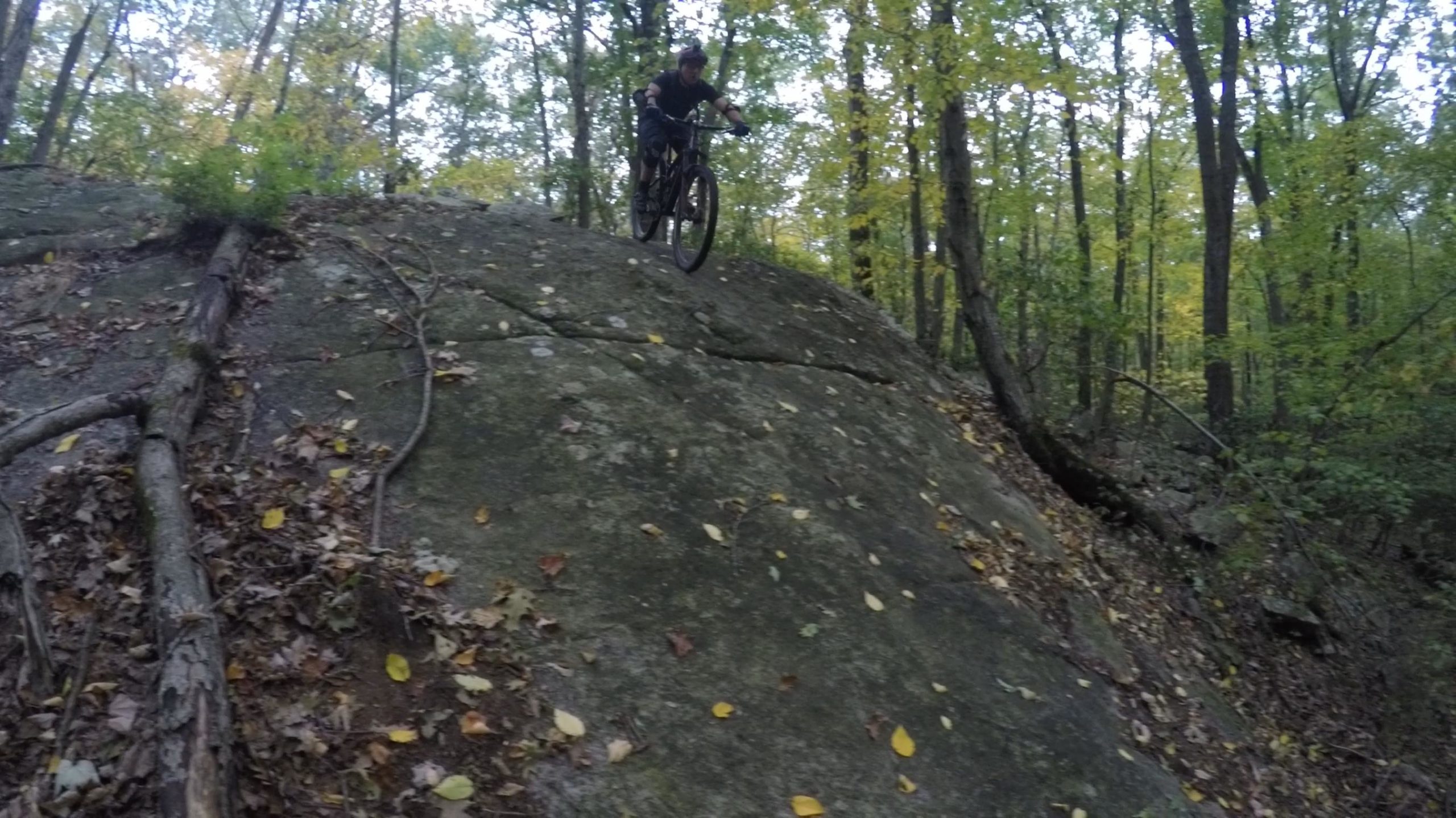
Hills steep at some parts, rocks and WATCH OUT FOR FALLEN TREES-- there is one that i know of all trail art marked
First added by searsandrewj on Jan 1, 2003. Last updated Apr 30, 2020. → add an update
Before you go
- Drinking water: unknown
- Lift service: unknown
- Night riding: unknown
- Pump track: unknown
- Restrooms: unknown
- Fat bike grooming: unknown
- E-bikes allowed: unknown
- Fee required: unknown
This trail information is user-generated. Help improve this information by suggesting a correction.
From I-95 take exit 55 and turn toward hoits you should be on rt 1. Stay on rt 1. After the graveyard (on left hand side) there is a stop light. At the stop light take a right. After you go under a brige take a left. Follow the road until you get to an open spot. Park your car and go around the gate. have a nice ride


I have bee away from Mountain biking for 15 years, and wanted to start it up again. I used to ride Trumbull quite a bit, and went there, knowing it would be a bit too technical for getting acclimated all over again.
I had also ridden the Supply Ponds.
I decided to give Branford a shot once again. I was happy I did. There are a lot of easy dirt road type rides to be done, but also single track that is 'accessible' for beginners and intermediate riders. If my memory serves there are some pretty good rides to be had here.
On this first time out, I took it easy, as I hadn't ridden here in so long and didn't know where trails would end up, or what a downhill schuss would wind up tossing at me.
I plan on going back soon and exploring it further. I left there with a smile on my face.
Very enjoyable.
Oh - like all public access - people just can't seem to keep their dogs on leashes...
| ThankThis is mostly easy and fun, great for a lunch hour ride. There is some singletrack in the southeast corner that's OK. Lots of people walking dogs here, but they are not averse to bikes. It's a great spot to induce a new rider to the sport.
| Thank