×

|
Rate it:
Tags:
Level: Intermediate
Length: 6 mi (9.7 km)
Surface: Singletrack
Configuration: Out & Back
Elevation: +272/ -176 ft
Total: 17 riders
Mountain Biking North Fork (lower Sect.)
#77 of 321 mountain bike trails in Oregon
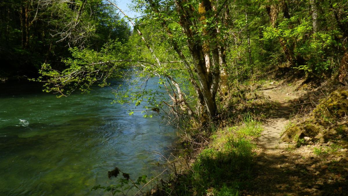
A classic X-C MBT trail, this out-and-back ride has all the elements that make riding in the woods so rewarding. It has plenty of fast and twisty sections, plenty of roots and rocks, some nice short climbs and decents, and gorgeous scenery. Just follow the riverbank trail from the parking lot.
The ride can be easily extended by continuing up the trail past Rd. 1912 to the upper stretches of the North Fork Trail (this upper section is much more technical). or by turning left up Rd.1912 and returning via the Alpine Trail (see Oakridge rides).
First added by MarcS on Feb 1, 2012. Last updated Apr 28, 2020. → add an update
Before you go
- Drinking water: unknown
- Lift service: unknown
- Night riding: yes
- Pump track: unknown
- Restrooms: unknown
- Fat bike grooming: unknown
- E-bikes allowed: unknown
- Fee required: unknown
This trail information is user-generated. Help improve this information by suggesting a correction.
Go to the Office Bridge trailhead location in Westfir (see Office Bridge)


This is a pretty easy trail. You can see our full review and video at:
| Thankhttp://getsomeadventures.com/easy-mountain-biking-on-the-north-fork/
Scenic XC singletrack trail along the North Fork. Very beautiful trail!
| ThankBy it's self it's a great easy/ intermidate trail along the river. Used as a starting leg for a Alpine loop it gives a nice single-track fix before the long road climb up the mountain.
| ThankI've ridden this trail as an out-and-back and as the first leg of a long loop up Rd. 1912 to Alpine Trail and back. It can be a little muddy through the first section in the wet season, and there is a considerable amount of poison oak as well. It's all worth it though, if you love X-C like I do. Great scenery and swimming holes, too.
| Thank