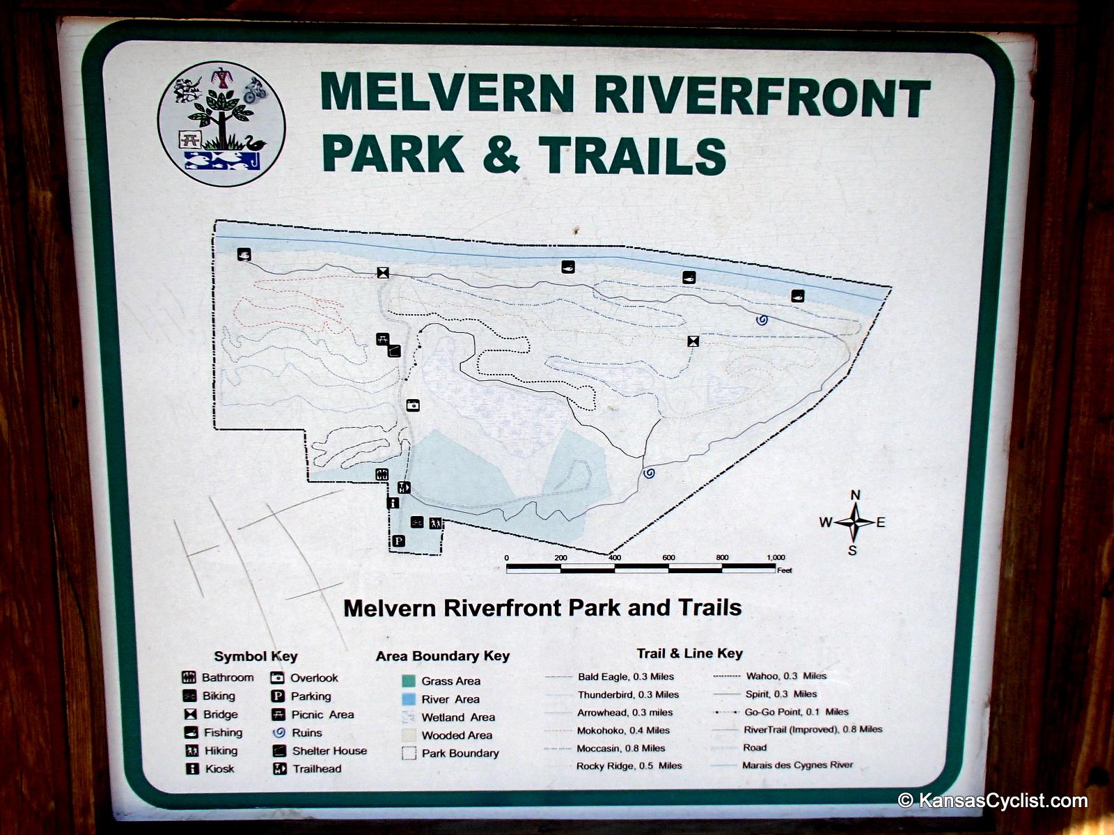
This park and trails surrounds a converted old quarry. The trail to the left is four trails connected to make one. You start off slow winding back and forth on a dirt trail with tree roots and rocky aeras. As you head down the hill this trail takes you to the edge above S Berryton Rd. Now you head down a technical decline with big rocks and tree roots. You will end up at the River Trail. This trail consist of packed chat rock and screenings. The trail runs along the Marais des Cygnes River and up through the east side of the woods back to the trail head. Head down to Lookout Point and jump on Go-Go Point Trail. This leeds tou to the Spirit Trail. This trail takes you down into the Quarry Pit. You ride along the north wall over some technical terrain. You come out at the east side of the pit to the Wahoo Trail. This trail takes you along the top edge of the north wall of the pit and heads deeper into the woods. You now come to the Rocky Ridge Trail. It is just that. This trail runs you along some sharp turns, technical climbs, and narrow rocky terrain. you will come to the Moccasin Trail. This trail is a good way to cool down as you head down twards the river on a dirt trail with some rocky aeras and roots. You can pick up some speed on this trail and have some fun. You end up back at the River Trail. You realy want to check out this trail it is a great ride.


Well I made it back to test my skills on this challenging terrain. The trail was a little overgrown with tall grass in spots but still rideable. Most of the trail was in good condition. The wood planked bridges were in good shape and stable. The quarry pit had a considerable amount of water that was just up to the edge of the trail. We have had one wet year. A few branches down and were removed for future riders. Down near the river Was a giant landslide that wiped our 20 to 30 feet of trail. Still one of my favorite places close to home.
| ThankI love the challenge that this trail has to offer. You really have to work to get any progress the whole way. The trail could use some clean up. Some tree limbs and one BIG tree across the trail. The wood plank bridge that I call billy goats gruff is getting a bit week. I stopped to pull a limb from my back rim and it started to really sway. Pleas be ware! Other than that a great ride!
| ThankThere are some really sweet trail sections that flow well, but there are other sections which I find to be too difficult to enjoy, with lots and lots of rocks, making it hard to maintain any rhythm. Some lovely scenery if you catch it in the right season. Come here if you want to be challenged!
These trails were built with help from a student-volunteer group called Kansas Corps, plus support from the Kansas Trails Council and other community groups. It is a rare amenity for a tiny Kansas town.
| ThankThis is one of my favorite places to ride close to home. I love the change of terrain and technical layout. When doing some online research, I discovered the Melvern Railroad Park that features the Atchison, Topeka & Santa Fe Pratt Truss Bridge just six blocks south of the trail. The A.T & S.F. Pratt Truss Bridge was built in 1909 to carry vehicular traffic over the hand dug cut. It is one of the few left in the US that spans an existing railroad line. Numerous photo and railroad buffs travel to Melvern every year to take the opportunity to catch this experience on film. The park area is under development to showcase this bridge, which was placed on National Register of Historic Places in 2003. There is a short trail around the park that is only one square block. There is also a railroad observation perch that hangs out off the bank of the tracks to let you get that perfect view. Check out the pic's
| ThankDecent track. Difficult in terms of obstacles and jagged rocks but hard to get any real speed. Any sort of dips were met with jagged rock turns impossible to keep any speed, which made the ride slow and technical.
| ThankI like to call this the Melvern Riverfront Quarry Trails. This set of trails are not verry long but they will challenge the best of riders. The rocky terrain, narrow passes, sharp turns, inclines, declines, and riding the edges of some bluff tops make this a killer ride. You need to check this one out. You won't be sorry.
| Thank