This park has everything. It is rated for everyone from beginner to expert, which is why I marked everything as a 5 since anything can apply. Most of it is singletrack, but there is a little bit of doubletrack in there too. The guys that maintain the trail ask that you *do not ride if the trail is muddy*!!!! It is maintained by volunteers and is always changing.


 1
1

This is a fun diverse trail that offers something for everybody. From the light technical single track to the intermediate rock crawling to the advanced big air jumping. Lots of intersections will keep you guessing if your going in the direction you planed on taking. Had more trouble with the snow and ice than I did with the rocks. I like the many line choices to make it as easy or as hard as you wish. Well done on this build!
| ThankIt's my home trail, love it
| ThankPassing through for work, brought the Fatty with to break up the long drive, a friend mentioned this place and I'm glad I stopped. Had enough time to do a couple laps on the Family loop and enjoyed it even more the second time through. Gonna have to make it a point to head down this way again!
| ThankI rode almost all of the blue and some portions of black yesterday. This was my first time on this trail system which means it will only get more enjoyable next time. Rode in on the fire road to dave's then right to will's took a quick loop on swedish then back to will's. From there crossed the fire road and rode rim trail back to the parking lot. Turned around and headed back to tasty. All of this was ridable although there are some very rocky technical sections thrown in on both blue and black trails. Popped a tube on tasty. Bring extras. The variety is great. The flow is fun. These are obviously bike trails not just hike trails to ride on. One word of caution...tasty is listed as four miles. It rides like it is longer...not sure why. I wasn't able to confirm distance.
| ThankLandahl Park is a great time, I went 3 times when I was in Missouri for a week! I would take a look at the map before if it your first time out.
Pros: Clean and well kept trails, Rock sections, Some descents, Lots of trail to explore
Cons: If you are the first person on the trail you will encounters lots of spider webs, happened to us on Tasty.
| ThankGreat mtb park. I mainly rode the blue trails and They are amazing. I rode 1 mile of the rim trail and it lives up to its name. I really enjoyed the park and I can't wait to come back.
| ThankIt rained the morning and the rocks were slippery when I went so I stuck to the easier trails. I can't wait to go back and hit the harder trails. LOVED THE ISH!! Not for beginners
| ThankThis is a great trail to ride if you're not an expert, as I am more of an intermediate rider. Will's Wanderer trail flows real well, not too steep either up or down. There's a few technical parts to it but very manageable for the rider who tries it a couple times. Have not tried rim job or tasty goodness yet. It will take you about 45 minutes or so to negotiate WW if you maintain a quick pace, prepare yourself for lots of roots!
| Thanknot for beginners. rode this years ago as a beginner and it was difficult although after a few years of riding its not as bad
| ThankI couldn't find the trailhead described in the directions on this website. Here's how to get to the trailhead I found:
From I-70, take MO-7 north through Blue Springs, turn east on Argo Rd. The trailhead is on the north side of Argo across from an archery center.
Trails were in great shape. I had a blast!
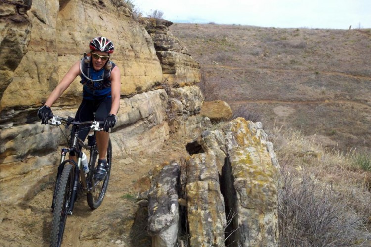
| ThankSome very technical sections of rocks on the Rim Trail, but a fun and very different experience. Not the most flowy, nor fast trail but there is plenty of fun to be had with unique rock gardens and trail sections scattered throughout. Definitely a fun trail to check out if you find yourself near independence and blue springs
| ThankI love this park. Great volunteers who have been maintaining the park extremely well the last couple of years now. Piles of Miles and Smiles. When the parking lot is full you can still ride for miles without seeing anyone. Easy and technical, whatever you are looking for. Kansas City is lucky to have this park.
| ThankWow what a neat little trail. I really liked the flow of this trail they did a good job. I like how they incorporated a lot of the rock features and creeks into it. It reminded me a bit of ridding in Eureka Springs. Not a whole lot of climbing but there is a bit, the little downhills are flow with some technical skill required on some and some are just flowing and smooth. The trails are well signed and looks to be well maintained. There are easy green trails to black advanced trails. There are a few scenic areas with all the rock formations. There are also a lot of skeeters so bring the spry. I rode with the wife on some of the green and blues and then went back and picked up some of the blacks after dropping her off at the car. Fun trail something for everyone.
| ThankMade an hour and half drive for this bad boy and was not disappointed. This was my first time and did not know my way around too well. As Snakeman said below, study the maps. This system has some flow as well as some raw techy areas. My favorite section was Rim Job, I had to run it back the other direction.
| ThankMostly intermediate but there are some fun technical sections. That trail system can be confusing when you get out there so study the map or print one off. Although the trails are marked and these trails look well
| ThankMaintained
This was a fun little ride. Unfortunately the weather hasn't been kind lately and the amount of rain the area has had is ridiculous so the trail had a few very sloppy sections, but the dry ones were pretty good. Needed some good TLC in some spots that were very overgrown, and one spot in particular was almost impassable due to a downed tree. The bread and butter of this trail was the great technical limestone section toward the back- very fun and kind of reminded me of some easier Moab rides.
| ThankThis place is great. The gps coordinates are not correct. 39.06603, -94.23199 takes you to the parking lot, trail will be ahead of you. Been here several times just keeps getting better.
| ThankThis place is legit. I really enjoyed loops 10 and 11, and the connector. Enough climbing to get the heart rate up. Rim trail is super technical and boney in sections. Well signed, well designed, and very worth checking out whether your passing through, like myself or local.
| ThankClose to home trail system.
| ThankThis is a good trail system. It has a little bit of everything for everyone. Some of the tech sections can be very rough but still a lot of fun. Personally I like fast and flowy but if you want to improve your skills ride these trails.
| Thank