×

|
Rate it:
Tags:
Level: Beginner
Length: 32 mi (51.5 km)
Surface: Singletrack
Configuration: Network
Elevation: +888/ -932 ft
Total: 130 riders
Mountain Biking Glacial Hills
#28 of 326 mountain bike trails in Michigan
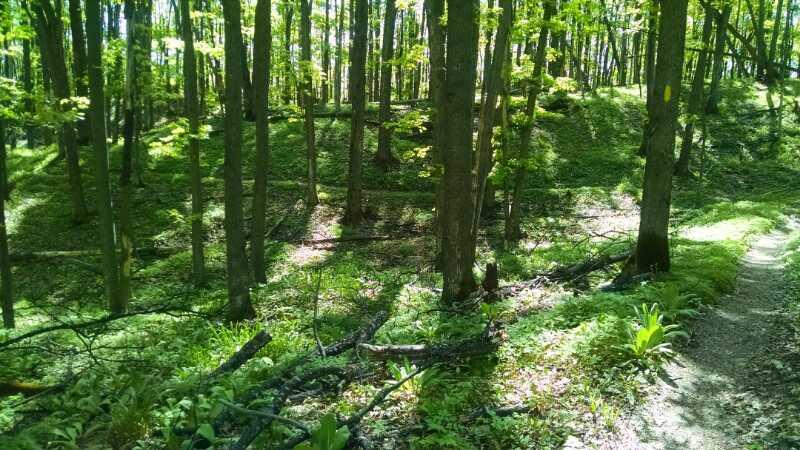
Trail system has been designed for both mountain bikers and hikers. Mountain bikers will find a flowy trail designed for riders of all abilities provided they have enough leg strength for some of the climbs and enough bike control for the downhills. Riders looking for the most elevation change should choose the outside loop on the trail west of Orchard Hill (just stay left or right at each intersection depending on your chosen direction of travel). The trail east of Orchard Hill has more elevation change with longer climbs and faster downhills. Current trail maps are available at gtrlc.org.
First added by JJBartos on Jul 28, 2013. Last updated May 11, 2020. → add an update
Before you go
- Drinking water: unknown
- Lift service: unknown
- Night riding: yes
- Pump track: unknown
- Restrooms: yes
- Fat bike grooming: yes
- E-bikes allowed: unknown
- Fee required: unknown
This trail information is user-generated. Help improve this information by suggesting a correction.
Three parking lots provide access to the trail system. Directions to each as follows from Bellaire:
*Orchard Hill parking lot - take Forest Home west from M-88 at the north end of downtown. Then turn north (right) on Orchard Hill. Parking lot is 1/2 mile ahead on west (left side). This entry point is about 1 mile from downtown Bellaire so many choose to ride from town.
*Vandermark Road parking lot - Take Bellaire Highway west from M-88 at the 90 degree turn in downtown Bellaire. Vandermark Road is about 1 mile from town; turn north (right) onto Vandermark. Road comes up quickly as it is on a curve. Parking lot is approximately 1/2 mile up the road on the right side.
*Eckhardt Road parking lot - Take Bellaire Highway west from M-88 at the 90 degree curve in downtown Bellaire. Eckhardt Road is approximately 1.5 miles west of town. Turn north (right) on Eckhardt Road. Parking lot is one mile down on east (right side)


Fun fast purpose builit flow trail. Hardwood forest with plenty of options.
| ThankNumerous options to follow a route (plenty of signs) or create your own. Very fun singletrack for any ability level.
| ThankFun last of season gold color. Fast hard pack flow.
| ThankNote*** They need to make this directional by day of the week or something. I nearly flattened an older woman coming the opposite way the day before the race. I was at nearly 20mph at that point. Had to lock up he brakes and totally eat it myself to avoid a crash that probably would have ended her life.
| ThankA little trickier than most beginner trails due to tight downhill turns on hardpack with a layer of sand above it. As mentioned in other reviews though, no rocks or roots.
| ThankVery fast and fun trail though.
Not sure where they get 32 miles from though. I only saw 9 in the race
Awesome fast flowing trail! It's rated as beginner, and while there are not any real technical futures, I would call this more intermediate. First time riders should use caution as there are tons of fast sections that go into sharp blind corners that you can be carrying way to much speed and could end up taking some very steeps crashes. Very cool trail though, can't wait to go again.
| ThankAlways a fun flow trail. Lots of Holiday Trail users, walking, running, biking.
| ThankGreat trail! Very well marked and very well laid out. The climbs don't even feel like you're climbing but are followed nice flowy descents. Highly recommend to ride.
| ThankA must ride! Not a lot of technical spots, but fast and exciting!
| ThankSpring time wild flowers at their peak, fun fast flowing trails, got 20 miles in of fast spring ride in lush green hardwood's.
| ThankThis would be a 5 if there were any rocks, roots, or other technical features. I wish the trail builders had used a lighter touch. Mostly machine built trail but there is a little hand built trail that is so much better than the rest. Just not enough of it! Other than that, its a great trail network and it doesn't hurt that I can ride it directly from home. I love that its not just one or a few loops like some trails downstate. You can mix it up and have a different ride every time. The trails are fast and overall have good flow. Intersections are all well marked and mapped. Great place to really hone your cornering skills as there are lots and lots of turns! Fat bike trails in the winter are groomed by a great group of volunteers.
| ThankFantastic trail! This is probably one of the best trails in Michigan and certainly a hidden gem. The ride is fast, fun and flowy. The trail is mostly smooth with few obstacles and continuous change in grade. The trails were well maintained and well marked with maps at every junction. Certainly worth the drive!
| ThankVery well engineered trail with many well marked options to make loops as long or as short as you need. Shorts is 2.5mi away for post ride food and rehydration which helps a lot!
| ThankGreat trail. It has lots of places designed just for mountain biking. Lots of banked turns and switchbacks. However there are almost no flat areas. It is either climbing or descending most of the time. It isn't very technical either so it can be ridden fairly fast.
| ThankTerrific beginner trail, with lots of fast flowing turns. Almost no technical features, but its still a ton of fun. Great place to bring someone just learning to ride, but fun even for the experienced rider. I'd recommend coming early in the day, because the course is huge, and exploring it all can take awhile. Seems to extend on forever (which is great). Definitely looking forward to coming back here.
| Thankwider trail. flowing. hills with slow incline...no rocks few roots
| ThankGreat Trail System. Fast, Smooth and Flowy. Lots of trail options. if you wanted to, I bet you could easily ride this system 50 times and never ride the same loop. We rode from the Vandermark Trail head, and did mostly the outer portion of the west section. It is heavily marked, and I wish that I was more familiar with the loops so that I didn't stop at most crossings, which would break up the flow. It shows that you have a pretty decent elevation change, but with the bench cut design, you don't notice many of the climbs. My GF is new to the sport, and she had zero problems with any of the climbs or the downhill sections. If you want some additional challenge, just ride it faster. I wish that we had more time to ride when we were just there. This is the kind of place that you could arrive and spend the entire day there if you would like to. Super fun trails. We are already trying to figure out when we can make the 3 hour drive to get back there to ride it again.
| ThankFast and Fun Trail, 1st ride in Northern Michigan. So beautiful. Protip, Sandy is a little difficult to ride on!
| ThankAwesome trail! I've been riding intermediate technical trails my whole life so this was my first smooth cross country type tracks and I really enjoyed it! It's a really easy track and there's a lot of it! The trail is marked really well but the trails are kinda confusing, I found it best to keep to their suggested rides. Overall tough definitely one of my favorite rides
| ThankNot technical, and awesome for a fun family ride! The trail is extremely well marked and maintained. Kind of too well marked. Lots of parts that branch off and cone back, so your ride can be anywhere between about 2 miles to 18. Also open year round for snow shoeing and XC Skiing. This trail feels like a a XC trail, nd you can go whatever speed you feel like.
| Thank