Flat Pass trail photo
See all photos (16)
×
User
Today
 
  |   Rate it:

Tags:
Level: Advanced
Length: 10 mi (16.1 km)
Surface: 4x4 Trail
Configuration: One-way
Elevation: +350/ -616 ft
Total: 21 riders
 

Mountain Biking Flat Pass

*****   Add a review
#41 of 695 mountain bike trails in Utah
#705 in the world

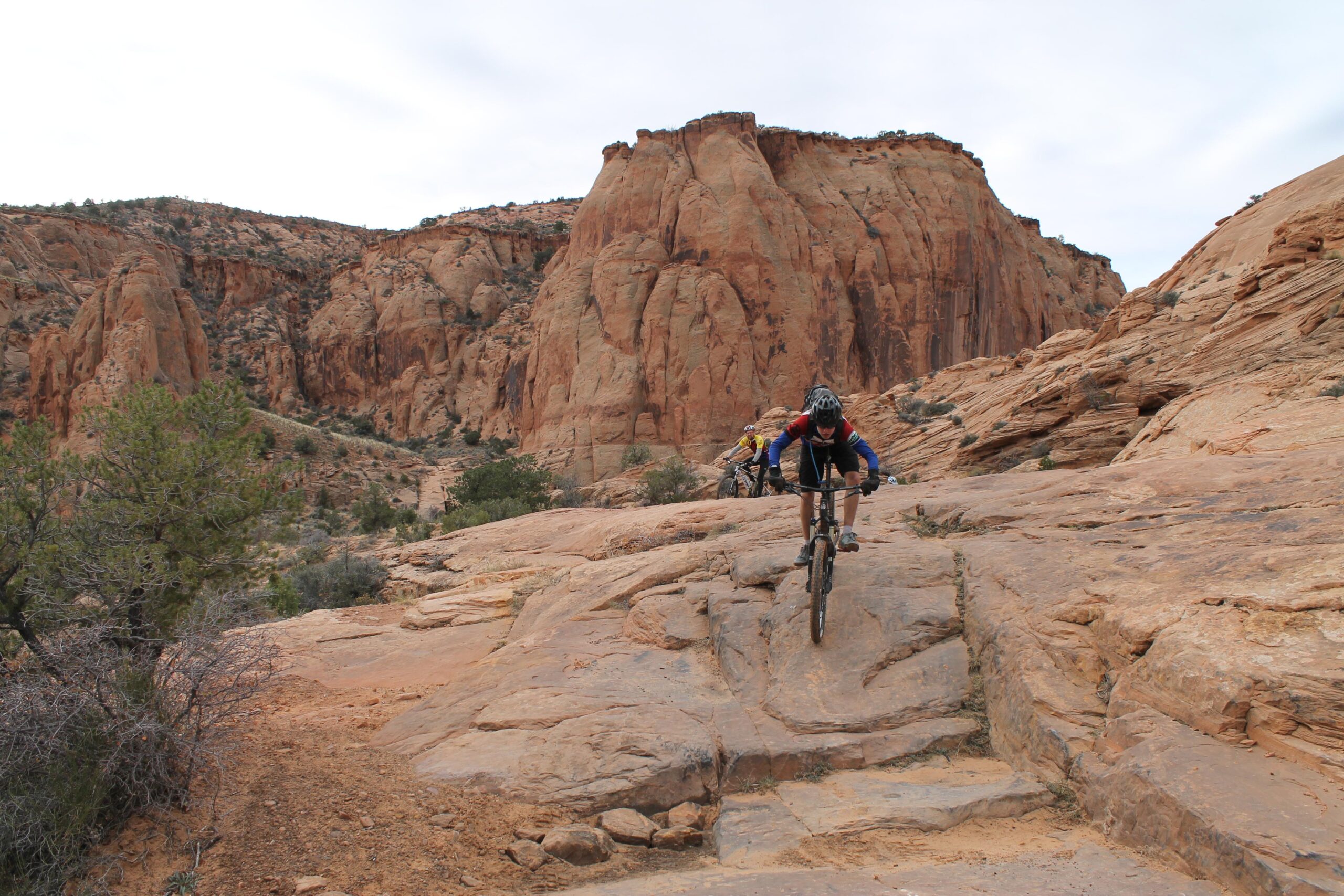
This is a rugged jeep route which bears a lot of resemblance to the traditional Porcupine Rim route. There is an initial climb of 1,000 feet in the first four miles and 1,500 ft of descending over the last six. There are ledges galore along the way, both going up and down, and plenty of play areas and stunt opportunities. There is also deep sand intermixed with the slickrock.

First added by John Fisch on Nov 28, 2014. Last updated Apr 27, 2020. → add an update
Before you go
  • Drinking water: unknown
  • Lift service: unknown
  • Night riding: unknown
  • Pump track: unknown
  • Restrooms: unknown
  • Fat bike grooming: unknown
  • E-bikes allowed: unknown
  • Fee required: unknown
This trail information is user-generated. Help improve this information by suggesting a correction.
Getting there
From Moab, travel south. Turn left at the sign for Ken's Lake. Follow the signs for Ken's Lake until the pavement makes a hard left to the lake at which point you will go straight onto the dirt road. Follow the dirt road up a notch and park at the clearing right before the cattle guard.

To leave a shuttle vehicle at the north end, going south out of Moab, turn left onto Spanish Trail Road. Follow it to a traffic circle and continue straight on through the other side of the traffic circle; although going straight the name of the street will change to Westwater Rd. Go past the golf course and park in the clearing on the right.

To ride the route from the southern trailhead, go across the cattleguard and down the dirt road. Go right at the fork and almost immediately go left across the creek. After that, follow the jeep trail to the dirt road at the other end. Most intersections have signs which say "Steelbender" (this is also known as the Steelbender Jeep Safari route). At the north end, go left at the T and make the tough climb out of the valley and over the ridge to your shuttle car.

If doing as a loop, continue past the parking area and go straight through until you get to Spanish Valley Drive and go left until you get back to the road which will take you back to the southern trailhead.
Featured in


Flat Pass Trail map

Add to or improve this map // Share this map on your website

Local Info

Club Sponsor

-

Trail checkins

CFM (on Oct 8, 2019)
What's this?

Upcoming Events

None.
Add one

Trail conditions

Dusty (on Apr 19, 2018)
login to update

Camping & Lodging

Coming soon!

Flat Pass videos

Add a video
We don't have any videos of this trail yet. Add one here.

Mountain Bike Trails Near Moab, Utah

****
Intermediate | 15 mi
****
Intermediate | 20 mi
***
Beginner | 0.8 mi
***
Advanced | 10 mi

Add a review

Rating
 
Difficulty
 
Review

Reviews

    Loading reviews...

Rider questions