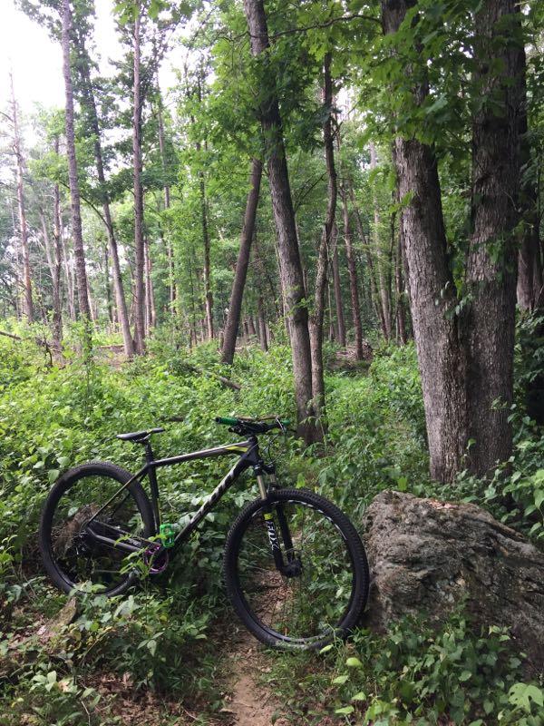
I only found about this trail over the internet (MtbR). It measures out 4-4.5 miles according to the builders. The entire trail is a combo of singletrack and fire road. It looks like the builders are working on even more, too. The first section of singletrack weaves around into a good, looooonnng climb onto some doubletrack. Eventually this turns into the first section of tight, weaving singletrack. Just like the other trails in this area, it goes up and down pretty rapidly. Be careful, as some of the bench cut sections are hard-packed yet, and riding the edge can definitely lead to a wash-out. The first section ends at the top of a hill which turns into an awesome fire-road downhill - big rings all the way...be sure to have a grip on the brakes cause you make an immediate left onto more singletrack. The second section gets a little more technical. The trail rises and falls a little more dramatically, but the ride is smooth. There are some good technical areas that will test you, too: some monster roots, a large log pile and some neat drops. The whole trail is built on a relatively small piece of land, but the way the builders used the entire landscape is admirable. The last fire road leads into the most awesome section of singletrack. After weaving through some pines, you enter a hilltop section that weaves you in and out of some awesome rock gardens. you need to be on your toes, 'cause the rocks are big, jagged and can pitch in a second. The last big climb is a technical rider's dream : a monster climb with rocks on all sides and some places that require a little bit of creative pedaling. It all ends after that climb as you exit back out at the parking lot...


Great shape as if 11/23/18. Leaves have been removed as well as any fallen trees.
| Thank07/24/2018 Trail in great shape. Summer grooming is complete. Ready for fall!
| ThankAs of 7/19/18 the trail has been groomed, de limbed and sprayed. In great shape for summer. Let it rip!
| ThankMy local, I like it a lot. It was very overgrown with briars, willow and wild grape vines but as of today I walked the first ~3 miles, to the big bridge, and used lopping shears to clean up the path. I will try to finish the second half soon. Will make it way more fun.
| ThankNice and clear, no trees, all leaves have been blown and the trail is tacky and fast. New enter/exit signs have been installed and the trail is nicely marked. Let it rip!
| ThankStill a good little trail. Maintained nice. Not sure why someone said it was overgrown but its almost 7 miles depending on what recording device you use. Some leaves down now but still nice. Has a few bridges to keep it fun. For sure not a beginner course. Intermediate would be best. Great workout. Bathrooms, water, night riding, fat tires are also aloud.
| ThankIt's a bit overgrown. And if u don't like spider webs, don't bother coming... well actually do come now, cause I just cleared the trail for you... yuck.
| ThankPretty fun trail lots of short climbs and short decents. Smooth terrain for the most part a couple of fun obstacles. Not a bad ride if your close by but definitely wouldn't go out of your way to get here.
| ThankOk trail, felt kinda swampy, but who cares if you are just trying to pound some miles in.
| ThankAs of 1/8/12 the trails is 5.75 miles. Nice trails with some bridges, short climbs and a nice rock garden. Also has a cool platform over a boulder near the end of the trail(if ridden couter-clockwise). For map check out Trail Maps section of www.ncmountainbiker.com.
| ThankThe trail is now about 5.5 maybe a lil more long and has has some newer sections that really adds to the flow of the trail.Check it out
| ThankGood little trail. As of 11/2/2008 its in great shape and needs nothing but riding. The fall leaves have fell so its a little slick but still fun. To me, its worth the drive up whether you are coming from Charlotte or Winston salem. More ladder crossings have been put in.
| ThankTeh first 3 miles is a beginners trails but it is fast and fun. The last mile to mile and a half has a few wooden bridges and rock gardens that make it a lot more interesting. I would say if you have to travel more than 30 miles ride Westwood Park instead.
| ThankAt first I thought this trail was going to be a dud. The first mile or so is very easy cruzing. Then the trail starts to wind through some trees. Along the way are some decent little hills that are a little tricky especially when wet with no traction. The last mile of the trail gets technical with several rock gardens, roots and ladder ride overs. I really wish the whole trail was more like the last mile. For being a bit out of the way I would say go to Westwood Park which is about 15 mins from Fish River.
| ThankGreat trail. Just when you think the going is easy you hit a couple of climbs that give you a great aerobic workout. The last part of the trail features some fun rock-gardens. Riding early in the season, there were at least eight trees blocking parts of the path and lots of sticks and branches on the trail. Overall though, the local bike club has done a great job with the trail. Trail markings were some of the best I have seen.
| ThankThere are two pretty fast downhills and you must stop quickly at the end of both. One is mentioned in the main review, the other is just before the rocky section and makes a hard left without alot of warning.
Trial summary: Short warmup, long hill, tight woods with a few roots and tree crossings and a fast downhill in the middle, an easy ride thru some small pines into another fast and straight section, into a rocky section that ends with a pretty challenging climb then back to the parking lot.
| Thankvery big hills lots of speed on the fireroad
| Thank