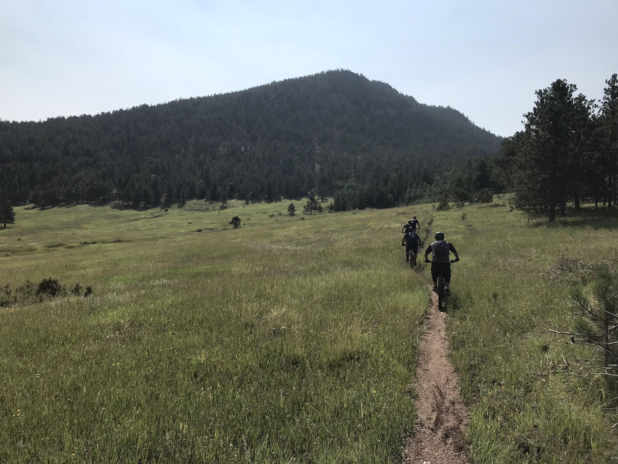
*This is a sensitive trail. Please excercise caution to minimize erosions effects. It is a mulit-user trail. There are 3 forks to this trail, and they join up near the summit. The middle fork begins at the rainbow pit trailhead in between Glen Haven(West) and Drake (East). This section sucks, avoid. The best place to start is in Glenn Have. The(technical, steep) climb with snaky switchbacks You will come to a crossroads that will take you west to Glen Haven down a wicked-fast bobsled run of rocks and slabs, thru a usually elk-laden Piper Meadows. It's all downhill from here. Or you can continue up for toward the summit trail. The actual summit trail is not really recommended for bikes. It's just not that fun. Steep, loose. More erosion that it's worth. Keep on rocking past the summit and you'll fly through singletrack meadows and glades and sweeping views of the Big Thompson Canyon. Be warned: continuing on this path will present you with one of two options. 1. Continue to the easternmost trailhead nearest Drake. For wimpy bikers this will mean extensive Hike-a-biking down eroded sections and rock stairs (not the fun kind), and an up-hill road ride back to the car. This trail received a LOT of damage from the floods and used to be 100% downhill ridable by the badass, now even the bad ass are walking a fair amount of the downhill. 2. Turn tail and head back up to the summit area and take the roller-coaster back to Glen Haven.


 8
8
Trail is NOT NOT closed, despite the sign that says otherwise. Uphill from Glenn Haven is in pretty good shape, though looser than it used to be. Downhill to Drake is in poor condition from floods in fall of 2013
| ThankThe guy who wrote the original description was smoking crack. Starting at the gravel pit (middle trailhead) is a lousy idea. As one other reviewer noted, he walked much of the uphill. Start in Glen haven. The ride up is fun and technical. Then choose your own adventure, either do it as an out and back, or ride down to the gravel pit, or ride all the way to Drake. The last two options are seriously technical. Down to Drake is double black diamond. He claims "unridable hike a bike sections", which is true if you don't bike double black. I ride 99.5% of it, but I am balls to the wall the entire way down. I would compare it to the rock garden section of Hall ranch, but for many many more miles, and looser and more eroded.*
Floods in fall 2013 washed out a lot of the downhill. Very eroded and significant hike a bike downhill even for the downhiller. The erosion caused wheel sized pot holes to form in the middle of the trail in many places. I have been biking back down to Glenn Haven rather than down to Drake.
| ThankAwesome trail. Did it as a loop. Parked in Drake. Biked to the third Trailhead in Glenn Haven behind the stables (6 miles on the road). Biked up from there. Steep mostly ride able uphill, with some hike a bike. The initial switch backs hurt. Hiked most of the last half mile to the summit just for the view, you could skip the summit if you wanted since it is a side trail, but the view is worth it. Over 3000 feet total climbing which hurts. The downhill was intense. I had to walk a few sections, which is saying something. Totally unrelentingly steep and technical. Way harder then anything on Horsetooth besides maybe the steepest section of Loggers, but like that for miles. Has some hike-a-bike even on the way down which was not appreciated. I met some guys up there who missed most of the uphill and the 6 mile road ride by shuttling to B.G. Ranch. Private land, but apparently the people don't mind, they actually talked to someone there... You could also ride down the trail back to Glenn Haven for a less technical descent, would still be fun though. Just lowers the difficulty down to blue square, but if that's you cup of tea, you will have trouble on the way up.
* Review edited 8/15/2011
| ThankI tried to ride up this trail, but I seemed to spend more time hiking than riding....the downhill was fun however. Wont ride it again there are ton of single track trails in the area that are better for the bike. Would not do this unless you enjoy hiking
| ThankI took my bike for a hike on this trail. From the trail head at the gravel pit, There is no way I could ride UP this trail. The average grade is 15% to 20% and is technical. So, I pushed my bike 2.5 out of 3.5 miles to the sumit. Then I lowered my seat and hung on. The downhill is awesome. Technical, steep, brutal and just fun! You'll get baby heads, adult heads, waterbar jumps, roots, small drops, etc... I only had to walk a small section near the sumit. I'd not try this trail without disk brakes though. There is another trail head about 4 miles after the 34/43 junction (2 miles before the main lot), which I'll try next time, as it's longer and meets .5 miles below the sumit. Then head down to the main trail head, and when done, continue down the road a couple of miles. If it's ridable, it would turn this into a nice loop. I didn't go far down the Glenhaven route, but it looks like it might be good.
| Thank