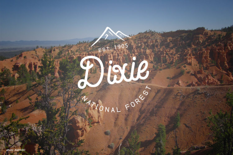
Cassidy Trail trail photo
See all photos (2)
×
User
Today
 
  |   Rate it:

Tags:
Level: Beginner
Length: 9 mi (14.5 km)
Surface: Singletrack
Configuration: Network
Elevation: -
Total: 7 riders
 

Mountain Biking Cassidy Trail

****   Add a review
#94 of 695 mountain bike trails in Utah
#2,573 in the world

Connects to Losee and Casto Canyons making a loop possible. Limestone canyon walls with manzanita, cedar and pines. Fun intermediate tech trail.

First added by abegold on Jul 30, 2014. Last updated Apr 28, 2020. → add an update
Before you go
  • Drinking water: unknown
  • Lift service: unknown
  • Night riding: unknown
  • Pump track: unknown
  • Restrooms: unknown
  • Fat bike grooming: unknown
  • E-bikes allowed: unknown
  • Fee required: unknown
This trail information is user-generated. Help improve this information by suggesting a correction.
Getting there
From highway 12 west of Thunder Mountain Trail (Red Canyon) head north along this trail that Butch Cassidy rode. 7200'-7900'.
Featured in


Cassidy Trail Trail map

Add to or improve this map // Share this map on your website

Local Info

Club Sponsor

-

Local Bike Shop

-

Trail checkins

Fatbike1 (on Aug 2, 2016)
What's this?

Upcoming Events

None.
Add one

Trail conditions

Dry (on Aug 2, 2016)
login to update

Camping & Lodging

Coming soon!

Cassidy Trail videos

Add a video
We don't have any videos of this trail yet. Add one here.

Add a review

Rating
 
Difficulty
 
Review

Reviews

    Loading reviews...

Rider questions