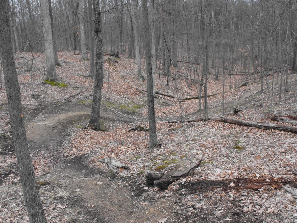
This 10ft gravel path goes through the historic fields and forests were the 3rd Battle of Winchester took place providing an enjoyable venue for family bike exploration and a key connectivity link between the Elementary and High School campus and residential areas to the north. The main path is 3 miles and consists mostly of gravel, with a short asphalt section near the steep ascent/decent to the Red Bud Run bridge.
The scenery is an enjoyable mix of open field and woodland with views across the Shenandoah Valley. Historic interpretative signs along the path provide context for the pivotal Civil War battle fought on the grounds in September, 1864. A side spur loop, approximately .5 miles in distance, on the south west part of the property takes riders down the trace of Hackwood Lane, shaded with a natural arbor of local fence line trees. Throughout the property visitors will notice the Shenandoah Valley Battlefields Foundation (SVBF) has commenced restoration and other activities intended to create a model for significant battlefield sites outside of the National Park System.
Formerly, single track trails were open for MTB use, however after consultation with state and federal land use agencies, the property owner (SVBF) has designated these single-track trails for hiker (pedestrian) use only as of January 1, 2014. Bicycles are encouraged on the 3 miles of 10' gravel paths on the property.
For more information including development plans for the property, visit the SVBF website at: http://www.shenandoahatwar.org/Make-a-Difference/Help-Preserve-Third-Winchester


As of January 1, 2014 the single track trails on this property are closed to bicycle use. The 10' wide gravel property trails remain open to cyclists. The Shenandoah Valley Battlefield Foundation (property owner), is making this change in trail use to limit potential damage to historic areas of the property.
| ThankThis is our go-to after work ride in the area. Traveling to Fountainhead/Lake Fairfax during the week means battling traffic both ways. But the Winchester Trails are easy to get to and offer a nice 1 hour workout.
The gravel/paved path loop is not the trail! You'll see single tracks darting in and out from the gravel loop. You can start at the parking lot, take the gravel path to the lake and then split off from there.
There are some fun sections of this trail for everyone. The back section by the high school fields has some nice technical climbs and descents with roots and water. Nothing overwhelming and great for all levels. It can get pretty chewed up when it rains. Overall, it's a flowy ride and good solid trail system for locals.
| ThankTrail needs more markings, not easilly followed. Good beginner course.
| ThankTrail is mostly doubletrack with some pretty cool obstacles and singletrack trails webbing out along the way. Overall it was a "nice" ride with some cool country scenery. If it were closer to me I would probably ride it on my chill days.
| ThankI am traveling to work at Winchester Medical Center and decided to bring my bike after I found this trail on singletracks. Trail is nicely maintained and worth bringing the bike up for a short after work ride. Nice country in this area and would be great if trails had extra millage. However, I wouldn't drive 5 hours to ride it though. I will give thanks to those for giving me a chance to ride after work while I am away from home... Nice work on the singletracks that are out there. Low rating because of how short trail is, otherwise it was fun.
| ThankIn general, the trail was a great variation of counteracting hill and dales. the trails are a fast composition of hard packed clay making peddling easy and fluid. rarely are trails marked, so map use is minimal, however because the park borders the high school, just keep in mind the location of the high school and try to get lost. my overall review is a 3.5 because i like faster trails with less turns and drop offs. these trails are ever growing and well maintained. give it a shot
| ThankThis is my go-to trail. Nice little bit of singletrack in winchester. This is a great place to introduce someone to mountain biking. It isn't too technical, but there are still plenty of small hills, roots, logs, bridges, and mud patches to keep you on your toes. Easy enough that a beginner can navigate it, but interesting enough to keep a more experienced rider from getting bored. You can ride all of the singletrack in about an hour. All in all, a great, fun trail.
| ThankJust rode this trail after taking a 13 year break from the sport. It's short but I thought a really nice little trail. Good, worn single track with just enought to keep you interested. Not an entire day thing just a quick stop but a lot of fun. Completed the ride and then changed directions and took some different loops. 5 minutes from my house so I'm grateful to have a nice ride so close. I would not travel more than a few miles to ride it however!* Review edited 8/5/2011
| ThankThis is a great trail to hit when you dont have much time. For me it is minutes away and always a good workout. Great after work or for us night shifters, pre-work ride.
| ThankThis is a great trail to hit when you dont have much time. For me it is minutes away and always a good workout. Great after work or for us night shifters, pre-work ride.
| ThankI thought this was a great trail. It is well maintained and cared for. There are several singletracks which I did not go on this day, but the main trail is paved and some parts are gravel. There are plenty areas for shade and several areas to stop and rest if needed. There are several benches along the trail for you to sit. The trail is well marked along the way so you will not get lost. Great trail for begginers and a great place to go riding with your children.
| ThankNot as technical as other trails i've riden but more my speed. Nice single track. Fast and smooth in areas, tricky in others. Good ups and down but nothing to crazy. I can spend a couple hours back there and never be bored.
My new favorite place to ride.
I only gave it a 4 since I dont have to much to compare it too.
| ThankI am new to biking and road this trail for the first time last week. Being out of shape and new it was a bit of the challenge but in a good way. Great trails to build up some basic skills and gain some confidence. I will be spending more time here getting in better shape to start tackling the much harder trails in Davis, WV. Very nice local spot though. I gave it a 5 based on it being a great beginner friend trail.
| ThankThe description of the trail configuration above is very accurate. I am specifically reviewing the red trail, which took us noobs around 10 to 15 minutes to ride. It's a loop with some good log obstacles (a few I walked over), some tighter turns, couple of good downhills and some uphills that I couldn't make even on my third loop. Other than being short I had a ton of fun on this trail - it's great for beginners but probably satisfying for folks who know what they're doing too. The only other places I've biked have been Schaeffer Farms and the C&O Canal. The outside loop (the main trails) remind me of the C&O, the red loop reminds me of Schaeffer. Oh - and warning: there is a ton of glass on the trail after the first sharp left turn around a tree trunk. Keep your eyes peeled and you will see it. We removed most of it but I still managed to get a flat riding over it. We're going back today 8/22 and will try to clean it up more thoroughly.* Review edited 8/21/2008
| ThankI live with in riding distance to the trail, just finished my 3rd ride on it. The main gravel trail is more of a walking trail, the single track is more fun but very new, the trail is still pretty soft in alot of places, hasnt been broken in propery let. Some of the trail flows nicely, other parts not so well. its difficult to keep speed up due to turns that are to sharp, to loose, or just plain awkward. Many of the turns could deffinately use berms. Once more people ride the trail and it gets broken in, it should become more flowy, overall has tons of potential and is a pretty fun ride
| Thank