
Certainly by now you’ve heard of the best Alpine rides located within 90 minutes of Denver. First on that list, the Lenawee trail, a technical, high country classic that starts at the top of Arapahoe Basin, is just over three miles long, and drops 2,200 vertical feet. Well, get ready to add another A-Basin banger to your playlist because they’ve recently completed a NEW downhill-only trail that drops down the west ridge, wraps around the front (read: in bounds), and is chock full of never-ending, spectacular views and fun. If you’re the type that yearns to earn turns, the new three mile descending trail, currently being referred to as Beavers Loop, is your cup of tea.
For those not familiar, Arapahoe Basin is a small ski area founded in 1946 by WWII veterans and Olympic skiers, located on the south side of Loveland Pass and nestled in some of the most beautiful scenery around. It is, in this writer’s opinion, one of the few “mom and pop” ski areas left in Colorado, with no resort atmosphere to speak of and some of the gnarliest, highest elevation terrain in North America. While skiing here is a given, bike trails have been but a pipe-dream since the 1990s and have only recently started taking shape, thanks in-part to legendary trail builder, A-Basin OG, and avid mountain biker since 1988, “Uncle Joey” Klein.

Joey has been an A-Basin enthusiast since living in the A-frame above the main lodge as an Atomic Janitor from 1983-1990. After a long career as a ski patroller, he ventured into hand cut trail work, helping design and build several of nearby Keystone Resort’s mountain biking trails in the mid 90s. Joey has been building mountain bike trails now for 30 years, and is also a founding member of IMBA Trail Solutions, a group that has been major player in the creation of A-Basin’s mountain bike trails. Trail Solutions is the planning, designing, building, and educational arm of the International Mountain Bicycling Association and was established in 2003 with a focus on “creating trail systems that serve the whole span of users while minimizing maintenance needs and environmental impact.”
Thanks to Joey’s vision, IMBA Trail Solutions, and A-Basin COO Alan Henceroth, the once pipe-dream drifted into reality when phase one of A-Basin’s 10-mile trail project started in 2010. Phase one included two trails, the Argentine North Fork Trail, a climbing trail that begins at the base of the mountain (10,800 ft) and winds uphill for 1.6 miles to mid-mountain at 11,500 ft and Wheels Up, a 2-mile descending trail that starts mid mountain, flows through forest, around berms, and over rock obstacles. Though not a Strava-worthy amount of mileage combined, Argentine North Fork and Wheels Up are not for the faint of heart. Climbing at elevation is no joke and looping these sections for additional miles requires a type-2 fun disposition.
Unfortunately, as anyone who’s ridden Lenawee knows, the remaining 1.5-mile climb from Black Mountain Lodge (mid-mountain) to summit winds up a particularly steep fire road, laden with loose gravel and chunks of scree with no alternative climbing options yet available. For those who enjoy a good suffer fest, it is possible to ride up the fire road, though for lack of a better term, it’s brutal. You can, of course, push your bike to the top, but does that even count bro? Yes. The answer is yes.

What about pedal-assist? E-bikes are not currently permitted per U.S. Forest Service regulations, though depending on the land manager in question, that could change. Having worked for several years in mountain bike advocacy, I wouldn’t put money on that.
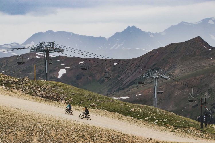
On the whole, A-Basin has no intention of offering lift serve trails or shuttles to access its mountain bike trails. They did not put money into these trails with the intention of making money, they say. They simply enjoy having high elevation, bike-optimized, backcountry trails available for employees, nearby residents and those who have an adventurous spirit. All existing and planned A-Basin trails (10-12 miles in total) are designed to be bike-optimized, destination-style riding with a focus on minimizing environmental impacts. Progressive loop models that other ski areas, such as nearby Keystone, offer will not work in conjunction with the A-Basin lift infrastructure and culturally speaking, it’s just not their style. They like the grit.
Good news: there is a plan to complete a climbing trail to the summit in 2023. Hooray! However, as it stands currently, one must engage in type-3 fun (not fun) in order to access phase two, Beavers Loop.
Beavers Loop summarized, is classified as a blue trail, and is roughly 3 miles long, starting with a drop to the west, adjacent to The Beavers Lift. It then winds along the ridgeline to Montezuma Bowl. After a short stint on the ridgeline, it meanders to the front of the mountain, through The Beavers terrain and under The Beavers Lift. After which, it continues to flow hillside through some of A-Basin’s most difficult ski terrain, under the Pallavicini Lift and eventually connects to Wheels Up mid-mountain.
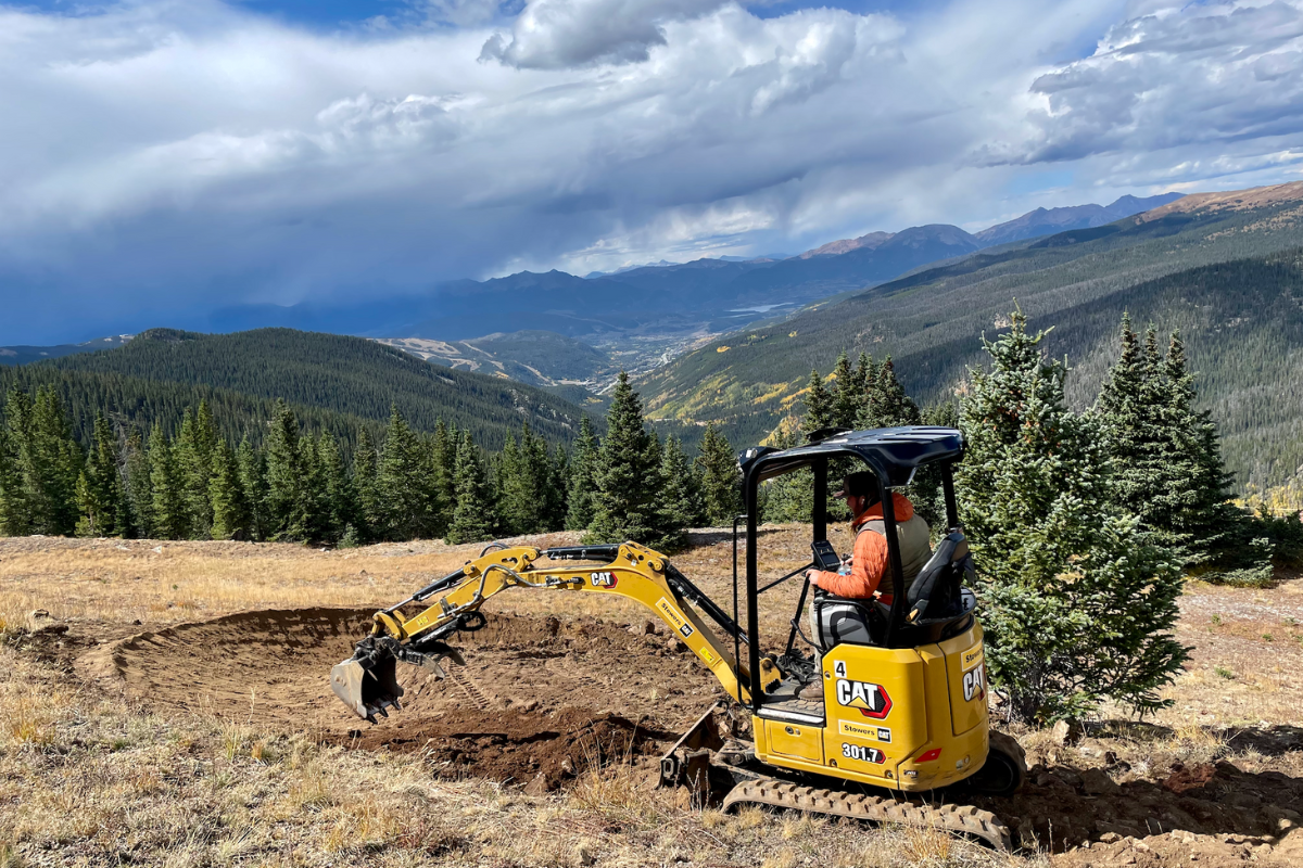
Though great efforts were put into making the trail feel natural, it is mostly machine cut because digging a trail by hand in this terrain is nearly impossible due to the hard, rock-filled soil. Because of this, most the trail is currently 2-3’ wide, which makes it feel more like double track. However, I was informed that after seasons of snowfall and wear they expect the trail to narrow to around 18”.
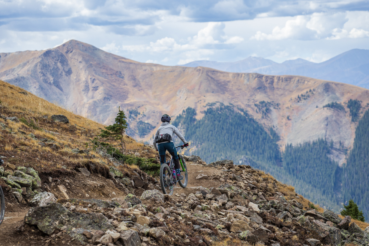
Despite the current width of the trail, it is impossible to feel anything but elation starting the descent. Immediately upon entering the ridgeline you are hit with stunning views of the 10-Mile mountain range, Keystone, Breckenridge, Lake Dillon, and two of Colorado’s 58 fourteeners: Grey’s and Torrey’s peaks.
The first portion of the trail is medium grade, flowy and relatively smooth. It winds along the ridge for a moment, then turns hillside through wide open space above tree line, around actual berms (this is rare for Colorado) and through medium-sized boulders. Personally, I enjoyed the chunks of rock and scree that were placed or left in the trail because it feels more natural despite it being machine-built. I suspect some of the reason for leaving these is to preserve the trail integrity as feet of snow pile up and melt year after year. Whatever the reason, they are fun to jump over and/or dodge through the straightaways and more playful than “point it straight and go.”

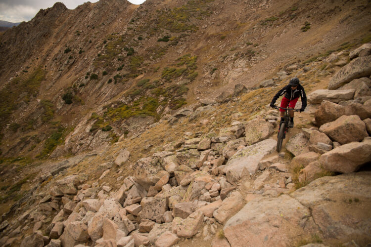
In addition to the smaller rocks, there are also optional, intermittent larger rock features to ride over and drop, which makes for even more enjoyment. Some of these rock features appear to launch into oblivion. Do not fret, however, all are rollable. Though rider beware, speed is required to plow over some stacks, as each is formed from rocks in their natural, imperfectly shaped state, not cut into a smooth sidewalk. There are also a few small jumps dispersed within the first few miles, which was a lovely surprise and all can be rolled with no danger to the rider.
After winding along the hillside, the trail drops into tree line and a very small climb is required to take the rider toward the front of the mountain. The trail crosses some of A-Basin’s most difficult runs at this point, and you get a visual of how steep the skiing is here. I’d venture a guess those who are not accustomed to exposure on trails may feel uneasy looking down “certain death,” but rest assured people do ski these hills and though the mountainside is steep, the mountain bike trail is more gradual. After the first few miles, the trail continues to wind down the mountainside, through a few more berms and into a steeper section with plenty of jumps/rollers that lead into several tight switchbacks. Eventually the switchback section leads to the fire road that then connects to the existing downhill trail Wheels Up for a total of a 5-mile descent.
Though Beavers Loop is easier than Lenawee, the enjoyment factor and spectacular views are on par. Aside from the climb required to access the trailhead, Beavers Loop is straight up fun. There’s something to be said for flowing down the top of the world rapt in awe, without a worry about what lies ahead.

I am looking forward to riding phase 3, the mid-mountain to summit climbing trail, which is slated for completion by Fall 2023. Once constructed, Arapahoe Basin will have a 10-12 mile, high alpine loop ready and waiting for those who can handle it. Unfortunately, with snow already starting to fall, riding season is over in the mountains so you’ll have to add this to your bucket list for next year.
Note: Beavers Loop may be renamed upon completion of Phase 3. Total mileage is not consistent between MTB Project, Strava, A-Basin employees and trail builders.


2 Comments
Oct 17, 2022
I believe you start pedaling at a minimum of 10,000 feet of elevation (3,000 meters). You are going to get winded coasting at that elevation. Climbing must be torture.
Oct 16, 2022