

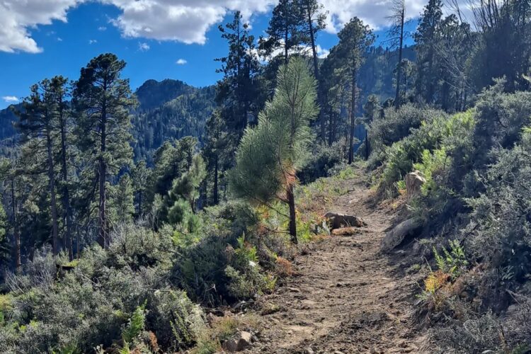
It took more than a decade, but the small town of Pine, Arizona, just completed a 21-mile singletrack loop that circumnavigates the community. Located just northwest of Payson, this trail system is more than a recreation asset — it’s a critical part of the region’s wildfire mitigation strategy.
This lengthy trail in Pine joins the revitalized Highline Trail in nearby Payson (not to be confused with Sedona’s Hiline) and the iconic Arizona Trail (AZT), cementing the region as a true bikepacking destination.

Trails provide more benefits than just recreation
The newly completed 21-mile loop is made up of several trails, including a few miles of the Arizona Trail (AZT). The 12-year-long project concluded this year with the completion of the Two Ravens Trail, a two-mile intermediate segment that completed the loop.
While there are some offshoots on different segments, five main trails make up the loop around Pine: Two Ravens, Whiterock Mesa (AZT), Pine Canyon, Bearfoot, and Pine-Strawberry. Each of these trails is rated blue, making the entire loop an intermediate-friendly ride that climbs to an elevation of over 6,000 feet.
But providing another option for outdoor recreation isn’t the only purpose behind the trail construction. The new loop is also meant to protect the town of Pine.
“When I came [to Payson], this group had already started this work,” Angie Abel, Recreational Manager for the Tonto National Forest, told us. “They were also the first group in Arizona that was trying to make this pitch for trails as fuel breaks — trying to protect their community from catastrophic wildfire risk.”
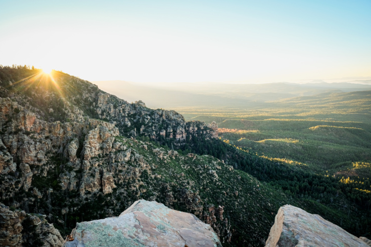
The “group” that Abel is referring to is Pine Strawberry Fuel Reduction (PSFR). Formed in the early 2000s, the group’s mission is to help reduce catastrophic wildfires in the area. The area below the Mogollon Rim, where communities such as Pine, Strawberry, and Payson are located, is among “the top ten areas in the country for the potential of catastrophic wildfire,” according to PSFR.
While many associate Arizona with desert landscapes and cacti, the area below the Mogollon Rim has the largest stand of ponderosa pine trees in the world. The area is rough and rugged, teaming with brush and pine trees. Arizona’s blistering heat and chronic lack of rainfall make it one of the most wildfire-prone places in the country.
And PSFR is fighting the fires with trails.
Not only do the trails provide a natural break in the vegetation, but they also offer a much more accessible path for wildland firefighters to enter backcountry areas.
“Twelve-plus years ago, [PSFR] were working a fuel break around their community, and that’s when the ‘Hey we can also put trails in the fuel breaks’ light bulb went off for them,” Abel explained.
Public education plays a vital role in land management efforts — especially when it comes to gaining support for projects like these. Getting the public educated can be difficult without them experiencing the land in question — walking the trails, seeing the vistas, and taking in the landscape. People rarely think of or visit fuel breaks, and likely never consider their benefit. When a trail overlaps with a fuel break, it can offer a tangible, on-the-ground example of why these fire mitigation tools matter — making their purpose clearer to the public.
PSFR has successfully partnered with both private landowners and public land managers over the past two decades to make this project a reality. The organization also hosts the popular Fire on the Rim mountain bike race, helping to further connect the community with wildfire reduction awareness.

The new mountain bike loop around Pine
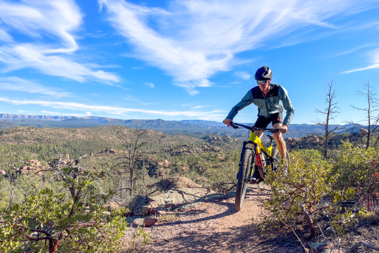
Even though the entire 21-mile mountain bike loop around Pine has an intermediate rating, it is important to acknowledge the rough and rugged terrain that makes up the lion’s share of Arizona riding — a blue trail in AZ may be a black trail elsewhere.
Abel explained that the loop is cut in half by Highway 87. “I’m going to say everything on the east side is blue,” she explained. “On the west side, it’s going to be a little more blue-green.”
The eastern portion of the loop is where the trail climbs above the 6,000-foot mark, but the entire loop is located at more than 5,000 feet above sea level.
While the two-mile addition of the Two Ravens Trail completed the 21-mile, 12-year trail project, the work isn’t finished: a few more additions are in the works.
Abel explained that four trailheads were included in the project’s most recent NEPA study and will become a new focus. Currently, access to the new loop trail is available from only one trailhead, which happens to be the AZT trailhead.
Correction May 6, 2025: Michael Browning, Director of Grants for Pine Strawberry Fuel Reduction, tells Singletracks there are actually additional ways to access the trails.
“It’s true that Pine has only one fully-fledged trailhead, on the southeast side of town. However, […] there’s a more rudimentary Strawberry TH on the northwest side, plus five more access points through forest gates,” he said. “Access to all sides of the loop is quite good, despite the lack of developed trailhead facilities at the forest gates.”
As more trailheads are built, more beginner-friendly offshoot trails will also be constructed. Abel also shared that a skills park is in the works for one of the trailheads. This will help create trails for mountain bikers of all ability levels, especially families with young kids. Abel hopes the new trailheads can be a place where families choose to spend a Saturday.

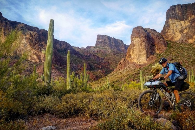
A growing bikepacking hub in Arizona
When we last spoke with Abel, Payson’s Highline Trail was nearing completion. While the 60-mile Highline was officially relaunched last year, trail crews were still working on several miles of trail. Now, the entirety of Highline is rideable.
The initial hope was that Highline would draw bikepackers in to experience the trail. Now, the Tonto National Forest is seeing an even greater potential for the area.
“I see Payson and Pine really becoming a hub for bikepacking,” Abel told us. “It’s those long-distance trails that you can get out in nature away from things for however long you choose.
As crews put the finishing touches on Highline, Abel spoke of another trail in the works. What they are currently calling the “Rim Country Connector” will span the distance between Pine and Payson.
When the Rim Country Connector is completed, it will add another 15 miles of trail connected to the 21-mile loop around Pine. And the loop around Pine is connected to the 60-mile Highline trail. All told, the area will boast nearly 100 miles of connected singletrack, providing huge bikepacking potential.

5 Comments
May 3, 2025
May 16, 2025
May 29, 2025
Jun 12, 2025
Jun 12, 2025