

Brevard, North Carolina, is the epicenter for epic singletrack in the southeast. Between Pisgah National Forest and DuPont State Recreational Forest – which together boast almost 300 miles of trail – the options are nearly endless. If you’re planning a trip to our neck of the woods, it’s pretty easy to suss out a list of the most popular trails these two forests have to offer.
But what if you’re interested in getting a little further off the proverbial beaten path? What if you’re a mountain biker who marches to your own drum, someone who’s always on the hunt for something a little different and/or unexpected? We’ve got your covered. Here’s our “Elite 8” list of “Under the Radar Rides” that will leave you with a grin on your face and an even deeper appreciation for Pisgah and DuPont.
DuPont State Recreational Forest

1. Turkey Knob
Only 1.3 miles in length, the Knob is, plain and simple, a blast. All manner of terrain and features are contained on this trail: rock slabs, tight twisty switchbacks, and smooth sandy corners. You descend over 300 feet in that short distance, aided by several high-speed, bermed turns. Located mid-forest and rated “Intermediate,” Turkey Knob is most easily reached via the Reasonover Road parking lot. Take Reasonover Creek Trail to its intersection with Turkey Knob. Turkey offers an excellent connection to the Guion Farms parking lot, turning this trail into an all-day adventure.
2. Rocky Ridge
While Ridgeline Trail has long been considered the “best” trail in DuPont, some riders with a deep knowledge of DuPont’s geography will also point you to Rocky Ridge (RR) for that honor. More challenging than Turkey Knob, with tighter turns and steeper terrain, RR drops over 450 feet in approximately 1.6 miles. You can get to Rocky Ridge by parking in the Guion Farms parking lot then take the Sky Valley gravel road south to the trailhead.
3. Poplar Hill
Essentially a “V-profile” trail with 116 feet of descent and 167 feet of elevation gain over 1.3 miles, Poplar Hill epitomizes all the qualities that make DuPont so popular: flowy lines, a mix of hardwood and evergreen forest, and accessibility. The easiest way to incorporate Popular Hill is riding from the Fawn Lake access. Ride down Reasonover Creek Trail, take a right on Turkey Knob and then a left onto Poplar Hill. Bonus points if you find the 1957 Rambler station wagon.
4. Stone Mountain
You’ll need your climbing legs for this one, but every watt you put down is well worth it on this out-and-back trail that summits on Stone Mountain’s exposed granite slabs. The views are unobstructed and stellar. The descent in both directions is about as raw as you can get, more closely resembling the rooty, rocky nature of Pisgah than DuPont. At 2+ miles roundtrip and with 600+ feet of climbing and descent, Stone Mountain demands technical descending skill plus the strength to power up a grade that reaches 15% in places. While there is some hike-a-bike portaging near the top, you are rewarded with fabulous views of the surrounding area and a few wild blueberry bushes.
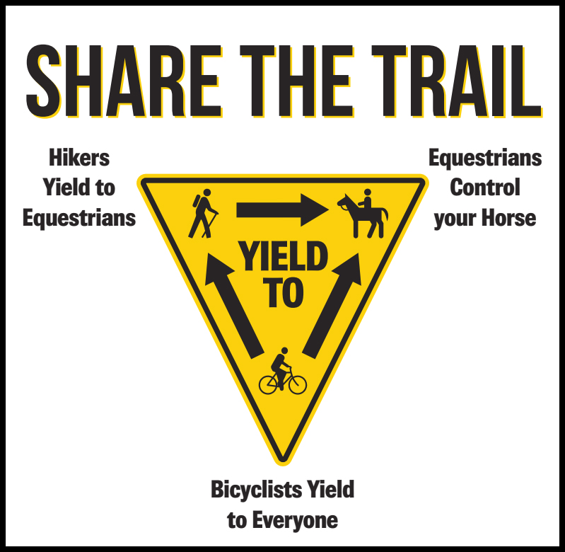
Please keep in mind the trails in Dupont State Forest and Pisgah are multi-use trails and bike riders will need to share the trail. Please follow posted trail etiquette and as stated on posted signs “Bicyclists Yield to Everyone” remember to ride within your limits and always be ready to yield.
Pisgah National Forest

1. Pilot Rock-Slate Rock #320
The defining feature of this 4.5-mile horseshoe route is Slate Rock and the incredible views from its slick rock bald. Like Stone Mountain, Slate Rock isn’t for the faint of heart. It’s not particularly technical, but it does get very steep, requiring a bit of hike-a-bike for some riders. No matter, the view is worth it. On this route, you’ll ascend 714 feet and descend over 1,000. While you may see a hiker or two, you likely won’t see another cyclist, especially if you go during the week. The quickest access to Slate Rock #320 is via the gravel Yellow Gap Forest Service Rd that intersects with US 276 in Pisgah Forest.
2. Cantrell Creek #148
In 2019, a consortium of non-profit groups, spearheaded by the Pisgah Conservancy and working closely with Pisgah National Forest, re-routed this trail out of the creek, resulting in a much healthier stream bed and a smooth, scenic ride. We recommend that you combine Cantrell Creek with Squirrel Gap for a satisfying exploration into Pisgah starting from Turkey Pen Gap. Combining Squirrel and Cantrell is a mash-up of old, classic singletrack and new more sustainable trail, like following the newest Top Gun with the original after heading home from the theater. You can ride this loop in either direction. Park at Turkey Pen and take South Mills River #133 to Cantrell.
3. Bear Branch #328
A great little out-and-back that you can get to from the North Mills River Recreation Area. It’s short – only 2.4 miles roundtrip – with an elevation gain and loss of 360 feet. Expect some wetness on the bottom section and a speedier upper section. Bear Branch is when grandma offers you just one more bite at Thanksgiving dinner. It is not too much and not too long, just enough to satisfy. From the North Mills River Recreation Area parking lot, take Trace Ridge #354 to Wash Creek #606 to Bear Branch #328.
4. Coontree Gap #144
Open seasonally from October 15 – April 15, Coontree climbs over 500 feet in just over 1.2 miles to Bennett Gap Trail. A beautiful stretch of woods proves to be a nice distraction as you ascend an ever-steeper grade. The easiest part is getting here. The trailhead is located right across from the Coontree Picnic Area on US 276 near the entrance to Pisgah National Forest. Note: While this is a loop trail, only the eastern side of the trail (right at the fork) is open to mountain bikers. Use it as an out and back or continue onward onto Bennett Gap Trail #138.
Please note: Currently ebikes are NOT ALLOWED on public lands in Dupont State Forest and Pisgah National Forest.
Explore Brevard
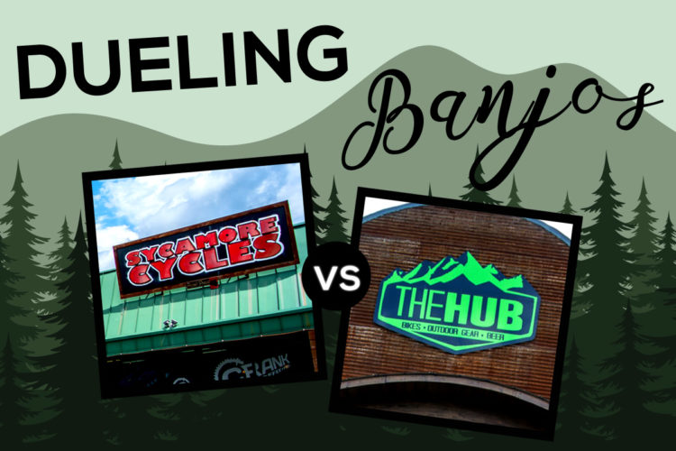
To navigate these under-the-radar rides, we recommend the purchase of the Pisgah Ranger District and DuPont maps made by the Pisgah Map Company. There you can also purchase a handy map app for your phone. If you need bike maintenance, a rental, or are just looking to score some cool swag, Brevard has four outstanding bike shops that can get you sorted: Sycamore Cycles, The Hub, Squatch Bikes and Brews, and Earth Mountain Bicycle. For a full list of Transylvania County’s cycling services, including shops, tour companies, and bike clubs, go here.
When you’re done exploring Pisgah and DuPont each day, there’s no shortage of opportunities for refueling. Brevard is home to five stellar craft breweries – Oskar Blues Brewery, Noblebräu Brewing, Brevard Brewing Company, Ecusta Brewing Company, and UpCountry Brewing. The food scene is equally robust and eclectic. From food trucks to fine dining, you’ll never have difficulty getting a satisfying carbo load. Check out a comprehensive list of Brevard’s restaurants here.
When it comes to lodging, there are loads of great options that can put you within a stone’s throw of your favorite rides. Here’s a full list of lodging in Transylvania County. Finally, for general information about all there is to see and do in Brevard and Transylvania County when you’re off the bike, there’s no better resource than ExploreBrevard.com or stop by the Visitor Center at 175 East Main in Brevard to help you find non-cycling fun.


3 Comments
Apr 1, 2022
For Cantrell, 2 bridges crossing south mills river have been destroyed from tropical storm Fred and therefore require a river crossings in hip deep water before ever getting to the trailhead.
Backcountry Pisgah trails can be daunting compared to popular front country trails like middle and lower black, so know your limits as local rescuers put their lives at risk to help.
Apr 6, 2022
Pilot Rock is a completely different trail and listed as #321
Feb 15, 2024
Starting in front of the campground where the gravel road splits, take the right fork like you are headed to Spencer Gap (which you climb to do Spencer Branch and Trace Ridge), follow that until you encounter another gated (usually closed) road on the right. Go around the gate and climb the road, after a mile or so, you'll see a trail on the right that is Bear Branch.
Watch for horses, they are permitted on that stretch and you will see them from time to time.