
While mountain bikers work hard to build new trails, we constantly face losing existing ones as a result of development, lobbying by hikers and equestrians, forest fires and natural disasters, Wilderness designations, and other rule changes. One area, almost literally in my backyard, seems destined for closure due to a rather unexpected cause: the presence of a threatened fish, the Greenback Cutthroat Trout.
This is a truly fascinating situation, with many layers, varying stakeholders, and almost as many opinions as there are people in the mix. Irony abounds in almost every discussion regarding this species, as does fear and mistrust.
The Greenback Cutthroat Trout is the Colorado State Fish. I grew up in Colorado and was sure I remembered being taught in my 7th grade Colorado History class that the state fish was actually the Rainbow Trout. It turns out I was right, but well behind the times. I first left Colorado in 1989, and the state officially adopted the Greenback as the state fish in 1994. The species was believed extinct, but after finding some small populations in tiny, isolated watersheds, there was much excitement and the brave, resilient little fish was given the official designation.
Irony #1: The Rainbow Trout which was, for so long, the unofficial state fish, was not actually native to Colorado, but introduced as it was everywhere else outside its historic habitat West of the Rockies. So, in 1994, Colorado actually found a native fish it could call its own! This still seems odd, given the tiny population known to exist. This shouldn’t have surprised me, however, since our state tree is the Blue Spruce which was, according to “The Native Trees of Colorado,” by S. K. Wier, “never abundant.” Indeed, depending on where you are in the Centennial State, you will be far more likely to see a Pondersoa Pine, Douglas Fir, Aspen, Lodgepole Pine, Pinion or Juniper than a Blue Spruce. So it is with the rare and isolated Greenback Cutthroat Trout.
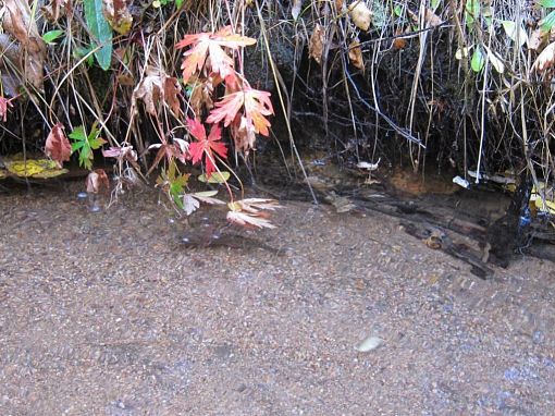
Irony #2: While Greenbacks were found in a few locations, it has been determined by University of Colorado Researchers that the only genetically-pure strain remaining lies in the Bear Creek Watershed on the Southwest edge of Colorado Springs. The irony here is the Greenback is not native to this watershed; it was originally native only to watersheds that feed the Platte River drainage in Northern Colorado, whereas the Bear Creek Watershed feeds the Arkansas River watershed in Southern Colorado. The Cutthroats were introduced in the late 1800s as a sport/food fish for area recreationalists (the Bear Creek Trail was an early route up Pikes Peak, predating the now standard Barr Trail route).

Efforts to protect the Bear Creek Watershed began in earnest in 2004 when Bear Creek was closed to fishing. In 2008, bridges were constructed across the creek to minimize sediment deposition in the stream by trail users of all types. Over the last few years, sediment traps were added to prevent further sediment from entering the stream.
Things began to heat up in 2012 when the Center for Biological Diversity filed a lawsuit with the USFS to close the area to motorized traffic. The Jones Park area at the upper end of the watershed has been a popular motorcycle destination for decades so when the USFS chose to comply with the closure proposed by the lawsuit, there was a great disturbance in the throttle-twisting force. This led to:
Fear #1: That mountain bikes would be next. In the local MTB community, there was much fear and loathing on one side, looking a lot like paranoia, and support for the USFS on the other side, either rejecting any alleged nefarious motives on the part of the USFS and environmental lobbyists, or simply supporting the fish. That fear became reality when the USFS began socializing a plan to close the watershed to ALL traffic, including mountain bikes, hiking and horseback riding. Interestingly, the mountain bikers who feared being personally targeted, were forced to admit this was not simply some anti-mechanical vendetta at this point.

Ray of hope #1: The USFS has already considered trail reroutes that would still allow hikers and riders to traverse the area, just outside the boundaries of the watershed. While the popular Jones Park route would be lost, there would still be a way to execute the great shuttle from Pipeline to Captain Jack’s.

To address the concerns of all stakeholders, the USFS held an open house in March 2013. Representatives from all affected agencies (USFS, City of Colorado Springs, and Colorado Springs Utilities) were present, including biological and land management experts of all types. Having many questions about the situation, and possessing a healthy degree of skepticism, I attended the open house in hopes of better understanding the situation, assessing the veracity and legitimacy of what was being put out for public consumption, and determining how I, as a trail user, would frame my participation in the coming debate and public comment period.

Question #1: Why, knowing all user groups, including motos, have been frequenting this area for decades, is there a need to close the watershed at this time?
The answer, which is multi-faceted, seems legitimate. First, as population has grown, so has trail usage in the area. The stream could tolerate a certain amount of sediment, but that amount is being exceeded by the popularity of the trail. Second, the fact is that recent years have consistently seen less rain than in previous decades. A good rain will increase stream flow to the point that it washes out the sediment, but those significant rain events are fewer and further between than before. Lastly, the very nature of the local geography exacerbates the first two conditions. The hills are dry and steep and the soil is primarily decomposed Pikes Peak Granite. Southern-facing slopes, which are in the sun all day, are especially prone to degradation. Less rain in recent years has led to less vegetation, which means fewer roots holding the dry soil together, which ultimately leads to more loose dirt and gravel which may be more easily deposited into the ever-shallower stream.
Question #2: In addition to mountain biking, I enjoy backpacking, so I had to ask–There are already regulations that prevent dispersed camping within a few hundred feet of any stream; why prohibit dispersed camping in the Bear Creek Watershed as it is not going to affect the stream?
This answer also made some sense, especially in light of last year’s devastating Waldo Canyon fire. Coming off yet another drought year with very low snowpack, the hills in the watershed are a tinderbox just waiting to go up in flames. The risk of fire is just too high to allow camping in the area. Well, this is the case across most of Central and Southern Colorado, so why not ban camping everywhere? Because a fire elsewhere, no matter how devastating, would not destroy the last bit of habitat for a threatened species.
Fear #2: Will the closure be permanent? In 1999, the popular and highly attractive Severy Creek Trail on the northeast flank of Pikes Peak was “temporarily” closed to protect a population of the Greenback. Once it was determined the fish were out of danger, the trail would be reopened. In 2010, the forest service determined the fish in Severy Creek weren’t as “genetically unique” as originally believed, and that human travel through the area no longer threatened the species. To date, however, there are no plans and no timeline for reopening the trail. This leads to–

Question #3: Why hasn’t Severy Creek reopened and what assurance to we have that the Bear Creek drainage closure isn’t part of an overall trend to minimize access?
During the intervening years of the Severy Creek closure, the trail has degraded due to a lack of maintenance. Parts are overgrown and require a great deal of work. Still other parts require rerouting and bridge construction is necessary to minimize impact to the stream. Lastly, parking at the lower trailhead is inadequate and trail users often block the path through the area which Colorado Springs Utility trucks need to pass to service reservoirs in the area. One Forest Service official said it was an “embarrassment” that Severy Creek hadn’t been reopened. Unfortunately, this discussion also led to—
Fear #3: The Cheyenne Creek draining also supports Greenbacks. If species protection must expand to this area, we would lose the Seven Bridges Trail and any of the reroutes noted above under “Ray of Hope #1.”
Despite all the fear and potential for things to go badly, at the end of my time at the open house, I had comfortably settled into—
Ray of Hope #2: The USFS seems to be managing this whole process in a very transparent way and were honestly seeking input from all user groups. Certainly, no single user group was being targeted and there was a genuine desire to maintain current recreational opportunities in the area to the maximum extent possible while still preserving the species. Also, this watershed isn’t the only incubator for this species’ recovery.
Ray of Hope #3: About 65 genetically-pure Greenbacks were removed from Bear Creek and have become a viable breeding population in a hatchery. They will eventually be reintroduced into their historical range in the Platte River drainage. I’m not sure how they will survive there given the fact they went extinct at that location before. The Greenback is a prey fish to larger, more aggressive species that were introduced in those waters. I’m guessing the wildlife experts who have hatched this plan know something I don’t, but I have yet to confirm that.
Exacerbating the fears is the loss of other trails in the area. It looks like the full “Ring the Peak” may never happen as required linkages on the East Slope of Pikes Peak remain off limits for a variety of reasons, as do sections on the West Slope (failure to obtain easements through private land). Furthermore, the aforementioned Waldo Canyon fire claimed a number of popular routes last summer, including Rampart Reservoir (which should reopen soon), Waldo Canyon, Williams Canyon, and Blodgett Peak Open Space. Fortunately, we here in Colorado Springs have such a wealth of riding options that a few losses is hardly devastating. But, at some point, it does get scary.


10 Comments
May 25, 2013
May 25, 2013
There is another financially-related worry as well. Not only is it cheaper to close a trail than build a new one, it's also cheaper to close a trail than to fight the lawsuits that come from well-funded and legally represented environemental groups with a single-minded agenda. As I noted in this article, indications are that this should work out fairly well, but we shall see. If developments warrant, I'll write a follow-up article this fall or next summer.
May 23, 2013
May 24, 2013
May 23, 2013
Thanks
Cheers
Barry
May 23, 2013
May 23, 2013
May 24, 2013
May 23, 2013
May 23, 2013