×

|
Rate it:
Tags:
Level: Intermediate
Length: 17 mi (27.4 km)
Surface: Singletrack
Configuration: Loop
Elevation: +1,483/ -1,328 ft
Total: 18 riders
Mountain Biking Wendell State Forest
#35 of 223 mountain bike trails in Massachusetts
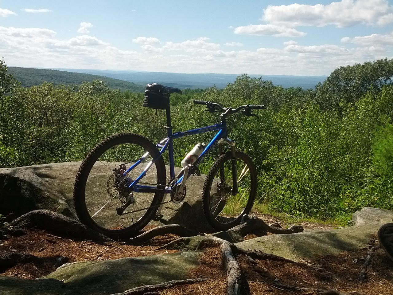
Classic New England Single Track, rocks, roots, downed trees, elevation and great views. The park has maps available but they are not the best, a lot of the system is marked but you have to pay attention as the markings are starting to fade. Follow a counter clockwise loop with a few cut through.
First added by Christopher M on Jul 21, 2013. Last updated Apr 28, 2020. → add an update
Before you go
- Drinking water: unknown
- Lift service: unknown
- Night riding: unknown
- Pump track: unknown
- Restrooms: unknown
- Fat bike grooming: unknown
- E-bikes allowed: unknown
- Fee required: unknown
This trail information is user-generated. Help improve this information by suggesting a correction.
From the East or West Take Rte 2 to Rte 63 south to downtown Miller's Falls- once in town take Wendell Rd over the Rail Road Bridge-where it becomes Montague Rd-follow up the hill for several miles. Wendell State Forest parking area will be on your left. Look for brown Wendell State Forest Signs with arrows pointing the way to the park-they're fairly obvious and lead right to the park


Some great single track in between dirt roads. Limited trail maintiniance has been performed lately. Lots of marked trees so this place may look very different soon. Still haven't found everything. Every time I go I find something new.
| ThankBack in 2004, we were given a great opportunity: Build a trail the Park manager wanted and he'd hand s the keys to the kingdom, allowing us to build a host of trails, and rework a number of others that had fallen into disrepair (or had been built that way by inept hateful old hiker clubs.).
10 years later, sweat, blood and tears of joy has made this still one of the best and most unique ride destinations in New England. Big climbs, burly trails, swoopy trails, unusual 'wilderness' feeling trails, you name it, all of it open to bikes in one of the loveliest forest settings in the North east.
FWIW, ever trail in every direction is/has been/ will continue to be cleared by bikers. The CCC isn't remotely the most challenging trail at Wendell. Fun facts for know and Tell: If you explore the trails outside of the parl to the south side of Montague Rd (M&M, Robert Frost) you can stretch the riding here into something truly epic.
Now is a great time to ride, parking is free and the air is cool and the view as lovely as ever. Wendell doesn't get the traffic other riding areas do, so leaf cover is something to keep in mind. Want something different? Tired of the xc race loops of Earl's? want to Break out of the Batchelor St scene to something different? Come on up to Wendell SF.
| ThankWell, being relatively new to MTB (be 3 years Aug 2014) I have Rutland 5 minutes away and LSF 20-22minutes away or TVSR (treasure valley scout reservation) 10minutes away.. I have to confess.. after 9.5 miles on a NEMBA Kona ride (went by myself but followed the Pink arrows) I have to say this place has some really great trails,, Lots of obstacles and lots of big climbs once you go down..
Trials seem to vary greatly which is nice for a change of pace from Rooty/rocky to twisty turny with lots of jumps (Nipmuck new fav.) and even some pine forest with a couple of really nice jumps..
I did find some of the obstacles to be less then friendly and would love to see someone be able to ride up them. .CCC trail for example.. and the Roots Houston, we got's roots..
It rained last night so the trails with Rocks and roots were pretty slippery out of the gate.. So if it's raining or has rained be careful lots of slip and slide..
Anyhow,, Was a very fun and challenging ride and will go back at some point..
| ThankI love this place. Wendell was my first introduction to true New England singletrack riding, and I ride here more than anywhere as WSF is about a 15 minute drive from me. There is a great description of some of the trails here http://www.nemba.org/trails/massachusetts/wendell-state-forest
| ThankFor the most part, the trails all start and end on old dirt access roads, so you can hammer a trail for a mile or two then catch your breath before the next adventure. Nipmuck is probably my favorite trail...mostly downhill but some short punchy climbs thrown in here and there, along with some bermed corners you can rail. Just be ready for the long access road climb at the end to get back to more trailheads (or head back to your car if you're spent). Great trails, great views, a couple areas to swim...just an overall great place.
Just finished a Kona adventure ride there, it was a bit of a haul but I think it was worth it. The trails are very technical but you will be rewarded with great descents, just remember that you will have to climb back up. The park has maps available but its best to get there early and just ride around. maps can also be downloaded off of mass.gov site.
| Thank