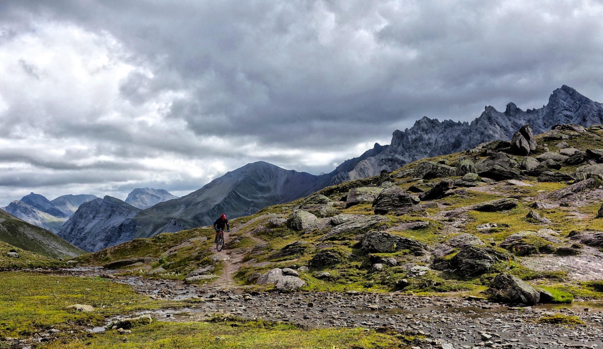
Welschtobel is probably the best singletrack trail in the Lenzerheide region! An epic 10-mile descent through a gorgeous high alpine valley that feels incredible wild, you'll pass through a variety of zones including above treeline alpine environments, river crossings, and then a lower treed zone.
While you could do an out and back on this trail from Arosa (the trailhead given is for the end of the trail in Arosa), probably the best way to do it is from the top of the Rothorn lift, then via Furcletta, to access the top of the Welschtobel trail. Then once down in Arosa, head up the lift and make your way back to the Lenzerheide side of the mountain.


 5
5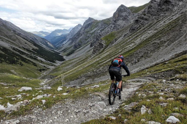

Welschtobel is truly phenomenal on every level: jaw-dropping views, challenging hike-a-bike climbs, and ripping, technical singletrack. At times it feels like you're riding on another planet, the mountains are so jagged, the ground is so rocky, and the water is so green. A must-ride in every sense of the word!
| Thank